Can you explain how such a proposed express bus would be turned around at Queensway? What routing would it take? From Google Maps, I don't see any location where a bus loop can be built near the stop. Buses would have to turn onto Lakeshore road and then make a U-turn. As well, a bus bay built underneath the streetcar stop would take away from the sidewalk. A better location might be at South Kingsway, where buses can easily be turned around by the following routing with a bus bay built right next to the streetcar stop. As well, there is plenty of room at the marker to build a bus bay.
I'm very pleased to have an answer I've been ruminating on. It's far from perfect, but it will work. And the cost is minute compared to the big picture.
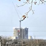
I initially mentioned the gap between the Queensway and the CN tracks as a possible loop for buses on Parkside as a shuttle to the Keele subway, but had only checked it out on Google map, can be very misleading. Just happened to be passing there on foot today hiking distance with the Big Black Lab (he loves the lake as well as High Park, and yes, he was in swimming...don't ask!) and got some pics of said gap possible for a loop, and then Lab and I walked up the steps within the Queensway/Parkside bridge, and caught a streetcar east. I'll try and get a pic from up on the Queensway overlooking it when I don't have the dog with me.
Here again is the location on Google Map:
https://www.google.ca/maps/place/To...23555502ab4c477!8m2!3d43.653226!4d-79.3831843
And here's the satellite view of same:
https://www.google.ca/maps/place/To...23555502ab4c477!8m2!3d43.653226!4d-79.3831843
There's only just enough space for a turning loop, but it's there, plus space for a load/unload platform close to Parkside, to allow passengers to walk around the corner, under the bridge, and up the stairs. I was looking at the steps closely today. A new passage could be cut from the first landing south directly to a bus platform later, but for now, all that would be needed is a loop, added lights for buses to turn east from going south into the loop, and it would be tight, but no tighter than at many bus platforms now on the subway bus platforms, let alone streetcar ones.
Remember, I don't tout Parkside alone as a north-south semi-express link to the subway. Other posters are making the cases for a number of them further west, and *together* they offer greater flexibility and distributed loading. If one route is blocked by an accident, two or three others will continue to offer alternatives.
And semi-express north/south routes on the South Kingsway and further west to the Humber Bay Shores would offer much greater connection either way in peak. Mimico is getting a GO station, and I suspect that defines the western limit for a 504 being needed, or do others think the present Humber Loop would be enough if frequent Long Branch service is initiated?
Most of their destinations are along King or Queen. Even now if I want to get from the Humber Bay area it would take 55 minutes if I'm on the 501 to Downtown (including the walk to the Humber Loop) versus 1h 5min via 66/2/1. And of course you are stuck when the subway breaks down.
This is resonating with me. It makes so much sense, and I'm glad you've offered the times to journey, because it makes a number of points, one being that the streetcar way, if streamlined, will do it in even less time, and the subway, and present bus routes, can only get worse.


