Toronto Four Seasons Hotel and Private Residences Toronto | 203.9m | 52s | Lifetime | a—A

I never said I was "disturbed", I said I did not like Uptown's setbacks. Also, I never mentioned the GE Building. I understand fully why setbacks are incorporated and the functionality of them as they relate to the streetlevel. I did not imply that setbacks should be symmetrical across the board, just in the case of Uptown.

4SViewsUptown3.jpg

(courtesy of interchange42)

Looking at this image, the horizontal spacing between the windows is symmetrical from east to west. This pattern continues from the top to the base. A vertical band appears where the spacing between the four centre windows (on each storey) is narrower, which should form the middle of the north and south elevations. Below the setbacks, the addition of the 2 -3 extra windows on the east detracts from the symmetry established at the top. The tower was designed with this symmetry in mind at the top, but when the floor plates grew the extra area was just tacked on.

The GE Building employs a consistent pattern from top to bottom of the horizontal spacing between windows. Uptown tries to be like the GE Building, but fails.
 
For this instalment on the Four Seasons Hotel and Private Residences by Menkes Developments, Lifetime Developments, and Four Seasons Hotels and Resorts, Urban Toronto brings you more views inside and out, courtesy of Dominic Defilippis, Superintendent for Residential Construction for Menkes.

Text by Doug Convoy, Photos by Craig White

4STourP1200218.jpg


The southwest tower had reached the 35th floor by the time of our visit.

4STourP1200221.jpg


Peeking through the weatherwall enclosure toward CityPlace and the hi-rises by Fork York

4STourP1200249.jpg


No. 10 Bellair

4STourP1200250.jpg


Southwest view across a corner balcony. The channel is for radiant floor heating.

4STourP1200273.jpg


Fresh air intake units

4STourP1200279.jpg


Close-up of the weatherwall enclosure

4STourP1200252.jpg


The weatherwall pushes away updrafts, catches potential falling debris, and serves as a storage platform.

4STourP1200247.jpg


Looking west

4STourP1200239.jpg


New playground / field area at Jesse Ketchum Public School, a recipient of Section 37 funds from the Four Seasons project

4STourP1200241.jpg


Flying formwork table

4STourP1200260.jpg


The view north

4STourP1200255.jpg


Northeast

4STourP1200266.jpg


Looking onto the residential terrace atop the amenities podium

4STourIMG_0228.jpg


The northeast tower progressing rapidly

4STourP1200222.jpg


Northeast tower

4STourP1200230.jpg


Spectacular south-facing views from the 24th floor, the first residential floor

4STourP1200234.jpg


4STourP1200258.jpg


4STourP1200281.jpg
 
Last edited:
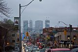
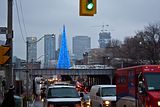
Four Seasons today (on the right), during a light snowfall from Yonge, south of St. Clair. The photos aren't great but it gives a bit of scale as to how this is looking from the mid-town area.

Click on the thumbnail to enlarge, then click again on the image for full size.

 
How much elevation do you climb, from the lake up to say, Eglington??

According to the elevations listed on Google Earth: If the lake were at 0 elevation, then Bloor is about 30 meters higher, St.Clair is 67 meters higher and Eglinton is about 100 meters higher than the lake.

Keep in mind, that is all very approximate.
 
According to the elevations listed on Google Earth: If the lake were at 0 elevation, then Bloor is about 30 meters higher, St.Clair is 67 meters higher and Eglinton is about 100 meters higher than the lake.

Keep in mind, that is all very approximate.

WOW!! That's around 300 feet?, that will impact how tall something looks for sure. Thats a pretty steep incline...so Quantum can look like 800 feet from the CN tower?? Thats a lot. Thanx Traynor....Love the lats.:eek:
I actually love the way you look down Yonge from up there, you can kinda see the old lake shore(s)?
 
I was always curious about the inclines myself, thanks for that answer Traynor.
 
If you have Google Earth, you can find any elevation above sea level for any location simply by hovering your cursor over a certain spot. Right at the bottom of the map, the longitude, latitude and elevation above sea level are displayed.

:)
 

Back
Top