News   Jul 12, 2024
 1.5K     0 
News   Jul 12, 2024
 1.2K     1 
News   Jul 12, 2024
 436     0 

The Weather

It lost it's intensity before coming to Toronto. It could have been much worse. Look to the south in Tennessee and Kentucky, Indiana, Ohio. There were a lot of tornadoes with the storm. The weather bomb itself didn't come over our area and was never supposed to. That was further north and gave areas in Manitoba, Wisconsin and northern Ontario a lot of rain. The heavy winds themselves affected areas in central Ontario more than us, where power was out for many people.
 
Yesterday we set record high temperatures in Ontario, including Toronto.

AWCN11 CWTO 020936
Weather summary for all of Southern Ontario and
The national Capital region
Issued by Environment Canada Toronto at 4:25 AM EST Sunday 2 January
2011.

Record warm temperatures to start the new year.
-------------------------------------------------------------
==weather event discussion==

A strong low pressure system from Colorado tracked across
Northeastern Ontario yesterday. This was the third such low over a
period of only a few days and the resulting persistent southerly
Flow brought unseasonably warm temperatures to southern and Eastern
Ontario. Numerous new maximum high temperatures records have
Were observed for new years day as a result.

The following is a list of new temperatures records as of 1 AM today.

-------------------------------------------------------------
Location new record old record old record year

Windsor airport 11.3 10.4 2007
Goderich 12.1 9.9 2007
Waterloo-Wellington 10.5 9.0 2007
Hamilton airport 11.1 10.6 1966
Burlington Piers 12.7 10.7 2007
Toronto Pearson 12.0 9.2 2007
Toronto downtown 10.7 10.1 2007
Toronto Island 9.0 8.7 2007
Toronto Buttonville 11.4 9.6 2007
Cobourg 7.6 7.2 2007
Mount Forest 9.0 8.8 2007
Collingwood 11.5 9.8 2007
Lagoon City 8.0 6.0 2007
Muskoka airport 8.2 6.7 2007
Parry Sound 8.2 7.0 2007
 
Also:

AWCN12 CWTO 020958
Weather summary for Northern Ontario
Issued by Environment Canada Toronto at 4:53 AM EST Sunday 2 January
2011.

Record warm temperatures to start the new year.
-------------------------------------------------------------
==weather event discussion==

A strong low pressure system from Colorado tracked across
Northeastern Ontario Sunday. This was the third such low over a
period of only a few days and the resulting persistent southerly
Flow has brought unseasonably warm temperatures to much of
Northeastern Ontario. Numerous new maximum high temperatures
Records were set on this springlike new years day.

The following is a list of new temperatures records as of 1 AM
Today.

-------------------------------------------------------------
Location new record old record old record year

Sault Ste Marie 7.0 3.5 2007
Sudbury 7.1 3.7 2007
North Bay 7.2 4.8 2007
Wawa 5.6 1.2 1987
Chapleau 5.7 -0.1 2007
Earlton 5.8 2.2 1966
Timmins 6.2 1.1 1972
Kapuskasing 4.5 1.1 1953
Moosonee 3.3 3.3 tied with 1936
 
get ready for it... overnight lows on Sunday will be in the -20 to -25 range, without the windchill. It all depends when the clouds begin to build in on Sunday night.. if it holds off closer to the morning hours, it could be lower then -25...
 
get ready for it... overnight lows on Sunday will be in the -20 to -25 range, without the windchill. It all depends when the clouds begin to build in on Sunday night.. if it holds off closer to the morning hours, it could be lower then -25...
Where do you get this? Environment Canada is reporting -13° tonight and -15°C tomorrow night and then a balmy -2°C the following night. It's hit -13ºC a couple of times in the last week, so it's only forecast to be a bit lower Sunday night than it has been.
 
I checked a weather iphone app. when I got in & it was -12, -21 with windchill (Toronto Island) when I walked my dog at 4pm!
 
Last edited:
680 News was reporting it was -21 (before the wind chill) out in Ajax about the time I was arriving at the GO station there this morning (7 am).
 
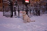
I live on Wellesley at Jarvis Street. I took my dog with me to run over to get cigarettes at "The Mix" variety store (the future site of the 40 Wellesley St. E. condo) which is a six or seven minute walk for us each way. Coming back my dog (a 53 pound yellow Labrador Retriever) stopped walking, started lifting & shaking her paws and refused to move. Fearing her paws were freezing on the cold concrete sidewalk I picked her up in front of the parkette on Wellesley and carried her to Church Street then put her down as I couldn't carry her anymore. We crossed the street then just past Pizza Pizza (almost home) it happened again so I had to carry her the rest of the way home. Labs love the winter and especially snow, they are well equipped for winter weather but today's temperatures proved far too cold even for her. I've seen her lift a paw occasionally on really cold evenings during a brief walk but have never had to carry her before. Goes to show how cold it is out there tonight! This is turning out to be one crazy cold month.

 
Last edited:
Maybe the road salt was irritating the dogs feet as well as the cold?

That's what I was thinking too, extreme cold + the reaction to the salt at those temperatures. Under normal conditions (less than about -20C) the salt doesn't bother her at all. I always do a quick cleaning of her paws with warm water and a towel dry when we get home just in case. I had my last Lab trained to wear dog boots from "Neo-Paws", lots of people would laugh & make fun of her but they were great. I tried with two pairs to train this one to wear them as a young puppy but she'd have no part of them so I gave up.
 
Since the salt doesn't bother her, it's kind of a moot point, but there's also both a stick and an ointment that you can put on their feet to help protect from salt.
 

Back
Top