From the Post:
Waterfront revolution begins tomorrow
Posted: November 29, 2007, 11:55 PM by Rob Roberts
City
Ground will be broken tomorrow on a $28-million project that will culminate in a total reconstruction of nearly 3.5-kilometres of downtown waterfront between Bathurst and Parliament streets by 2011.
The Post's Zosia Bielski reports:
Tomorrow, work will begin on a slip at the head of Spadina Avenue. To be completed by June, the slip, carved out of timber and dipping toward the lake like a staircase, will be the first of seven along the waterfront. Next, construction crews will start building an uninterrupted Martin Goodman Trail through the neighbourhood and then revamp Queens Quay for pedestrian use between Spadina and York.
“Along the entire water’s edge we envision a fully connected promenade based on the quay wall where we would have a double row of maple trees, and then a timber boardwalk allowing you to make the full walk from Bathurst to the Parliament, uninterrupted,†said Marc Ryan, project leader of West 8.
The Rotterdam design and architecture firm, along with Toronto-based du Toit Allsopp Hiller, won a competition last year. Their plan is receiving funding as part of a larger $1.5-billion waterfront deal made between federal, provincial and municipal governments two years ago.
“The western part of the downtown waterfront was built in a way that the water’s edge isn’t for the people. It’s disconnected by the slips and this is the start of reconnecting the people of Toronto with their waterfront,†Mayor David Miller said today. “In the next two to four years, people should be able to walk from Ireland Park in the west, all the way along the water’s edge to the Don River in the east. That’s the goal.â€
Mr. Miller said the biggest challenge will be the ferry terminal, but was optimistic that this phase of construction on the central part of the waterfront would be completed within three years.
The entire concept is intended to draw people off Queens Quay Boulevard and encourage “closer contact with the lake,†said Mr. Ryan. The design’s highlight is a series of maple leaves floating on the surface of Lake Ontario. Surrounded by boardwalks, these are wetlands intended to process storm water running off from the city core.
Mr. Ryan says the wetlands are one example of turning the waterfront into a public destination “that’s not a shopping mall or an IMAX theatre but a public place, not just along the waterfront but out into the bay.â€
The plan also includes a series of curvy timber bridges rising from the boardwalk, as well as a series of pontoons, or finger piers, which will moor boats at perpendicular angles so as not to block views of the lake. The backbone of the reconstruction is Queen’s Quay Boulevard, which today, is five lanes bisected by crumbling streetcar tracks, a narrow, cracked sidewalk separating it from the slips.
The goal is to give more priority to pedestrians, cyclists and public transit, Mr. Ryan said. Queens Quay’s eastbound lanes, the ones closest to the water’s edge, will eventually be shut to traffic and replaced by a public esplanade planted with native species of trees, not yet decided upon.
Mr. Ryan is re-imagining the humble boulevard by the water’s edge as Spain’s Las Ramblas. “Toronto is such a vertical city and it lacks the human scale, and also a strong image,†he said. “That’s the most shocking thing with the Toronto waterfront: you’re left with no impression. It feels very local. There’s an expectation that in such a fantastic city, the expression at the lakefront is underwhelming. There’s a lot of work to be done.â€
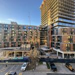
Image of Spadina slip courtesy Waterfront Toronto
AoD