oreoshack
Active Member
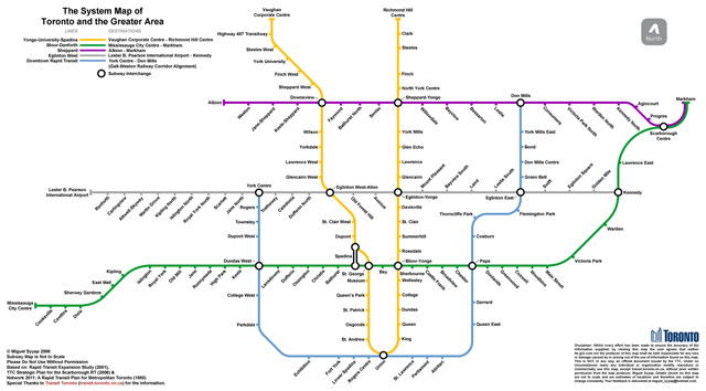
are there any plans to add the streetcar lines onto the subway maps to make our transit system look beefier to tourists?
I don't know about adding the streetcar maps but I heard that the future LRT lines will all be added to the maps on the subway cars. It will look like a really extensive system.
I am guessing that the LRT lines won't have circles for stations accept for the SRT which is being converted to LRT. Maybe they will have dashes for LRT stops on these futere maps.
Her map does look very similar to SOS's. I'm almost embarrassed that we ended up accepting Eglinton as LRT when she hasn't
If I were a Torontonian, I'd vote for her simply on this basis. Although I don't even know if she's on the left or right.
Haha, agreed! Time to changeHer map does look very similar to SOS's. I'm almost embarrassed that we ended up accepting Eglinton as LRT when she hasn't
If I were a Torontonian, I'd vote for her simply on this basis. Although I don't even know if she's on the left or right.
Weren't you the one who voiced most strongly that we downgrade it to light-rail for the sake of completeness? Anywho, even a partial Eglinton metro is better than a half-arsed LRT line running in my book. The needs along Eglinton east and west of the DVP are totally different, the former where buses can travel at speeds of 55kph in some instances.


