News   Jul 17, 2024
 356     0 
News   Jul 17, 2024
 779     0 
News   Jul 16, 2024
 1K     2 

Transit Fantasy Maps

Ortelius is inexpensive as compared with Illustrator, but is not the cheapest at US$99.

I have Illustrator though (as well as QGIS; yes, it is possible to draw maps using QGIS).

Yup. I was considering buying Illustrator, but considering that all I was going to be doing with it was making maps (as a hobby, no less), it wouldn't have been worth it to splurge for Illustrator. Ortelius on the other hand was in the right price point.
 
http://adigitalcity.com/2014/09/14/the-don-mills-subway-and-the-big-picture-for-toronto-transit

Some interesting ideas in here. Notably Richmond Hill line sharing the Midtown corridor, Barrie GO realigned to the Junction and following that corridor to Union, Milton line converted to the Midtown line, and DRL alignment choices.

I'd want to add GO-RER stops at Liberty Village and Spadina (or Bathurst) however. If we are bringing the Western DRL to the Junction,, we may as well bring it up to Mount Dennis as well.
 
Yup. I was considering buying Illustrator, but considering that all I was going to be doing with it was making maps (as a hobby, no less), it wouldn't have been worth it to splurge for Illustrator. Ortelius on the other hand was in the right price point.
Illustrator is cheapest when purchased as a bundle with Photoshop, InDesign, and Adobe Acrobat Pro for $250 (students only).

For non-students, Ortelius is the way to go, price-wise.
 
Illustrator is cheapest when purchased as a bundle with Photoshop, InDesign, and Adobe Acrobat Pro for $250 (students only).

For non-students, Ortelius is the way to go, price-wise.

Inkscape is free and open source. I used it when making images for a review (cell biological diagrams) a few years back. I can't speak to its current iteration, but it was quite good a couple of years back.
 
So I brought something up in the GO service thread a while ago about the possibility of extending GO RER service beyond the Hunter St Station terminus in Hamilton. The right-of-way that I chose to use is currently the Escarpment Rail Trail, which used to be a CN line before it was ripped out. What I propose is re-instating the rail tracks, but building an elevated pedestrian pathway above the tracks that doubles as the support system for the RER catenaries. It may cost a bit extra, but it provides a valuable transportation corridor, while still maintaining the rail trail.

Here's the map:
Hamilton%20RT.jpg

Link: https://dl.dropboxusercontent.com/u/43869799/Hamilton RT.jpg

It also sets up a direct connection to the Hamilton Airport quite nicely, which could really be a boost for the airport in giving in alternative option for a lot of travellers.

Thoughts?
 
... but building an elevated pedestrian pathway above the tracks that doubles as the support system for the RER catenaries.

Is this a safe option though? Mainline electric rail operates with something like 20 kV. The bridge structures probably have some conductivity, and thus are an electric ground. Now if anything goes wrong with a catenary support, pedestrians may be in danger.

Btw, subway operates with a much lower voltage, something like 500 or 800 V. It is still a lethal voltage, but is much easier to insulate reliably.
 
20kV is AC, 500V or 800V is DC. I don't think there's actually any difference in terms of insulation or safety, it's just a manifestation of the differences between AC and DC.

Reactivating the old line up the Escarpment is a neat idea, but I agree that the idea of an elevated walkway above the tracks is completely unrealistic.
 
The elevated walkway I added in order to placate the inevitability of a small but vocal opposition to the removal of the rail trail. It's very possible that they would raise a big stink about losing the trail, even if it's for re-activating the corridor for it's original purpose, without getting something in return. The corridor probably isn't wide enough to run 2 tracks and a pathway in parallel, so I figured elevating over the tracks was the next best option.

Overall, I don't think we've seen the potential impact of all of these rail to trail conversions yet. In the 90s and 2000s, a whole bunch of rail corridors were converted in this fashion, and there may come a time when they will need to be used again as rail corridors. However, I think significant battles will ensue over whether these corridors should be allowed to return to their original purpose.

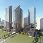
On a larger scale though, I think this RER extension accomplishes a lot of valuable goals: It links downtown Hamilton to the Mountain (both existing and future development). It links the Mountain to the rest of the GTA via the RER line that would continue all the way to Oshawa. It turns the BLAST network from a long haul network into a feeder network, with every line connecting to the RER line at some point along it's route. It links to the airport, which would allow Hamiltonians, as well as people from Halton Region and even further east to use that airport as an alternative to Pearson, without having to drive there. It would also give the sprawl occurring on the Mountain some points around which to centre. Yes, you could say that this would accelerate the sprawl, but the reality is it's happening anyway. Might as well make it less dependent on long distance auto travel.

The corridor is already there, and by and large the grade separations, particularly along the escarpment, are already there. The most complicated part of the line would be the section from Mohawk Rd to Stone Church Rd, which would likely involve going under the Linc. Still, compared to an LRT or a subway, the cost per km of this line should be pretty reasonable.
 
As much as I'd like to see some of these old trails still sitting as potential corridors (particularly the Leaside trail which would've made realignment of the Richmond Hill line easier), I am almost certain that this kind of back-conversion would be a complete non-starter, particularly from the perspective of municipal and provincial politicians. I think we can only assume that what's converted is lost, and just be mindful of preserving existing RoW's that haven't been converted.

As a frequent runner on the Beltline trail, although there is no need for the corridor ever to be converted, if you look at its usage as a proxy for other trails, it just won't happen.

Agreed. While converting unused rail corridors into rail trails is a good idea on the surface, converting them back if they're needed could prove exceedingly difficult, and ultimately force the public to pay for a much costlier option (ex: at-grade or grade separated along a parallel street, etc).

I have no qualms about using these corridors as paths while they're no longer needed, but the conversion should be done with the explicit understanding that the City or Metrolinx or whoever reserves the right to re-install rails in the corridor for use as a rapid transit corridor at any point. Unfortunately, I don't think that that was ever really part of the consideration, and thus getting them back may prove politically difficult, and will need to be done in the face of a small but vocal opposition.
 
I’d like to get to know Hamilton more than I do. Of any mid-size city in the GTHA, I think it has the most potential to be great. Waterfront, amazing topography, heritage buildings, a natural downtown…all it needs is more intensification and TOD, and I guess a streetcar/LRT.

As much as I'd like to see some of these old trails still sitting as potential corridors (particularly the Leaside trail which would've made realignment of the Richmond Hill line easier), I am almost certain that this kind of back-conversion would be a complete non-starter, particularly from the perspective of municipal and provincial politicians. I think we can only assume that what's converted is lost, and just be mindful of preserving existing RoW's that haven't been converted.

As a frequent runner on the Beltline trail, although there is no need for the corridor ever to be converted, if you look at its usage as a proxy for other trails, it just won't happen.

I'd consider the Belt Line to be a bit different from standard rail-to-trail conversions because it was used so long ago - and even then it was only briefly. I believe different sections were used well after the 1890s, but the track through Moore Park was pulled up in the 40s. As well, I don’t think its route could’ve worked with conventional technology because of the steep grades (although that doesn’t rule out streetcar operation).

But I’m still holding out hope that the Leaside Spur can become rail again. As much as I’m a supporter of bike/recreation trails, I think it’s too strategic and important to have been let go of. It’s currently City-owned, but if we sold it to Metrolinx we could absolve ourselves of wrongdoing and shield ourselves against NIMBY backlash. I think the Prov is much better suited to pushing forward with these decisions.
 
As much as I'd like to see some of these old trails still sitting as potential corridors (particularly the Leaside trail which would've made realignment of the Richmond Hill line easier), I am almost certain that this kind of back-conversion would be a complete non-starter, particularly from the perspective of municipal and provincial politicians. I think we can only assume that what's converted is lost, and just be mindful of preserving existing RoW's that haven't been converted.

As a frequent runner on the Beltline trail, although there is no need for the corridor ever to be converted, if you look at its usage as a proxy for other trails, it just won't happen.

I am only aware of one rail trail that's specifically reserved for re-activation if needed - the former Montreal and Ottawa Railway (later known as the Canadian Pacific M&O subdivision) which was abandoned in the 1980s except the portion still used by AMT. It is owned by VIA rail in case a high-speed rail project ever requires the right of way - it's a better alignment, for the most part, than the Alexandria Sub used today by VIA.

I support rail trails; at least they theoretically can be re-activated as the corridor is preserved; most railway rights-of-way are sold off to adjacent landowners instead and are even harder to put back together, like the CASO subdivision.

But the former CN Hagersville Sub? The trouble is that while it climbs the escarpment on a rail-friendly alignment, it doesn't do a very good job serving people where they live. I've biked it serveral times. You're much better off with a route directly south from Downtown Hamilton, serving St. Joseph's Hospital, Mohawk College, and other nodes. I'd also like to see a return of daily coach bus service between Hamilton, Caledonia and Port Dover; that's an unrealistic rail market.
 
Last edited:
But the former CN Hagersville Sub? The trouble is that while it climbs the escarpment on a rail-friendly alignment, it doesn't do a very good job serving people where they live. I've biked it serveral times. You're much better off with a route directly south from Downtown Hamilton, serving St. Joseph's Hospital, Mohawk College, and other nodes. I'd also like to see a return of daily coach bus service between Hamilton, Caledonia and Port Dover; that's an unrealistic rail market.

RER doesn't need to directly serve people where they live, it just needs to have stations at convenient access points, either for local transit or for driving. Yes, I agree that it could be better if it took a more direct route from lower to upper, but the existing rail corridor is the least expensive option by a long shot. Development on the Mountain is going to continue, and there will need to be some sort of GO rail service up there eventually. Might as well build it now so that it can guide development.

The RER route that I'm proposing serves express trips to downtown Hamilton, as well as trips eastward into Halton, Peel, and Toronto. The James LRT, which follows the route you describe, is still in this plan, and would do a great job of hitting local trip generators and stimulating local demand.

The RER route here could also run the coach service you describe from the terminus at White Church, similar to how Oshawa has buses to Peterborough and similar exurban locations.
 
I’d like to get to know Hamilton more than I do. Of any mid-size city in the GTHA, I think it has the most potential to be great. Waterfront, amazing topography, heritage buildings, a natural downtown…all it needs is more intensification and TOD, and I guess a streetcar/LRT.

Agreed. I think for all the horrible reputation Hamilton has regionally last half century, this century Hamilton will shed that reputation and grow substantially. And that will start with transit investment both within the city and between it and Toronto. Once the Hamilton labor market is merged with the GTA, Hamilton will prove to be a regionally vital city-center and things will get more interesting. :)

I was doing some google-maps exploring and I am surprised at how many parking lots are within Hamilton, definitely lots of room and space for infill developments.
 
I’d like to get to know Hamilton more than I do. Of any mid-size city in the GTHA, I think it has the most potential to be great. Waterfront, amazing topography, heritage buildings, a natural downtown…all it needs is more intensification and TOD, and I guess a streetcar/LRT.

Yes it seems like one of the most interesting cities in southern Ontario because of the reasons you mentioned. Being near the lake for better climate and beaches is a really great benefit, in my opinion. Great waterfalls, very hilly with good places for hiking and scenic views from high elevations. Neighbourhoods with character & historic architecture.

I was thinking about taking a day trip somewhere with GO for fun and Hamilton seemed like the ideal place, and since I almost never ride GO and want to try it. Unfortunately the all day two way service ends before reaching Hamilton (for now).
 

Back
Top