News   Jul 12, 2024
 1.1K     0 
News   Jul 12, 2024
 976     1 
News   Jul 12, 2024
 366     0 

Transit Fantasy Maps

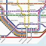
Essentially, Council just voted to kick the can down the road by a few more years. If you believe the vote meant something, we still do not even know what alignment the subway would take, and if the EA is going to look at what route is best to serve Scarborough, we could have almost anything become the preferred alternative.

Given that the province has a serious stake in this subway now, and federal money are involved, it is very unlikely that anything but subway will be built in the corridor between Kennedy station and Scarborough Centre.

The alignment and the number of stops might change.

I do not see any person, group, or party that would have both clout and interest in promoting any other technology in this corridor.
 
I did some more thinking about the DRL using the Scarborough Subway, and I came to a conclusion:

DRL%20Option%203.jpg


With the Scarborough Subway being part of the DRL, much of the "relief" function of the DRL is already being satisfied. The transfer of B-D riders onto the DRL at Pape or Donlands is much less critical, because the bulk of them are already on it (from Victoria Park eastward).

What does this mean? It means that, from a numbers perspective, there doesn't need to be a DRL branch up Pape, through Thorncliffe Park, and up to Eglinton & Don Mills. Because of the reduced importance, building the Don Mills LRT pretty much as envisioned in Transit City may actually be the best option, because it can go north of Eglinton. The only difference would be that it would extend south of the Danforth, and end at a terminus at Gerrard Square, at a hub with the DRL and GO REX.

Not having to branch simplifies DRL operations, and the LRT can go all the way up to Finch for about the same cost as building the DRL branch up to Eglinton. Using the eastern end of B-D as the DRL opens up a whole bunch of interesting opportunities, and this includes resurrecting the Don Mills LRT in a way that actually makes sense.
 
Last edited:
Dunno if this was posted before but I saw this on Josh Matlow's website:

relief%20line.png


So this is how the map would look like you think? No stations listed on the LRT, just a blank line?
 
I did some more thinking about the DRL using the Scarborough Subway, and I came to a conclusion:

DRL%20Option%203.jpg


With the Scarborough Subway being part of the DRL, much of the "relief" function of the DRL is already being satisfied. The transfer of B-D riders onto the DRL at Pape or Donlands is much less critical, because the bulk of them are already on it (from Victoria Park eastward).

What does this mean? It means that, from a numbers perspective, there doesn't need to be a DRL branch up Pape, through Thorncliffe Park, and up to Eglinton & Don Mills. Because of the reduced importance, building the Don Mills LRT pretty much as envisioned in Transit City may actually be the best option, because it can go north of Eglinton. The only difference would be that it would extend south of the Danforth, and end at a terminus at Gerrard Square, at a hub with the DRL and GO REX.

Not having to branch simplifies DRL operations, and the LRT can go all the way up to Finch for about the same cost as building the DRL branch up to Eglinton. Using the eastern end of B-D as the DRL opens up a whole bunch of interesting opportunities, and this includes resurrecting the Don Mills LRT in a way that actually makes sense.

I really like your map. Do you have a larger version? Or one that focuses on the DRL?
 
With the Scarborough Subway being part of the DRL, much of the "relief" function of the DRL is already being satisfied. The transfer of B-D riders onto the DRL at Pape or Donlands is much less critical, because the bulk of them are already on it (from Victoria Park eastward).

What does this mean? It means that, from a numbers perspective, there doesn't need to be a DRL branch up Pape, through Thorncliffe Park, and up to Eglinton & Don Mills. Because of the reduced importance, building the Don Mills LRT pretty much as envisioned in Transit City may actually be the best option, because it can go north of Eglinton. The only difference would be that it would extend south of the Danforth, and end at a terminus at Gerrard Square, at a hub with the DRL and GO REX.

Not having to branch simplifies DRL operations, and the LRT can go all the way up to Finch for about the same cost as building the DRL branch up to Eglinton. Using the eastern end of B-D as the DRL opens up a whole bunch of interesting opportunities, and this includes resurrecting the Don Mills LRT in a way that actually makes sense.

That layout has a major drawback: the trunk role of the Don Mills line is totally eliminated. Those who live within walking distance from Don Mills will use this LRT line. But people living elsewhere between Yonge and Kennedy will not take a bus to LRT, and then LRT to Gerrard Square and transfer to subway that is already full at that point. They will continue taking a bus to Yonge or BD lines.

The optics isn't great, either: all subway construction in Toronto tailored to benefit Scarborough. East York and other areas will take offense, especially given that LRT will anyway have to be underground from Gerrard terminus to at list Thorncliffe.

I like the branched DRL option (Don Mills + Scarborough); but if TTC is unwilling to operate branches, then I think it is better to send the subway up Don Mills.
 
I did some more thinking about the DRL using the Scarborough Subway, and I came to a conclusion:

DRL%20Option%203.jpg


With the Scarborough Subway being part of the DRL, much of the "relief" function of the DRL is already being satisfied. The transfer of B-D riders onto the DRL at Pape or Donlands is much less critical, because the bulk of them are already on it (from Victoria Park eastward).

What does this mean? It means that, from a numbers perspective, there doesn't need to be a DRL branch up Pape, through Thorncliffe Park, and up to Eglinton & Don Mills. Because of the reduced importance, building the Don Mills LRT pretty much as envisioned in Transit City may actually be the best option, because it can go north of Eglinton. The only difference would be that it would extend south of the Danforth, and end at a terminus at Gerrard Square, at a hub with the DRL and GO REX.

Not having to branch simplifies DRL operations, and the LRT can go all the way up to Finch for about the same cost as building the DRL branch up to Eglinton. Using the eastern end of B-D as the DRL opens up a whole bunch of interesting opportunities, and this includes resurrecting the Don Mills LRT in a way that actually makes sense.

Your purple line looks a bit heavier on Queen - I am guessing that the 2 branches of the Lakeshore West would become tunnelled through this portion from maybe Roncessvalles to Dufferin. Maybe the Harbourfront LRT/Street Car could be extended to this Roncy Station.

For the Don Mills LRT, could you consider something like reverse branching. Normally, 2 branches should come together to a tunnelled portion* as you get to the busier areas. In this case, there is plenty of room on Don Mills north of DVP, but south of it the roads are very narrow. Maybe you could run the LRT in the road median (streetcar style) from DVP to the DRL. (Give it signal priority and dedictated lanes during rush hour**). Next, split that LRT traffic on 2 streets instead of just one (Pape) - this would give the LRT in semi-mixed traffic a better chance of working. I would suggest a separate Don Valley bridge that joins in to either Coxwell or Woodbine and goes down to the DRL.

* - That is one thing I do not like about Transit City and Eglinton LRT in particular. $4B is spent on a tunnel, yet there is no branching. In the West, maybe at Jane one branch could continue along Eglinton and one could go up to Dixon and across to Pearson. In the East, I could never find any good opportunities.
** - I think the street car tracks should be elevated a few inches above the right lanes so cars know they are on the streetcar ROW. It might lead to better compliance.
 
I really like your map. Do you have a larger version? Or one that focuses on the DRL?

Thanks! Here's the full version: https://dl.dropboxusercontent.com/u/43869799/DRL Option 3.jpg

That layout has a major drawback: the trunk role of the Don Mills line is totally eliminated. Those who live within walking distance from Don Mills will use this LRT line. But people living elsewhere between Yonge and Kennedy will not take a bus to LRT, and then LRT to Gerrard Square and transfer to subway that is already full at that point. They will continue taking a bus to Yonge or BD lines.

The optics isn't great, either: all subway construction in Toronto tailored to benefit Scarborough. East York and other areas will take offense, especially given that LRT will anyway have to be underground from Gerrard terminus to at list Thorncliffe.

I like the branched DRL option (Don Mills + Scarborough); but if TTC is unwilling to operate branches, then I think it is better to send the subway up Don Mills.

I would say the relief role is actually increased, because in this scenario you have RT on Don Mills that actually goes north of Eglinton. As for transfers, how is taking a bus to the LRT and then transferring to the subway any different than taking a bus to B-D and then transferring at B-Y now? And like I said, the bulk of the riders that would be transferring onto the DRL at Pape get on B-D at Victoria Park, Warden, or Kennedy (from the SRT). In this scenario, they aren't transferring, so "intercepting" them isn't a need.

Doing this option also keeps the possibility open of doing an LRT under Queen or Dundas into downtown. From Gerrard Square, the line can eventually go westward, or southward, or eastward, depending on how the travel patterns shift.

Your purple line looks a bit heavier on Queen - I am guessing that the 2 branches of the Lakeshore West would become tunnelled through this portion from maybe Roncessvalles to Dufferin. Maybe the Harbourfront LRT/Street Car could be extended to this Roncy Station.

Yes, it would run in a tunnel under Queen from just west of Roncesvalles to Dufferin & Queen (I've called it Parkdale Station on other maps). Doing it this way also leaves the door open for a Queen LRT extending into downtown. Parkdale Station would be the biggest transit hub in the west end, with a subway line, an LRT line, a streetcar line, and 2 GO REX lines.

For the Don Mills LRT, could you consider something like reverse branching. Normally, 2 branches should come together to a tunnelled portion* as you get to the busier areas. In this case, there is plenty of room on Don Mills north of DVP, but south of it the roads are very narrow. Maybe you could run the LRT in the road median (streetcar style) from DVP to the DRL. (Give it signal priority and dedictated lanes during rush hour**). Next, split that LRT traffic on 2 streets instead of just one (Pape) - this would give the LRT in semi-mixed traffic a better chance of working. I would suggest a separate Don Valley bridge that joins in to either Coxwell or Woodbine and goes down to the DRL.

* - That is one thing I do not like about Transit City and Eglinton LRT in particular. $4B is spent on a tunnel, yet there is no branching. In the West, maybe at Jane one branch could continue along Eglinton and one could go up to Dixon and across to Pearson. In the East, I could never find any good opportunities.
** - I think the street car tracks should be elevated a few inches above the right lanes so cars know they are on the streetcar ROW. It might lead to better compliance.

Your suggestion is very similar to what Ottawa was proposing in their original N-S LRT plan for downtown, and I believe what K-W is building now. That scenario certainly could work, and given that the Don Mills LRT would be the secondary feeder to the DRL instead of the primary feeder, that may be a cost-effective solution.
 
I was also thinking about how the DRL could potentially work within the rail corridor. What I think would be cool to build an elevated structure over the rail corridor, but have it covered, somewhat like this (http://upload.wikimedia.org/wikipedia/commons/8/8f/Sapporo_subway_shelter.jpg), but only a bit more glass to make it more open. I would suspect that any elevated line along that corridor would draw the eyre of neighbours because of noise, but if the line is covered like that and properly sound proofed, that should mitigate the vast majority of it. Not to mention during the winter not having to worry about freezing switches or really cold open air stations.
 
... or you could build it properly for a little bit more underground away from the corridor. The rail corridor doesn't hit proper ridership points, and you would only save a couple hundred million by putting it on the rail corridor. While these new ideas are great for discussion, in the end I feel the only line that actually makes sense is connecting to Pape or Donlands. (preferably Donlands for me) If you connect further out you miss large portions of ridership (remember that large portions of the B-D line come from stations before Victoria Park) and any closer and you will be saving minimal amounts of time for riders, giving little incentive to transfer there instead of Yonge. (that's the reason I prefer Donlands as the transfer, it saves 1 more stop on the B-D line but doesn't add an additional stop on the DRL meaning an even faster ride through, even with a more tightly packed stop spacing on the DRL) The only major routing that I really feel is debatable is the western portion. You could run it up Roncasvalles, Dufferin, Lansdowne, etc.

My phase 1 of the DRL still runs something like this: (though I would prefer the current plan of building phase 1 & 2 at once)

Donlands
Gerrard
Carlaw
River
Parliament
Jarvis
King
St. Andrew
Spadina

This is tight enough stop spacing to eliminate the 504 from Carlaw to Spadina (and the entire King st. portion would be eliminated once the Western DRL is built, only maintaining the Roncasvalles portion as the stop spacing on the DRL would be to limited on that portion of the line) and would probably still shave 3-4 minutes off of someones commute. (much more if you are a streetcar user on the 501,502, 503, 504, 506 and 508 lines)
 
Last edited:
Actually, the majority of the ridership on Bloor-Danforth east of Pape comes from sections of the line that under the scheme above would become part of the DRL. From Kennedy to Victoria Park, the total ridership is 122,480 (source: http://www.ttc.ca/PDF/Transit_Planning/Subway ridership 2011-2012.pdf). From Main to Donlands (the station before the supposed transfer) the ridership is 78,680. Almost 65% of the potential DRL transferees are saved a transfer by this setup, a number that will only go higher when the Scarborough Subway to McCowan & Sheppard is built.

The fact that the rail corridor in this scenario isn't a big ridership generation area is borderline irrelevant, since most of the people who would in a "traditional" DRL setup be transferring at Pape/Donlands are already ON Bloor-Danforth by the time they hit Main St. Add in a new DRL station at Main St to intercept the 504 and provide a transfer with GO REX, and put in a stop at say Coxwell, and you're good to go. The whole point of putting it in the rail corridor is to provide an express bypass so people from Scarborough don't have to go through stations like Greenwood and Donlands in order to reach downtown.
 
What is the status of the Don Mills LRT?

It was pushed to a subsequent yet-to-be-funded, yet-to-have-timeline-determined phase, along with the Jane LRT, the Waterfront West LRT, and the Scarborough-Malvern LRT. It's probably one of the most in-limbo lines, because it's fate is directly tied to what option is decided for the DRL.
 
regardless you are still skipping 45% of your ridership. again, it isn't worth saving a couple hundred million to bypass 45% of your ridership. To refute that 45% of ridership isn't a large portion of the ridership is silly. That's the difference between a full train and one with seats to spare. you essentialy argued against yourself there by saying your version of the DRL would only be 65% effective as my version of the DRL all to save a stupid transfer that people couldn't care less if it existed or not.

Don Mills LRT is dead. It is only mentioned in transit fantasy images today, as the DRL is now planned to serve the busiest portion of the LRT (south of Eglinton) and the fact that it didn't make the cut for Metrolinx's Big Move. What remains of the LRT ( the portion north of Eglinton) would be better off as bus lanes, especially since VIVA is supposed to switch it's routing to the Sheppard subway on Don Mills only by 2017.
 
Last edited:
gpr8a01l.png


Largehttp://i.imgur.com/gpr8a01.png

The cutbacks continue! As was suggested, I truncated Jane south of Eglinton. The LRT really didn't make sense south of there. And the Malvern BRT now terminates at Scarborough Centre rather than Midland.

I'm also considering dumping the Don Mills Subway from Eglinton to Finch. The idea was that bus riders from the east would transfer to Don Mills instead of Yonge (four of the TTCs most used routes run through or on Don Mills). But I'm not convinced that it will relieve the Yonge Subway enough to justify the $3 Billion price. It would probably have only 70% - 80% of the riders that the Spadina Subway (Glencarin to Sheppard West) has
 
Last edited:
gpr8a01.png


The cutbacks continue! As was suggested, I truncated Jane south of Eglinton. The LRT really didn't make sense south of there. And the Malvern BRT now terminates at Scarborough Centre rather than Midland.

I'm also considering dumping the Don Mills Subway from Eglinton to Finch. The idea was that bus riders from the east would transfer to Don Mills instead of Yonge (four of the TTCs most used routes run through or on Don Mills). But I'm not convinced that it will relieve the Yonge Subway enough to justify the $3 Billion price. It would probably have only 70% - 80% of the riders that the Spadina Subway (Glencarin to Sheppard West) has
All of your maps are great. Really. Lots of thought in these. I would keep don mills, maybe bring it to finch. I would keep Jane south of Eglinton. I think the ridership will be there for both. But not Jane south of Bloor. Close the Sheppard subway in between Yonge Sheppard and Downsivew. Maybe bring it to Albion or Martin Grove.

Add a LRT or BRT on any of Islington, Kipling, Martin Grove, Royal York, Warden, Birchmount, Kennedy, Markham roads. North South Transit is lacking this city.
 
Last edited:

Back
Top