Toronto Panorama at Concord CityPlace | 96.01m | 28s | Concord Adex | BDP Quadrangle

Re: pano

gbelan:

It's Block 31 and Block 32/36 of the West Railway Lands - there is a map in here:

www.toronto.ca/legdocs/by...aw1073.pdf

The social housing component is going to be at both ends of the park - that said, both are going to be mixed social and market housing projects.

AoD
 
Re: pano

was wondering if anybody knew about the status of the park. is there a start date for construction?
 
Re: pano

mark simpson:

I think there is space for both a school/community centre AND social housing in the N-S subdivided Block 31.

AoD
 
Re: pano

teh government housing?

please don't call it that.

Re:park

Does anybody have a better rendering? From my limited review it looks uninspiring.

Louroz
 
CityPlace: Panorama

I couldn't find an existing thread for this.

There were questions in other threads about exactly where Panorama is going...

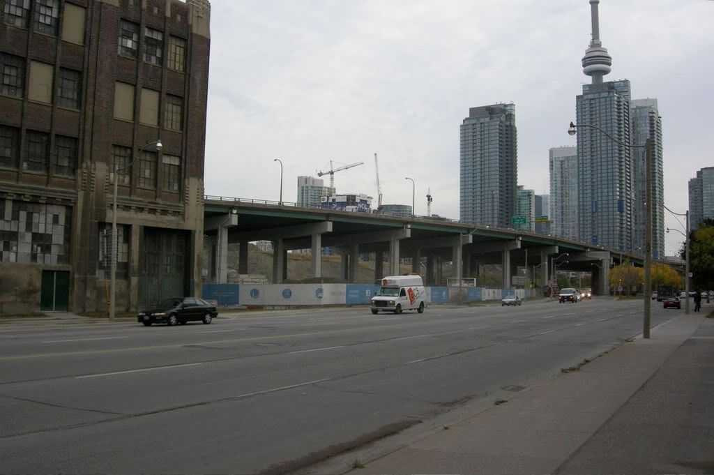
Looks like a tight squeeze for the building behind the blue and white boards... and an almost impossible entrance/exit for drivers who will live here.

DSCN1062.jpg


^Looking west along Lakeshore with Malibu rising one block west.

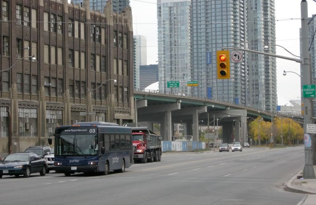
DSCN1061.jpg


^Looking east on Lakeshore... right next to that great old building (possibly for Loblaws, and at one point we wondered maybe for Malibu II).

DSCN1057.jpg


^ Fly Porter!
 
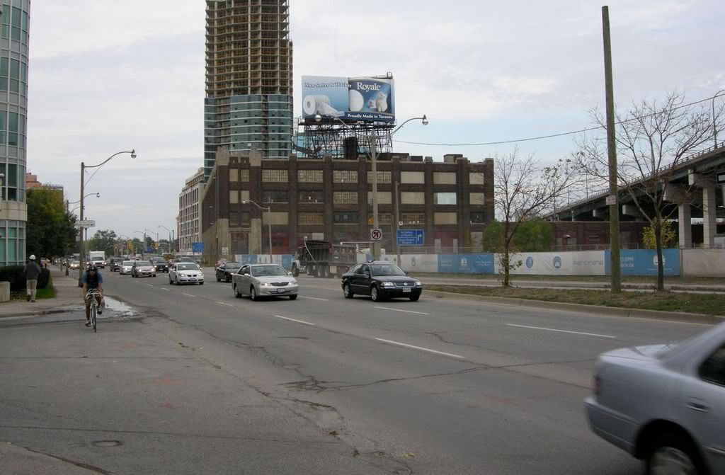
Loblaws building a perfect candidate for another Aa Burano-style makeover to keep the streetwall intact! Then have some single story market shops under the Gardiner to keep the area vibrant; narrow Lakeshore Blvd or have on street parking, plant some gorgeous trees (including fir trees for winter time), some University Ave-style planters and sculptures=instant beautiful vibrant place to live.
 
I don't think it's much more than a driveway that's planned for cars accessing Loblaws, so narrower than a full-blown road.

42
 
Isn't there a road planned to go between this project and the warehouse connecting up to Fort York Blvd?

From the photo's I shoot on Sunday, the answers is no.

At Bathurst St. Note elevation difference
1478369398_b52d8ce723_b.jpg

1478373442_2497c6e2ba_b.jpg


Midpoint. Note: The Fort York LRT ROW is in place considering the EA is only starting now. The only thing missing is the tracks, poles and platforms. Now who said its going to run here when it may go up onto Front St? The road going to the south will connect to Loblaws.
1478378242_e1e17078bb_b.jpg

1477522413_dbc66a531f_b.jpg

1477516613_3fa58cd3b8_b.jpg


At Spadina
1478383742_c3c9b01673_b.jpg


This road is way to wide for this area.
1477520491_a996a9072e_b.jpg


Precast panels
1477526485_e1e3fad24c_b.jpg
 
The heritage truss portion of the Bathurst bridge won't be touched - that was rehabbed about 10 years ago. It is the structures south of that which will be rebuilt. Odd that they've poured concrete curbs right up to Bathurst Street when the grade needs to be changed at that location...IIRC they will be altering the FYB/Bathurst intersection to flatten it out, allowing streetcars to turn there. As for why a central median streetcar ROW was protected for in advance of an EA...well, that is an interesting question and one which was debated a good deal at the time. The short story is it was better to protect now than have to go back and take away a lane of traffic later (WES wanted the Bremner extension built as a four-laner). Kind of a shame this was done before the Cherry Street EA concept...a dedicated streetcar ROW on the south side of FYB, along the north edge of the park, would have been an interesting concept.
 
Isn't is just possible that it's intended to be used as a (tree-lined) median for the time being and then switched to a ROW once the EA is complete and the need arrises?
 

Back
Top