You are using an out of date browser. It may not display this or other websites correctly.
You should upgrade or use an alternative browser.
You should upgrade or use an alternative browser.
Toronto Lower Don Lands Redevelopment | ?m | ?s | Waterfront Toronto
rdaner
Senior Member
I love the idea of this building becoming a cultural/event centre! And the first exhibit should be a retrospective of Burtynsky’s work including the amazing whale sculpture that he is creating for Kingston. Taken 25 March.

Northern Light
Superstar
I'll post this here first, and double check w/everyone..........
The McCleary District is on the agenda for Waterfront Design Review Panel tomorrow.
I know we've discussed it before, but do we have a dedicated thread for it? As I don't see it if we do.
The McCleary District is on the agenda for Waterfront Design Review Panel tomorrow.
I know we've discussed it before, but do we have a dedicated thread for it? As I don't see it if we do.
mburrrrr
Senior Member
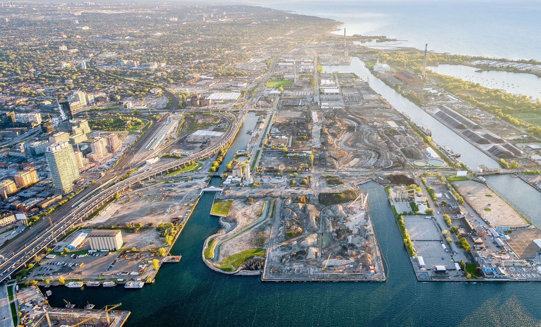
Image from

Port Lands
Toronto’s Port Lands is an area of about 356 hectares (880 acres) that stretches from the Inner Harbour on the west to Leslie Street in the east, and from Lake Shore Boulevard in the north to the to the Outer Harbour in the south. The Port Lands were created in the early 20th Century by filling […]
rdaner
Senior Member
Thanks!
UtakataNoAnnex
Senior Member
From the same link above...
...what are we, Elves? Most of us will be long gone before this thing wraps up! >.<
"a comprehensive 50-plus year vision for the area"
...what are we, Elves? Most of us will be long gone before this thing wraps up! >.<
afransen
Senior Member
There is not enough demand for housing to justify a faster build-out.From the same link above...
...what are we, Elves? Most of us will be long gone before this thing wraps up! >.<
/s
jxmyth_
Senior Member
Currently in the community meeting and a little taken aback that they're saying resident occupancy in 2031. They've increased the density to help the housing crisis, but that 8yr wait doesn't look to help any time soon. Makes me wonder what Sidewalk's timeline would have been.


rdaner
Senior Member
Thanks! But 2031 occupancy can’t be correct. Is there a chance that this date is full buildout? I’m not doubting you but the area is getting ready to start applications for individual projects (the one on Old Cherry.)
UtakataNoAnnex
Senior Member
More like 2074 for occupancy of anything if that, the way they're going on about it. >.<
jxmyth_
Senior Member
Jed Kilbourn of Waterfront TO just confirmed that construction would begin in the late twenties with occupancy "hopeful" for 2031. So that's confirmed.
here's other stuff including a QR code for a poll


here's other stuff including a QR code for a poll
greenleaf
Senior Member
This may be wrong, but it was my understanding that a local population of 20,000-25,000 is needed to sustain a grocery store. That should be a goal of Villiers here IMO. 8500-9000 units seems like it may not make this threshold.
jxmyth_
Senior Member
9,000 units at what- 1.5 per unit = 13,500? Maybe they get a RABBA and pointed towards the pedestrian bridge to Queen's Quay?This may be wrong, but it was my understanding that a local population of 20,000-25,000 is needed to sustain a grocery store. That should be a goal of Villiers here IMO. 8500-9000 units seems like it may not make this threshold.
Was also just thinking about how they have a plan for three non-profit day cares and a school - all this time I was envisioning traffic issues as residents try to come and go at rush hour with Lake Shore jammed up. I never considered the influx of parents who'd be driving in to pick up their kids. I suppose by 2031 we'll have hover-streetcars and transportation tho- so it's sorted
Don't think I heard anything in this meeting about the new density making (the soon to be renamed) Villiers Island a priority. We've got 7 years to get a streetcar up New Cherry, and QQE figured out I guess. Maybe there will be a shuttle to East Harbour (which barely got a mention in this meeting btw) while they figure out an Eastern route.
rdaner
Senior Member
Is that a large Loblaws type of grocery store? What about the smaller format ones like Leo’s?This may be wrong, but it was my understanding that a local population of 20,000-25,000 is needed to sustain a grocery store. That should be a goal of Villiers here IMO. 8500-9000 units seems like it may not make this threshold.
rdaner
Senior Member
I still don’t get the late development timelines! lol What about the other districts? There have been uses on the Portlands for decades such as Pinewood and Rebel. There must be a reason.