Mustapha
Senior Member
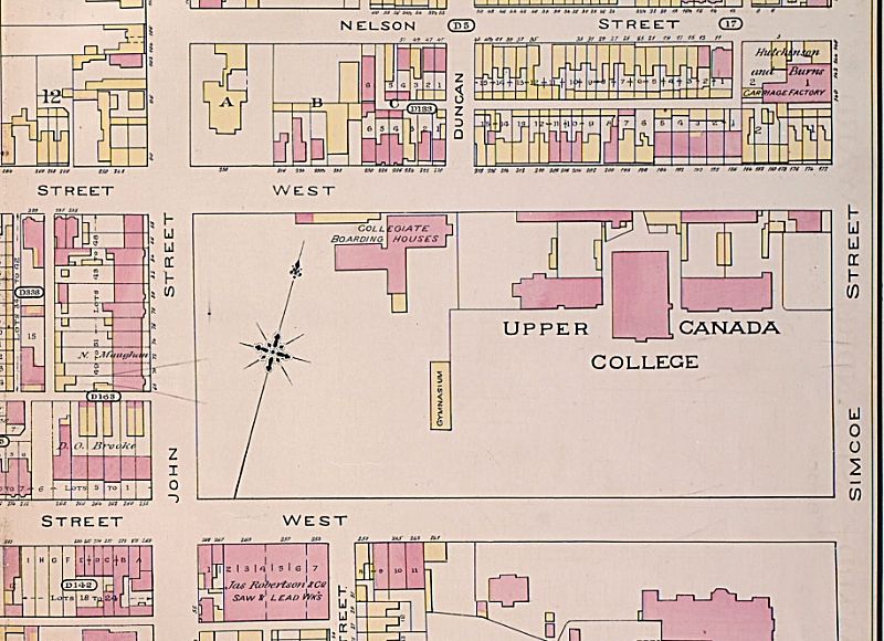
Then and Now for April 9, 2013.
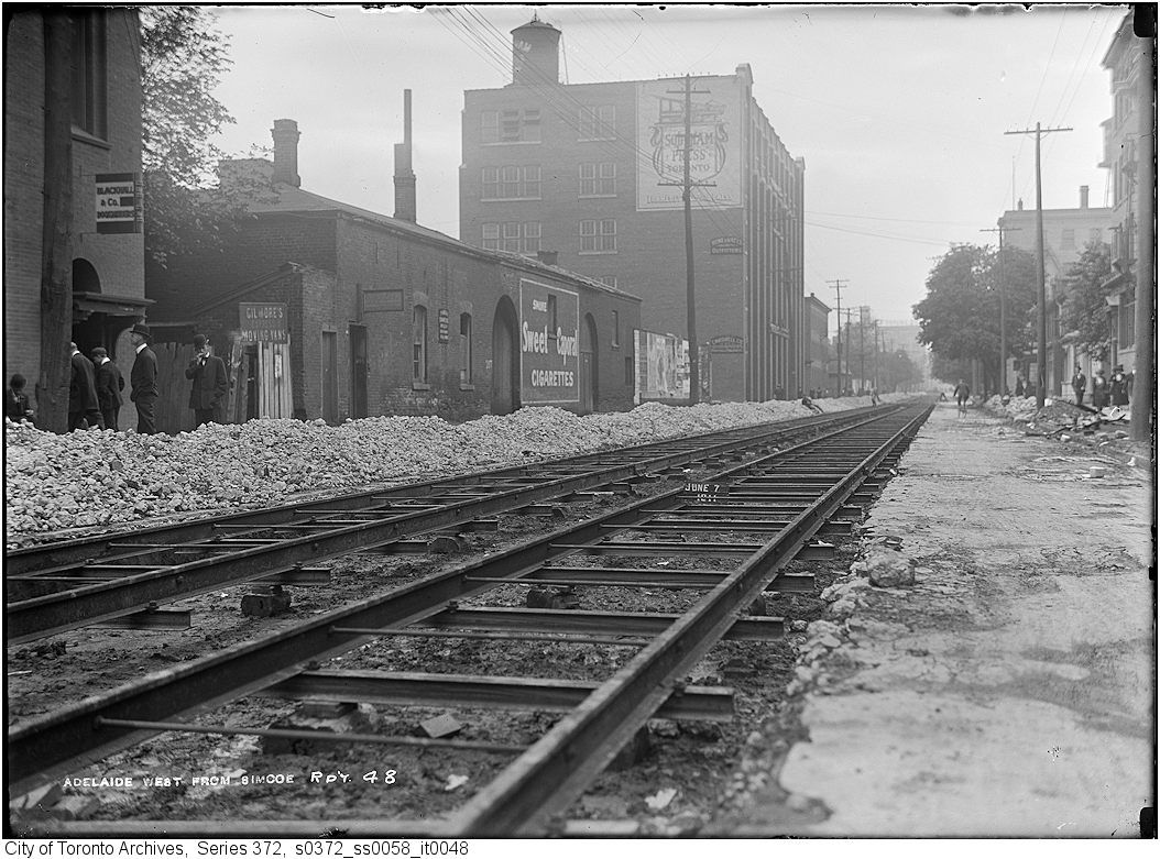
Then. Adelaide looking W from Simcoe today. Same date as yesterday - June 7, 1911.
There is more 'transportation excitement' today than yesterday - streetcar rails are being laid in this view.
The natty smoking bowler hatted gent is contemplating the beckoning future of railed street transport. Parallel Steel Ribbons; hulking electrified one eyed monsters athwart them, demolishing Time and Space; that is, until you get behind the stop and go mass of cars on Queen westbound from about, oh say, Sorauren, in the evening rush hour.")
Now. September 2012.
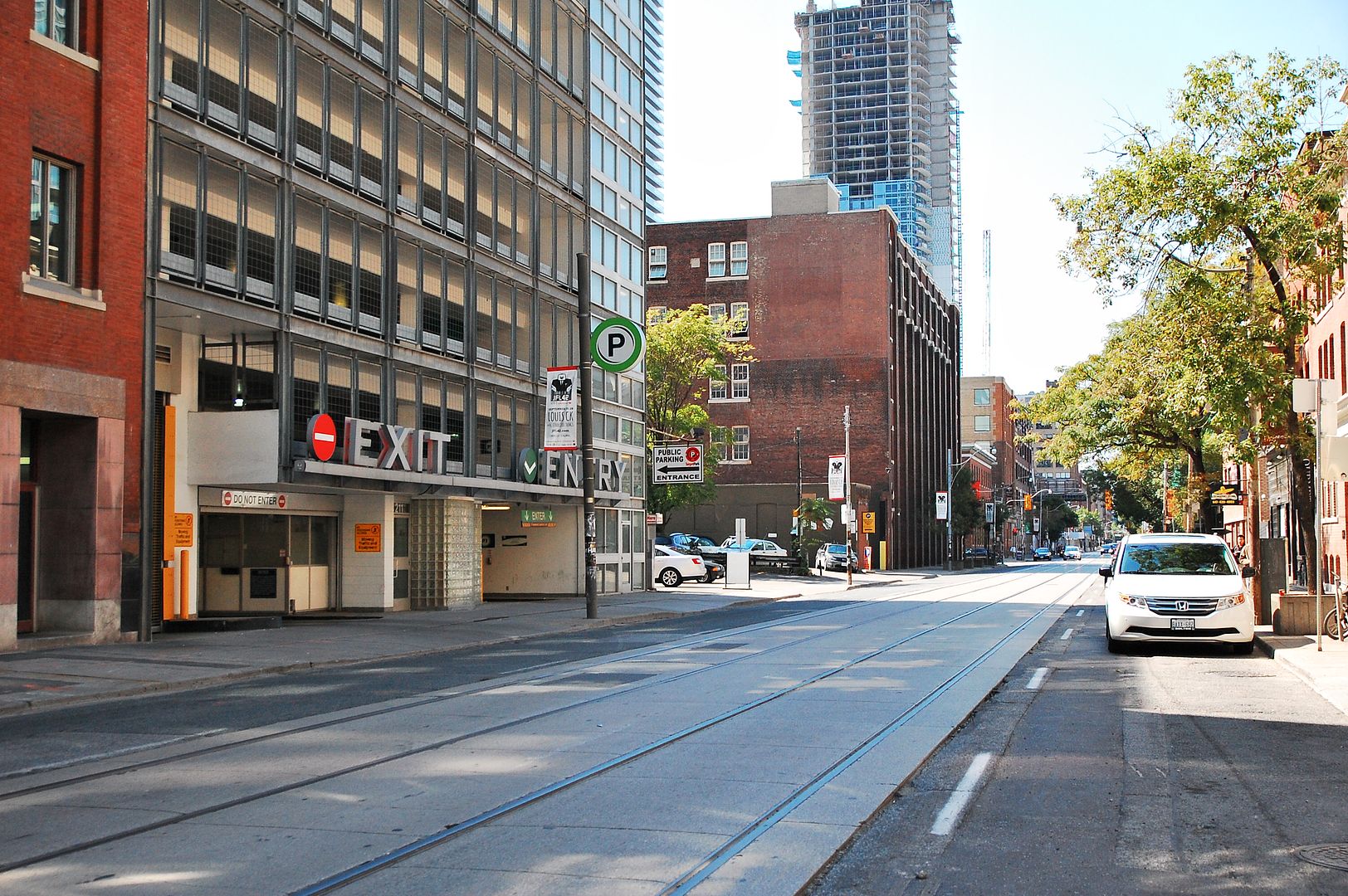
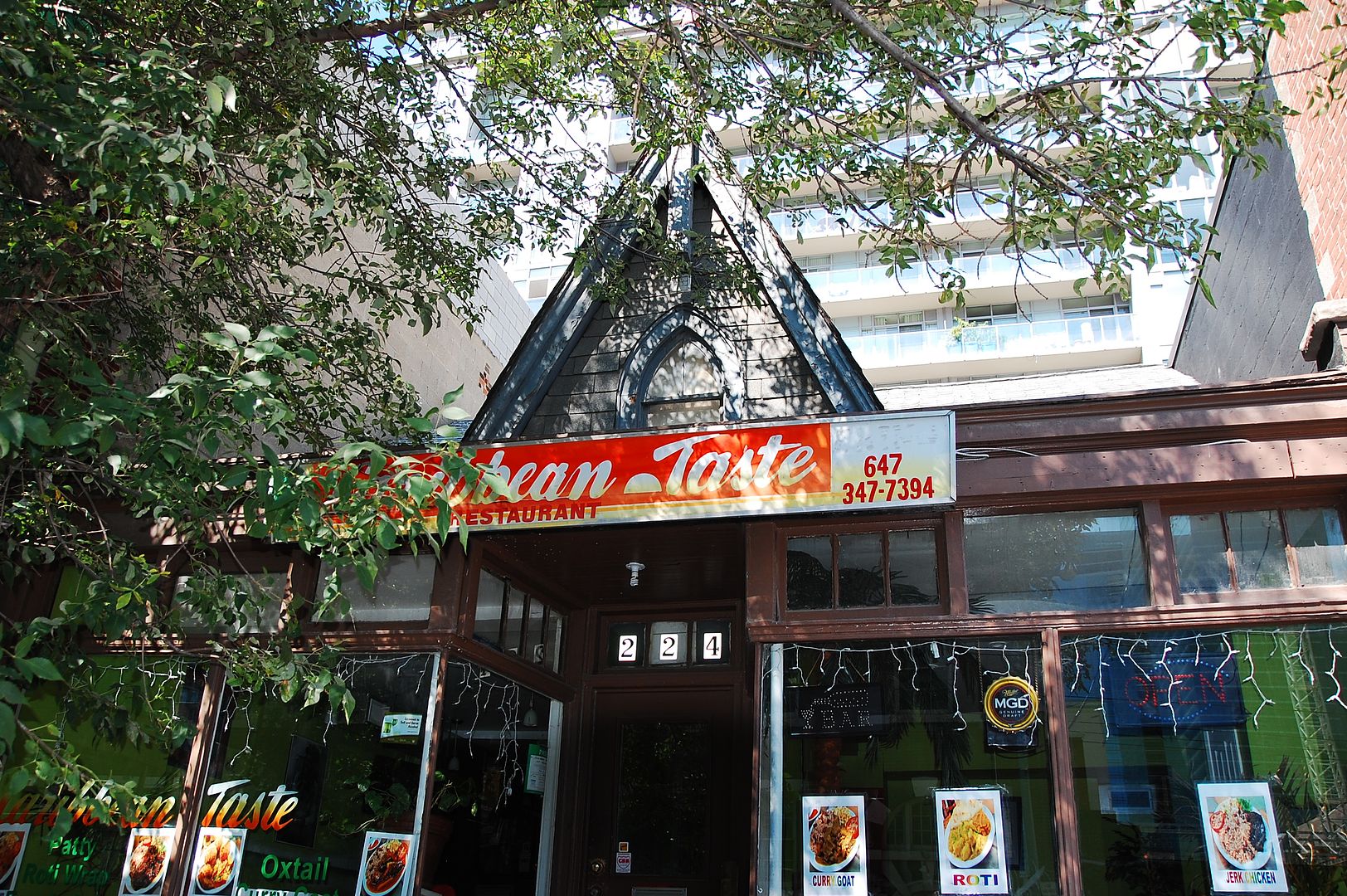
In the right distance in the middle of the roadway of the Then picture, a cyclist can be seen. To his approximate right would have been 224 Adelaide W. It's a fast food place now but a tantalizing glimpse of the past can be seen above it.
Then. Adelaide looking W from Simcoe today. Same date as yesterday - June 7, 1911.
There is more 'transportation excitement' today than yesterday - streetcar rails are being laid in this view.
The natty smoking bowler hatted gent is contemplating the beckoning future of railed street transport. Parallel Steel Ribbons; hulking electrified one eyed monsters athwart them, demolishing Time and Space; that is, until you get behind the stop and go mass of cars on Queen westbound from about, oh say, Sorauren, in the evening rush hour.
Now. September 2012.
In the right distance in the middle of the roadway of the Then picture, a cyclist can be seen. To his approximate right would have been 224 Adelaide W. It's a fast food place now but a tantalizing glimpse of the past can be seen above it.
Last edited: