the lemur
Senior Member
I'll agree it's not Kodachrome, her skin colour is all wrong.
The exterior still seems to be B/W as well ...
|
|
|
I'll agree it's not Kodachrome, her skin colour is all wrong.
Then and Now for September 18, 2012.
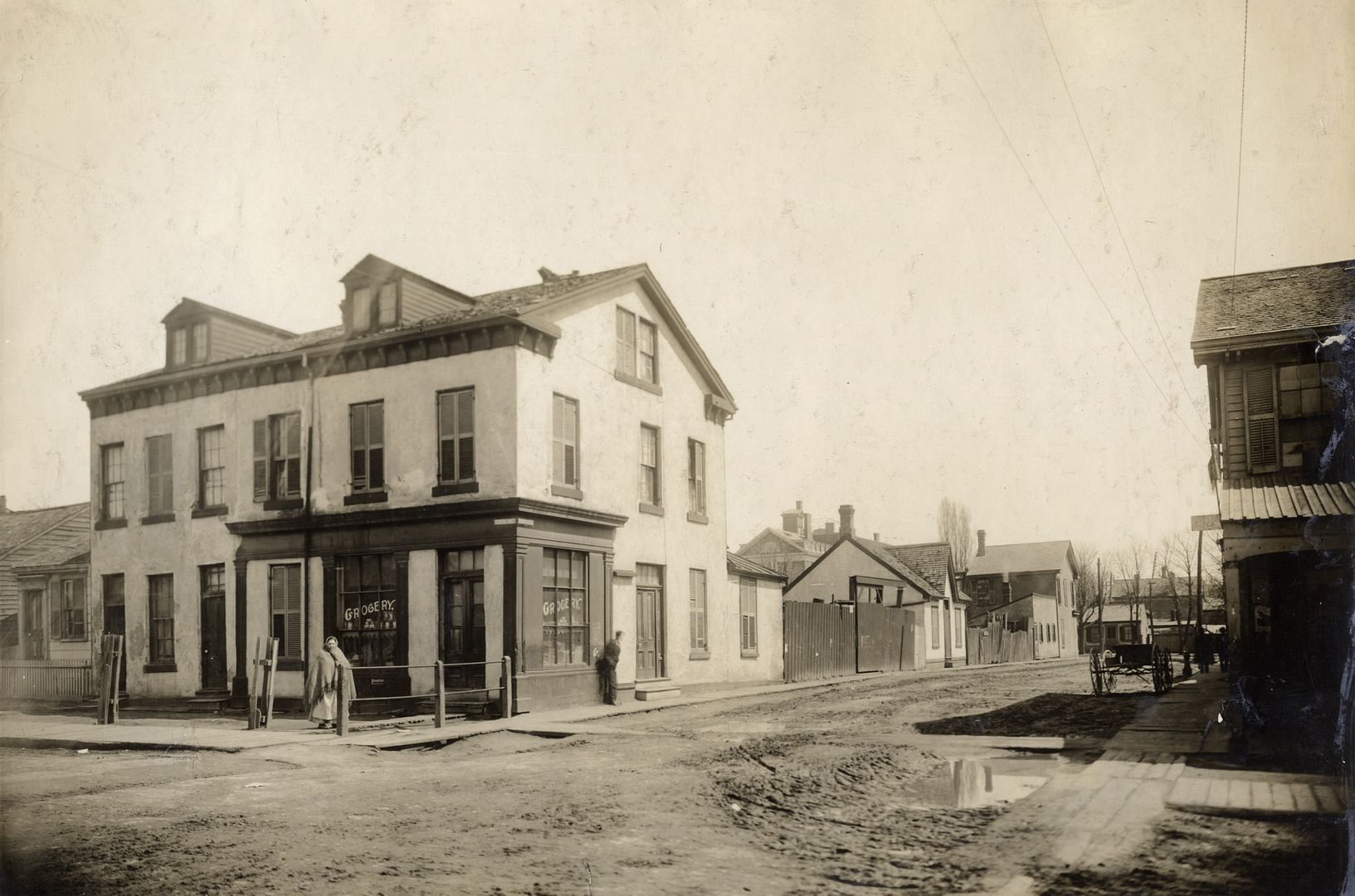
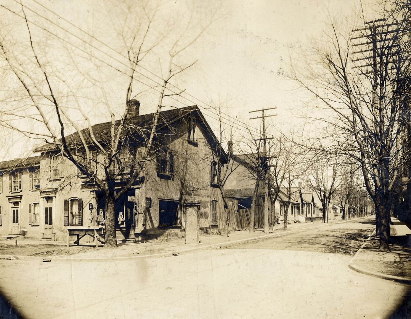
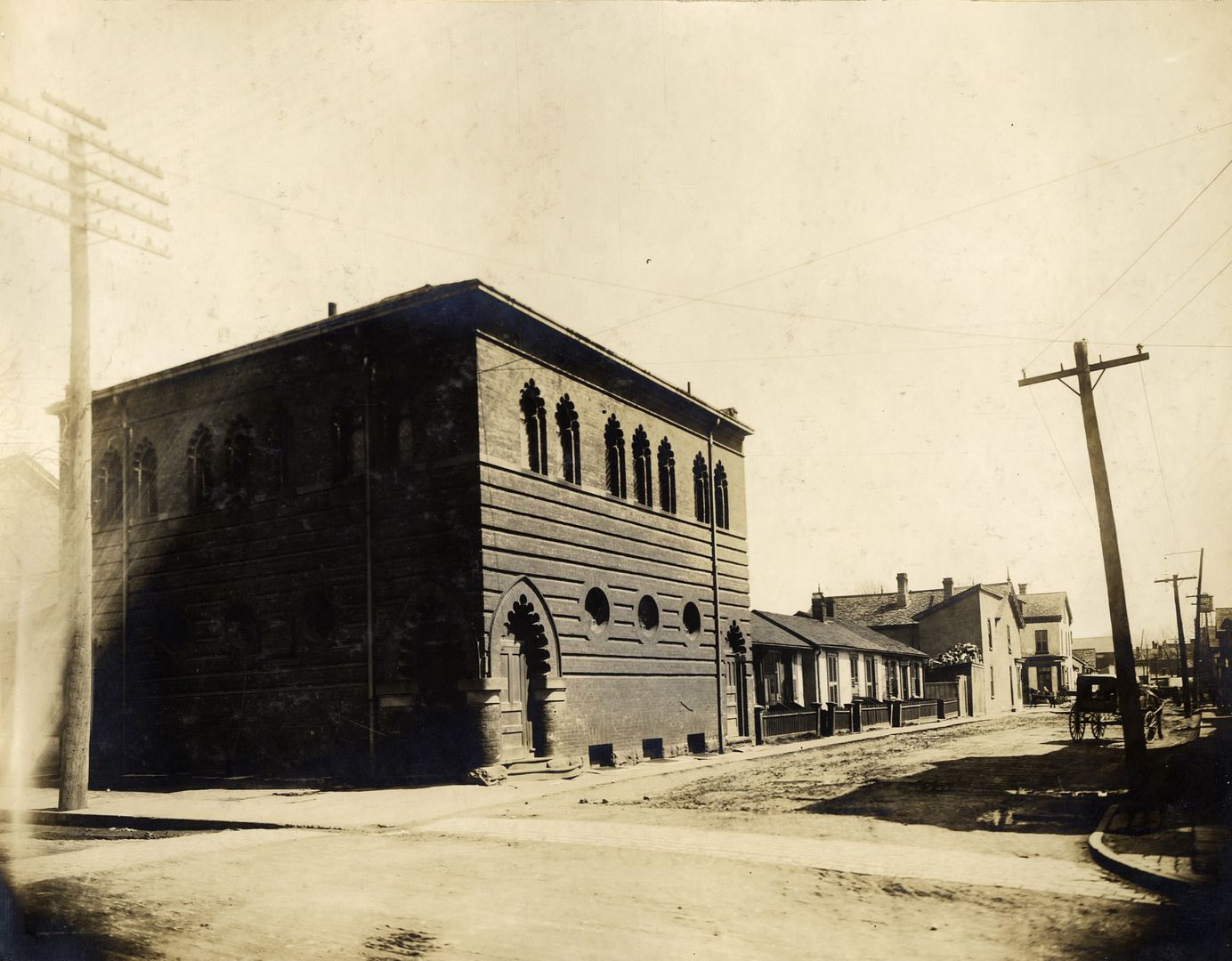
Then. View of Chestnut, looking N from Christopher Street. 1907.
For a great way to research the comings and goings of Toronto street layouts over the years check out UTer plink's Goads Maps:
http://skritch.blogspot.ca/2012/04/goads-atlas-of-toronto-online.html
A great link we've seen before but too useful not to merit an occasional reminder.
.
")
The exterior still seems to be B/W as well ...
Thank you for the kind mention! A minor note for your (Mustapha's) attention: the URL link (to the map site) on the corresponding Urban Toronto post seems to have been truncated (or, rather, elided) in the middle, and consequently doesn't resolve.
In the spirit of sharing useful resources, I'd like to mention a site I've found quite complementary to my usage of the Goad maps:
Jane MacNamara has made a simple list of Toronto City Directories. This consists of the deep-hyperlinks to the corresponding entries in the TPL and Archive.org databases -- it saves you the time of manually searching in those databases for specific years. (this is very useful in the middle of the night when you want to quickly look something up and of course the TRL is closed).
For those who haven't accessed the directories before, you can use them to look up who occupied a particular structure at a given date. And, similarly to Mustapha's comment above, they can be used to track the changing occupants of a building over time.
With reference to the photo -- in 1908 Distaz Domenico lived at 228 Chestnut (on the corner), and at 230 his neighbour was Mel Graziano. Could Distaz or Mel be the gentleman standing sentry on the corner in the photo?! Probably not -- but it's fun to speculate.
ps. Hi JT!
Then and Now for September 18, 2012.
Then. View of Chestnut, looking N from Christopher Street. 1907.
Hard to believe our downtown hospital district was a residential area for a time - from about the mid 1800s and up until about the early 1940s.
Christopher street doesn't exist at all anymore. Nor does Chestnut, at least north of Edward street.
For a great way to research the comings and goings of Toronto street layouts over the years check out UTer plink's Goads Maps:
http://skritch.blogspot.ca/2012/04/goads-atlas-of-toronto-online.html
A great link we've seen before but too useful not to merit an occasional reminder.
.
It's just amazing that a neighbourhood could be wiped clean as if it never existed.
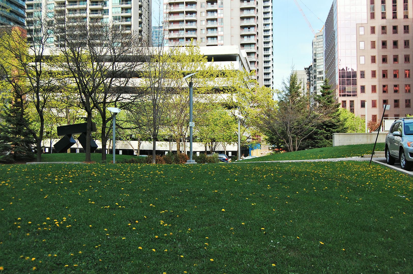
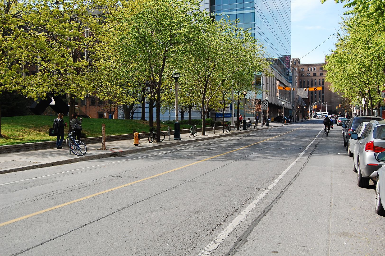
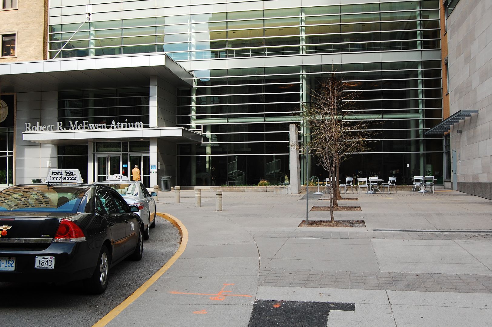
Now. May 2012. The forecourt of Toronto General Hospital. It's just amazing that a neighbourhood could be wiped clean as if it never existed.
Thank you for the kind mention! A minor note for your (Mustapha's) attention: the URL link (to the map site) on the corresponding Urban Toronto post seems to have been truncated (or, rather, elided) in the middle, and consequently doesn't resolve.
I went to the 1910 map on plink's site to find out what the building was at the north end of Chestnut street - but by then the area bounded by University/College/Elizabeth/Christopher was marked 'Site for new General Hospital' and all those buildings in the photo were gone.
Heya,
mattelderca, Hogdust, Hudson8 and the other 'car' guys whose names I can't remember right now. Oh, yah, LI Mike, JT, Gebbois...
I came across this in my travels last week.
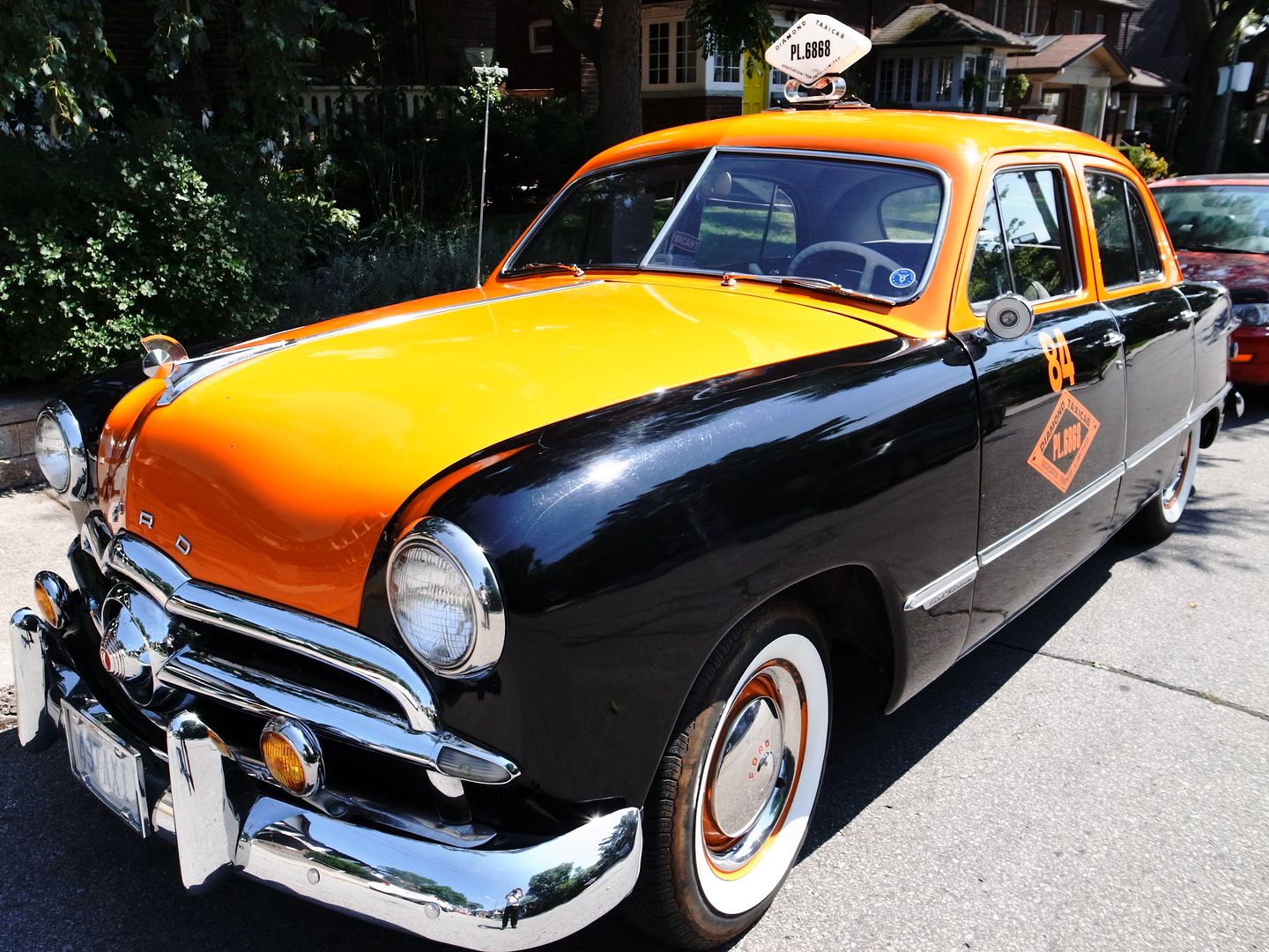
Thanks Mustapha, nice find......Diamond Taxi has a pic of this car on the landing page of their website, in their own version of a "Then and Now"
http://www.diamondtaxi.ca/
Mustapha: Good thought and good picture of a 1949 Toronto Taxi...
Yes-I also noted that self-portrait...
I recall that the Ontario vanity plate TAXI was in use on a Niagara Falls Taxi...
I recall noting it at times during my visits to NF...49TAXI is good to note but
to me the best option would be to use 1949 Ontario plates for YOM (Year of Manufacture)
re-registration...I am a big proponent of car buffs using vintage plates where and if possible...
LI MIKE
Of course, this was the Ward. Many were likely happy to see it go.
There really is very little left of the entire neighbourhood (south of college, east of University, west of Bay/Terauley, north of the Osgood Hall area)--just a few row houses on Gerrard and the strip along Dundas (which still retains a bit of its Chinatown flavour).
And a little bit on the south side of Elm, west of Bay, including the facade of the House of Industry.
Royal College of Dental Surgeons of Ontario:

from:
http://www26.us.archive.org/stream/universityoftoro04univuoft#page/n3/mode/2up