News   Nov 15, 2024
 1.4K     4 
News   Nov 15, 2024
 1.4K     1 
News   Nov 15, 2024
 1.6K     0 

Miscellany Toronto Photographs: Then and Now

My knowledgeable consultant, Charles Cooper, sent me this note after seeing the above comment:

"The gentleman who thinks he has seen an embankment north of Taunton Road should not necessarily conclude that it was the CNoR's - there was also the Toronto Eastern Railway that built out east as an electric line but the work was interrrupted by WWI and the line was never completed."

The tracking (pardon for pun?) of old rail lines around metro could be a full time endeavour.

Check out this work

Canadian Electric Railway Map Collection
http://cermc.webs.com/

Ontario Railway Map Collection
http://www.ontariomap.webs.com/
 
Since it is mentioned the CNoR went through Port Hope, lets look at the station there (if I can get images to work!)

railway4_800.jpg


The station is still sort of there as part of the MTO buildings.

http://maps.google.ca/maps?hl=en&client=firefox-a&hs=r6e&rls=org.mozilla:en-US:eek:fficial&q=hope%20street%20port%20hope&biw=1600&bih=770&um=1&ie=UTF-8&sa=N&tab=wl I hope that works.

Street View:

http://maps.google.ca/maps?hl=en&client=firefox-a&hs=r6e&rls=org.mozilla:en-US:eek:fficial&q=hope%20street%20port%20hope&biw=1600&bih=770&um=1&ie=UTF-8&sa=N&tab=wl

I am from Port Hope. There are still the bottom of the concrete pilons in the river from the bridge.

I was amazed at the difference between the Then and Now in the streetview; thanks donoreo. That old station is a real treasure.
 
My acquaintance, Mr. Cooper, sent me this note when he read the key words, "Belt Line":

"Another curiosity is the one referred to by one of your correspondents - The Toronto Belt Line.
It only operated for two years from 1892 to 1894.
It had an eastern and a western section.
The bridge over the subway at Davisville was part of it, and that section of the Belt Line remained in service so that the red Gloucester subway cars could be delivered to the Davisville yards.
Not to be confused with the onetime TTC Belt Line.
This was a steam railway and the fare was a nickel a station.
Way ahead of its time.
I don't know whether you remember a track across the Bayview Expressway near the brick works - that was part of the alignment as the line descended down through Moore Park. The right-of-way there is a bicycle trail now."

Charles Cooper recommends this site to those who wish to learn more of the Belt Line:

http://www.trha.ca/beltline.html

Thanks Goldie, I'm now inspired to walk at least a portion of the route when the weather gets warm, but before it gets too hot.
 
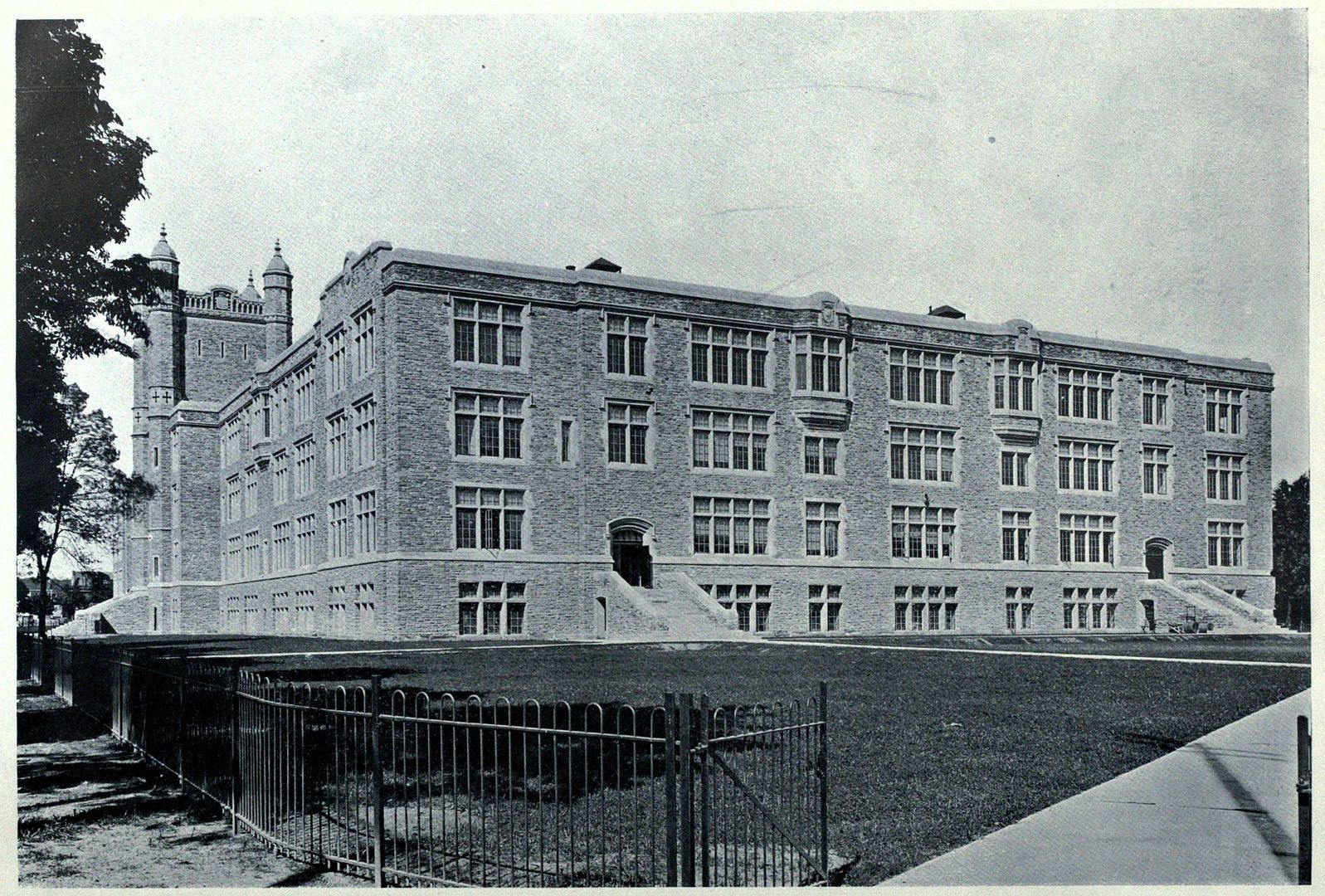
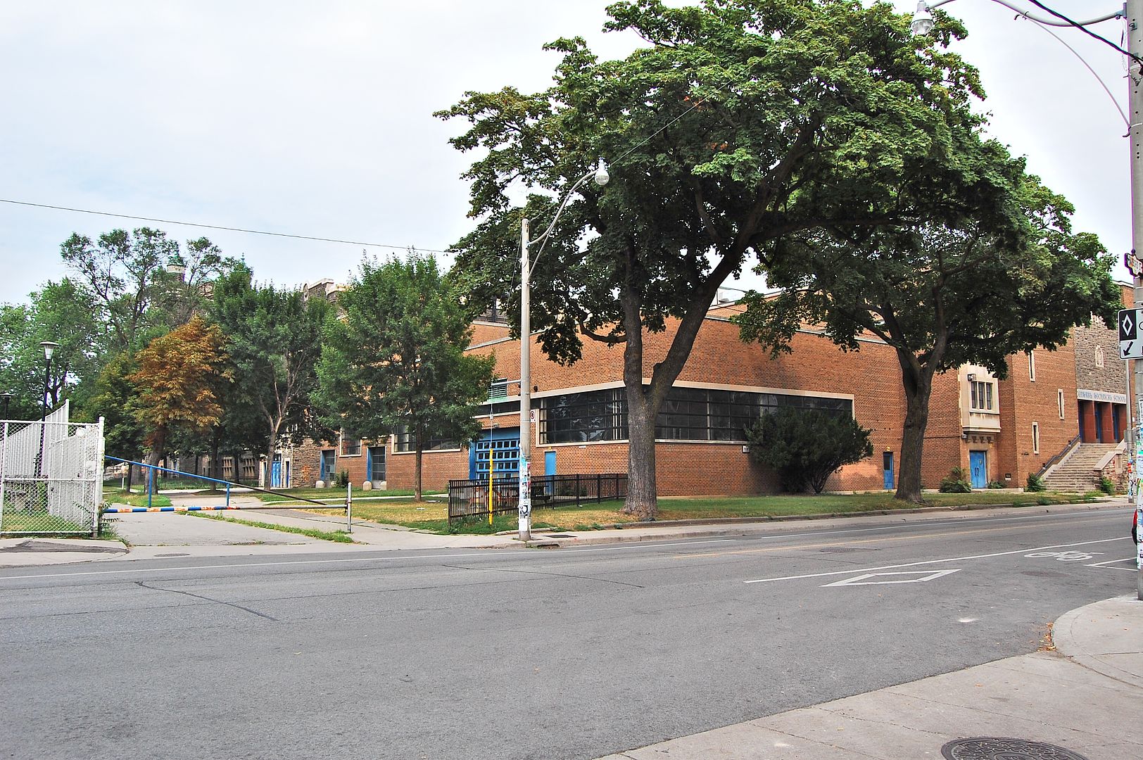
The two photos are a nice illustration of the decline of architecture between the early part of the 20th century and the 1970's or whenever that crappy addition was built.
 
Actually, the south addition (which once housed, believe it or not, the aircraft building program) was built in 1951--and for that particular date is rather underratedly 30-years-ahead-of-its-time extraordinary; not only in the strip windows that likely inspired your date guess, but mashed up with Gothic details that foreshadow Postmodernism...
 
Actually, the south addition (which once housed, believe it or not, the aircraft building program)


Oh, I believe it... the aircraft that hung from the ceiling was a bit of a neighbourhood talking piece in the 70s.

Hard to believe that the Avro/McDonnell Douglas plant up in Malton is just a field now.
 
Then and Now for Feb 16.


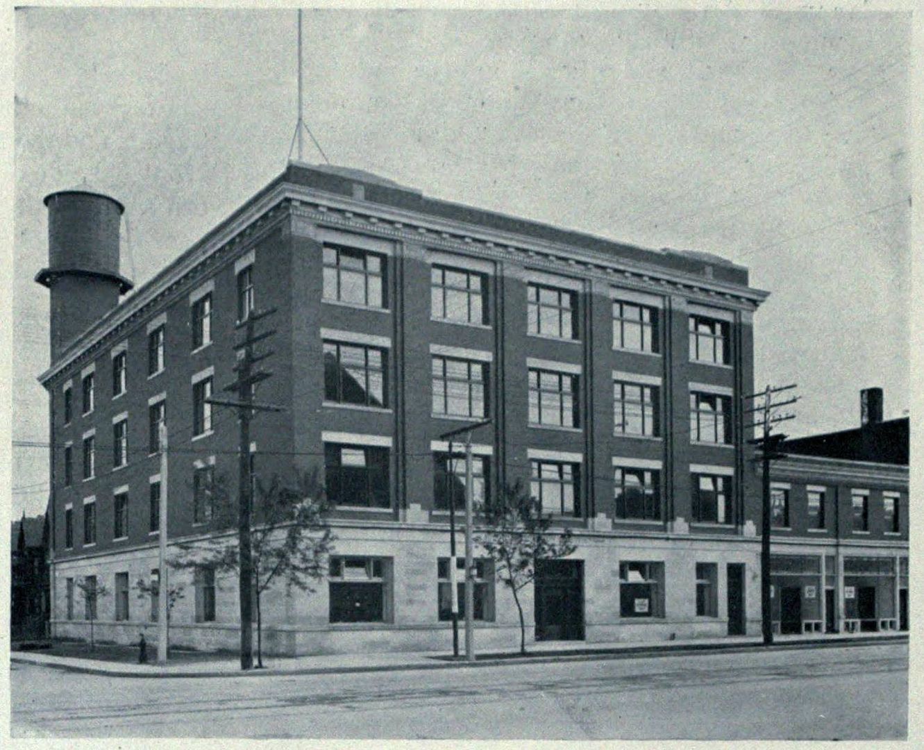
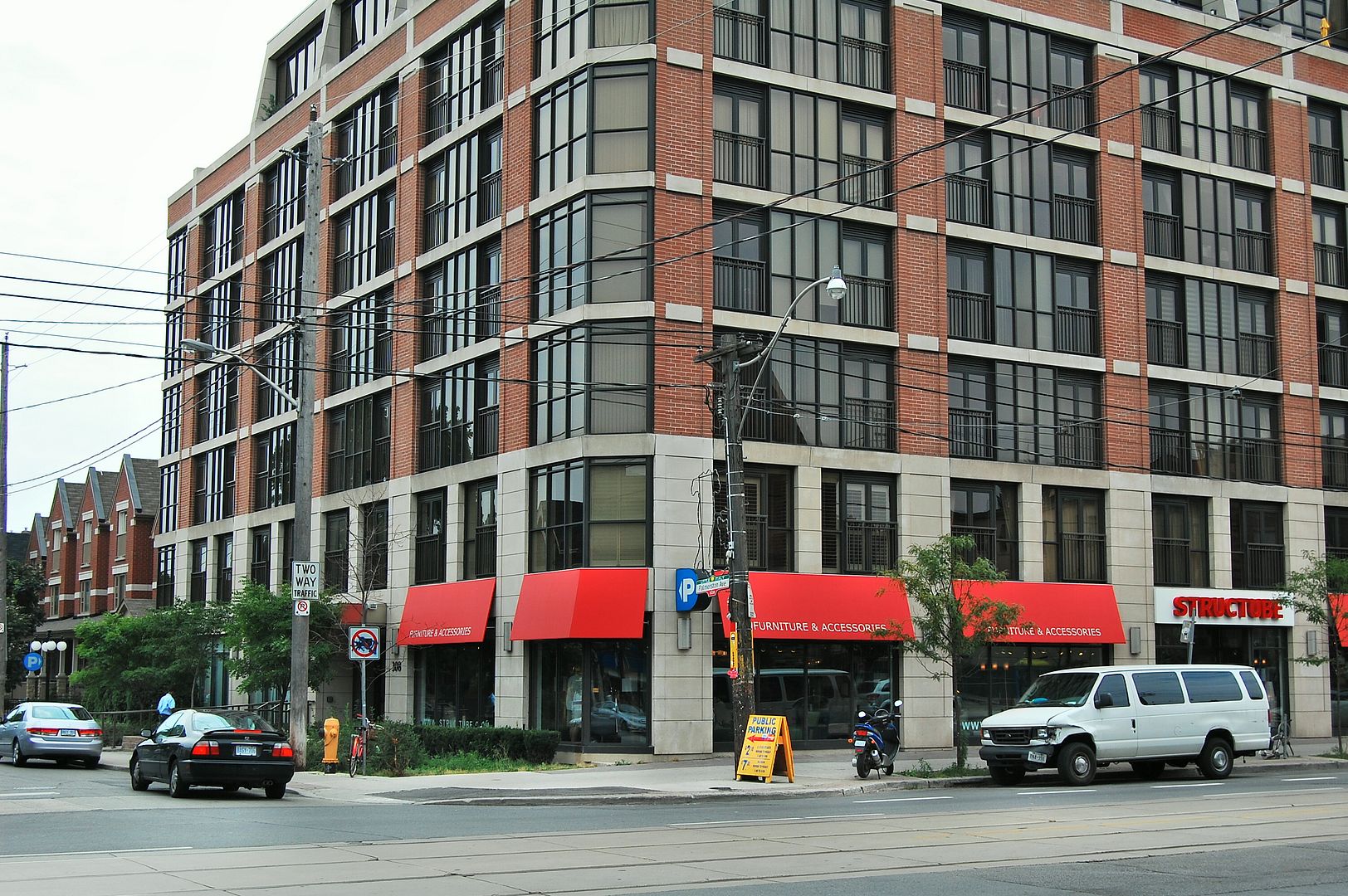
Then. College and Palmerston, SW corner, c1918. You all must recognize the 'look' of the wwwebster sourced pictures by now. I don't even mention where they come from anymore.. thanks wwwebster. Does anyone know what this building housed? Did it survive up to the present condo that's there now?

408CollegePalmerstonSWc1918.jpg


Now. June 2011.

409.jpg


See you all next Tuesday morning just after midnight.. I'm taking a long weekend off. Feel free to stir the pot in our little thread.
 

Back
Top