News   Jul 10, 2024
 1K     0 
News   Jul 10, 2024
 531     0 
News   Jul 10, 2024
 759     0 

Toronto CityPlace: Montage + Neo (Concord Adex, 47 + 16s, KPMB)

City Place lacks this accessibility to other destinations except China Town, the waterfront (is this really a destination?) and the sports complexes (Rogers, ACC and the Ex). Once the streetcar comes in along Fort York and the surrounding area is built a sence or belonging and completion should take hold around City Place. As an island on its own, it comes up short. The lack of transit connectivity and proximity to other established "lived-in" areas adds to City Place's failure.
Boy, these are some of the least valid reasons to hate CityPlace I've heard on these forums, and I'm not even a fan of the development.

Of all the failures Cityplace represents, location really isn't one of them.
 
I can't seem to find a clear, large, good quality render of what the entire development will look like from the air. (That includes the big park and new streets). Anyone have one?
 
I can't seem to find a clear, large, good quality render of what the entire development will look like from the air. (That includes the big park and new streets). Anyone have one?

Not exactly the clearest, but the best I've found:

1382795478_5efbba60e1_o.jpg
 
Boy, these are some of the least valid reasons to hate CityPlace I've heard on these forums, and I'm not even a fan of the development.

Of all the failures Cityplace represents, location really isn't one of them.

It wasn't a location argument. Rather, it was a physical and social infrastructure argument. City Place is new. The area around it is new. The post was in reference to why City Place is different than Bay St eventhough the developments share many similar features.

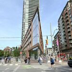
My argument is that City Place lacks the social (easy access to well-lived-in neighbourhoods) and physical infrastructure (higher-order transit) to give it a destination feel. No amount of shiney new glass condos surrounded by dead trees and private amenities can make a desirable destination unless it is physically connected to other established areas. Perhaps if it had character, vibracy, life and oh, some unique qualities then it would be better. And if it had easy, well-connected access to higher order transit then it would have more access. The location of City Place is not the issue but its isolation to the rest of the well-lived-in sections of Toronto remains a problem. The area immediately surrounding City Place is either undeveloped, under construction or brand new. There is heritage or history around the development - just train tracks, highway, wasteland and glass towers. Yes, it is an island.


Bay St residents can get to Yorkville, Church/Wellesley, Annex & UofT, financial core, and every stop on the Subway very easily. It is well connected and, even if it lacks a certain street vibrance and is still dominated by private amenities it can still pass itself off as connected to the overall downtown lifestyle. City Place cannot make the same claim.

City Place may be beside downtown or right in the middle of downtown but it is not connected. There is no intergration or sense of community development. Unlike other areas where the development lifecyle has allowed for a mish-mash of old and new and various forms of buildings, CityPlace and the surrounding waterfront-glass tower developments are all the same. If it had been, oh lets say, The MET or Minto Y&E then it wouldn't have the same failures because those developments are smack in the middle of well-lived-in (and worked-in) neighbourhoods. And both of these tower-developments are in direct access to higher order transit. So not only are they accessible by those who live around them but they are part of a greater integration of destinations and lived-in centres.

If City Place had been built in a fashion that allowed for a greater mix of uses, types of buildings and it coincided with the completion of a higher order transit line (whether subway or LRT) then it would have avoided some of its issues. Location, as you can see, is not the problem. Poor planning is (one of) the problems.
 
lots of words

I would agree to your arguement applied to everything west of Spadina (and even then, only those not immediately attached to Spadina, like Parade, Luna, and any dwellings closer to Bathurst). That side is definitely an island.

For the eastern half, however, your transit isolation arguement has a hole in it the size of a Spadina streetcar. I also think people tend to greatly overstimate the distance from Wellington, Front, and maybe even King St, psychological or otherwise, where you'll find some of the city's best established areas.
 
Sorry if these questions have already been answered, but...

Will Bremner act as a main thoroughfare between Spadina and Bathurst?

If so, will a streetcar line go down the center of Bremner to create a loop effect between the Spadina and Bathurst cars?

(And thanks Avatarreb for the render).
 
The render is rather misleading for a variety of reasons, but the one that bothers me the most is that Front Street (in front of the Globe and Mail building) has disappeared. That street actually butts right up to a chain link fence to stop people from falling over onto the tracks several stories below. And there only a few trees planted along the northside of that 4 lane street.

To the north of Cityplace there wont actually be any green space as the render suggests. Just tracks and then more concrete.
 
Took a Spadina streetcar down yesterday and it's going up fast. So far, it looks good, but I still prefer the lighter bluish windows and cladding of the rendering then the dark grey. Also the new low rise loft building just south of it called and correct me if I'm wrong the Gallery, looks pretty plain and dull with simple concrete siding.
 
I would agree to your arguement applied to everything west of Spadina (and even then, only those not immediately attached to Spadina, like Parade, Luna, and any dwellings closer to Bathurst). That side is definitely an island.

For the eastern half, however, your transit isolation arguement has a hole in it the size of a Spadina streetcar. I also think people tend to greatly overstimate the distance from Wellington, Front, and maybe even King St, psychological or otherwise, where you'll find some of the city's best established areas.

Got to agree. Seems the supposed isolation is more psychological than physical. Seems so easy to forget how close these distances are (these maps aren't to suburban scale!!)

I like mixed use, but I wouldn't write off cityplace just yet. I'd say the condo clusters on Queen's Quay are more isolated...
 
Sorry if these questions have already been answered, but...

Will Bremner act as a main thoroughfare between Spadina and Bathurst?

If so, will a streetcar line go down the center of Bremner to create a loop effect between the Spadina and Bathurst cars?

(And thanks Avatarreb for the render).

One of the alignments being looked at by the TTC to link the West Waterfront LRT to Union Station is via Fort York/Bremner.
 
If a streetcar track were to run behind all of the Water Park City projects on Fort York and then also along Bremner in the middle of CityPlace this could make all the difference.
 

Back
Top