You are using an out of date browser. It may not display this or other websites correctly.
You should upgrade or use an alternative browser.
You should upgrade or use an alternative browser.
Waterloo Region Transit Developments (ION LRT, new terminal, GRT buses)
CDL.TO
Moderator
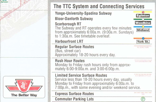
The TTC also used "LRT" when planning and building the Spadina line and St. Clair ROW. They dropped the term after the lines started operation.
Glad to see so many people coming around to the idea that the terms "streetcar" and "LRT" are practically meaningless when being compared to each other. It's a continuum.
It's FAR more meaningful to discuss the design aspects of a line.
Glad to see so many people coming around to the idea that the terms "streetcar" and "LRT" are practically meaningless when being compared to each other. It's a continuum.
It's FAR more meaningful to discuss the design aspects of a line.
Neil
Active Member
Yes. Let's not revisit that old terminology chestnut once again.
W. K. Lis
Superstar
The TTC also used "LRT" when planning and building the Spadina line and St. Clair ROW. They dropped the term after the lines started operation.
Glad to see so many people coming around to the idea that the terms "streetcar" and "LRT" are practically meaningless when being compared to each other. It's a continuum.
It's FAR more meaningful to discuss the design aspects of a line.
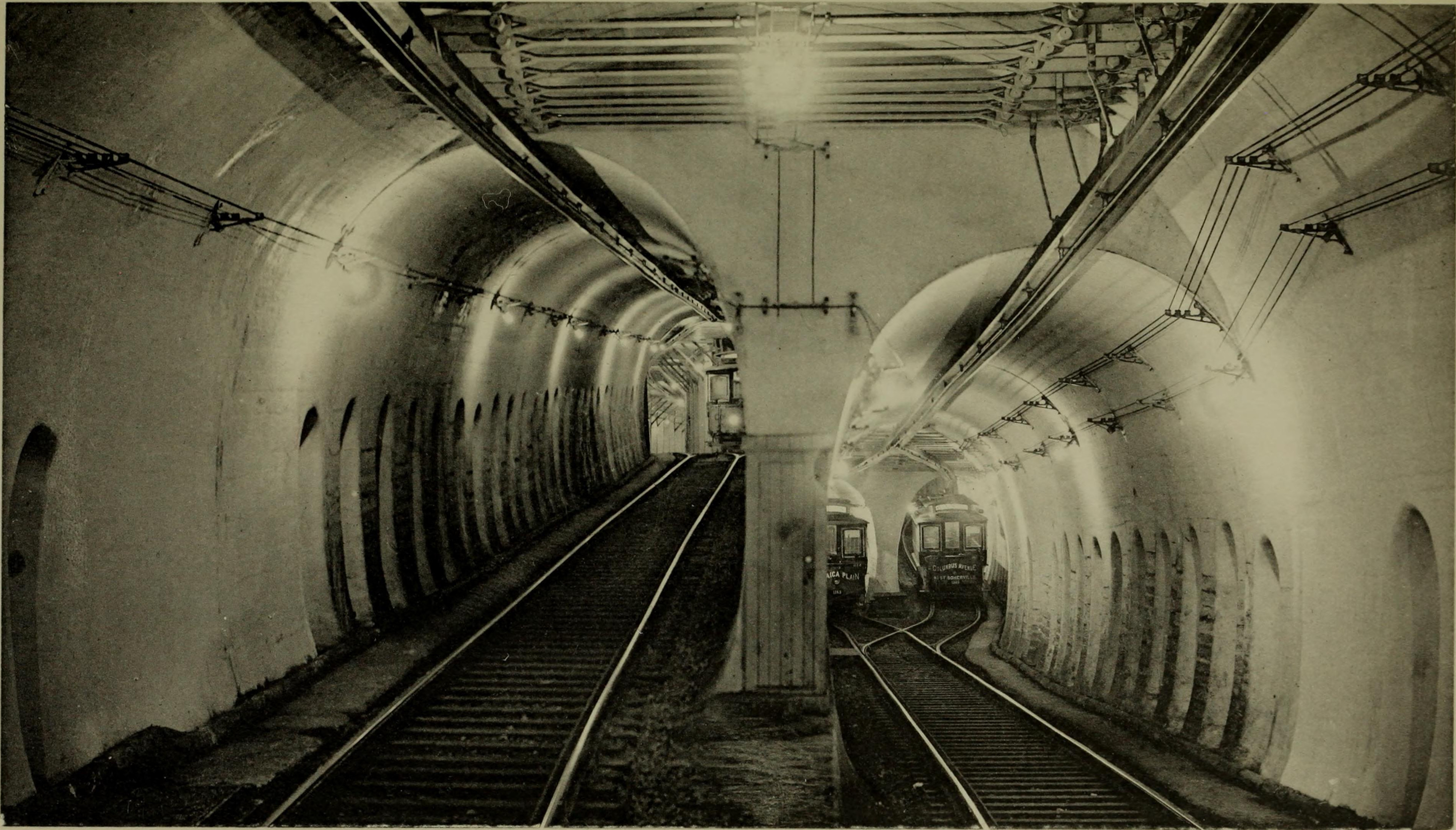
The first "subway" in North America was the Tremont Street Subway in Boston, Massachusetts. It opened in 1897 using streetcars. See link. It is now part of the Green Line.
Bytor
New Member
Is there going to be any double-track street trackage anywhere? I'm not getting any "streetcar system" impression here.
Of course. There will be double tracks along most of the length of Ion Stage 1, except for the three loops where the directions will separated onto different streets. With 8 minute headways (to start) along a length that will take rough 46 minutes, that's 5-6 trains travelling in both directions at any one time. Coordinating trains to wait on side spurs until the other direction passed would be a real PITA and would obviate much of the scalability benefits of an LRT system.
P0per
New Member
Nov 28
Waterloo Spur is 100% on new rails from Uptown Waterloo to Northfield. At Columbia, crossing protection is being re-installed, new signal bungalow has arrived and old rails are torn up.
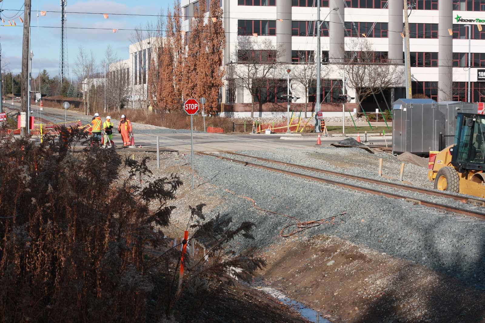 Untitled by ION Construction, on Flickr
More LRT track and Uptown Waterloo station complete on Caroline.
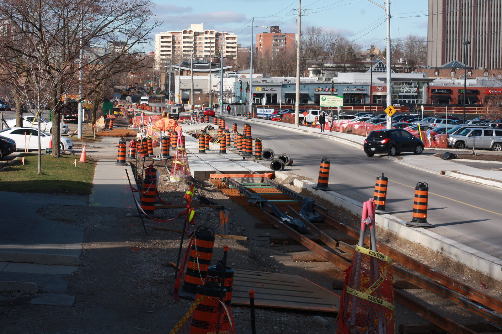 Untitled by ION Construction, on Flickr
King St. being repaved with median now reserved for LRT. Crews were working on the weekend pouring concrete for curbs, probably a rush before the winter.
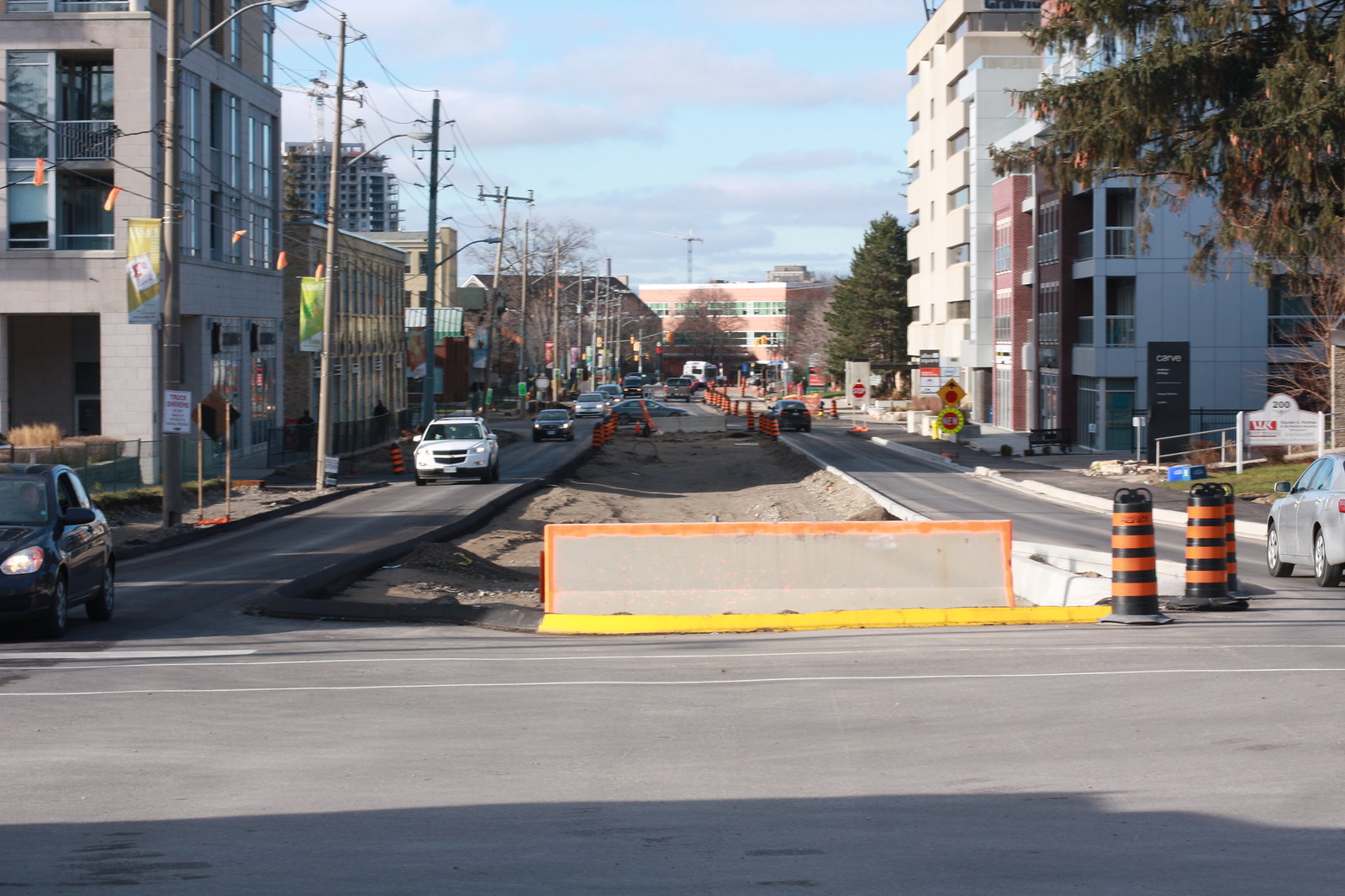 Untitled by ION Construction, on Flickr
More recently poured curbs for median on King St.
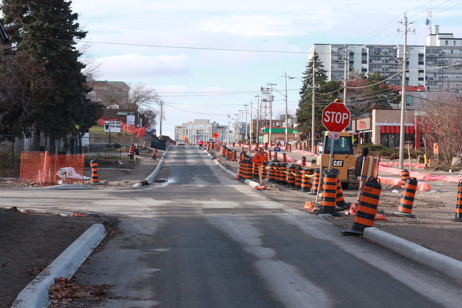 Untitled by ION Construction, on Flickr
Charles St. partially re-paved at Benton, looking great!
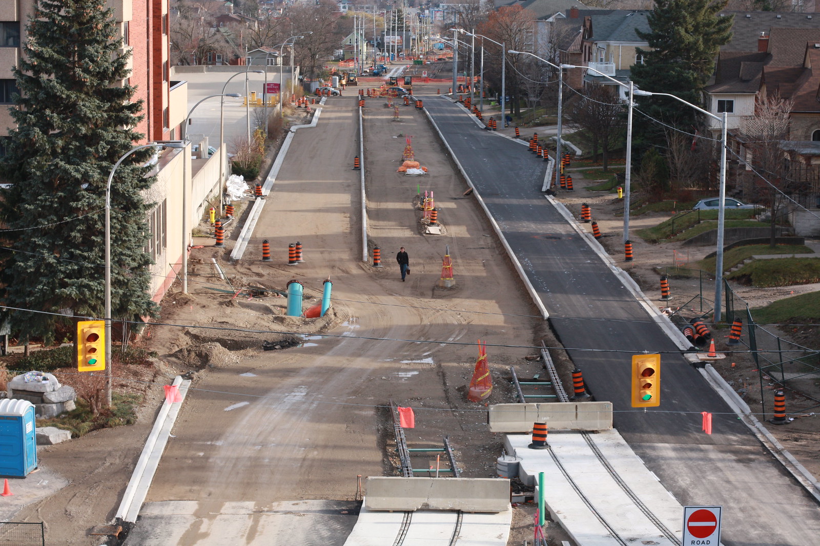 Untitled by ION Construction, on Flickr
Charles St. at Stirling, also looking ready for tracks.
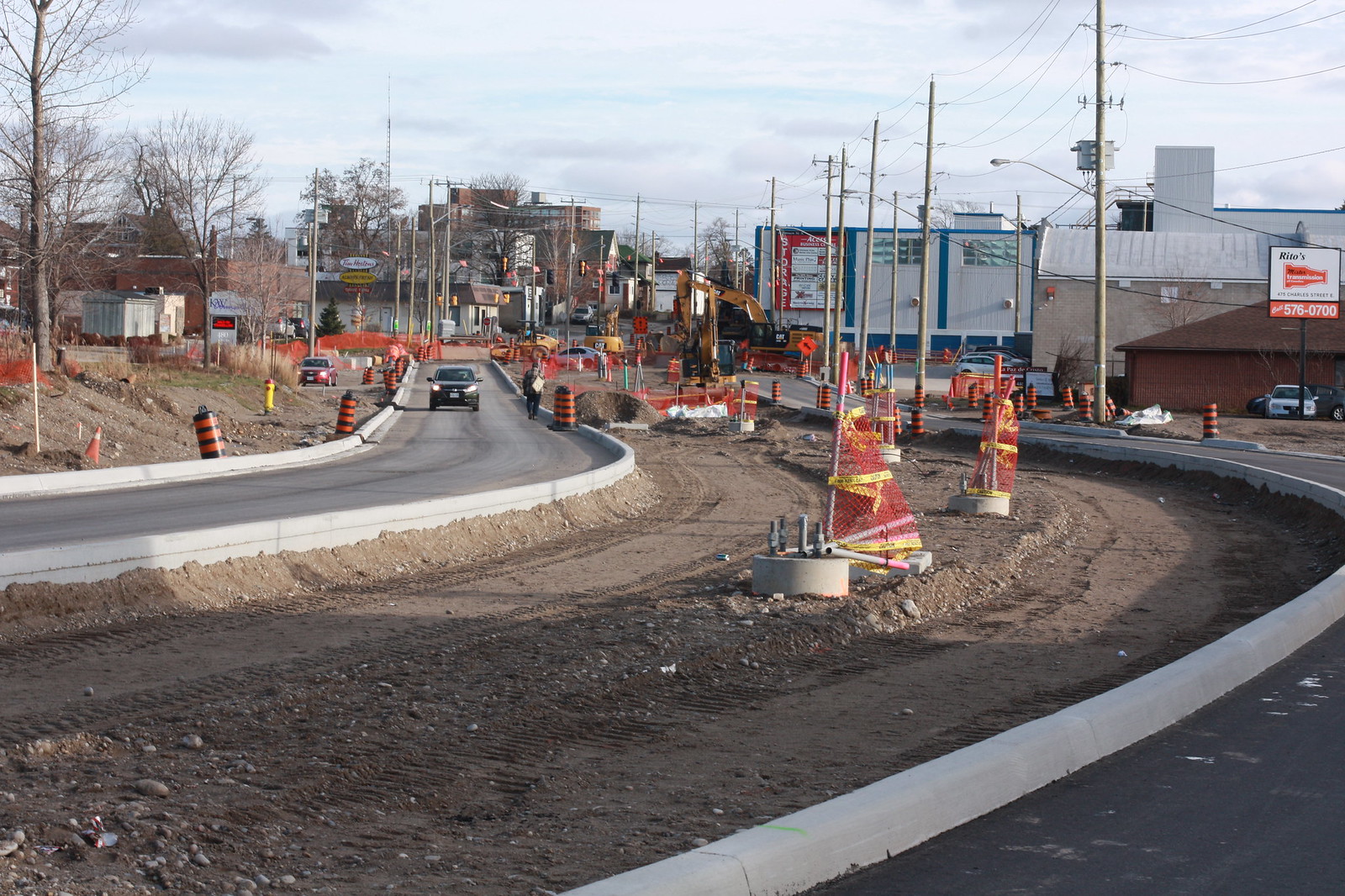 Untitled by ION Construction, on Flickr
Most of track along Borden between Huron Park spur and Schnieder Creek has been laid.
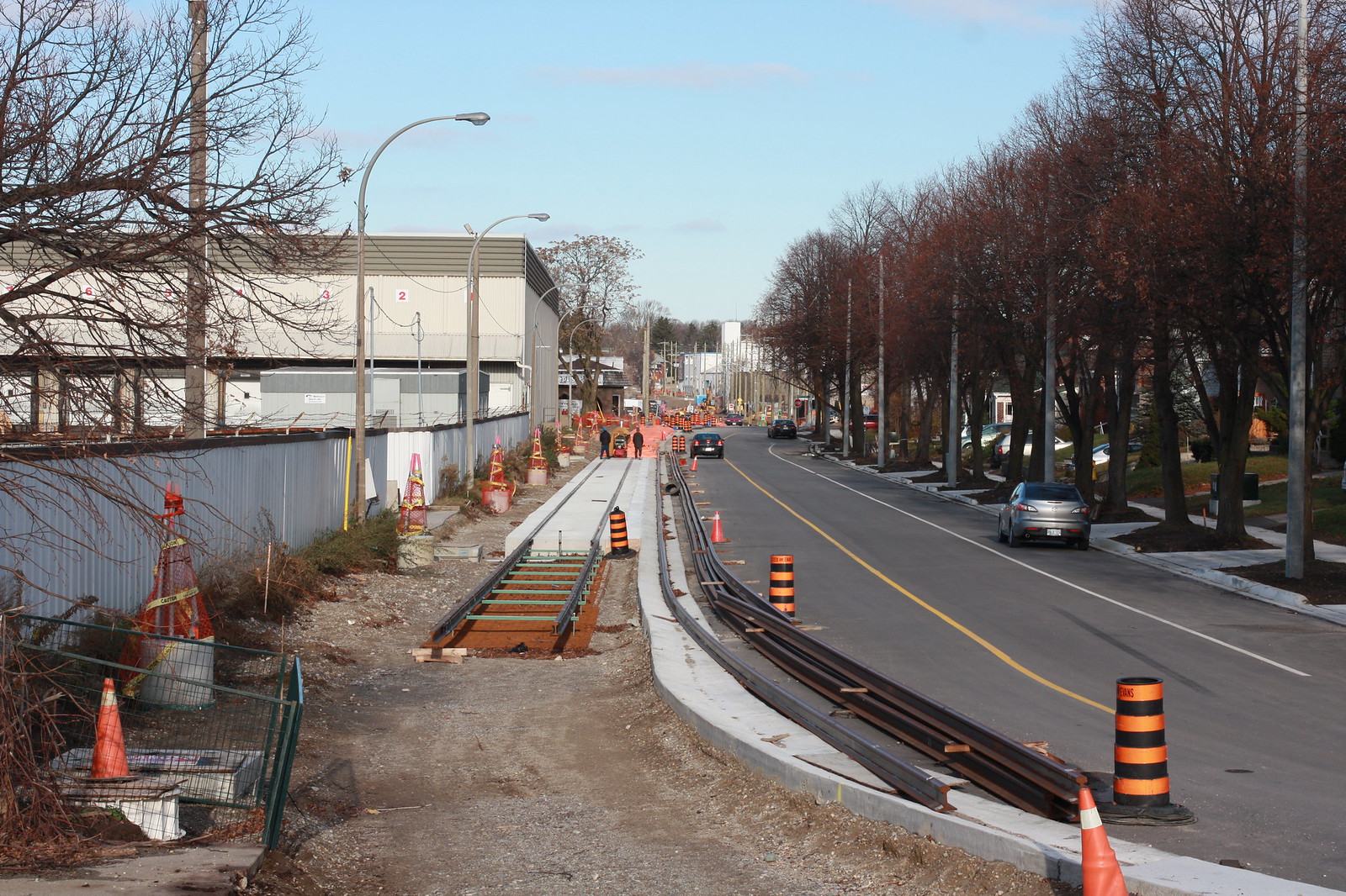 Untitled by ION Construction, on Flickr
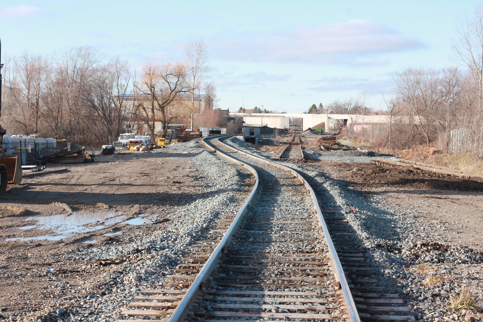
Huron Park spur now running over new Schnieder Creek bridge, allowing work on the new Eastern bridge for the LRT tracks.
 Untitled by ION Construction, on Flickr
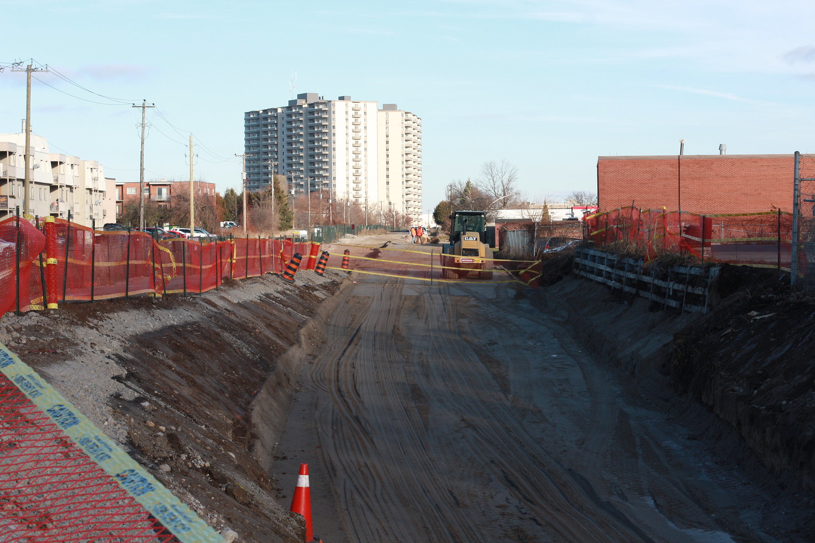
Grading for the LRT section running on Hydro ROW parallel to Fairway.
 Untitled by ION Construction, on Flickr
Rest of today's album on Flicker.
Waterloo Spur is 100% on new rails from Uptown Waterloo to Northfield. At Columbia, crossing protection is being re-installed, new signal bungalow has arrived and old rails are torn up.
 Untitled by ION Construction, on Flickr
More LRT track and Uptown Waterloo station complete on Caroline.
 Untitled by ION Construction, on Flickr
King St. being repaved with median now reserved for LRT. Crews were working on the weekend pouring concrete for curbs, probably a rush before the winter.
 Untitled by ION Construction, on Flickr
More recently poured curbs for median on King St.
 Untitled by ION Construction, on Flickr
Charles St. partially re-paved at Benton, looking great!
 Untitled by ION Construction, on Flickr
Charles St. at Stirling, also looking ready for tracks.
 Untitled by ION Construction, on Flickr
Most of track along Borden between Huron Park spur and Schnieder Creek has been laid.
 Untitled by ION Construction, on Flickr
Huron Park spur now running over new Schnieder Creek bridge, allowing work on the new Eastern bridge for the LRT tracks.
 Untitled by ION Construction, on Flickr
Grading for the LRT section running on Hydro ROW parallel to Fairway.
 Untitled by ION Construction, on Flickr
Rest of today's album on Flicker.
muller877
Senior Member
Great pictures. Thanks for the update.
I've always thought that Waterloo Region should be highlighted and congratulated because they looked at all options and came up with great connections in a cost-effective way. In-median, one-way, Hydro ROW, old train tracks, etc. Not just someone opening up google maps and drawing a line down one street and then asking themselves LRT or subway? Buried or Surface?
I will miss the quick way through downtown via Charles/Stirling/Courtland/Vic Park/Park.
P0per
New Member
I've always thought that Waterloo Region should be highlighted and congratulated because they looked at all options and came up with great connections in a cost-effective way. In-median, one-way, Hydro ROW, old train tracks, etc.
Using the existing rail ROWs comes with the benefit of pre-existing crossing protection at road intersections - no fights with drivers for transit priority.
Piggybacking on the Highway 7 widening through Kitchener to get a second rail tunnel was a great move. That probably would have been the most disruptive and costly element to build (comparable to the King St. grade separation). This type of forward thinking isn't being applied to Phase 2 to Cambridge - as the 401 is being widened, there are no similar provisions. There will also need to be new bridges of the Grand (could have been accommodated during Highway 8 widening project) and Speed Rivers and potentially grade separation with the CP rail Galt sub. All of this means the extension to Cambridge will be significantly more costly, I'm sure.
D
Duck
Guest
Sorry for the repeat shots - many of the same photos as POper's above.

Freight connection at Northfield is now shifted over to the final alignment here.

This is still temporary though, until the switches get installed and finalized.

Another shot looking toward the OMSF.

Some conduit troughs and control cabinets along the Right of Way, behind Albert McCormic Arena.

This is the future R&T Park platform.

R&T Park platform work.

University of Waterloo station. Some kind of maintenance road is being built on the right.

One of the one-track stations on the Waterloo loop, this is on Caroline.

Caroline

Caroline

Caroline

Caroline

Caroline

Benton/Charles is now back open to traffic.

Benton/Charles
Freight connection at Northfield is now shifted over to the final alignment here.
This is still temporary though, until the switches get installed and finalized.
Another shot looking toward the OMSF.
Some conduit troughs and control cabinets along the Right of Way, behind Albert McCormic Arena.
This is the future R&T Park platform.
R&T Park platform work.
University of Waterloo station. Some kind of maintenance road is being built on the right.
One of the one-track stations on the Waterloo loop, this is on Caroline.
Caroline
Caroline
Caroline
Caroline
Caroline
Benton/Charles is now back open to traffic.
Benton/Charles
Attachments
-
 IMG_5945.jpg264.7 KB · Views: 1,150
 -
 IMG_5947.jpg256.2 KB · Views: 1,087
 -
 IMG_5948.jpg205.2 KB · Views: 1,109
 -
 IMG_5952.jpg227.6 KB · Views: 1,086
 -
 IMG_5957.jpg255.4 KB · Views: 1,068
 -
 IMG_5958.jpg198.4 KB · Views: 1,029
 -
 IMG_5960.jpg233.2 KB · Views: 1,125
 -
 IMG_5963.jpg177 KB · Views: 1,069
 -
 IMG_5966.jpg234.1 KB · Views: 1,088
 -
 IMG_5971.jpg198.1 KB · Views: 1,057
 -
 IMG_5976.jpg194.5 KB · Views: 1,104
 -
 IMG_5979.jpg166.8 KB · Views: 1,067
 -
 IMG_5982.jpg237.3 KB · Views: 1,055
 -
 IMG_5989.jpg204.6 KB · Views: 1,131
 -
 IMG_5990.jpg181.5 KB · Views: 1,098
D
Duck
Guest
This crossing at Borden/Courtland recently re-opened. Some of the concrete is still being warmed to help it cure.
Looking along Borden.
Lots of work still to do here, but the catpole foundations are in. There were some soil contamination issues here.
Charles. This will be the location of one of the centre platform stations.
Attachments
D
Duck
Guest
D
Duck
Guest
Some more photos from this weekend. Platforms are now uncovered at Research & Technology and Willis Way. The first few photos show the roof of the Operations, Maintenance and Storage Facility being finished in the area that was damaged by the fire a few months ago.


Attachments
-
 IMG_6003.jpg170.4 KB · Views: 886
 -
 IMG_6005.jpg208 KB · Views: 846
 -
 IMG_6010.jpg221.8 KB · Views: 837
 -
 IMG_6012.jpg150.8 KB · Views: 844
 -
 IMG_6014.jpg264.4 KB · Views: 837
 -
 IMG_6015.jpg252.5 KB · Views: 807
 -
 IMG_6016.jpg145.6 KB · Views: 837
 -
 IMG_6019.jpg302.2 KB · Views: 822
 -
 IMG_6020.jpg217.8 KB · Views: 836
 -
 IMG_6022.jpg154 KB · Views: 798
 -
 IMG_6025.jpg236.8 KB · Views: 844
 -
 IMG_6026.jpg262.1 KB · Views: 832
 -
 IMG_6029.jpg232.9 KB · Views: 811
Adjei
Senior Member
Are there any public realm improvements associated with this project?
D
Duck
Guest
I'd say the entire line is a public realm improvement.  I'm not familiar with the term, but I imagine you mean things like the general look and feel of areas along the line?
44 North
Senior Member
I like that third image, and the vantage. That'll look really nice with an LRV zipping along on a misty morning.
