News   Jul 17, 2024
 396     0 
News   Jul 17, 2024
 872     0 
News   Jul 16, 2024
 1.1K     2 

Waterfront Transit Reset Phase 1 Study

How should Toronto connect the East and West arms of the planned waterfront transit with downtown?

  • Expand the existing Union loop

    Votes: 203 72.5%
  • Build a Western terminus

    Votes: 11 3.9%
  • Route service along Queen's Quay with pedestrian/cycle/bus connection to Union

    Votes: 30 10.7%
  • Connect using existing Queen's Quay/Union Loop and via King Street

    Votes: 20 7.1%
  • Other

    Votes: 16 5.7%

  • Total voters
    280
I came upon a photo I shot on Dec 11 2008 for the Lake Shore LRT and it show the street width. From Long Branch loop to 30th St, ROW is 24 to 26m; 30th to Kipling 29m; Kipling to Louisa, the ROW is 23 to 25m; Louisa to Legion, the ROW is 29m; Legion to Parklawn, the ROW is 34m; Bike lanes where from Browns Line to 23rd and First to Parklawn. The photos above clearly show there is no room for an ROW and bike lanes without some major land buying that was and still is opposed by the locals from First St to Louisa. On street parking was only used 30% of the spaces on a Sat May 10 between 10am and 7pm and Tuesday May 27 between 7am to 7pm. Moving to a 36m street, only 20% to 25% of the current parking spaces would remain that match the survey numbers. 8 of the current 26 stops would be remove. Stop spacing would increase from 250 to 370m with some being less.
 
they had a plan in place before the eventual cancellation. ROW with 1 lane traffic, reduced sidewalks, retained parking and no building demolition.
 
There is little in common between it and construction costs. The cost increases on materials like steel, concrete (limestone in particular), labour, etc. is far more relevant and MTO averages it at about 7% for the last couple decades in Ontario.
I haven't dug into it for a while, but I thought 5% was a better long-term average.
 
Public Notice

Waterfront Transit "Reset" Phase 2 Study - Public Meeting
f9d0d96f-12e9-4a9f-8df2-c72212cf94cd.jpg

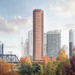
The revitalized Queens Quay West in the Central Waterfront.

We invite you to attend an upcoming public meeting for the Waterfront Transit "Reset" Phase 2 Study. Two public meetings have been scheduled - one at a location in the central waterfront and one at a location in the western waterfront. The same information will be available at each meeting. Please choose the location convenient to you.

The Study
The City of Toronto, in partnership with the Toronto Transit Commission and Waterfront Toronto, is undertaking a multi-phase Waterfront Transit "Reset" Study. The study involves a comprehensive assessment of needs and options for transit improvements from Long Branch to Woodbine Avenue. Phase 1 was completed in 2016.

The Phase 2 study is undertaking a waterfront network travel demand analysis, and operations analysis, functional design, cost estimates, and comparative evaluations of alternatives for improvements to transit for key areas of the network. The completion of these tasks will help identify and confirm priority areas for implementation.

Join us at one of the following public meetings to learn about and comment on the preliminary results of Phase 2.

Public Meeting Details (Central Location)
Date: Monday, September 18, 2017
Time: 6:00 pm to 8:30 pm
Open House 6:00 pm / Presentation 6:30 pm / Facilitated Open House 7:30 pm
Location: 235 Queens Quay West, Toronto, ON M5J 2G8 at Harbourfront Centre in the Brigantine Room (major intersection is Queens Quay West and Lower Simcoe Street)
Map: Click here
Transit: Closest TTC subway station is Union Station. Take the 509 Harbourfront streetcar or the 510 Spadina streetcar to Harbourfront Centre. Walk west on the south side of Queens Quay to Harbourfront Centre at Lower Simcoe Street. Please use the TTC trip planner for additional options.

Public Meeting Details (West Location)
Date: Tuesday, September 26, 2017
Time: 6:00 pm to 8:30 pm
Open House 6:00 pm / Presentation 6:30 pm / Facilitated Open House 7:30 pm
Location: 1 Colonel Samuel Smith Park Drive, Toronto, ON M8V 4B6 at The Assembly Hall in the Performance Hall (closest major intersection is Lake Shore Boulevard West and Colonel Samuel Smith Park Drive)
Map: Click here
Transit: Take the Bloor-Danforth (Line 2) subway to Kipling Station. Then take either the 188 or 44 bus south to the Colonel Samuel Smith Park Loop. Walk north on the east side of Colonel Samuel Smith Park Drive to The Assembly Hall. OR Take the 501 Queen (Long Branch) streetcar to Kipling Avenue and walk south on the east side of Colonel Samuel Smith Park Drive to The Assembly Hall. Please use the TTC trip planner for additional options.

To keep informed of project updates, visit: www.toronto.ca/waterfronttransit

Contact Information
If you have specific accomodation requirements or would like more information about this project, please contact the project community liaison office.

Niki Angelis, Community Liaison Officer
416-410-3888 ext. 714
nangelis@lura.ca
 
I strongly recommend everyone get out to one of the 2 meeting and have your say on what been proposed. "PULL NO PUNCHES" on your view or recommendations to the plans at the meeting. Presentation will start at 7:00 pm with round table for the boards at 8:00. You can see the boards before the presentation.

On Sept 18, I and others can release info on what is plan and has taken place today as well state our views.

Last night was a waste of people time since we rehashed ideas for Union Loop that were rejected back in 2008.

There is no recommendation; prefer option; time line; cost, other than a 2041 completion date at this time.

Metrolinx has screw up the 30% design time table for the extension from the current CNE loop to Dufferin loop as they are looking at fixing the current station and it will impact the extension. No idea if Metrolinx will be at this meeting to show what they are looking at for the station.
 
  • Like
Reactions: DSC
As Drum states, the Stakeholders meeting was rather an anti-climax and as this is in the CEO's Report on WT website I assume it can be revealed:

Waterfront Toronto continues to work collaboratively with City of Toronto and TTC staff on the Waterfront Transit Reset study. The team has been very busy this summer developing three options for the connection between Union Station and Queens Quay. These include a LRT option, a moving sidewalk, and an automated cable-pulled system. The details of these three options along with a preliminary review will be presented at a Stakeholder Advisory Committee and at two Public Meetings this September.
 
I hope one of the meetings being at the assembly hall is a good sign for lakeshore corridor winning out over Queensway
 
I hope one of the meetings being at the assembly hall is a good sign for lakeshore corridor winning out over Queensway
Not sure what you mean about Lake Shore winning over Queensway, but nothing is really happening to it at all other than 1 or 2 location. An ROW from Legion to Humber Loop with Lake Shore being widen.

Queensway is a future transit corridor going into 2018 update plan.

As for the automated cable-pulled system, it will have 2 tracks with a passing track in the centre with about 1 minute head between the 2 lines using 4 cars/train for 5,000 pppd. There will be a platform between the 2 lines at each end.

The walkway will be the same as the airport in 2 sections because of the curve in the tunnel. You will be able to walk it also.

This was talked about in 2008 and rejected. The cable system is an update version using 4 trains in place of the past plan using 2.
 
Ooh then that means the only big interest is where the tracks are going in between union and roncesvalles. I'm hoping the exhibition is getting some love.
 
Ooh then that means the only big interest is where the tracks are going in between union and roncesvalles. I'm hoping the exhibition is getting some love.
There is an approved EA that takes the 509 west of CNE to Dufferin St that will go down the centre of a new Lake Shore to Corbin Lodge where it will connect to the Queensway. Corbin Lodge will be close to traffic with transit in an ROW in the northbound lanes with the southbound lanes for cycles and pedestrians.

The New Lake Shore will use less land and open up more public domain land to the south.
 
So the waterfront west LRT goes through Lake Shore all the way to Union and the 509 will take some remains of the old 501 and run towards queensway? (and likely eventually through) not a bad compromise if you ask me.

edit: wait that doesn't sound quite right lol
 
Last edited:

Back
Top