


EnviroTO
Senior Member
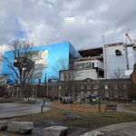
GTA Transit 2040: Hamilton

|
|
|
amazing work, these look greatGTA Transit 2040: Already existing, under construction, or in procurement:
- Line 1 (towards Richmond Hill): Extension from Finch to High Tech in procurement.
- Line 2 (towards Woodside): Extension from Kennedy to East Village (Sheppard East) under construction.
- Line 3: New line extending westward (towards Pearson) to Exhibition, and northwards (towards Markham) to Don Crossing (Science Centre)
- Line 5: New line opening soon from Mount Dennis to Kennedy.
- Line 5 (towards Renforth): Extension from Mount Dennis to Renforth is under construction.
- Line 6: New line opening soon from Elia (Finch West) to Humber College.
- Line 8: New line from McMaster eastward (towards Confederation) to Eastgate is in procurement.
- Line 10: New line from Port Credit extending northward (towards Brampton Centre) to Uptown Main (Brampton Gateway Terminal) is under construction.
- Line A: Corridor improvements under way to increase services, new stations at Confederation and East Harbour under construction.
- Line C: Corridor improvements under way to increase services, new stations at Grandstand (Woodbine Racetrack), Mount Dennis, Stockyards (St Clair West), Liberty, West Harbour, and L'Amoreaux (Finch East) are in various stages from early procurement to full construction.
- Line D: Corridor improvements under way to increase services, new stations at Caledonia and Lansdowne in early procurement.
GTA Transit 2040: Already in active study
- Line 4: Extensions west from Yonge and east from Parkway Forest (Fairview) - https://www.metrolinx.com/en/projects-and-programs/sheppard-extension
- Line 7: Study of this route as a busway initially - https://www.metrolinx.com/en/projects-and-programs/queen-st-hwy-7-brt
- Line 9: Sections of this route are under study as a busway initially by Halton (Trafalgar Road BRT) and Metrolinx (Dundas BRT)
- Line 11: Under study for enhancement as part of the BLAST network route A.
- Line B: Commitment to increase service to all day from the province by 2031.
- Line E: Stations for this line are in Vaughan and Bolton planning documents and work is progressing on the business case.
Really liking this map! A couple names might need a bit of tweakingGTA Transit 2040: Downtown Toronto Map
View attachment 560981
Note that:Really liking this map! A couple names might need a bit of tweaking
Fashion (way outside of fashion district) - alternatives: Clarence Square (to the north) or City Place (to the south)
Pape Village (for outsiders this might be too vague) alternative: Cosburn, Pape-Cosburn
Dentonia Park - alternative: Crescentown?
With how persistently crosstown has been coming up lately I've been playing with possible service patterns, and this is the one I'm happiest with at the moment.
View attachment 565192
I do note that there is a lot of room for deferring or outright cancelling eastern branches... I'm particularly thinking that the eastern Markham branch is probably wholly redundant if the Stoufville line chord is built and there is no Pickering Airport in play (and in an either/or scenario I think Unionville would be the better terminal); but otoh it would be VERY cheap if VIA is using this as their city entrance, and has any kind of desire for a Markham station. Similarly, while I feel like the northern Durham corridor is more important on a multi decadal scale the Pickering connection is probably more useful today. I could definitely see a lot in favor of staging this with Picking to the Junction rolled into Milton expansion and putting off much of the rest of it into future projects.
In short, I mostly agree. I've actually further simplified this and like the results better than what I ended up with earlier. Basically if you build a proper interchange station at Agincourt I'd cut GO from the northeastern line entirely unless a Pickering airport link happens (relatedly I'm somewhat torn on a Junction interchange, it would have it's uses, but on balance I'm inclined to think it's really too close to other stations to be advisable, especially given how awkward getting a platform in for mainline Milton trains would be); discounted commuter fares on HFR really should suffice for the short term demand levels to out Markham. Then eliminate the weird through running, so there is a GO Crossotown service to Pickering and a North Durham line to Union, probably through running with Milton.I don't think the eastern portion of the Pickering rail link is necessary, especially considering it would need significant new railway. The benefit of having a rail link to any potential Pickering airport is drawing from the large population base WEST of the airport lands, not the east. GO Service should terminate at Pickering airport while VIA (or other intercity rail) continues on to Claremont and Peterborough