salsa
Senior Member
These communities deserve to have their oil supply cut off.


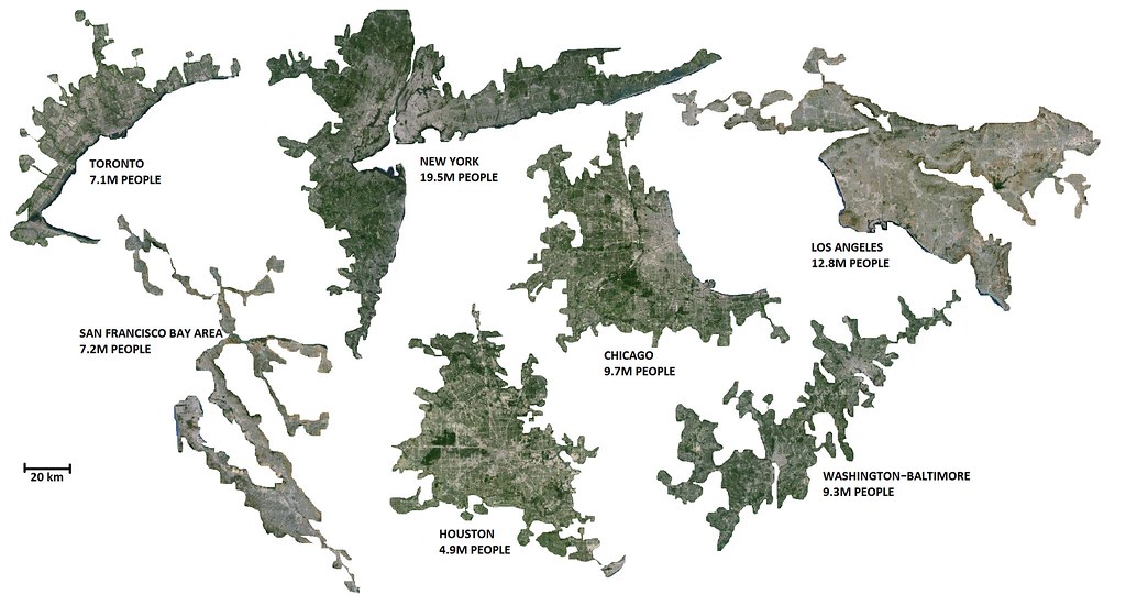
You can try expanding the image to make room for Atlanta, Boston, and Phoenix.A couple US comparisons. I doubt I got all of the US urban areas in though, due to my lack of geographical knowledge about them and the fact that some of the residential areas are very low density and from the scale I had to isolate them it looked uninhabited.

FULL SIZE
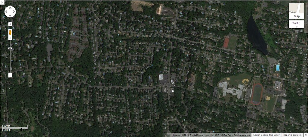
FYI: You may think that I made a mistake with New York leaving all that green, but this is what it looks like when zoomed in. SPRAAAAAWWWWWL.

You can try expanding the image to make room for Atlanta, Boston, and Phoenix.
These communities deserve to have their oil supply cut off.
Places like this should be outlawed. Unless these families are working a homestead nearby or have employment within 10km this just should be allowed.
While this may be a little hyperbolic sometimes I just wish the state would kick people like this out of their homes and relocated them closer to society.
A couple US comparisons. I doubt I got all of the US urban areas in though, due to my lack of geographical knowledge about them and the fact that some of the residential areas are very low density and from the scale I had to isolate them it looked uninhabited.

FULL SIZE
FYI: You may think that I made a mistake with New York leaving all that green, but this is what it looks like when zoomed in. SPRAAAAAWWWWWL.

I expected LA to me a lot bigger with all their sprawl.
The problem with areas like new york is that they never really end... they just sort of morph into the next city. New York Becomes Newark which becomes Trenton which becomes Philidelphia, New York becomes Stamford which becomes Bridgeport which becomes Hew Haven which becomes Hartford
MJ: The 6 US metropolitan regions that you posted look correct...
I especially noticed the NY-NJ area and I believe that I reside about half way out on Long Island to the E and the area of New Jersey that is shown
is definitely the areas and counties considered to be part of the New York region...
Where is the NY-NJ area map section that you posted located?
The map of Chicagoland shows that sprawling region - for comparison the City boundary should be added to show how much growth has occurred outside the City...
The Baltimore-Washington area is interesting because what the growth in Maryland between the cities shows (they are 40 miles apart-similar to Toronto-Hamilton)
that the two once-separate areas have become one region in the past 40-50 years...
Houston and Los Angeles as many know are primarily auto-centric cities that have large amounts of low-medium density sprawl...
I would like to see more of these renderings - they very much interest me...LI MIKE


