Tokyo and Toronto differ in this respect because Tokyo is a megapolis of near national size, so there are multiple CBDs and the need to connect all of them.
Toshima, Shinjuku, Shibuya etc would all be their own CBD of a major city if we picked them up and plopped them down in North America.
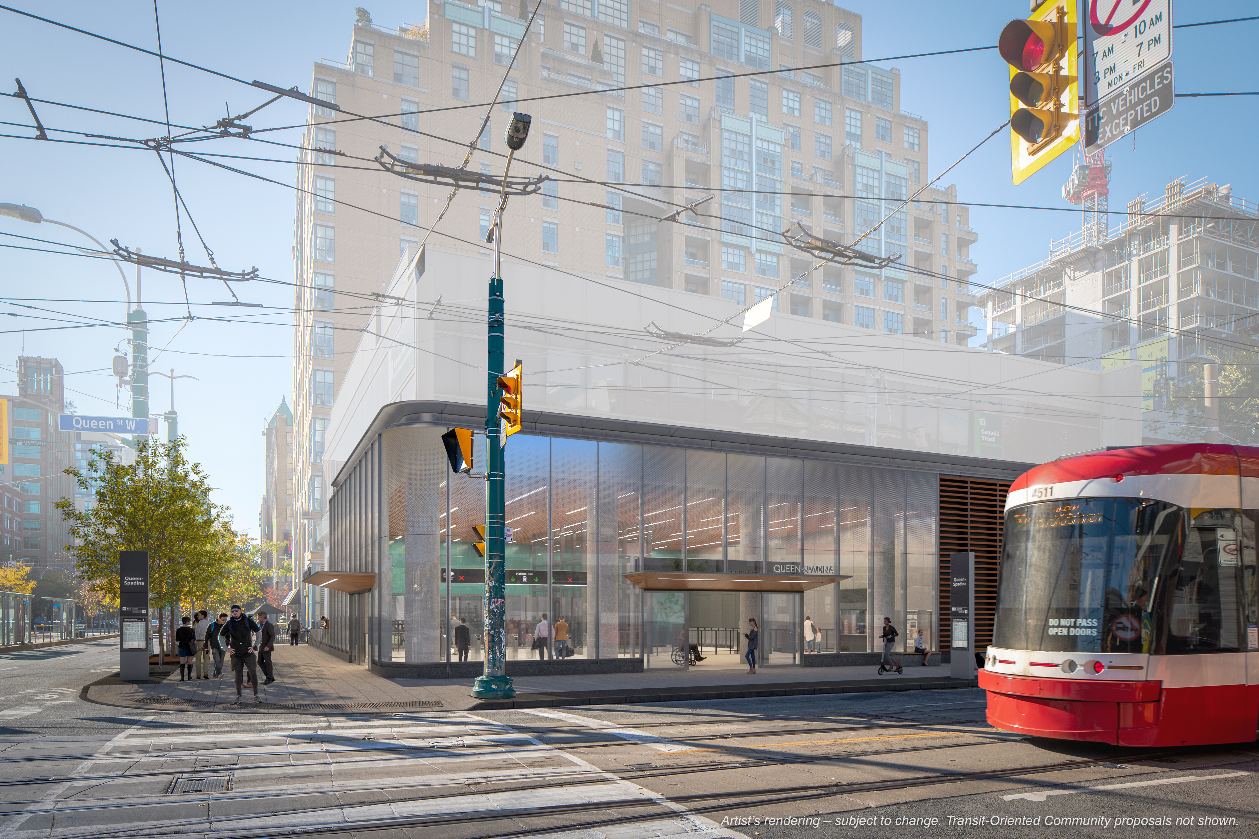
What are Toronto's major hubs? Union and then what else? Bloor and the Yonge spine south of Bloor maybe? Liberty Village???? They're building new secondary hubs in Sq One, VMC, RHill, Markham but those don't exist right now and are orders of magnitude further than Tokyos hubs.
Downtown Torontos development pattern is very different from Tokyos. Our development pattern resembles an upside down T clustering around the lakeshore and the Yonge University spine. To that extent why are we trying to draw a loop line here?
Lets examine Tokyos two loop lines, the aforementioned Yamanote line and the Toei Magenta Line. As we can see the Yamanote Line is actually connecting multiple CBDs but more importantly than that, is that it intercepts multiple radial lines that DONT meet at a common point.
View attachment 533319
View attachment 533324
Meanwhile in Toronto we have an T shaped downtown cluster with secondary hubs that are located
linearly to each other at St Clair, Eglinton and North York Center. So why would we have a loop line here? Everything is connected to each other in one seat or two seat trip anyways and there isn't nearly the demand to have a direct journey from Bloor to Liberty Village or East Harbor.
View attachment 533325View attachment 533327
Following on, (Please forgive my terrible late night handdrawn spaghetti maps)
When people draw loop lines in the Toronto context what do they look like relative to the CBD, radial lines and secondary hubs?
Dark Red being the CBD, light red being secondary hubs + Pearson
Plus some contours in yellow that are roughly 2-5, 10-15 and 20-30km from Bay and King, and the light blue lines of Go and the orange ttc lines
If we examine this map then we see that all the GO lines are radial, and that the Yonge Line is very clearly a radial line. This explains why the Yonge Line is so dang busy, its the only reliable way from the outskirts of the Northern GTA into Downtown. (At least prior to GO expansion)
The Bloor Danforth line also reveals itself to a mostly radial line, but crucially one that does not reach the center of the GTA.
If we want to create a circumferential line here, then (as it was designed and planned to be) the most obvious candidate is going to be one at the 20km contour, running along the 407, and hitting the Mississauga secondary hub, Pearson, and the 3 planned hubs in VMC, RHMC and Unionville.
Based on the shape of Torontos semicircular development, creating a loop line makes a weird radial/ circumferential line that won't properly serve either use case.
If you give it the service patterns needed to properly serve radial trips into the central business district, then the circumferential portions are going to be overserved or you'll have to constantly turn trains back around.
But if you give it the service patterns appropriate for connecting our anemic secondary hubs and doing suburb to suburb trips, then you are underserving the radial CBD journeys.
My point here being that Torontos geography and orientation lend itself poorly to a loop line because development is not circular around a central point. The lake means that development is semicircular around the CBD. Trying to jam a circular line onto this geography makes for poor design and would duplicate the path of existing radial lines into downtown.
Instead circumferential lines that want to connect secondary hubs, radial lines and suburbs should be an arc
Look at Melbourne, where they are building a suburban connector line and because of their coast hugging geography, they are building it as an arc too