


drum118
Superstar
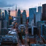
yepAre those little shelters supposed to be the temporary bus loading area?
|
|
|
yepAre those little shelters supposed to be the temporary bus loading area?
You reminded me that I watched a timelapse of the light rail system in Seattle once before. I dug it up to show what you mean.
I believe Kipling has the best benefits to cost ratio. My top two would be Martin Grove and Kipling.So, we can select Islington (reasonably priced according to all estimates) and Martin Grove (the highest traffic impact) for grade separation. If we can afford one more, that could be either Jane or Kipling or Royal York.
I believe Kipling has the best benefits to cost ratio. My top two would be Martin Grove and Kipling.

The congestion at Martin Grove & Eglinton is already packed during the rush hours. I would expect to see even more congestion (from non-YYZ commuters) as Eglinton gets redeveloped over time. Plant World, for example, will be replaced by high density (see link). I would expect to see even more development all along Eglinton to increase density, congestion, and more users for the LRT.
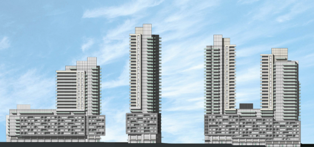
Possible development at 4000 Eglinton Avenue West (where Plant World is today).
It pains me to hear a suggestion that we should be doing grade separation for the "perception of rapid transit". Because we have nothing else that $500M couldn't be spent on.
Its like the request to tunnel the Barrie line overpass....that price tag worked out to approximately $700k PER property that abutted the section being elevated, yet people said this was a reasonable use of dollars. Thankfully Metrolinx never went for it.
If what you're saying is true, then it would stand to reason that the CTrain stops at red lights quite frequently. Can you confirm that this is the case? More than likely, the traffic signals and crossing arms detect a train coming far enough away to make these kinds of conflicts very rare.Crossing arms aren’t some panacea - it won’t allow the trains to have a green wherever and whenever.
The limiting factor is that pedestrians need at least 30 seconds for north/south movements across Eglinton Avenue, including around 20 to 25 seconds for the “flashing hand” signal, warning them that they’ll soon no longer be able to cross. If a train comes up to an intersection where pedestrians have the north/south walk signal, the train is going to have to wait until the 30 second walk phase is complete until proceeding. With trains crossing any intersection every 1.5 minutes, this is going to happen quite frequently.
If what you're saying is true, then it would stand to reason that the CTrain stops at red lights quite frequently. Can you confirm that this is the case? More than likely, the traffic signals and crossing arms detect a train coming far enough away to make these kinds of conflicts very rare.
Cities from Calgary to Edmonton to Seattle to Salt Lake to Minneapolis have LRT lines designed this way. It's not new or unproven.
Well, if selling light rail to the public is not important, and we are OK with having big plans but few lines in service, then let's ignore the perception.
Some excellent points in there.I'm not intimately familiar with the C-Train, but I can speak on Seattle. In that system, the stations are extremely far apart; around 2.5 kilometres between stations. These distances are highly unusual for light rail and conventional metro systems.
The wide distances between stations allows the transit signal priority system to accurately predict when a train is coming. It can see that a train is a kilometre away, and know that it will be here in roughly 60 seconds, because it doesn't have intermediate stations adding variability to the schedule. It can the accordingly adjust the signal phases to accommodate the train.
With the Eglinton West LRT having stops every 1000 metres, that kind of set up will not be effective here. It might work if we drop half the stops, leaving stops only at Jane, Royal York, Kipling and Renforth. The LRT itself would be a lot faster, but you'd be forcing people to walk another 10 mins or so to their destinations, or forcing them to transfer to a bus. This isn't a very attractive option, in my opinion.
I was just watching two vids on their system, reminds me very much of San Diego's, with tunnel and bridge sections, and priority signals on shared roadway. And far apart stations. They're not stops as much as stations, but I also noticed the Seattle model sharing the trackbed in tunnel with buses!I'm not intimately familiar with the C-Train, but I can speak on Seattle. In that system, the stations are extremely far apart; around 2.5 kilometres between stations. These distances are highly unusual for light rail and conventional metro systems.
https://en.wikipedia.org/wiki/Downtown_Seattle_Transit_TunnelThe Downtown Seattle Transit Tunnel (DSTT), also referred to as the Metro Bus Tunnel, is a 1.3-mile-long (2.1 km) pair of public transit tunnels in Seattle, Washington, United States. The tunnel serves Downtown Seattle, running west under Pine Street from 9th Avenue to 3rd Avenue, and south under 3rd Avenue to South Jackson Street. It was used only by buses from its opening in 1990 until 2005, and since 2009 it has been shared by buses and light rail. The double-track tunnel and its stations, except Convention Place, constitute parts of the Central Link light rail line, which continues north to the University of Washington station and south through the Rainier Valley to Seattle–Tacoma International Airport as part of Sound Transit's Link light rail network. Its five stations are also served by King County Metro and Sound Transit Express buses that leave the tunnel north via Interstate 5, south via the SODO Busway, or east via Interstate 90. The DSTT is the busiest section of the Link light rail network, with an average of over 10,000 weekday boardings. It is owned by King County Metro and shared with Sound Transit through a joint-operating agreement signed in 2002. The Downtown Seattle Transit Tunnel is one of two tunnels in the United States shared by buses and trains, the other being the Mount Washington Transit Tunnel in Pittsburgh, and is the only one in the United States with shared stations. [...]