News   Jul 12, 2024
 1.3K     0 
News   Jul 12, 2024
 1.1K     1 
News   Jul 12, 2024
 393     0 

The Star: Jarvis St. must change with evolving environs

There is a speed limit sign in the photo reading 30 MPH, so about 50 km/h might be a good guess.
 
From the Apr. 2 edition of eyeweekly.com


Overdue justice
Finally, restitution for the crimes against Jarvis is at hand

BY SHAWN MICALLEF April 01, 2009 21:04

On February 20, at 8:02am, city councillor Denzil Minnan-Wong tweeted “Used the middle lane on Jarvis St to get to work. Fast and efficient!†When questioned he said, “It was a great way to get to work. Imagine driving to work and not having to wait in gridlock! It was fantastic!â€

The exclamation-mark-mad muckraking councillor was intentionally wading into the contentious debate about the future of Jarvis. At the same time, he betrayed the strange panic that causes car drivers to think anything taming the dominance of the automobile on urban design is somehow a declaration of war on the car.

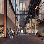
Jarvis, once the most beautiful street in Toronto, has been reverse-gentrified and turned into a fat arterial traffic pipe between North Toronto and downtown. The City’s Jarvis Street Improvement Plan, championed by local councillor Kyle Rae, aims to return the street to some of its pedestrian-friendly glory.

Back in deep winter, it was evident those who want to keep Jarvis the way it is were upset. In the Globe and Mail on Feb. 7, Rosedale resident Rob McEwen was apoplectic, saying “It’s coming out of the blue. I never heard a thing about it. You don’t just drop something like this on people’s laps.†The shrill tone of Mr. McEwen’s histrionics might lead one to believe the city wants to close Jarvis and hand it over to ambulatory south-of-Bloor Bolsheviks.

This, of course, is not the case and as early as 2000 Rae told Christopher Hume of the Star, “What we’re trying to do is bring back something the city lost many years ago... a dignified and safe street with a park and a boulevard.†This includes wider sidewalks, more trees and possibly a bike lane, but the main item fanning Rosedale’s rhetorical flames is the removal of Jarvis’ unique middle lane, which reverses direction depending on the rush hour flow.

Recently, Rae has suggested it’s “going to get ugly,†but points out that the McEwens and Minnan-Wongs of Toronto haven’t noticed the “residential urbanization that has happened around Jarvis south of Bloor in the last few decades.†It’s easy to miss speed by in a car. Walk Jarvis, and you quickly notice the incredible residential density, and how much of its past grandeur still remains.

Today, Jarvis begins in a different kind of grandeur, along Bloor’s Insurance Company Row. The Rogers headquarters was once Confederation Life, a company that went under in 1994, long before insurance company failure was bailout-fashionable. Here, Mt. Pleasant Road, opened in the early 1950s (once referred to as the city’s first expressway) funnels all that Rosedale and North Toronto traffic onto Jarvis. The traffic eventually pressured planners to remove trees and widen Jarvis in the 1960s.

Just south and opposite Rogers is a block of wonderful mid-century modern apartment buildings with angular yellow brick and glass that look as sharp as Glenn Gould’s Goldberg Variations of the same era sound. One is appropriately named “Massey House,†as the Massey family lived just down the street in what is now the Keg Mansion. To understand the Jarvis story, stand across from the Keg at the corner of Cawthra Square. From there, you will see two massive Richardson Romanesque mansions (that look like smaller versions of Old City Hall), high-rise and low-rise apartment buildings and Jarvis Collegiate south of Wellesley, where so many Torontonians of note went and where so many Canadians of future note currently attend. All good things, but in front of that celebrated Keg Mansion is one of Toronto’s ugliest parking lots, there like a blunt piece of public art representing the crimes against Jarvis.

Nearby, the details that make Jarvis great are many. At Wellesley, on the northeast corner, “Plaza 100†— a narrow, wide and high concrete building complete with rooftop swimming pool — is surrounded by mod parkettes defined by Expo ’67–era avant-garde sculptural shapes. Sit on one of the benches and the potential of Jarvis to return to its former, welcoming state is obvious.

Until I walked Jarvis to write this — that is, until I paid attention to the street — I hadn’t noticed that just south of Wellesley at 440 is the Hincks-Dellcrest Centre, a children’s mental health facility and brutalist masterpiece tucked away behind some trees. More details follow a few steps down at 432-438 where the Jarvis Court apartments have gorgeous pre-war de Stijl tile and window designs. Across the street, round apartment towers rise behind a Second Empire mansion that could have been the inspiration for the house in Hitchcock’s Psycho. At this point, Jarvis begins to seem like it should be a cherished architectural museum rather than Toronto’s shortcut.

The most recent celebrated jewel in Jarvis’ heretofore secret crown of gems is the Canadian National Ballet School, a perfect collision of new and old, with glass and steel surrounding old mansions and the former CBC headquarters, itself once the Havergal school for girls. The condo towers that rise behind — appropriately named Radio City — are simply the latest additions to this dense, residential neighbourhood.

South of Carlton, Jarvis begins to look more fortified. The Inglewood Arms rents rooms daily and weekly, Allan Gardens has an underwhelming street presence, the traditional downtown sex-worker “stroll†is here — guys in cars really do drive slowly in the evening looking at the sidewalk like they’re extras in Taxi Driver — and the fenced-in Moss Park Armoury is a bad urban neighbour.

Still, old mansions, townhomes and newer residential buildings continue along Jarvis to the St. Lawrence neighbourhood where there is no questioning the street’s vibrancy. Here Jarvis no longer has the magic centre lane and traffic is forced to squeeze into two lanes — even one lane during non-rush-hour times. All this fuss over a street that isn’t really a highway after all?
Politically, Kyle Rae knows that even though the drivers on Jarvis outnumber the residents, the people who vote for him all live in the neighbourhood. And considering Jarvis’ historic role as a beautiful street, and the potential its revitalization has to improve the rest of the downtown east side, it’s the right thing to do. Cars will still pass through, war will not have been declared and Toronto will be better off.

One day soon, the good people of Ward 34 Don Valley East are also going to start demanding beautiful, more pedestrian-friendly streets from their councillor. What will Minnan-Wong tweet then?
 
Chuch: The greater the density, the larger the transportation network required. .

Only a couple of things wrong with this:

A. "transportation network" is not equal to cars.
B. Wrong in the first place. When you have a lot of density, you have options such as walking, biking, or transit that are not available to you with less density.
C. New York is maybe the worst example you could have picked. Have you ever been there? Highest use of transit in N America, has ripped down freeways, no major development of roads on Manhattan since the 1950's, but somehow thriving. And a fabulous place.
 
C. New York is maybe the worst example you could have picked. Have you ever been there? Highest use of transit in N America, has ripped down freeways, no major development of roads on Manhattan since the 1950's, but somehow thriving. And a fabulous place.

that isn't really a fair assessment.

New York did what Toronto was trying to do in the 50s and 60s, way back in the 20s and 30s (and way before), when there was little organized opposition. They didn't need major development of roads in the 50s because the work had already been done.

They have ripped down freeways, the West Side Highway because it was dangerous and sections of road occasionally dropped out. What was the other one? The West Side I always remember, but I can never remember if there was a second.

Either way, even having torn out a highway, NYC is hardly lacking them.
 
It is a fair comparison, using Manhattan (where the photo is from) as an example. Given that no extra capacity has been built on Manhattan (or anwhere in the boroughs?) in 60 years, given that some capacity has in fact been removed, (and further, no additional transit added, within Manhattan) and given that Manhattan has undeniably thrived in that period, then I don't see how pointing out the silliness of the argument made earlier is unfair.

In fact, I could go so far as to say, your thoughts on this issue are seriously dated.
 
It is a fair comparison, using Manhattan (where the photo is from) as an example. Given that no extra capacity has been built on Manhattan (or anwhere in the boroughs?) in 60 years, given that some capacity has in fact been removed, (and further, no additional transit added, within Manhattan) and given that Manhattan has undeniably thrived in that period, then I don't see how pointing out the silliness of the argument made earlier is unfair.

It's silly because it compares nothing :)

Manhatten could have had an extreme surplus of capacity for the last 60 years, in which case it wouldn't need to add capacity. In truth, they have added capacity though. They've reorganized their street grid into predominately one-way streets (when was that done, anyway?) so that more traffic can fit through the same spaces :) Also, NYC was building highways into the 70s, and unless I've been _really_ lazy in updating my desk calender...


In fact, I could go so far as to say, your thoughts on this issue are seriously dated.

You could [write] it, though I'm not sure anyone would agree it made any sense.
 
Manhatten could have had an extreme surplus of capacity for the last 60 years, in which case it wouldn't need to add capacity.

There's no such thing as a surplus capacity of road space in a city with a population density of 25,000/km2.

In truth, they have added capacity though. They've reorganized their street grid into predominately one-way streets (when was that done, anyway?)

In the 1950s and 60s. Fifth and Madison were converted in 1966.

Also, NYC was building highways into the 70s

It was not.

You could [write] it, though I'm not sure anyone would agree it made any sense.

They made sense to me.
 
Highway building in New York City was pretty much done by the 60's. And speaking about New York how about the current plan to close part of Broadway?


Mayor Plans to Close Parts of Broadway to Traffic

By WILLIAM NEUMAN and MICHAEL BARBARO


The New York Times


The city plans to close several blocks of Broadway to vehicle traffic through Times Square and Herald Square, an experiment that would turn swaths of the Great White Way into pedestrian malls and continue Mayor Michael R. Bloomberg’s effort to reduce traffic congestion in Midtown.

Broadway traffic would also be barred in Herald Square.

Although it seems counterintuitive, officials believe the move will actually improve the overall flow of traffic, because the diagonal path of Broadway tends to disrupt traffic where it intersects with other streets.

The city plans to introduce the changes as early as May and keep them in effect through the end of the year. If the experiment works, they could become permanent. The plan was described by several people who were briefed on it this week.

Mr. Bloomberg was expected to announce the plan Thursday.

A City Hall spokesman declined comment in advance of the announcement.
The plan calls for Broadway to be closed to vehicles from 47th Street to 42nd Street. Traffic would continue to flow through on crossing streets, but the areas between the streets would become pedestrian malls, with chairs, benches and cafe tables with umbrellas.

Seventh Avenue would be widened slightly within Times Square to accommodate the extra traffic diverted from Broadway.

Below 42nd Street, Broadway would be open to traffic, but then would shut down again at Herald Square, from 35th Street to 33rd Street. Then, below 33rd, it would open again.

The plan is the latest move by Mr. Bloomberg to change the way the city thinks of its streets, making them more friendly to pedestrians and cyclists and chipping away at the dominance of the automobile.

Once the changes are in effect, a large stretch of Broadway in the heart of Midtown would be radically changed.

Last summer, the city narrowed Broadway from 42nd Street to 35th Street by setting aside two lanes on the east side of the street for a bike lane and promenade with tables, chairs and planters.

That project, called Broadway Boulevard, met with some skepticism at first but quickly became a popular lunch spot for office workers and tourists. Under the new plan, officials are considering creating a similar promenade from 47th Street north to the vicinity of Columbus Circle.

A theater industry executive who was briefed on the plan this week said the reaction among Times Square business leaders was largely favorable.

“I think it potentially could be a big plus if it speeds up traffic flow through the Times Square area,†said the executive, who spoke on condition of anonymity because the briefing was considered confidential until the mayor announces his plan. “If you have a major pedestrian area, that actually could be something welcoming and lovely.â€

Cora Cahan, president of the New 42nd Street, a nonprofit group that oversees seven historic theaters, said she was not briefed on the latest plan but had seen preliminary proposals last year.
“I think it’s very worth trying,†she said, adding that Times Square badly needs more room for pedestrians.

The plan has some risks, especially if it does not deliver on the promise of decreasing congestion.

New York drivers, including cabbies and truck drivers, can be zealous in defending their use of the city’s streets. Their passion helped doom Mr. Bloomberg’s congestion-pricing proposal last year to charge drivers to use the most heavily traveled streets of Manhattan.

Some may also question the timing, now that the city is struggling with a recession. The theater executive who was briefed on the plan said one worry was whether taxis and other vehicles would have difficulty leaving people in front of theaters.

Jeffrey Zupan, a senior fellow for transportation for the Regional Plan Association, an independent organization, said planners had been calling for similar changes for years.

He said Broadway tended to foul up traffic at each intersection with an avenue. To allow for green lights on Broadway, the duration of the green lights on the avenues and cross streets had to be shortened, backing up traffic.

“The lower the volume is on Broadway — or if you eliminate it altogether — then traffic is going to move better,†Mr. Zupan said. “That’s one of the positive things that’s going to come out of this. The win-win is that the space that you’re feeing up will be used by pedestrians.â€
 
There's no such thing as a surplus capacity of road space in a city with a population density of 25,000/km2.

Didn't say there was. Just pointing out that without mentioning any specifics, any numbers, anything, it was just conjecture - equal in value to suggesting it might have had surplus capacity.

New York is larger than Toronto. New York hasn't built new capacity in 60 years (false anyway). Therefore Toronto doesn't need to build new capacity?

I feel like there are a couple connections missing.


It was not.

Most everything was done by the 60s.

The Long Island Expressway was finished in the 70s.

East Side Drive was rebuilt in portions in the 80s and into the 90s.

60 years ago: 1949


They made sense to me.

"They" ? That didn't even make sense.
 
Last edited:
And speaking about New York how about the current plan to close part of Broadway?

<deletia>

Seventh Avenue would be widened slightly within Times Square to accommodate the extra traffic diverted from Broadway.

<deletia>

Something missing from the Jarvis St. suggestions.
 
Better bitter than dated. What could be more dated in 2009 than arguing for expressways cutting through a city? Nothing. It's a position oblivious to everything in good urban planning, good transportation planning, or common sense.

Gosh, Seventh avenue, widened slightly, in one block? Quickly, smash down everything along Jarvis for ten lanes of pure powertraffic happiness based on Manhattan's traffic-happy engineering. That's not only dated, it's delusional.
 

Back
Top