News   May 08, 2024
 446     0 
News   May 08, 2024
 460     0 
News   May 08, 2024
 683     0 

Novel Coronavirus COVID-19 (nCoV-2019)

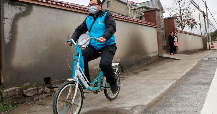
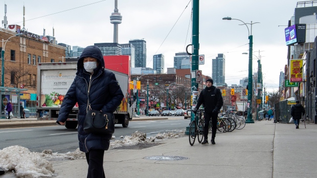
Unfortunately they are not doing themselves any favors walking around with masks on. I get that they are worried but unless you're currently in China they are not needed.

They may not be infected but the masks are the new plague doctor outfits. It gives some people the creeps.

I actually asked someone last night at my work about why they wear one and the short answer is that they were worried about catching the disease. I then promptly explained that a surgical mask does virtually nothing to protect them from the disease.

I get that they are worried but walking around with a surgical mask won't solve anything.

I will say though, I wonder if population density in Asia is making for a fertile breeding ground in terms of outbreaks. It seems as though the most recent outbreaks have come from China. You never hear of major outbreaks starting in Saskatoon for example.

I think population density has a lot to do with it but so do things like public health and food safety policies. The Chinese version of communism evolved years ago to allow entrepreneurialism - something Stalinist communism would never countenance - so you get non-corporate residents trying to eke out a living buying/growing/raising/selling products domestically with virtually no state involvement.

Interestingly, it seems that there have not been epidemic outbreaks from the Indian sub-continent and other places with seemingly similar conditions (high density, weak public infrastructure, etc.), at least none that I can recall.
 
More on facemask need/effectiveness:


AoD
 
  • Like
Reactions: vic
1280px-2019-nCoV_Outbreak_World_Map.svg.png

Dark Red: Mainland China
Red: Countries with confirmed cases
Blue: Countries with suspected cases
 
I always find those kinds of maps to be somewhat misleading. Canada, the second largest country in the world, only has two (or is it three now?) confirmed cases, but ends up leaving a GIANT red mark across the norther hemisphere. As if Nunavut is all infected..... And....do they actually have confirmed cases in Hawaii and Alaska?

A map with more localized information would be much more useful / accurate.

Use the John Hopkins University real-time map at the OP post. (though all maps types have benefits and drawbacks)

AoD
 
The death rate is low but it could increase if the disease spreads like a pandemic as overburdened health systems try to provide care but at reduced levels.
 
1918. Spanish flu.

1918flu3.jpg

From link.

When half the city took ill

From link.

Toronto 1918 – a city of a half-million people, but the streets seem empty, the result of 70,000 young Torontonians having enlisted in World War I. Suddenly and without warning, an enemy deadlier than any German weapon appears in one of many military camps across town.

...The Spanish flu reached Toronto on Sept. 29, 1918. Within a month, half the population was infected by this highly infectious pathogen. Once the fever, diarrhea and other symptoms had dissipated, more than 1,750 Torontonians were dead. Across Canada, some 50,000 people died from that flu, many of them between 20 and 40 years old. One way the flu strain killed was by triggering an extreme reaction in the immune system. Around the world the death toll is estimated to have reached upwards of 40 million, compared to roughly 10 million victims of the Great War...
 
Last edited:
Airlines around the world have started to cancel more flights to China as coronavirus fears have dragged down demand for air travel in the area.

Air Canada normally runs 33 flights a week to China out of Toronto, Vancouver and Montreal but on Wednesday the airline announced it would halt all flights to Beijing and Shanghai until the end of February at least.

https://www.cbc.ca/news/business/coronavirus-air-travel-1.5444326
 
1918. Spanish flu.

1918flu3.jpg

From link.

When half the city took ill

From link.
I read that the "Spanish" flu was quite widespread toward the end of the war. Spain was not in the war (WWI), and could be open an honest about the flu. Many of the war participants didn't want the general health of their population known to others, so it wasn't as reported.
Since the only reports about flu were from Spain - that's how it got it's name.
 
I always find those kinds of maps to be somewhat misleading. Canada, the second largest country in the world, only has two (or is it three now?) confirmed cases, but ends up leaving a GIANT red mark across the norther hemisphere. As if Nunavut is all infected..... And....do they actually have confirmed cases in Hawaii and Alaska?

A map with more localized information would be much more useful / accurate.
Here you go:


The above link contains maps of the administrative divisions of countries (excluding China) that have the virus.

For China:

1205px-2019-nCoV_cases_in_Greater_China.svg.png
 

Back
Top