News   Jul 12, 2024
 1.2K     0 
News   Jul 12, 2024
 1K     1 
News   Jul 12, 2024
 378     0 

Miscellany Toronto Photographs: Then and Now

It's hard to believe that even in the ‘50s the stretch of Don Mills Road at the top of that hill and north was still country. I remember a large dairy farm on the east side at Eglinton, smaller farms on the west side where the Science Centre is now. My father would drive down Don Mills Rd. on our way from York Mills to visit grandparents in the east end – past the farms, down that hill, across the concrete arch bridge then winding up the other side to O'Connor. There was a riding stable in the valley.

When IBM built in 1951 (844 Don Mills Rd. - before Eglinton existed) it was surrounded by farmland.
That must be one of the greatest examples of foresight!
 
When IBM built in 1951 (844 Don Mills Rd. - before Eglinton existed) it was surrounded by farmland.
That must be one of the greatest examples of foresight!

Seen these yet, Goldie? :)

s0065_fl0513_it0001.jpg

s0065_fl0513_it0002.jpg

s0065_fl0513_it0003.jpg

s0065_fl0513_it0004.jpg

s0065_fl0513_it0005.jpg

s0065_fl0513_it0006.jpg

s0065_fl0513_it0007.jpg

s0065_fl0513_it0008.jpg

s0065_fl0513_it0009.jpg

s0065_fl0513_it0010.jpg

s0065_fl0513_it0011.jpg

s0065_fl0513_it0012.jpg

s0065_fl0513_it0013.jpg

s0065_fl0513_it0014.jpg

s0065_fl0513_it0015.jpg

s0065_fl0513_it0016.jpg
 
Thanks, Lone. I had not seen those before - all in preparation for the widening of Don Mills Rd. I expect.

Here's another early (1953) scene of Don Mills Rd.

TNDonMillsRdbridgeNofLawrence1953_zpsd1f6bde2.jpg
 
Thanks, Lone. I had not seen those before - all in preparation for the widening of Don Mills Rd. I expect.

Here's another early (1953) scene of Don Mills Rd.

TNDonMillsRdbridgeNofLawrence1953_zpsd1f6bde2.jpg

I wonder if that house in the upper view is still there in the development...
 
Lone Primates images above. I'd like to also single out the Philco plant. There's a name from the distant past of corporate histories.
 
Interesting from those 1965-ish photos that (a) the MONY building was the first built part of the Foresters complex, (b) the tree placement/retention at the Ortho plant was truly "artful", and (c) interesting combination of old-model and new-model Esso signs at the station (and around the time that the new-model logo was introduced)
 
Interesting from those 1965-ish photos that (a) the MONY building was the first built part of the Foresters complex, (b) the tree placement/retention at the Ortho plant was truly "artful", and (c) interesting combination of old-model and new-model Esso signs at the station (and around the time that the new-model logo was introduced)
The ESSO station with the Imperial Oil complex behind is priceless!
Phlico, yes nice. Ortho was north of the tracks, North of Gestetner. Third photo down, original post.
And wow, Mony was before IOF!
Anyone remember the Latin Quarter!
 
Last edited:
you'll remember Tumper's Hill, then, just south of the white bridge, forcing a hard right turn there

most of it was levelled to provided fill for the dvp

The TPL site has a couple of good photos of the bridge, hard right and hill (1954 and 1958)

Don Mills Rd 1954.jpg
Don Mills Rd 1958.jpg
 

Attachments

  • Don Mills Rd 1954.jpg
    Don Mills Rd 1954.jpg
    78.7 KB · Views: 1,120
  • Don Mills Rd 1958.jpg
    Don Mills Rd 1958.jpg
    44.3 KB · Views: 1,102
Then and Now for April 3, 2013.


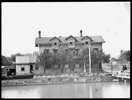
Then. Betz's hotel. Esplanade and Front. c1866. This is a very old image.

1043BetzHotelatthecornerofEsplanadeandSimcoestreets1866.jpg


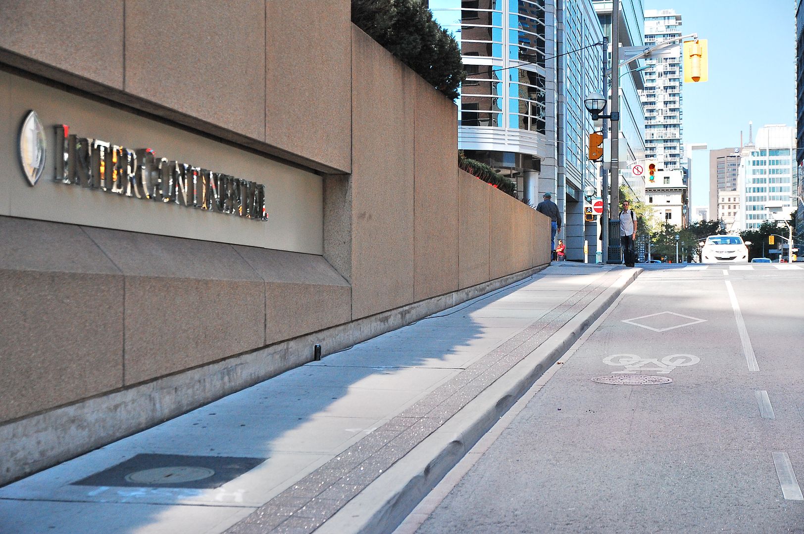
Now. September 2012.

1044.jpg
 
Seen these yet, Goldie? :)

s0065_fl0513_it0001.jpg

One of the most interesting changes to the S/E corner of Don Mills & Eglinton, I believe, took place immediately to the east of the Foresters Tower.

TNohabuilding24FerrandDr_zps98ff39e9.jpg


[edit, April 3] Recently found another photo to add to this story:

OHAdemolition1994_zps7e4d3ed0.jpg
 
Last edited:

Back
Top