News   Nov 15, 2024
 1.4K     4 
News   Nov 15, 2024
 1.4K     1 
News   Nov 15, 2024
 1.6K     0 

Miscellany Toronto Photographs: Then and Now

But in 1940, the QEW would already have existed--far more important (and red-line-worthy, as per the map) than the Queensway. In fact, an early proposed name for this beginning stretch of the QEW was the Queen Street Extension. (yeah, looked that one up thru Wikipedia)

Queen and the Queensway weren't hooked up until the mid-50s.

Before the opening of the Queensway through the bottom of Swansea in 1957, Queen St. ended at grade with Parkside Dr. Until the Queensway/South Kingsway intersection was altered recently, maps still showed the original w/b to n/b off-ramp at the intersection as being "Queen St. Extension".

As for North Queen Street in Etobicoke, I can only surmise that it was named as such because it was/is the first main street north of the "extension of Queen St."
 
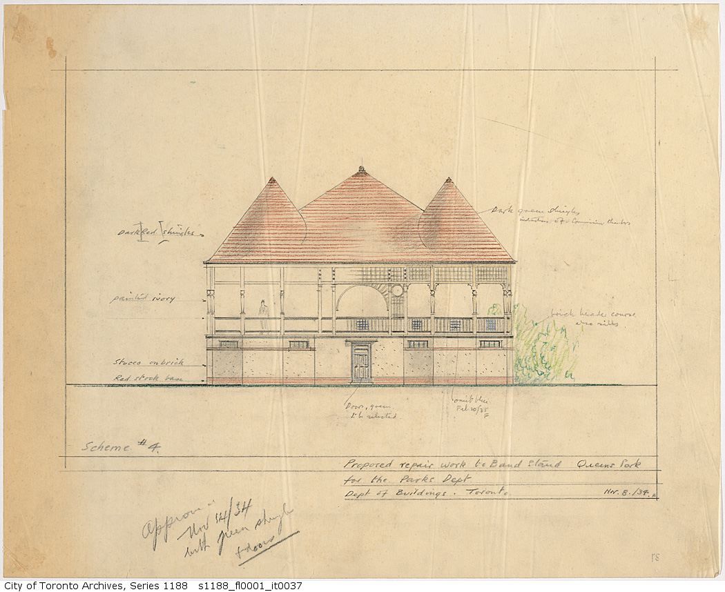
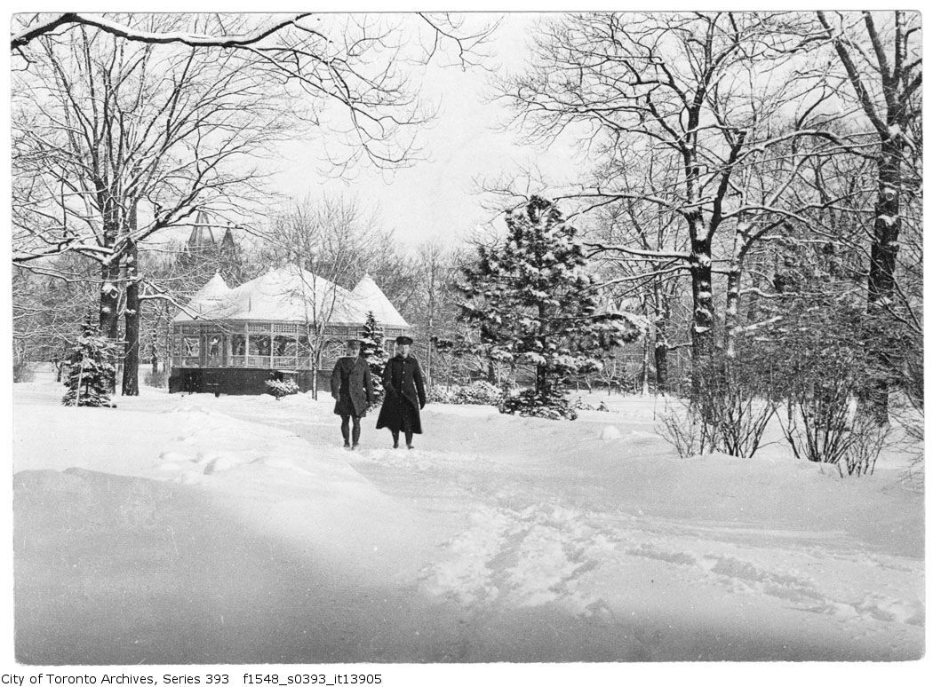
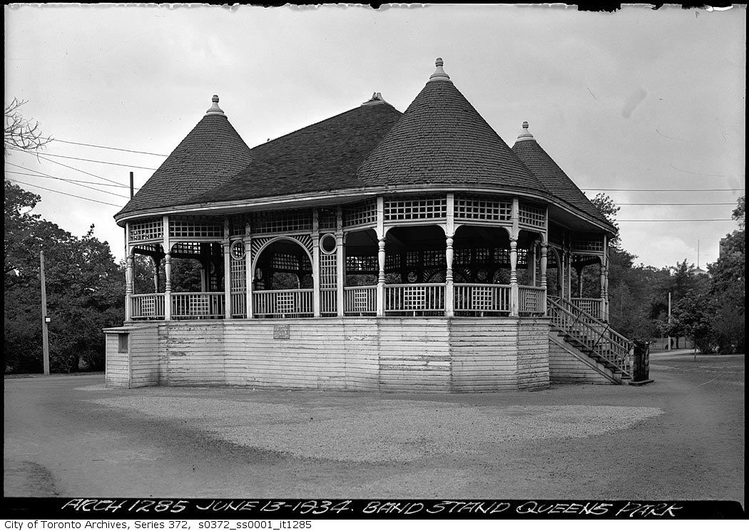
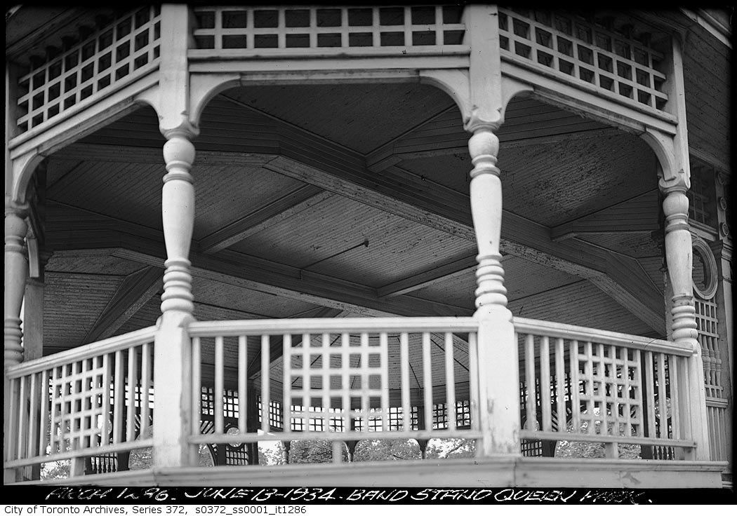
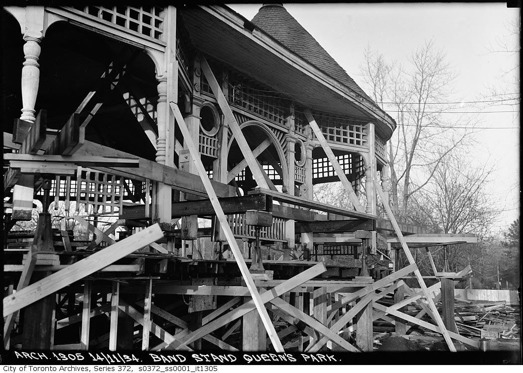
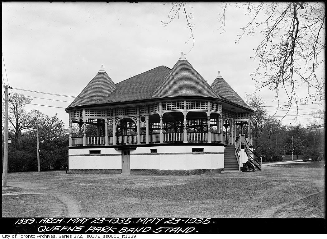
It was the Queen's Park Bandstand, which was replaced by the equestrian statue of Edward VII. Great set of photos, brewster!

s1188_fl0001_it0037.jpg


1917:

f1548_s0393_it13905.jpg


s0372_ss0001_it1285.jpg


s0372_ss0001_it1286.jpg


s0372_ss0001_it1305.jpg


s0372_ss0001_it1339.jpg

Great set of photo's is right thecharioteer. I never new any of this exisited thanks to Mustapha's observation and your quick research.
 

"The tradition of men not buttoning the bottom button of waistcoats is said to be linked to Edward, who supposedly left his undone due to his large girth. His waist measured 48 inches (122 cm) shortly before his coronation. He introduced the practice of eating roast beef, roast potatoes, horseradish sauce and yorkshire pudding on Sundays, which remains a staple British favourite for Sunday lunch."

http://en.wikipedia.org/wiki/Edward_VII
 
Funny what you don't notice Mustapha. I wonder how long that building was there and when did they decide it was time to go?

First attempt at Panorama. Park Hyatt looking south. Looks like I have a new addiction , didn't realize how easy these Panorama programs were to use.
IMG_1484Panorama.jpg

Is the bar still open up there? I haven't been in 20 years.
 
Is the bar still open up there? I haven't been in 20 years.

It was when I was there in January 2008. We didn't get any hassle about being out on the balcony that I can remember, though. :)

[video=youtube;M8KScMvue1M]http://www.youtube.com/watch?v=M8KScMvue1M[/video]
 
Before the opening of the Queensway through the bottom of Swansea in 1957, Queen St. ended at grade with Parkside Dr. Until the Queensway/South Kingsway intersection was altered recently, maps still showed the original w/b to n/b off-ramp at the intersection as being "Queen St. Extension".

As for North Queen Street in Etobicoke, I can only surmise that it was named as such because it was/is the first main street north of the "extension of Queen St."

Technically, you're correct--traditionally, the Queensway *was* regarded as a de facto westward transcription of Queen, even before they were connected in the 1950s.

So may I offer an alternate argument: that as an "extension", the QEW was regarded as a bypass of the existing Queensway alignment--and that the name "Queensway" (another question: when did that come about? I'd like to suspect it was post-QEW) was a modish way of avoiding a name like "Old Queen Street".

Certainly at the time the 1940 map was made, the QEW was a far more important artery--the present-day Queensway was but a local concession road on the verge of suburbia, and nothing to depict as a red line on the map...
 
Looking south from the Park Hyatt--Bloor and Avenue Road
ViewfromUOfT.jpg

IMG_1491-Copy.jpg

For me the interesting part is that none of the downtown skyscrapers visible in the 50s shot are visible from that aspect today. They're either gone or blocked.

And the nearby Whitney Block is dwarfed in today's shot.
 
For me the interesting part is that none of the downtown skyscrapers visible in the 50s shot are visible from that aspect today. They're either gone or blocked.

And the nearby Whitney Block is dwarfed in today's shot.

No, I can still see this entire block, and I think it was one of the tallest at one time.
IMG_1491-Copy.jpg


Of course I'm not as versed on the building as others here, and could be wrong.
 

Attachments

  • IMG_1491-Copy.jpg
    IMG_1491-Copy.jpg
    76.1 KB · Views: 598
Last edited:
No, I can still see this entire block, and I think it was one of the tallest at one time.View attachment 8352

Of course I'm not as versed on the building as others here, and could be wrong.

That's the Whitney Block, right across from Queen's Park. In the 50s shot the tower stands alone; now, it doesn't really stand out at all, especially with the backdrop of skyscrapers in the core.

The blocked buildings I was referring to were those further off, in the downtown core.

And I missed the most significant thing of all: In the 50s shot, you can see the lake and Centre Island. In the current shot, they're blocked, too.
 
Then and Now for Jan 30.


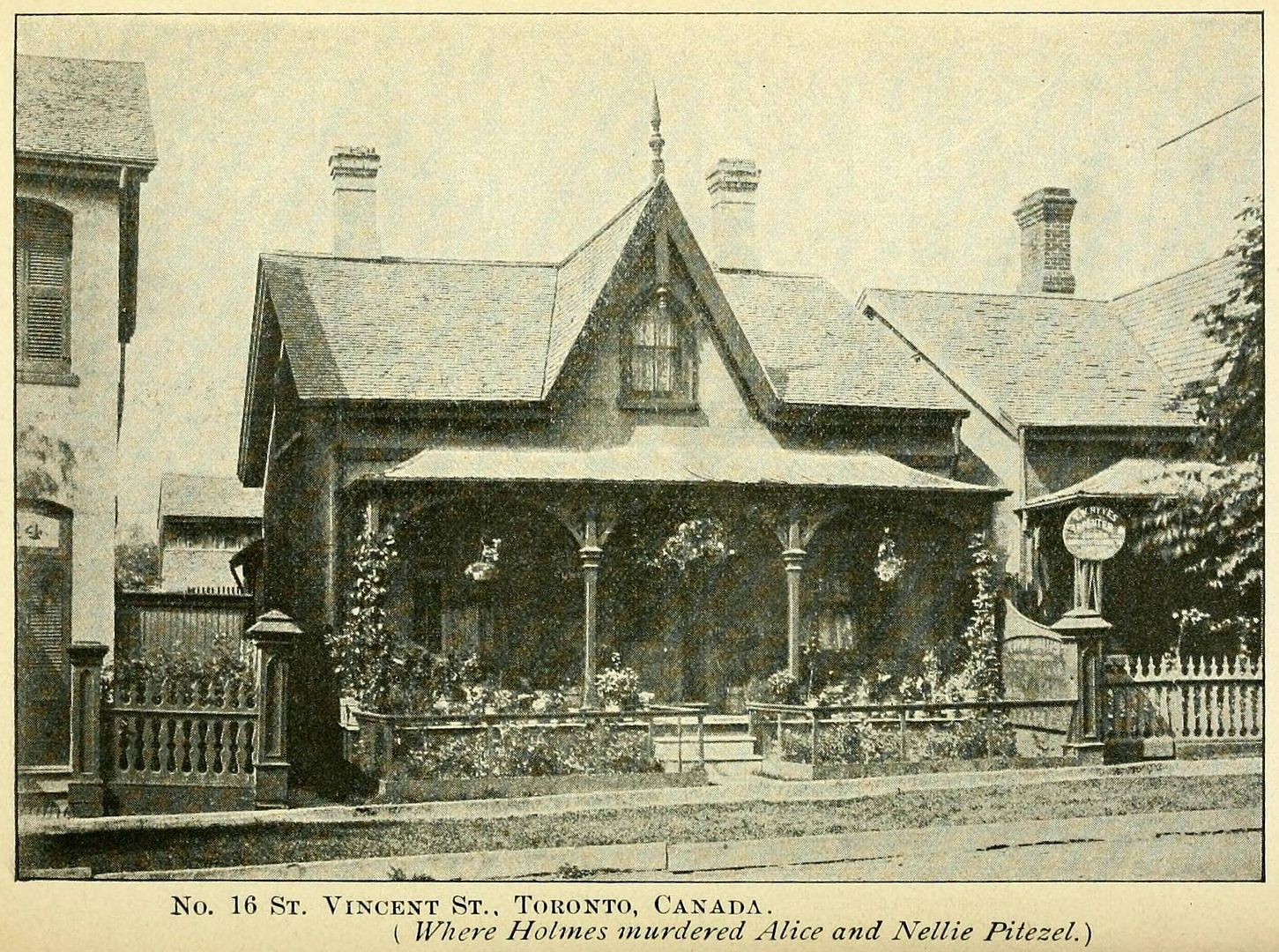
Then. 6 St. Vincent St. 'Where Holmes murdered Alice and Nellie Pietzle.'

Well, it's been over three years since this thread has been up, and we make our first Then and Now foray into long ago crime. Please don't click on the link if the crime of murder makes you uncomfortable.

http://en.wikipedia.org/wiki/H.H._Holmes

373pitezel4a.jpg

Thanks for this one. I've read the Erik Larson book (one of his best) and knew about the Toronto connection, but had never realized quite where the house was.

(wonder if a "then and now" for the Chicago "Castle" where he did most of his dastardness could be conjured? the Wiki article mentions there's now a post office on the site.)
 

Back
Top