


Goldie
Senior Member
Let's get back to Toronto.
The CNE is just around the corner - a great place for photography!

The CNE is just around the corner - a great place for photography!
|
|
|
Let's get back to Toronto.
The CNE is just around the corner - a great place for photography!
The food sucks though. Bleh.
")
thecharioteer,
In your 1862 picture: we - well, me anyways
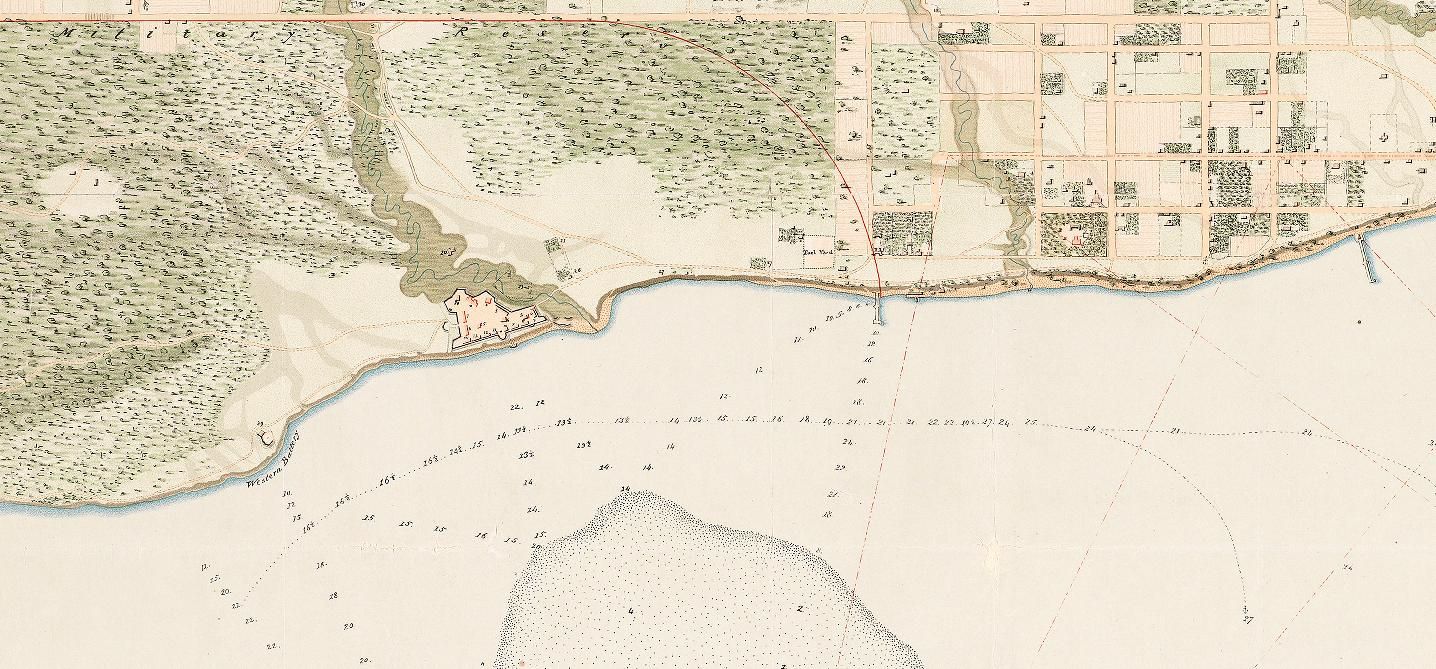
One interesting note was that before the railroads came, there was apparently some thought of preserving the shores as a park
...
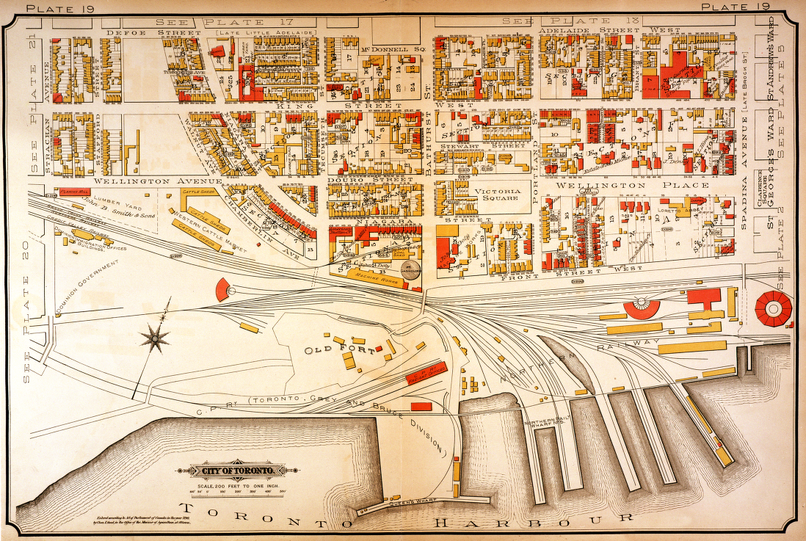
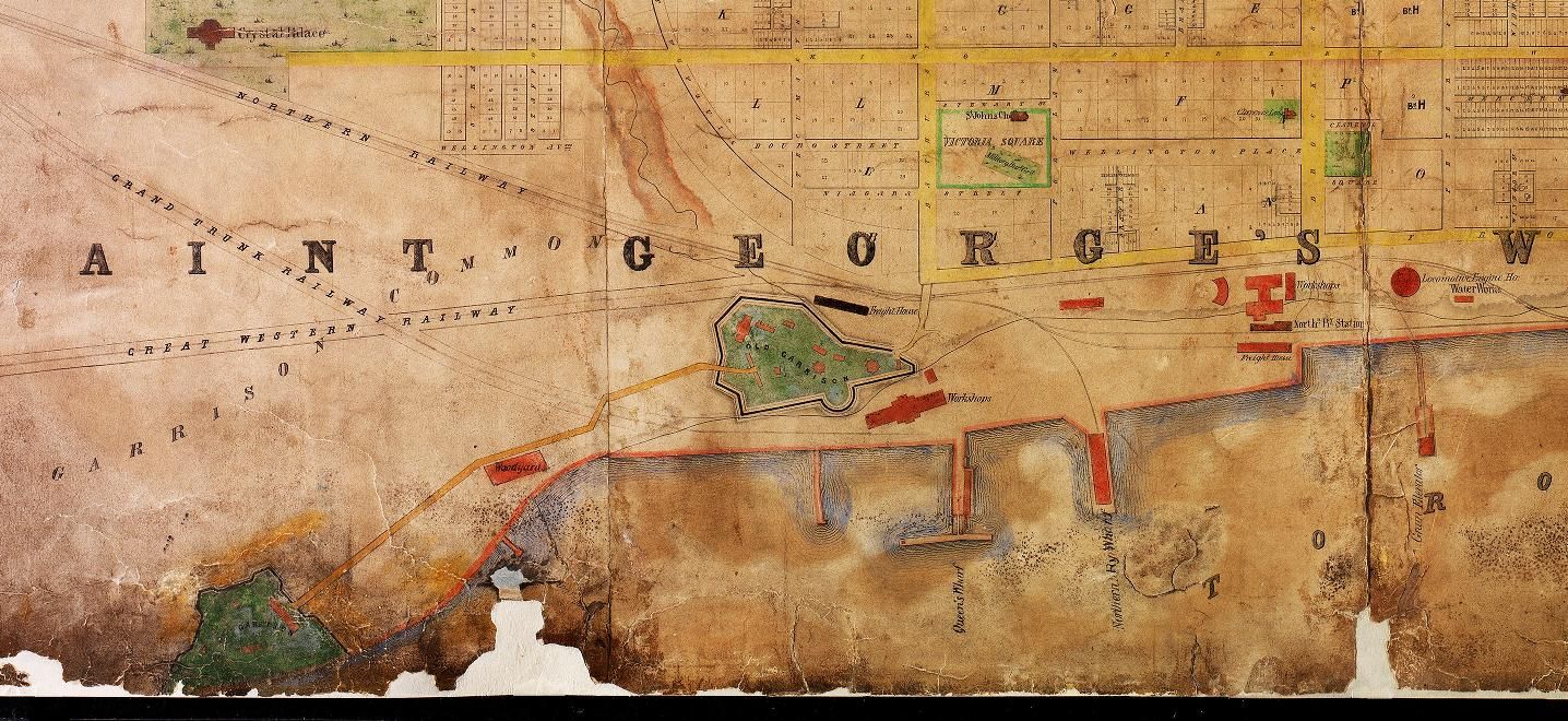
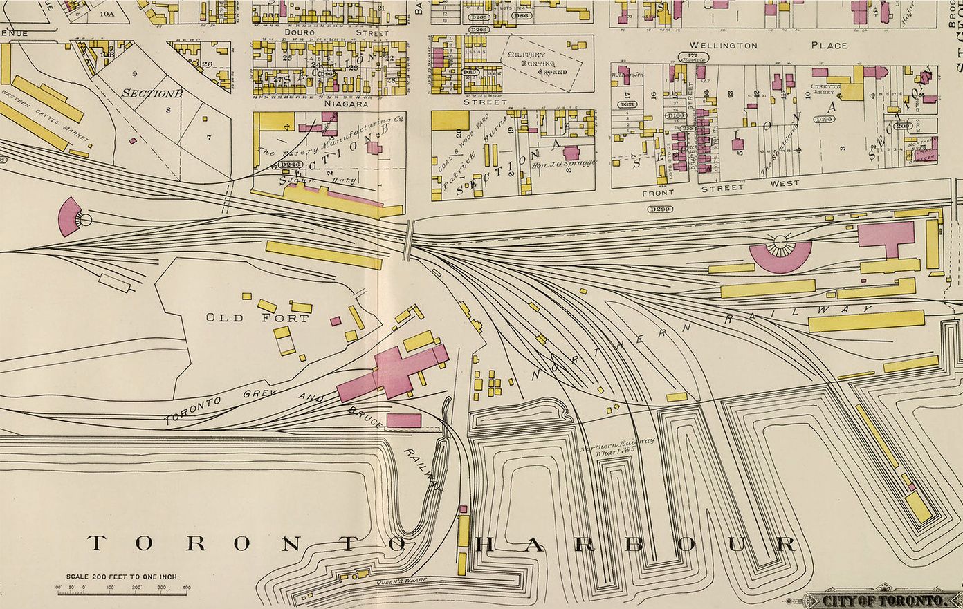
The guide had a drawing of Toronto in the late 19th century that showed how the railways peeled off to the east of the fort and down right onto the piers. (If I could find that image, I could do an interesting Then and Now...)
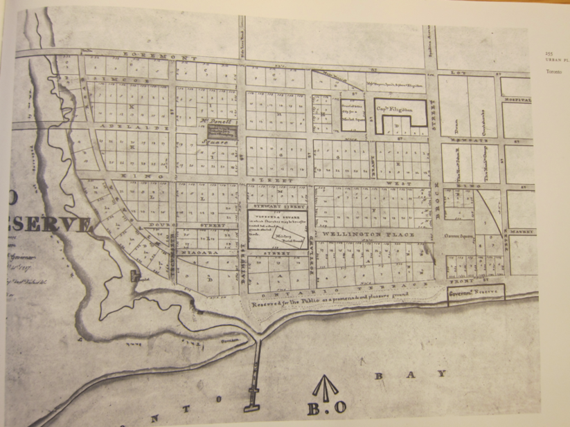
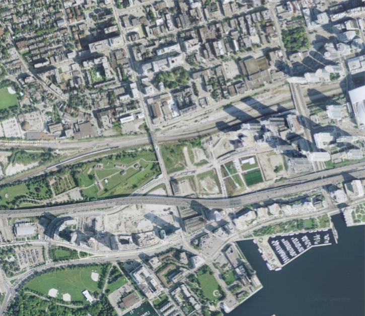
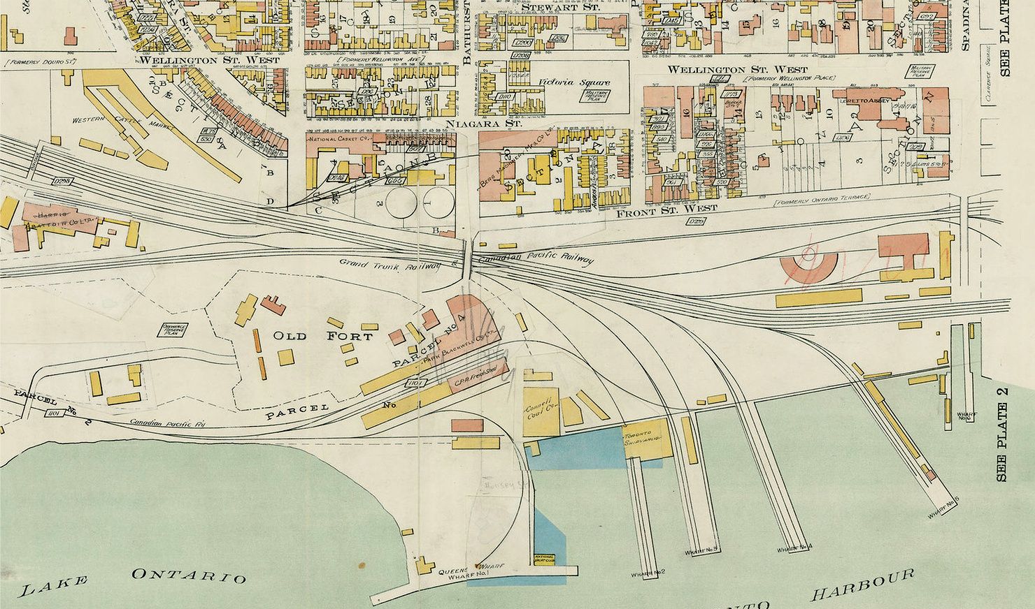
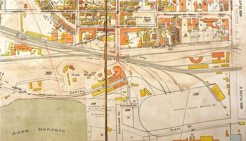
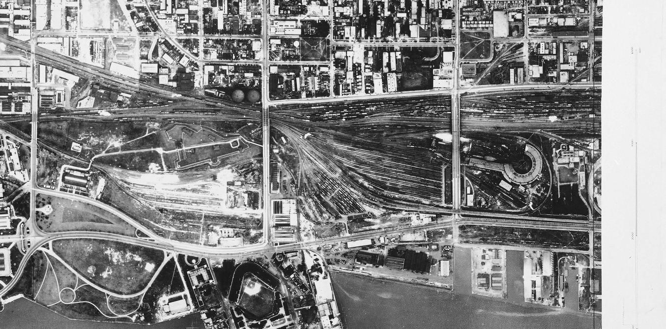
I got down to Ft. York yesterday for Simcoe Day and went on a walking tour that focused on the changes to the shoreline. We went up on the fortifications and down the set of stairs off of Bathurst St., and for the first time I really got a sense of how the fort met the shoreline and how everything related to the harbour and the town of York. One interesting note was that before the railroads came, there was apparently some thought of preserving the shores as a park.
Another particularly interesting bit was peering down into the excavations on the east side of Bathurst, where they've unearthed evidence of the railway spurs and piers. The guide had a drawing of Toronto in the late 19th century that showed how the railways peeled off to the east of the fort and down right onto the piers. (If I could find that image, I could do an interesting Then and Now...)
And the third interesting bit? I'd always thought the hollowed-out bits around one of the blockhouses and the magazine were defensive, when in fact they show the original ground level within the fort.
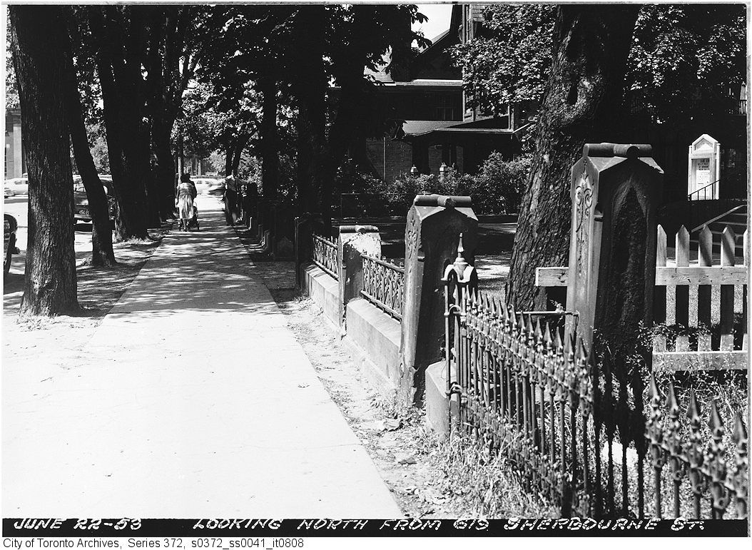
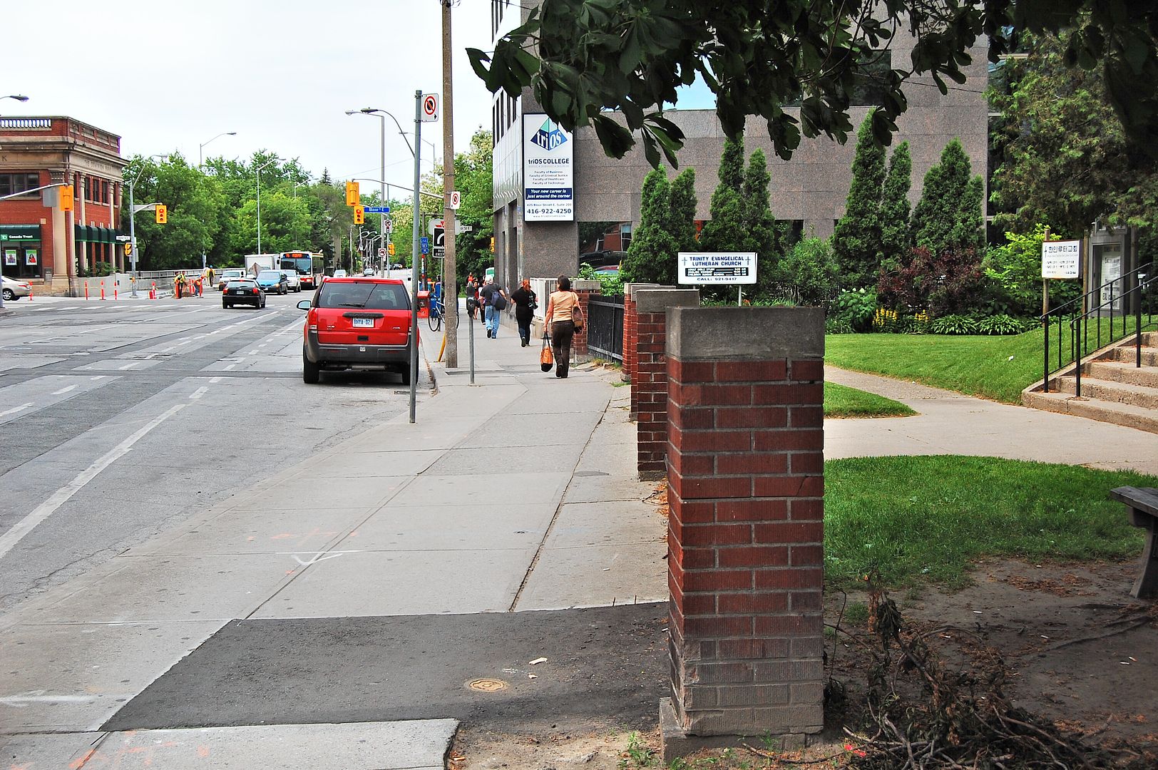
A few shots up - I'm not sure if I'm mistaken, but that fence on the right at 619 Sherbourne....I think it might have been saved and moved down to the corner of Sherbourne and Wellesley, where the hospital entrance was. Where the Rekai centre is now. I'll see if I can find a picture.
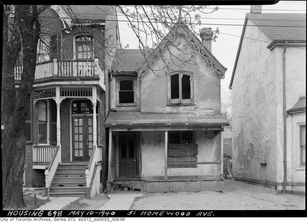
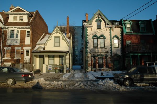
On Homewood Avenue, 1940 and last year:
*Is* that the same address? Doesn't look like it...