News   Nov 18, 2024
 1.5K     1 
News   Nov 18, 2024
 794     0 
News   Nov 18, 2024
 1.8K     1 

Miscellany Toronto Photographs: Then and Now

A fascinating story - many thanks to all participants.

It's amazing what a little digging will do.
 
King Camera had three locations within blocks of each other. (Yonge King, Bay at Temperance, as well as the Star building. Run by Earl Eiensenstat, a bare knuckle owner who did pretty good. We used to supply Star and Globe photographers with last minute supplies if theirs ran out. Also had to lug rental audio-visiual equipment to offices in the TD Centre. Lots of fun carrying those while jaywalking across King. Those were the days!!
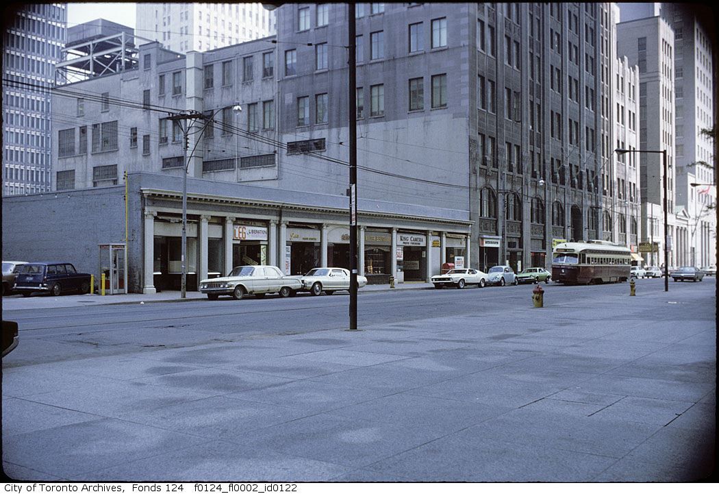
Here you go.

f0124_fl0002_id0122.jpg
 
December 1 addition.


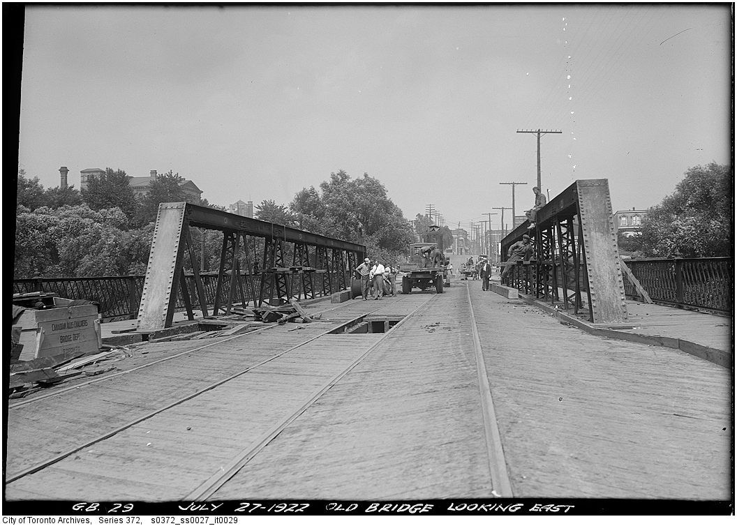
Then. "Old bridge looking east". July 27, 1922. This is of course the Gerrard street bridge over the Don River.


s0372_ss0027_it0029.jpg


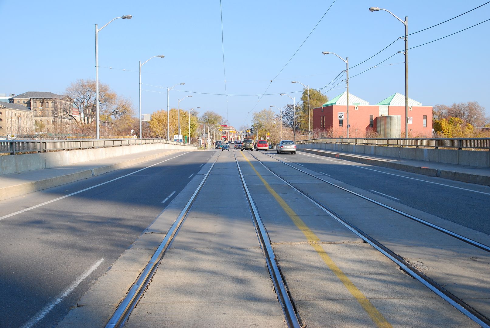
Now. November 2010.


DSC_0059.jpg
 
December 3 addition.


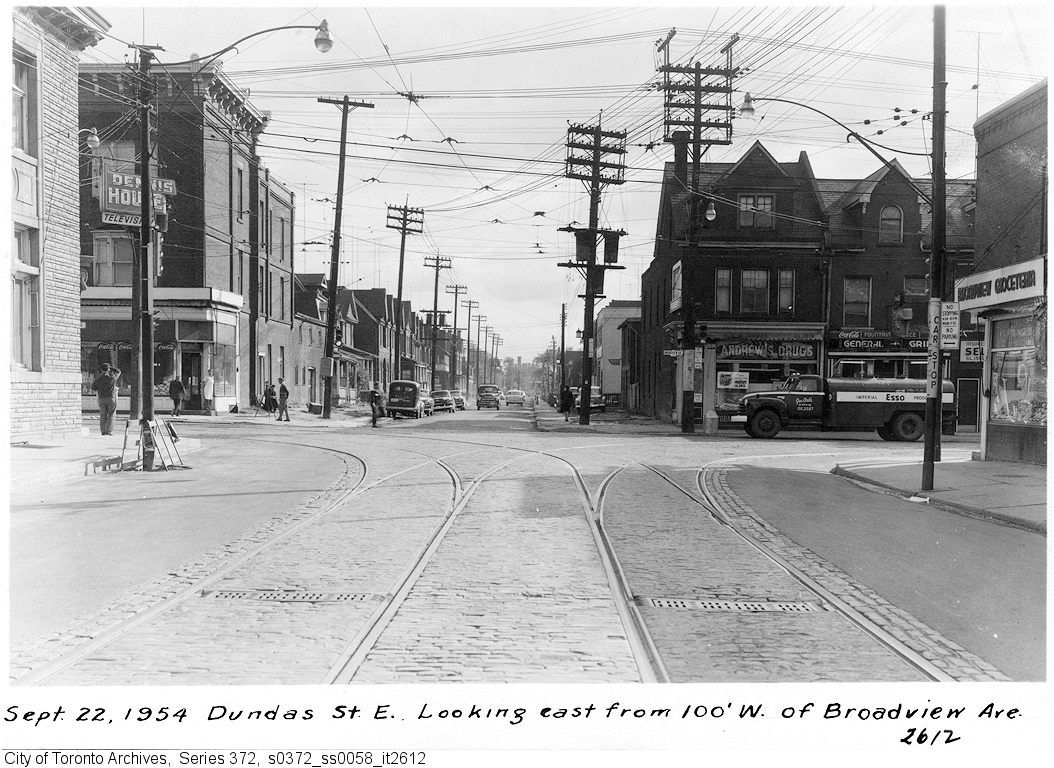
Then. "Sep 22, 1954. Dundas street E looking E from 100' west of Broadview".


s0372_ss0058_it2612.jpg


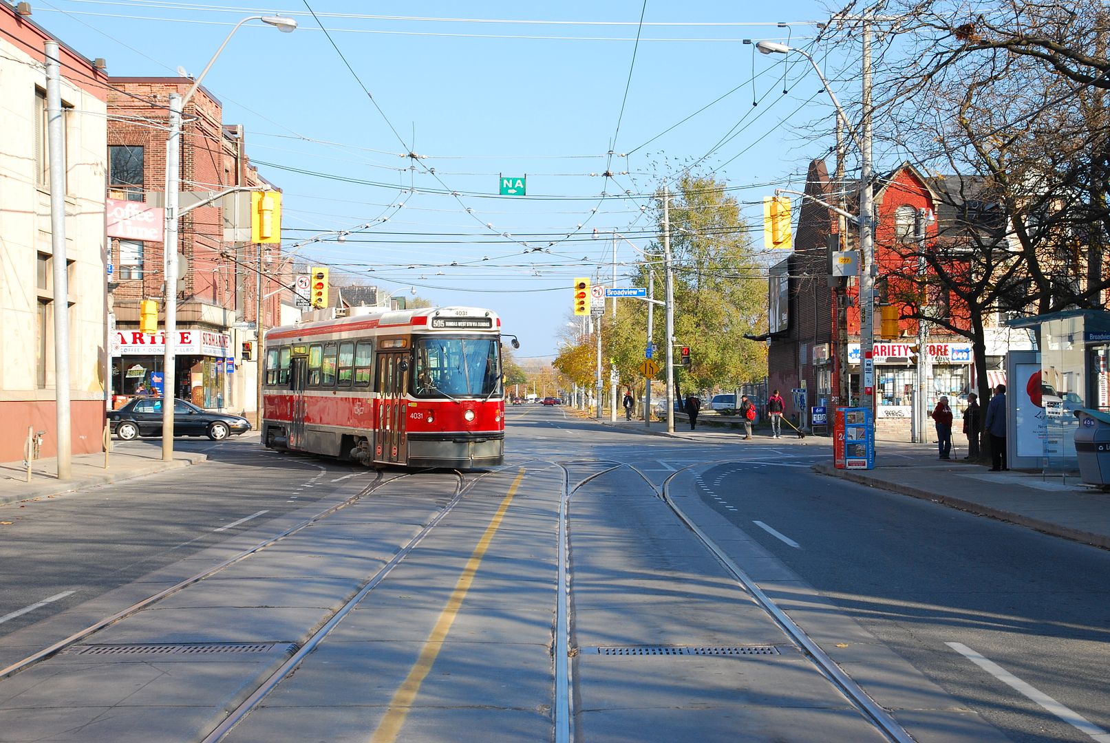
Now. November 2010.


DSC_0064.jpg
 
What's the chronology of the Dundas extension? (i.e. was it UC, or finished, at the time of the earlier picture--by the looks of the road width, it looks like there still may hve been "work to do")
 
What's the chronology of the Dundas extension? (i.e. was it UC, or finished, at the time of the earlier picture--by the looks of the road width, it looks like there still may hve been "work to do")

The ‘1916 Map of greater Toronto and suburbs’ has Wilton Ave extending over the Don as far as Bolton Ave. There are photos at the archives of the backs & fronts of various houses on DeGrassi, Dagmar & Mallon dated 1951/52 that were likely taken in advance of the extension – the date on the railway underpass is 1953.

s0372_ss0100_it0050.jpg


This house was chopped in half - #55 is still there, but #53 is gone:
s0372_ss0033b_it0242.jpg
 
East Toronto Police Station

Three eras of a police structure on Main St., Toronto east end.

Early station & its replacenent (1911).
Currently a Community Centre (2010).
 

Attachments

  • OLD east Toronto police station  1911.jpg
    OLD east Toronto police station 1911.jpg
    91.2 KB · Views: 459
  • east Toronto police station 1911.jpg
    east Toronto police station 1911.jpg
    97.2 KB · Views: 495
  • former police station x.jpg
    former police station x.jpg
    78.9 KB · Views: 440
December 4 addition.


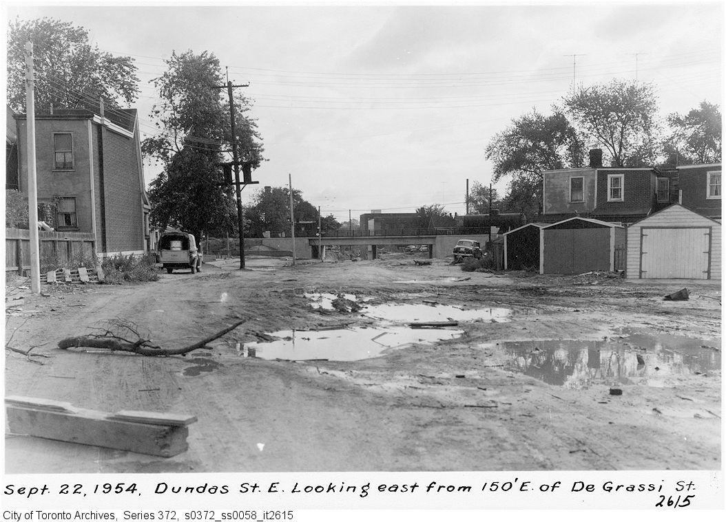
Perhaps something helpful re: Dundas East extension. Actual construction going on here...


Then. "Sep. 22, 1954. Dundas street looking east from 150' east of Degrassi street".


s0372_ss0058_it2615.jpg


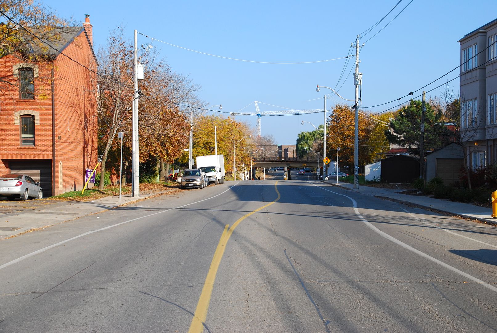
Now. November 2010.


DSC_0065.jpg
 
Well, confirmed my suspicion, to say the least. (All the more so that in that picture from Broadview, Dundas to the E still looked to be of "pre-arterial" scale, which didn't make sense if the extension had already opened. Then again, the Dufferin jog's been eliminated, and yet Dufferin north of the ex-jog still resembles a washboard)
 
and yet Dufferin north of the ex-jog still resembles a washboard)

They'll repave it. I think of the miilions of litres of gas saved each year by eliminating that jog, or perhaps more people will take to their cars - who knows? I wonder if someone will do a study of traffic volumes pre and post?

edit post:

I forgot to add in the carbon footprint of the jog elimination construction. Any engineers here? Can we do a back-of-envelope as to when we get a net benefit?
 
Last edited:

Back
Top