News   Jul 16, 2024
 650     0 
News   Jul 16, 2024
 581     0 
News   Jul 16, 2024
 724     2 

General cycling issues (Is Toronto bike friendly?)

If you compare how things were when we came into the picture, we've achieved enough changes that we have the right to be proud of where we are.

This almost always happens. Millennial's will, eventually, also bear a lot of blame from those that follow.

The newest group isn't aware of the history and how things came to be (very little history is taught to them, and it's hard to related to it when it is). They only see what exists today and the problems of today are clearly evident even if they are less severe than problems of the past. This history thing applies to companies too; staff turn-over and history is lost. Eventually the rules either disappear and the problems return (Clinton and the Glass-Steagall act) or the rule remains unchanged and their inefficiency slows things down (I'd like to put North American fire-truck design in here).

I think most people asking for cycling infrastructure are asking so they have an additional option available. Even the most cycling friendly cities of Europe still have a majority of their street space usable by vehicles. Nobody, on this forum at least, intends to make vehicles illegal (electric perhaps, but not illegal).

As the saying goes, if you only have a hammer then everything looks like a nail. They're asking for screwdrivers to be made available, not for hammers to be eliminated.
 
Last edited:
I did the Peterborough to Uxbridge Rail Trail yesterday. Had to do it fast since GO train to Oshawa was delayed half an hour due to a stalled train ahead with a "hotbox", fortunately they held the Peterborough bus (only runs every two hours) at Oshawa. Travel time on the trail (approx 100 km) about five hours. Didn't want to miss the last bus out of Uxbridge. Peterborough bus an excellent ride. I never knew there was so much swamp and bog between Pete and Ux. Whether it's because it's been so dry or not don't know, but the crushed limestone for most of the distance had separated into the very fine stone on top of the hardened clay underneath, and was quite dangerous in spots. Possible solution is to spray it with a binder. See: http://www.americantrails.org/photoGalleries/cool/3-ADA-Accessible-Trail-Surface.html

Where were the worst spaces for poorly groomed trails? I found it was between Lindsay and Omemee in 2014, and the Uxbridge-Lake Ridge Road section to be the best-groomed area. Was it like that for you?

And yes, dirt bikers are the worst. I don't encounter too many of them, but they wreck up the trails, they're noisy, and they're obnoxious.
 
Glad you read the post Shon, you were my inspiration to do it. I don't mind doing the travelling distance to do trails, but do need to know at least something about them before travelling. I'll post an update on your "revisited" article once I finish digesting the details. I can only recall in general where the worst spots are, but let me say this, the last thirty or so kms towards Uxbridge were in good and consistent shape *save for dirt bike ruts* on occasion, and you can't see them, especially later in the day with the Sun at a lower angle, as they get lost in the shadows on the trail surface.

Omemee was one of the poorer sections, and to the east of there if memory serves me correctly. Certainly there was a change in consistency of surface moving between jurisdictions. One real issue, and I find this on most trails: Lack of signage when entering urban areas and the original trail no longer exists, but detours do. Happened in Lindsay, an otherwise surprisingly pleasant place. Fortunately I had my "Joint Operations Graphic (Air)" maps from 1988 and slightly earlier that show the rail lines intact circa the eighties, and unlike almost all other maps nowadays, it also shows relief in colours (these were for the Air Force to navigate visually by) so I gleaned the general direction that the trail is picked up. Similar in Peterborough, had to ask the very near locals where the trail was after getting off the bus. The worst instance of this for me is in Brantford, rich with trails, but unless you have a detailed map, or dead reckoning (which luckily I had that day first time) I never would have gotten through.

So one can waste a lot of time and valuable 'spark' trying to find the trail, much of which has been strung together from disparate links, so the name can throw you a false lead too unless they've added "Trans-Canada-Trail" to the signs.

Omemee I came off the trail to get something to drink, lovely place, been decades since I last biked through there by road. Peterborough, even though I've been through it a number of times, looked down on its luck, whereas Lindsay was much softer and appears to be thriving, even without GO access.

I was amazed at how differently the topography changes along the trail, one could be blasting along in the middle of a pine forest and suddenly emerge into a lush farmland valley. Overall, the bogs do extend for miles, and it can become droll mile after mile, but I'd do it again!

lol...had to laugh, blasted past this blur of a black and white cat in the middle of the a bog at the side of the trail, "what the hell is a cat doing out....wait a minute, keep going, it's a skunk".

The pressure of the thought of missing the last bus out of Uxbridge (18:40) kept me on almost full tilt the last 30 kms or so. Only the thought of losing control on the loose surface kept me backed off a bit. In the event, I got to the stop in Uxbridge with almost 30 mins to spare. Uxbridge looking very good indeed, albeit the GO driver tells me almost all of them drive into TO. Bus, even at peak, is only a quarter full to meet the trains.

Edit to Readers: Beware most published trail maps. They are guides, not maps. The most detailed ones I've seen can be downloaded from the web, albeit I don't have a printer. Most government trail maps are next to useless to keep you on your route and timetable, not all, but most.

A compass always light, affordable, and easy to use, and invaluable when in doubt. Any tips as to *detailed* maps for trail trails most appreciated.
 
Last edited:
The sidepath: a solution for suburban cycling infrastructure

See link to Spacing Toronto.

img_2302-001.jpg

Sign instructing cyclists to dismount and walk bicycle across road crossing on Derry Road in Mississauga
(Not going to happen.)
 
Big take-away from yesterday's trip, and fortunately, no Montezuma's Revenge today...but much of the local tap water was *skuzzy*, even in Peterborough. Tastes mouldy. Unfortunately there's not many towns to stock up in, but any stops you make, buy *bottled* water! I normally don't advise that, but if it it's potable, the psychology of drinking skanky water means it doesn't satisfy your taste buds, which sounds odd, but necessary when slogging the miles.
.

Peterborough's water comes from the water comes from the Otonabee river. The smaller towns water will either come from the same source (the Kawartha highlands) or from wells. The MOE does tests on all the water so no worries about Montezuma's Revenge in Ontario when drinking in a town.

The taste is probably because the water is a bit warmer at source...or it's a bit harder than Toronto's water.

Remember you are use to Lake Ontario water which flows right by the Love Canal before it ends up in our taps.
 
From the article above:

These shared paths are similar to sidewalks, but are paved with asphalt instead of laid concrete, are wider, easy and inexpensive to install, and don’t take space away from automobiles and trucks.

They're not even made of asphalt in some places. Quite a few regional roads in Markham have concrete multi-use paths with no road markings. They look like nothing more than a wide sidewalk. The worst one I've seen is a new path on Warden between 16th and Elgin Mills. It's made of concrete and has no signage or road markings, nothing whatsoever to tell cyclists, pedestrians, and, crucially, drivers that cyclists are supposed to be there. It's a terrible design but it's officially a multi-use trail. The new buffered bike lanes on Highway 7 are much better.
 
Remember you are use to Lake Ontario water which flows right by the Love Canal before it ends up in our taps.
As someone who lived downstream from a nuclear dump as a child in Port Hope, and drank the local creek water (my case was front page in Globe and Mail, written up in about twenty Cdn journals, including a special in Macleans, I ended up doing research with my Endocrinologist) Love Canal is the least of my worries.

Toronto's water tests at remarkably good results.
[...]Toronto’s finest tastes so much like fresh air — and so little like chlorine or algae — that it won third place in the 2007 Best of the Best Water Taste Test, a blind comparison of tap waters from across North America, hosted by the American Water Works Association (Oklahoma City and a small county in Kansas beat us). This didn’t surprise our mayor at the time, David Miller, who claimed tap water in the 416 was “purer than Perrier,” and made a point of serving it at every council meeting instead of bottled water.[...]
http://news.nationalpost.com/posted-toronto/trumpeting-toronto-award-winning-tap-water

One does get spoiled by it, and having to get used to the taste of anything less can be a challenge.

From "Otonabee Conservation"
[...]While the majority of area residents, including those living in the City of Peterborough and Lakefield, obtain their drinking water supplies from surface water sources, most individual farms and rural homes depend on water obtained from small aquifers such as thin sand and gravel deposits of glacial or other origin. Although these aquifers are individually not very significant, in total they make up a very important groundwater resource. [...]
http://www.otonabee.com/watershed/water-quality/ground-water-quality/

That would account for the taste of Algae, a common problem in areas like that, especially in drought conditions. Some wells will test incredibly pure, others not, I've found the same problem with well water, and often it's not the aquifier, it's the piping, storage and plastic fittings. Next time I'm taking Toronto water, or buying bottled water locally.

Edit to Add: Speaking of Port Hope, and health issues, I got dropped off at Hwy 28 and 401 on Saturday morning, at around 9 am. What is a very enjoyable ride still (and very nostalgic for me for personal reasons) is through Port Hope itself, a lovely town, and then along Lakeshore Rd until Newcastle. There is an extension now into Bowmanville, but it's pretty lame, the very high quality ride is between Port Hope and Newcastle, the latter where you can catch a pretty frequent GO bus to Oshawa and onto the GO train. The route described is all on-road, but one with extremely little traffic, and very historic. It was the original Hwy 2, and goes back to pre-confederation days. Google the names of the villages and hamlets before travelling, especially the "ghost town" of Wesleyville. The route is now a leg of the "Glorious Ganaraska" cycle route.
 
Last edited:
I've seen cyclists on pedestrian area and paths all the time in Japan, and it seemed to work. Maybe because most of them are short distance cyclists (bike within neighbourhood or riding their bikes from their home to the nearest transit station).

There's also a cultural aspect at work there: Japan is very much a place where people know the rules and abide by them. The rule just happens to be that cyclists are expected to use the sidewalk where indicated and to be respectful of pedestrians, pedestrians are cautious and drivers know that carelessness will cost them.
 
Find it interesting that in the Netherlands, for e-bikes, the maximum speed limit is 25 km/h and helmets are not required. However, here in Ontario, the maximum is 32 km/h and helmets are required.

graphic2.jpg

The light mopeds were at one time permitted to use some bike tracks due to their low power and nominal ability to be pedalled (in order to start them). There is also a class of small car-like single-seater vehicles based on scooters that are permitted on shared paths, mostly to allow the elderly and disabled some motorized mobility in the absence of the ability or desire to drive a conventional car.
 
Sometimes we should be glad we live in the GTA, and not in AB.....

http://www.calgarysun.com/2016/07/23/no-point-trying-to-steer-us-away-from-driving

- Paul

The other side of this argument that says 'We kinda have to drive, so there's no real point in encouraging us to do anything different' is that it's often put forward by the kind of people who simply won't consider going somewhere they can't drive to (and preferably park for free when they get there) and then when congestion starts to build up and they start complaining about what a drag it is trying to drive everywhere, they'd still rather sit in traffic than consider alternatives. Their loss.
 
We need a NATIONAL approach to cycling, like in the Netherlands.
The Nederlands, as the commentator states, had a *National Will* for change, or at least did a few decades ago. Some of the smaller European nations have displayed this, it's a product of a national mindset and cohesiveness that is very lacking in a nation like Canada, albeit it was displayed here two decades ago too when electing the Chretien-Martin regimes to tackle the national debt problem. The nation gave them a mandate to do it. That won't happen today.

With the *ME,ME,ME* generation (the term *I* phone is no mistake) that will is gone. Holland today could not do what she did back then, not to begrudge her in the least, the Dutch have a magnificent sense of social responsibility manifest on a national scale, such that the Frisians have never pushed for independence, they don't need to, and they are extremely fortunate that the National Will to change transportation policy happened when it did, as today, change on a national basis is difficult for most any nation to affect. I have extreme respect for the Dutch, but to think that we can copy their highly laudable model and mindset is manic to say the least.

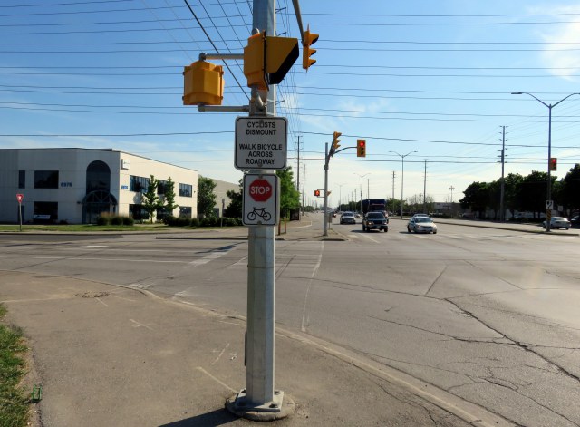
Just stand at a major intersection in Toronto and watch motorists and cyclists alike. I'm sorry to be so cynical, but the Will to Change is absent in most Anglo nations, perhaps NZ being an exception...

It doesn't mean that we shouldn't keep pushing for change, but to think we could ever achieve something like what Holland has is fantasy. Canadians drive more distance per-capita than even Americans, and use more fuel to do it. It's just fortunate, as some posters have pointed out, that Toronto compares favourably to Calgary and Edmonton. Talk about a low bar....we can't even come close to New York, for instance.

On an up note, I'll be forwarding the link to that vid to a number of persons, not just for the cycling aspect, but also the societal one. The Danes did something very similar. It can be done, but not by just anyone.

[...]
The Danish model

From the 1970s to the 1980s, several conflicts arose between bicycle and car interests in Danish cities. One example was the wave of popular protests which followed in the wake of a proposal from the Copenhagen authorities to establish a motorway across the lakes which separate the inner city of olden times from the more recent suburban districts. There was an enormous outcry because, then as now, the lakes were some of the city's loveliest open spaces.

Gradually it became clear to most people that the solution to the problems had to be city planning that gave space to cars, bicycles, pedestrians and public transport. Out of this realisation grew the Danish model with its extended network of cycle lanes along the roads, which continues to be further developed. In the last 10 years, new challenges have emerged. In Denmark, as in other countries, there is a desire to improve public health and combat climate change. In Copenhagen and several other Danish cities it has led to an intensified effort to maintain and strengthen cycling culture.
[...]

http://denmark.dk/en/green-living/bicycle-culture/how-denmark-become-a-cycling-nation

The entire article is much longer and fascinating.
 
Last edited:

Back
Top