News   Dec 20, 2024
 1.1K     5 
News   Dec 20, 2024
 853     2 
News   Dec 20, 2024
 1.7K     0 

Cycling infrastructure (Separated bike lanes)

Honestly I don't miss the lower don trail at all. As a cyclist I find that the temporary replacement path along Bayview has been a huge benefit in every possible way.
  • I dislike this city's "multi-use trail" concept that mixes pedestrians and cyclists together on busy routes, which creates all sorts of conflicts for everyone. At least with the new Bayview cycle-track, I'm no longer encumbered by slow-moving pedestrians since they don't tend to use it
  • It connects directly to the Rosedale valley trail. This is the fastest option for getting to/from Yonge street, but this route was not as useful until now since it's inaccessible from the lower don trail
  • I frequently bike from midtown Yonge to the West Donlands neighbourhood or the Lakeshore East waterfront path. Since last summer, the ability to take Yonge > Rosedale Valley > Bayview has been such a gamechanger for getting there really quick. Once I turn off of Yonge, there's almost no intersections, driveways, vehicle turn movements or pedestrians to worry about. It's like a freeway that bypasses the entire downtown core and all its congestion compared to any of the alternatives.
  • The southern portion of Bayview has convenient connections to Queen St, King St, River St, Front St, and the Mill St/Esplanade cycle track. With the lower don trail, you'd have to go all the way down to the rail underpass at Corktown Commons before you can exit and backtrack onto these streets.

I know that the Bayview path (from River to Mill St) was meant to be temporary until the Lower Don is rebuilt, but I would love it if council decides to make it permanent. Anything that helps take some pressure off the city's recreational trails like the lower Don on those busy summer weekends is a good thing in my view.
 
I know that the Bayview path (from River to Mill St) was meant to be temporary until the Lower Don is rebuilt, but I would love it if council decides to make it permanent. Anything that helps take some pressure off the city's recreational trails like the lower Don on those busy summer weekends is a good thing in my view.
It's not in Scarborough or Etobicoke, so yes, it'll probably stay.
 
It's not in Scarborough or Etobicoke, so yes, it'll probably stay.
I reviewed one of the cycling reports that went before council in December, and looks like there will be an update on this soon.

0477B2CF-E45E-4AA4-A749-B45C0F5B012E.jpeg


The ActiveTO routes that were recently made permanent were implemented in 2020, whereas Yonge and Balview only went in last summer. So these haven’t yet had their final evaluation after 1 year.
 
The UK Highway Code is being changed - I can see a lot more cycling deaths! https://www.thetimes.co.uk/article/...-of-the-road-under-new-highway-code-87khrjklc

Cyclists will be told to ride in the centre of the lane to make themselves more visible to motorists under far-reaching changes to the rules of the road intended to improve safety and “unleash our nation of cyclists”.

The updated Highway Code, which takes effect on Saturday, will also encourage cyclists to ride two abreast and require motorists to leave a minimum of 1.5 metres (nearly 5ft) when overtaking.
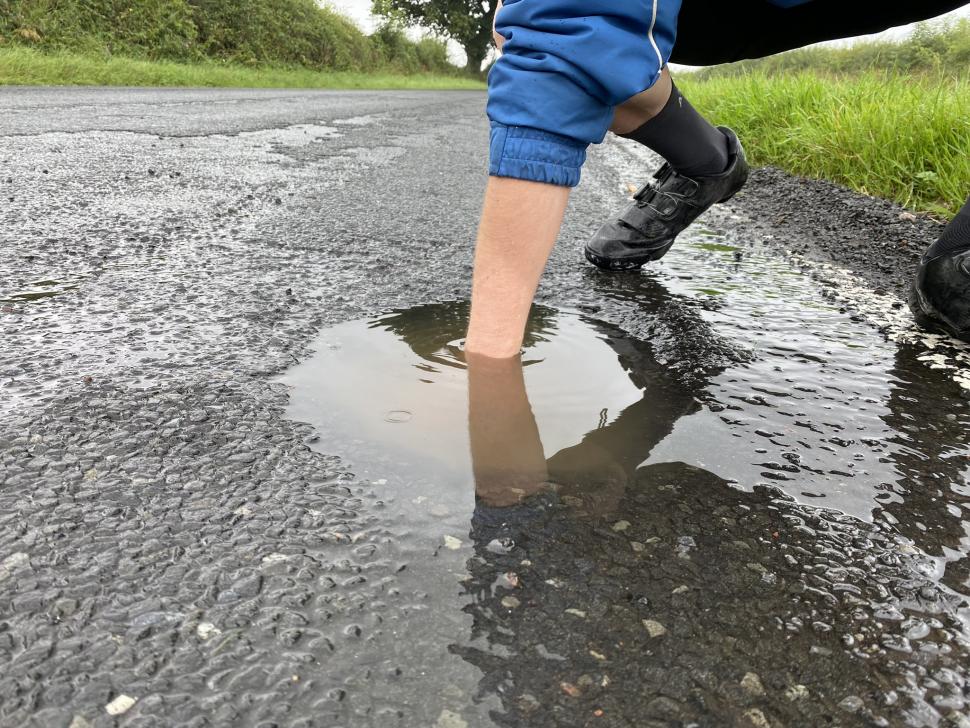
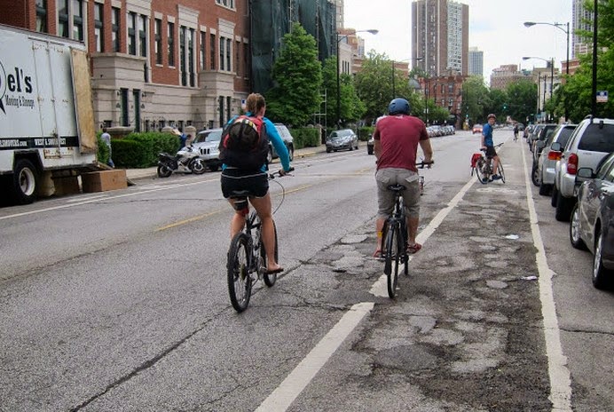
There are more potholes (especially around sewer grates) closer to the curb.

cyclist-pothole-compressor.jpg
From link.
The first thing you learn as a road cyclist is to keep your eyes open for potholes, drains, crumbling shoulders, cracks, or anything that could spell trouble for someone riding on tires less than an inch wide.

Why do cyclists ride in the middle of the road?

Usually, these obstacles and road damage are located close to the gutter, where you also get the greatest build-up of glass and metal debris. Regular road cyclists get very good at spotting the dangers and have learnt to ride out from the shoulder to avoid these common hazards.

It is difficult to see many of these obstacles at driving speeds, but for a cyclist they are all too real.

There are also the deliberate obstacles. These are those pedestrian refuges, traffic islands and all manner of concrete highway furniture that councils fill up the road with. They are all potentially lethal hazards for a cyclist. If a cyclist swerves into the lane suddenly it may just be that they are attempting to avoid running into half a foot of immoveable concrete!

Avoiding obvious road debris, potholes, and man-made obstacles is reason enough, but there is also the general visibility factor.

It is foolish to weave around road obstacles in and out of the flow of traffic – it is far safer to hold a consistent line within the flow and become predictable and visible, not being hidden behind cars. If the cyclists gets dark looks, abuse, or a honk from an impatient driver, it is better than getting an “Oh I didn’t see you there” while they scrape you up of the bitumen.

This behaviour is noticeable when a cyclist is negotiating a roundabout. Timidity here can result in being run off the road on the exit of the turn. A confident cyclist will move out into the lane to prevent being overtaken while completing the maneuver or corner. This is called assertive positioning and is a crucial skill to master on the road.

Cyclists will also assume the primary position to avoid “dooring” by motorists opening their car doors without looking, or when about to turn right.

Cyclists, in law, operate “carriages”, and have done since a court case in 1879. And, as operators of vehicles they have as much right to the whole lane as a motorist. Most of the time cyclists, quite sensibly, allow motorists to pass because that’s the safest and nicest thing to do. But it’s not a legal requirement. There’s no such thing on the road as a “car lane.” The only roads that motorists can call their own are motorways – the clue is in the name.

Riding a bike on city streets can be hazardous and dangerous; there would be few regular cyclists who haven’t had a near miss or know someone who has been hit by a vehicle. Cyclists are terribly vulnerable when put beside a ton of metal travelling at 50kph, and the truth is that no driver was injured when colliding with a person riding a bike.

New laws are appearing which mandate a minimum distance for cars passing cyclists to prevent any further injury and death. Cyclists assert their position on the road not to annoy or for the sake of righteousness, but to simply stay alive.

image.jpg
From link.

e9avbhyweacspdy.jpeg
From link.

blythwood.jpg
From link.

howfarfromkerb04.jpg
From link.

This spring, watch out for more.
 
Wonder how many pedestrians are walking on the streets because of uncleared sidewalks AND breaking the laws of Ontario...

From link.

According to section 179, subsection 1 of the Ontario Highway Traffic Act: “Where sidewalks are not provided on a highway, a pedestrian walking along the highway shall walk on the left side thereof facing oncoming traffic and, when walking along the roadway, shall walk as close to the left edge thereof as possible.”
Signs-for-Walking-on-the-Street.jpg
 
I definitely had to occupy a traffic lane with my stroller a few times this week while trying to walk to daycare. I eventually gave up and took the car, which I don't think is the result the city is trying to drive.
 

Brown University Students Launch ‘Waze for Safe Bike Routes’​

From link.

Pointz.png


A software startup run by two seniors at Brown University aims to help more bike riders find better bike routes with a new navigation app that lets users rate streets along their way.

Last week, Brown University seniors Maggie Bachenberg and Trisha Ballakur launched their app, Pointz, on the Apple and Google Play app stores. They describe it as “Waze for bikes” – it’s a mapping app that offers turn-by-turn directions, but it also invites users to evaluate streets along the way to to inform future route recommendations for others.

When you download Pointz, it looks like a typical mapping app. But when you ask it for directions, Pointz will often suggest routes that follow low-traffic neighborhood streets, instead of more direct routes over busier roadways.

Once the turn-by-turn directions are activated, users have the opportunity to rate the streets along their way on a simple 5-point rating scale, ranging from 😠 to 😍. After the ride, users are invited to provide more detail about their ratings, which influence the app’s future route recommendations.

Eventually, once enough users provide a critical mass of ratings, the Pointz map will show those ratings on the map. Over time, that data could help local planners and advocates pinpoint streets that could benefit from safety improvements, or identify gaps in neighborhood bike routes.
The idea for Pointz app emerged from some the founders’ coursework at Brown.

“I got interested in this space when I did a cross-country bike trip in my gap year, and when I got to college, I decided to do something entrepreneurial to encourage people to try biking,” Maggie Bachenberg told StreetsblogMASS this summer, when Pointz was still in beta-testing mode.

“Our main goal is to make it more enjoyable and safer for your average person to ride in American cities. Originally we wanted to do something that could improve infrastructure, but through the process of customer discovery we came to understand that infrastructure is pretty hard to change,” said Bachenberg. “So we decided to work more with what already exists. Our overall goal is to get more people on the road and help them find safer routes that feel comfortable.”

I hope they take inclines into consideration.
 

Back
Top