News   Nov 29, 2024
 479     0 
News   Nov 29, 2024
 240     0 
News   Nov 29, 2024
 560     1 

Cycling infrastructure (Separated bike lanes)

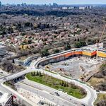
The newest section of the Rouge Valley Trail in Markham is now open in the Milne Dam area, extending the trail by a bit over 1 km. The centrepiece is undoubtedly the cable stayed bridge that crosses the river next to the dam. The trail now goes from 16th east of Warden to 14th Ave near Ninth Line, with a small gap east of Markham Road.


The trail is sadly mostly gravel.


The next phase is under construction and will fill the aforementioned gap.
 
The newest section of the Rouge Valley Trail in Markham is now open in the Milne Dam area, extending the trail by a bit over 1 km. The centrepiece is undoubtedly the cable stayed bridge that crosses the river next to the dam. The trail now goes from 16th east of Warden to 14th Ave near Ninth Line, with a small gap east of Markham Road.


The trail is sadly mostly gravel.


The next phase is under construction and will fill the aforementioned gap.

I'm slightly mixed on this one.

In my Utopian world, Rouge National Park is extended up the main River to Milne...............Milne is removed............the River restored, and trails inside the valley are entirely hiking grade.

Love it as a bike trail.....but but.....
 
I just discovered the rail path. Rode from Cabbagetown to Corktown Common, to Queens Quay, Ontario Place, and over the pedestrian bridge into Parkdale. What a circus that place is, open drug sales and use, junkies sleeping in parks, jeez. I will never again complain about Cabbagetown.

Anyway, rode up the Rail Path to the top, waited for train to pass and then eastward to home.

205131


205132
 
I just discovered the rail path. Rode from Cabbagetown to Corktown Common, to Queens Quay, Ontario Place, and over the pedestrian bridge into Parkdale. What a circus that place is, open drug sales and use, junkies sleeping in parks, jeez. I will never again complain about Cabbagetown.

Anyway, rode up the Rail Path to the top, waited for train to pass and then eastward to home.

View attachment 205131

View attachment 205132
The police on bicycles should be using the railpath. Both day and especially at night, cameras on.
 
When I used to ride the Martin Goodman Trail regularly, I saw police almost every time I was there. 14 Division had quite an active bike police section.
 
Yes, lots of cops on horseback around the Liberty Village / Fort York areas, leaving their poop in bike lanes -- there are always plenty of comments in community groups about it
 
Some of you might take an interest in what it costs to deliver new/enhanced cycling trails and/or cycle tracks (on roads).

The TRCA is putting their high-level costs out for public consumption; so here ya go, from the new Trails Strategy:

(link here) https://pub-trca.escribemeetings.com/filestream.ashx?DocumentId=5050

205826


Worth saying here is that these numbers are very high-level averages and individual projects can vary widely, especially where additional land is being acquired; but also where conditions vary (hills require more erosion-control design elements, while floodplains typically require higher levels of base, and or bridges/viaducts over wet areas. )
 
Yet another example of half assed cycling infrastructure in the GTA. The multi use trail along Leslie has been extended from 16th to Major Mackenzie. On one hand, it's nice to see a trail built separately from the sidewalks, making use of the large grass boulevards that suburban regional roads offer.


The problem, like so many suburban bike paths, is at intersections. The bike path disappears and cyclists are forced to dismount and walk. There's little to no effort made in creating effective and safe intersections for cyclists, so we end up with cyclists facing cars blocking their path and drivers not noticing them. Case in point, the picture below. Right turning cars are especially problematic because drivers are looking the opposite direction. This is lazy and irresponsible design that makes intersections needlessly dangerous. It ensures that novice cyclists will still be too intimidated to use the path and serious cyclists will keep using the road. It's obvious that the people who design these things aren't cyclists.


If the intersections can be designed competently, then there's a lot of potential for this kind of infrastructure all through the inner suburbs of Toronto. There are dozens of arterial roads in Scarborough, North York and Etobicoke with that look just like this and could easily have dedicated cycling infrastructure built.

I live near here and have seen some people use the path, but all the people who bike in groups still bike on the road.

What do you say about the section just south of Major Mackenzie Dr, where the sidewalk and multiuse path merge together? It is a better implementation than south of the Beaver Greenway Trail?

Another thing I would like to point out are the intersections on the older part of the new trail. Specifically at intersections like 16th Ave, West Beaver Creek, West Wilmot, and East Pearce, the MUP narrows to match the original intersection's sidewalk. However, ever since the northern extension, they added yellow lines to mark the middle of the path at these sections, which is terrible because the path becomes 1 foot wide on each side. It is not feasible to ride a bike side-by-side in that narrow width, especially with a retaining wall, new stands, bus shelter, or open traffic right next to you.

There has been talks about intersection improvements at Leslie/Beaver Creek and Leslie/Wilmot, but it doesn't seem like it is that great, as opposed to this response I got in an email:
Good afternoon Leo,

Thank you for your email.

York Region will be undertaking intersection improvements at Leslie Street/Beaver Creek Road and Leslie Street/Wilmot Street in 2019. The proposed improvements include traffic signal upgrades to comply with new accessibility standards, road resurfacing, and installing a 3 metre multi-use path to connect the Lake to Lake Cycling Route and Walking Trail through these two intersections. Once the improvements are completed, the intersections will provide seamless connections to the existing Lake to Lake Cycling Route and Walking Trail on either end. Cyclists will not have to dismount to get across these intersections.

For more information regarding the status of this project, please contact Lindsey Adlam, Communications and Community Engagement Specialist at lindsey.adlam@york.ca or 1-877-464-9675 ext. 75923.

Kind regards,

Christine M. | Customer Relations Coordinator, Customer Strategy & Services
Transportation Strategic Initiatives & Programs, Transportation Services
 

Back
Top