


AlvinofDiaspar
Moderator
RRR:
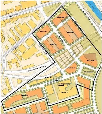
See the Block Plan for WDL:
http://waterfrontoronto.ca/dbdocs//450ef44699525.pdf
(p. 14 of PDF)
AoD
See the Block Plan for WDL:
http://waterfrontoronto.ca/dbdocs//450ef44699525.pdf
(p. 14 of PDF)
AoD
|
|
|
WDL will only realize the full benefits of the Gardiner coming down if the Cherry underpass is also made a lot more people-friendly -- dedicated, separated bike path? Streetcar running all the way to Cherry Beach and/or connecting to Queen's Quay?
New Pedestrian Oriented Streets
Waterfront Toronto, with support from the City of Toronto, has been developing an innovative design for pedestrian streets within the West Don Lands. These pedestrian oriented streets introduce a new street typology for the City which erases the boundary between sidewalk and street to provide a common public space shared by pedestrians, cyclists and low-speed motor
vehicles. The concept is one of integration. Pedestrians, children at play, bicyclists, parked cars, and moving cars all share the same street space.
By redesigning the physical aspects of the street, the social and physical public domain of the pedestrian is reclaimed. This concept has successfully been used in countries including the Netherlands, Germany, England and France. Waterfront Toronto has adopted the Dutch term "Woonerf", meaning ‘living street’, to refer to this new street typology. The first detailed design for the woonerfs in the West Don Lands has recently been submitted to the City.
Yet more evidence for the value of a Downtown Relief Line.
Correct me if I'm wrong, but wouldn't it be a lot cheaper to build a subway to the largely uninhabited West Donlands while everything else is being constructed?
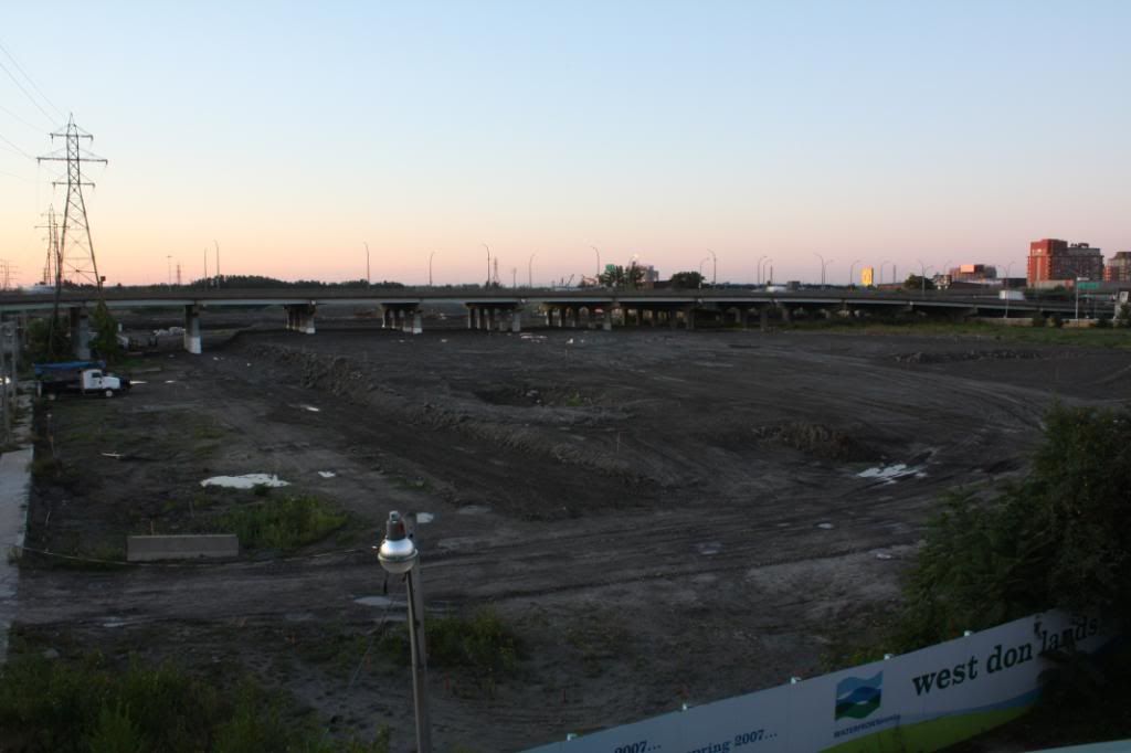
People asked about this at the EA open houses and got lots of mumbling and no real answers, so I fear not. These are not Toronto Hydro pylons; they belong to Hydro One - I think they originally connected to the Hearne station on Unwin and now bring electricity from the Lakeshore up the Don Valley, maybe from the new gas powered station next to the Hearne.will those hdyro wires be buried as part of the development? or will the city be converting them to Toronto-standard crappy old wooden poles?