News   Sep 03, 2024
 612     2 
News   Sep 03, 2024
 911     1 
News   Sep 03, 2024
 1.9K     0 

Virtual Earth Bird's Eye: Toronto & More

waterloowarrior

Senior Member
Member Bio
Joined
Apr 25, 2007
Messages
1,781
Reaction score
114
Location
Ottawa
big Virtual Earth/Live Maps imagery update... there is now bird's eye imagery in the following Canadian cities

* Calgary, Alberta
* Toronto, Ontario
* Montreal, Quebec
* Victoria, BC
* Edmonton, Alberta
* Vancouver, BC

http://maps.live.com/default.aspx?v...29378531&phscl=1&where1=toronto, on&encType=1

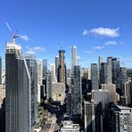
torontobirdseye.jpg


accmls.jpg


Haven't checked out the other cities yet, but the Toronto imagery also has suburban bird's eye pics....

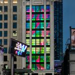
guessthelocation.jpg


http://maps.live.com/default.aspx?v...29378531&phscl=1&where1=toronto, on&encType=1
also, new orthos for Halton/Toronto and Hamilton

from http://blogs.msdn.com/virtualearth/archive/2008/05/01/virtual-earth-imagery-release-april-2008.aspx
 
^The house packing is urban enough, it's the ridiculously over engineered road and lane right-of-ways that make it suburban in character.
 
Cool! I can waste hours just looking at the Windows live maps; it's so much better than Google's useless "Street View" application.
 
I've been using these bird's eye views to spy on Toronto for a while now - google's satellite photos are years old but the bird's eye photos are invariably fresher.

And you can rotate the views (!).

^The house packing is urban enough, it's the ridiculously over engineered road and lane right-of-ways that make it suburban in character.

Actually, the houses are not more packed than, for example, large parts of Markham built in the 80s and 90s along Denison or much of northern Scarborough. From the air, Cornell just seems denser than it really is (as do neighbourhoods like the Annex) solely because of backyard garages. Cornell is pure suburbia, only packaged as urban lite. I'm sure the Denison area has higher transit usage and more pedestrians than Cornell, too.
 
Cool! I can waste hours just looking at the Windows live maps; it's so much better than Google's useless "Street View" application.

Indeed. Until this came out, Google certainly had the upper hand (it still has better coverage). I notice that most of the Toronto area images are from Fall of 2007, which is very recent by most standards. If they update this every year, it would be amazing.
 
Wow, that's awesome. Nice to see how much more recent the imagery is for the overhead views as well. Google's imagery of Hamilton is from when I was in middle school. I'm currently at the end of my grade 11 year. Yeah, it seriously needs an update.

Also, I can't help but notice that neither mapping service is showing the Red Hill Creek Expressway on it's maps yet, even though it's been open for a while now. They should probably get to updating the roads layer.
 

Back
Top