News   Jan 15, 2025
 1.5K     2 
News   Jan 15, 2025
 1K     1 
News   Jan 15, 2025
 542     0 

Transit Fantasy Maps

Thanks for the comments guys, I made that map last summer and I am working on a new one. I will take those comments into consideration and make updates! Hopefully I can submit a bigger map as well. :p
 
I think if you're going to make a "fantasy map" you should fantasize a little more. In particular, if you're going to extend Sheppard west, at least extend it to Vic Park.

I'd probably add the Yonge RHC extension too.

Extending Sheppard east to Vic Park would mean that passengers on the sheppard BRT would have to take a subway for a stop or two to get to Don Mills, the terminal for the DRL. As much of the traffic would be transferring to the DRL, this causes an extra transfer, that would probably not save any trip time for most riders.

I think Sheppard should be extended east eventually, but all the way to STC in one shot. That's another reason I put it down as BRT first, in order to build up ridership without the heavy investment of LRT that would delay the sheppard subway's extension for a very long time.

I agree the Yonge RHC extension would be viable at this point. I was a little Toronto-centric with this map. I imagine BRT/LRT lines could also come in from York region to meet up at Don Mills and/or Malvern, or from Mississauga via Dundas to Kipling and the Airport, or from Durham via Elsemere to STC.
 
I had finished this quite some time ago: it was hiding in the depths of my hard drive, so I had it all polished up and opened a brand new Flickr account:


Eglinton LRT Line by MafaldaBoy, on Flickr

Probably more of a banner-type map for stations or subway cars rather than a full-fledged fantasy map.
What do you think?

It looks nice, howver, even if the line is elevated, or dare I say underground, there would be more stations than shown. If it is at-grade median than there are probably twice as many stations on the Eastern portion.
 
I had finished this quite some time ago: it was hiding in the depths of my hard drive, so I had it all polished up and opened a brand new Flickr account:


Eglinton LRT Line by MafaldaBoy, on Flickr

Probably more of a banner-type map for stations or subway cars rather than a full-fledged fantasy map.
What do you think?

The visual design of that map is incredible! But I think that there needs to be more stations. What software did you use to make it?
 
Well now that I'm looking back at it, I do agree that i have skimped on the stations :p
And for this particular one i used Adobe Photoshop CS5.
 
Well now that I'm looking back at it, I do agree that i have skimped on the stations :p
And for this particular one i used Adobe Photoshop CS5.
Do you mind if I use a few of the design elements from your map in another map (of the entire system) that I'm working on. It won't look the same but there are a few things from your design that I'd like to incorporate in my own. Of course I'll give you credit for your ideas :)
 
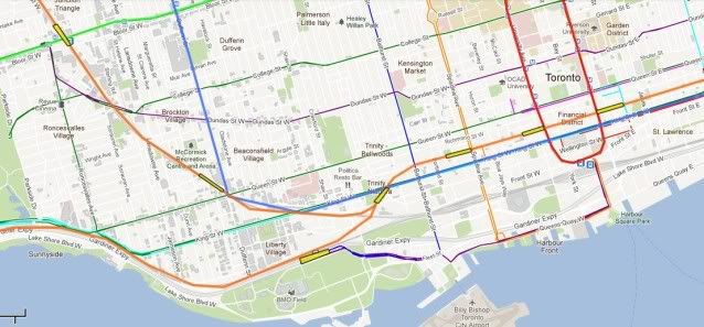
i always wanted to make a drl that started at st clair west went down bathurst across king and up to pape. i figured that the st clair street car users would then be free of the university line. bathurst would be a good street to create a new border for downtown and across king because its shorter then queen.
 
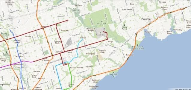
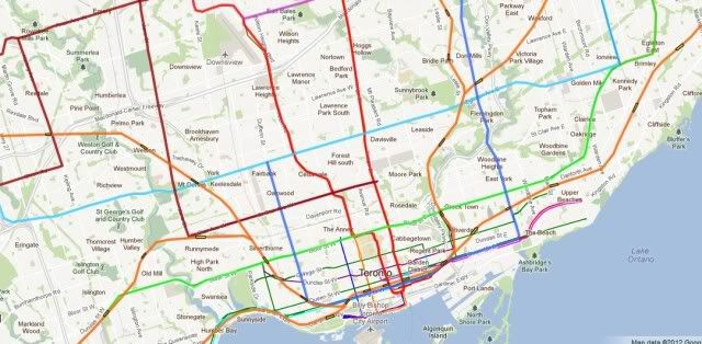
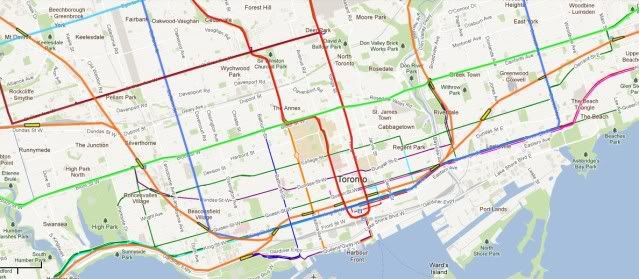
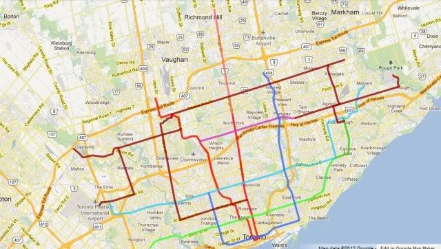
I just thought I'd throw in my plan. It's a mix of Subways and LRT'S.

A quick overview.

torontoa.jpg


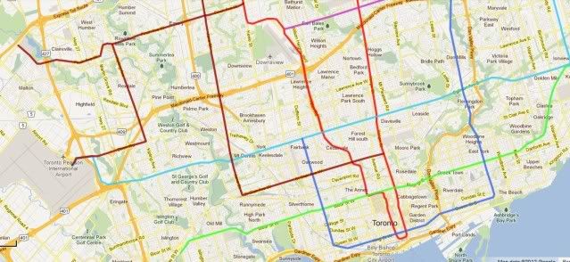
Bloor/Danforth line (green) would be extended eastwards to Scarborough via Eglington, Danforth and Mccowan.

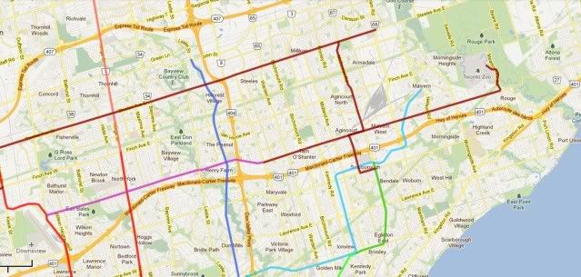
The Eglington line (light blue) would remain an LRT, with a central subway. It would stretch from the Airport to Scarborough and then to Malvern Town Centre via Progress and Mclevin (with some Hydro).

Younge (red and rose) would extend to Richmond Hill.

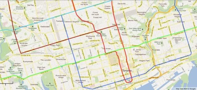
A new downtown line (mid blue) would follow Don Mills from John St to the Parkway and then on to Coxwell, until Queen and then King st once that begins. It then continues West till Dufferin where it Heads North till Eglington again. This line would be nearly all in tunnel south of Eglington, but surface LRT North of there.

torontod.jpg


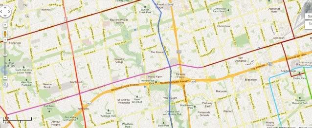
The Northern and western suburbs would be crisscrossed by surface LRT. St Clair would extend west till Jane and then North on Jane. Then through the University and East on Steeles until it hits the Markham Road.

torontoefinch.jpg


torontoc.jpg


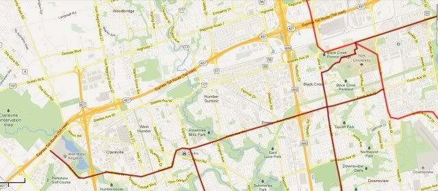
The shepherd would be extended West to Downsview and East to Victoria, after that it would LRT on shepherd till Toronto zoo. There would be a North South link on Mccowan to Scarborough.

torontofshepherd.jpg


In the West there would be an LRT on Finch till Wild Water and a link to the airport via Kipling and Dixon.

torontob.jpg


I imagine we would be looking at 30 billion over a 20 year period. But thats a blink of an eye in transport terms. Will Toronto have added another million by then? What is the price of fuel. Will car ownership fall by 30% because the working classes can no longer afford to run a car. You could have little traffic and crush load on every bus, with every council man demanding a subway or LRT. If peak oil is real no one will care if you rip up a traffic lane to fit in a tram, there will be plenty of space.
 
Last edited:
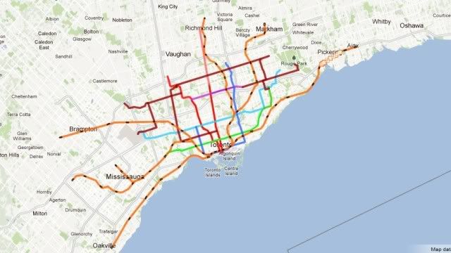
Just thought I'd add the final layer of a proper regional rail service. I've only added the lines and stations that would run through a new downtown tunnel. This imagines a fully electrified network with european EMU's and a large tunnel under inner Toronto. As the system would be fully fare integrated with the TTC, plus much better acceleration, would mean more stations both in the suburbs and the inner city.

This plan involves one tunnel of about 6 miles of tunnel in the centre and 6 underground stations. One option worth considering is a short underground branch up Hurontoronto through MCC with at least three underground stations. This would cover the busiest section of the proposed LRT line.

Overview

toronto-gocrossrailnetwork.jpg


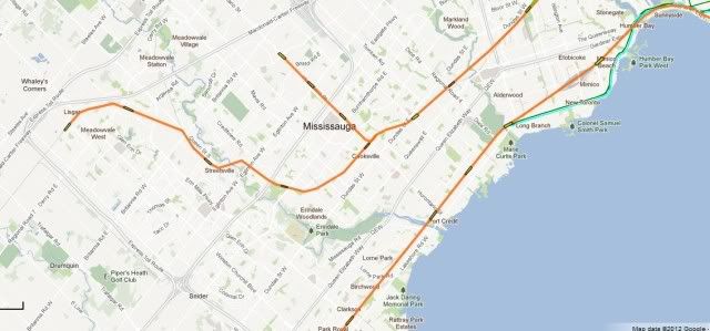
The Southwest. A few extra suburban stations and the MCC branch. Normal GO services would continue further out.

toronto-gocrossrailnetworksouthwest.jpg


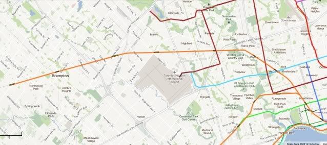
The Northwest

toronto-gocrossrailnetworknorthwest.jpg


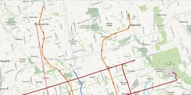
The North

toronto-gocrossrailnetworknorth.jpg


Eastern Lakeshore.

toronto-gocrossrailnetworkeast.jpg


The centre

toronto-gocrossrailnetworkcentral.jpg


Here you can see the common section where routes combine. There are plenty of interfaces with the Subway and LRT network.

toronto-gocrossrailnetworkinner.jpg


Greater detail of the inner stations

toronto-gocrossrailnetworkcentrewest.jpg


toronto-gocrossrailnetworkcentreeast.jpg
 

Back
Top