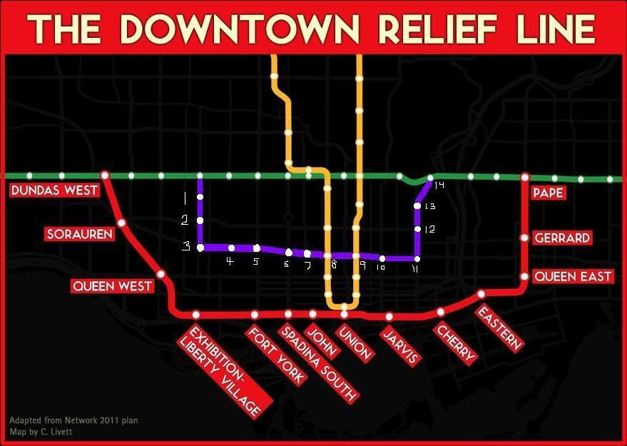
All this talk of the DRL recently inspired me today to create a "mini DRL" fantasy map. Please excuse the embarrassingly crude nature of my drawing. If someone could make a much nicer, professional looking version of it I would greatly appreciate it! I believe such a route, or a similar one, would have merit in the future. I chose Ossington in the west end since Dufferin would be too close to the main DRL, though a Bathurst alignment could work as well. For east-west, Dundas seems to be a logical route that bissects the core nicely and has a number of important nodes.
The stations:
1) HARBORD - Probably excessive. I just thought it would be nice to revive the Harbord streetcar route all the way into U of T from this western terminus station.
2) COLLEGE WEST - Gateway to to bustling Little Italy.
3) BROCKTON - Dense older neighbourhood, Ossington retail strip, CAMH down at Queen. Perhaps future access to Liberty Village in the south?
4) BELLWOODS - A small mid-block station between Ossington and Bathurst. Perhaps redundant.
5) KENSINGTON - Western entry point to Kensington Market, as well as the hospital.
6) CHINATOWN - The epicentre of Chinatown and eastern entry to Kensington Market.
7) BEVERLY - The AGO and Grange park. Perhaps excessive.
8) ST. PATRICK - Transfer to University line. Hospital district.
9) DUNDAS - Transfer to Yonge line. Yonge-Dundas Square. TLS. Eaton Centre. Western access to Ryerson U.
10) JARVIS - Major arterial road undergoing intensification and revitalization. Eastern access to Ryerson.
11) REGENT PARK - Massive residential and commercial redevelopment project. Corktown to the south.
12) CABBAGETOWN - Carlton and Parliament, an established, dense older area.
13) ST. JAMESTOWN - Most densely populated block in Canada.
14) CASTLE FRANK - An underused station that would become a vital link in the network.
