Toronto GO Transit: Davenport Diamond Grade Separation | ?m | ?s | Metrolinx

Considering the relief of the Lake Iroquois shoreline to the north of the tracks, the track geometry and earth moving needed to pull off an underpass is bound to be either straight-up impossible or possible only at outlandish expense.

I have a hard time believing it would be drastically different than the West Toronto Diamond separation which with space for four track went under the CP rail line a short distance west of the site. Also the amount of earth moved out to have the line go under would be similar to the amount of fill brought in to go over.
 
I have a hard time believing it would be drastically different than the West Toronto Diamond separation which with space for four track went under the CP rail line a short distance west of the site.
(With apologies in advance for my atrocious Late Pleistocene glaciological skills ;))

As best as I understand, the Weston sub and the Newmarket sub, despite being pretty close to one another in that neck of the woods, deal with very different topographic conditions as they head outbound because of the precise shape of Lake Iroquois ~12,000 years ago. The second map on this page is particularly useful as it has the railway lines marked (but not named), while this map from the city of Toronto looks prettier, but requires you to imagine in the railway lines at the appropriate places.

Basically, the Weston sub runs northwesterly up the so-called "Toronto passage" and of all the railway lines running out of downtown Toronto (obv. excluding Lakeshore E + W) has the gentlest possible ride up the Iroquois shoreline. With the sole exception of the ancient sandbar that the Harwood neighborhood is built on (which I think the tracks pretty much cut through at-grade), the topography is essentially flat until nearly Weston. As such, all the West Toronto flyunder needed to do is restore the trackage back to roughly the same height it had to begin with, and it had plenty of room to do so in the ~400 m north of the CP tracks.

With the Newmarket sub, you're running perpendicularly into the Iroquois shoreline within 100m of the diamond. Climbing out of a trench while also climbing a hill makes for unhappy locomotives.

Also the amount of earth moved out to have the line go under would be similar to the amount of fill brought in to go over.
Not only am I not a geologist, but I am also not a civil engineer. :) That said, I think in general building up costs much less than digging down... building an above-grade retaining wall and dumping fill comes much cheaper than pile-driving down, pouring concrete, and excavating and trucking out hardpan. The added complications of keeping out groundwater have to be considered, too, especially as the West Toronto project suggests that underpasses in that neck of the woods mean an unfortunate journey below the local water table.
 
January 2010 update

Got an email yesterday from GO/Metrolinx. It seems that not too much has changed since the last update on November 10 2009, except that:

  • GO/Metrolinx have purchased the entire Newmarket/Barrie railway corridor (as reported here on December 15th)
  • The environmental assessment has been pushed back to 2012.

Here's a copy of the email, also posted here.

January 27, 2010

Phone: (416) 869-3600 ext. 5501
Fax: (416) 869-1755
Email: gary.mcneil@gotransit.com

Subject: Environmental Assessment study update
GO Transit Barrie Corridor rail service expansion

Many thanks for your interest in our projects.

Metrolinx recognizes the need to expand its commuter rail service on the Barrie rail corridor. GO recently purchased the southerly section of the rail right-of-way, and now owns the entire corridor from Barrie south. GO also built a new rail-to-rail grade separation north of Steeles Avenue to remove conflicts with East-West freight movements on CN’s York Subdivision.

In early 2009, a Public Information Centre (PIC) for the Davenport Diamond Rail-to-Rail Grade Separation (separating the Barrie Commuter trains from the East-West CPR freight trains on the North Toronto Subdivision) was held at St. Josephat School. At this PIC, the feedback and the interest shown by the public about this project proved just how important sensitive deign solutions are for this community.

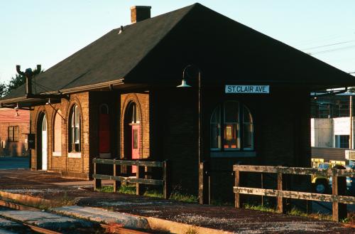
We are taking the community’s comments about this project into consideration. In 2012, we are planning to initiate an Environmental Assessment (EA) that will include a potential design solution for the construction of a rail-to-rail grade separation at the Davenport Diamond, a proposed new station at St. Clair Avenue, and the twinning of the tracks in the corridor to operate some additional GO trains.

Please contact Greg Ashbee if you have any questions or concerns (Tel: 416 869 3600 ext. 5211, or email: greg.ashbee@gotransit.com).

Sincerely,

Gary McNeil
Managing Director, GO Transit
Executive Vice President, Metrolinx

c: Rob Prichard, President & CEO, Metrolinx
Vasie Papadopoulos, Director, Government Relations & Strategic Communications, Metrolinx
Greg Ashbee, Manager, Infrastructure Expansion Planning, Metrolinx
 
Got an email yesterday from GO/Metrolinx. It seems that not too much has changed since the last update on November 10 2009, except that:

  • GO/Metrolinx have purchased the entire Newmarket/Barrie railway corridor (as reported here on December 15th)
  • The environmental assessment has been pushed back to 2012.

Here's a copy of the email, also posted here.

Vic, do you know where the proposed new station at St. Clair West would be located? I'd heard that the block of land on the southwest section of Caledonia/St. Clair West is being rezoned for residential with the idea of putting townhomes in there. On the northwest corner is the cement facility.
Any ideas?

Hi Lilibet,

Not sure where that station is supposed to go. I don't really have any more details on this whole project.

However...if you walk along the tracks at St. Clair, you'll notice there's actually an old train station platform up on the bridge, including a set of stairs up from the street (blocked off). So maybe they would keep something similar? Not sure... Although, if they're planning on twinning the tracks, it may require significant re-jigging of everything.

Photos from March 28, 2009. More here (scroll way down).
Platform:
MD-2009-03-28-112.jpg


Stairs:
MD-2009-03-28-118.jpg
 
StClairStation.jpeg


St. Clair Ave station, in 1982 after it had been abandoned. It eventually fell to arson.
 
Hi Lilibet,

Not sure where that station is supposed to go. I don't really have any more details on this whole project.

However...if you walk along the tracks at St. Clair, you'll notice there's actually an old train station platform up on the bridge, including a set of stairs up from the street (blocked off). So maybe they would keep something similar? Not sure... Although, if they're planning on twinning the tracks, it may require significant re-jigging of everything.

So that's what those stairs are from! Thanks for the info RedRocket. It would be nice to think having a station there might bring some life to that section of St. Clair West. The bridge really does act as a barrier for the west side neighbourhood and from Caledonia westbound until you go under the bridge it's a dead zone. I'm also curious to know what the status is of the proposed residential development on the tract of land I mentioned in my earlier post (the southwest portion of the intersection). Personally I wouldn't buy a property there, but I'm sure there are folks who would, which again could contribute to livening up that section.
Now if only the concrete factory would disappear :p
 

Back
Top