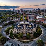
High Park North is bounded on the south by Bloor Street, on the west by Runnymede Road, on the north by Annette Street, Quebec Avenue and Humberside Avenue, and on the east by the CNR/CPR railway tracks. It is located in the Parkdale-High Park provincial and federal ridings. The area east of Keele Street is also known as the "West Bend" neighbourhood informally.
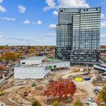
High Park north is mainly residential, containing many semi-detached homes built in the early 20th century. North of High Park, the neighbourhood has several high-rise apartment buildings, built after the construction of the Bloor-Danforth subway. Bloor Street is the main east-west thoroughfare. It is a four-lane road and is commercial in with storefront-type businesses with residential second and third storeys. North-south roads include Keele Street and Dundas Street. Both are primarily residential within the neighbourhood.
High Park North falls entirely within the boundaries of the town of Toronto Junction, which was purchsed from the Keele estate in 1882 by Daniel Clendenan who subdivided the farm and racetrack for a residential district (now called High Park North) to serve the Junction commercial district. As Bloor Street was still an uneven and a mostly undeveloped street, early housing in the area was concentrated to the north and east, where it was easier to access the stores and industry along Dundas Street and High Park Ave in particular was the site of many early homes of the Junction wealthy, as was modern Evelyn Crescent; many of these houses are still standing. High Park North emerged as a neighbourhood once Bloor Street was widened and evened out following World War I, when most of the residential homes which still exist today were built.
In 1915, Bloor Street was the site of a major public works at the north-west corner of High Park. The street, west of High Park Avenue, was crossed by creeks that emptied into Grenadier Pond. The creek banks were steep, making the roadway treacherous and difficult for traffic. A rail trestle was built to cross the gap at a level of 60 feet. The rails were used for rail cars to dump soil around the trestle. The trestle was completely buried and the present Bloor Street roadway built on top. Existing north-south roadways connecting to Bloor Street were raised to meet the new level of Bloor Street and this facilitated the development of the neighbourhood.
In the 1960s, the area directly north of High Park was the site of 'block-busting' development. The residences on High Park Avenue, Quebec Avenue and Gothic Avenue were bought up by developers; razed and large apartment buildings were built. The area from north of the subway line to Glenlake Avenue is now almost entirely high-rise towers. At the time, the City government was very much pro-development, and there were no local ratepayer/community associations as is seen today. By the 1970s, local residents formed associations in harmony with new reform Council members, partly to fight the block-busting north of High Park.
Developers are continuing to operate in the neighbourhood. 'Block-busting' has continued with the current controversial slated development on the north side of Bloor one block east of High Park Avenue, between Pacific and Oakmount, where a block of Edwardian-era homes has been purchased by developers with the exception of one, well publicized 'hold out'; this would be the first block of older homes directly on Bloor Street to be demolished for apartment building.


