News   Jul 15, 2024
 228     0 
News   Jul 15, 2024
 520     0 
News   Jul 15, 2024
 623     1 

Roads: Gardiner Expressway

That $500 million figure is very misleading. Tearing down the Gardiner is NOT ANY CHEAPER than refurbishing it completely right now. The supposed extra cost of the maintain or hybrid options is the higher projected maintenance costs OVER 100 YEARS!

Like with everything you post in this thread, your claims are unsubstantiated bunk that is unsupported by evidence. Recall that in the 1990s the Gardiner east of the Don River was torn down. That segment was in need of expensive repairs, and an EA at the time determined that it would cost $48 million to refurbish vs $34 million to tear it down. What kind of logic thinks that re-decking an elevated highway and rebuilding all it's ramps somehow costs the same as removing the darn thing.

If the 100 year thing bothers you so much, then lets compare the upfront cost instead: $414 M for the hybrid, $342 M for maintain, $326 M for removal. Removal is not only way cheaper anyway, but also brings in more revenue from development. When the cost is extrapolated over time, it should come as no surprise that maintaining a massive concrete elevated structure costs a lot more than a surface roadway, and that is not something to be ignored. The city is sinking well over a billion dollars into fixing this highway, only 5 decades after it was built. Decision-makers in the past could not care less about the future implications of their choices that we now have to deal with, but by all means lets praise them for their short term thinking.


Whether it's 3-5 minutes (city estimate) or 5-10 minutes (U of T estimate) delay, that's a lot of extra cars idling and fuel burning at rush hour. I'd like to see an estimate of the health impacts of that. With so many people now living along the central and western Gardiner, that would be really costly. Thousands of cases more asthma, more heart attacks, more chronic child illnesses. All because we intentionally took out a working highway and made our rush hour traffic worse. Will the proponents of the tear down admit they're doing this?

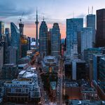
Lets take a look at an air pollution map:

pollution-1.jpg


Notice that the most polluted areas are near highways. Even in downtown, the worst areas are not on gridlocked surface streets like Bloor, Bay or Yonge, but around the Gardiner. For all your sensationalist talk about thousands of [insert disease here], you ignore the fact that other cities have seen air quality improve after removing their downtown highways. You also choose to ignore the many pedestrian fatalities that happened around the gardiner thanks to it's dangerous road design and poor sight lines on Lakeshore. Here are three of the top 10 most dangerous intersections in this city: #1 - Lake Shore & Lower Jarvis, #2 - Lake Shore & Don Roadway, #10 - Lake Shore & Spadina Ave.​ Surprise Surprise, a lot of pedestrians get killed at this kind of intersection...

Screen shot 2015-05-08 at 4.14.47 AM.png


...compared to something like this:
Screen shot 2015-05-08 at 4.14.57 AM.png


As for the "tearing it down will cause traffic congestion" argument that we hear all the time, reality says otherwise. Toronto's top 10 most congested intersections:
1. Bayview Ave. at Sheppard Ave. E.
2. Yonge St., Highway 401 to Sheppard Ave.
3. York St., Front St. to Gardiner Expressway
4. Sheppard Ave. W. at Allen Rd.
5. Leslie St., Highway 401 to Sheppard Ave. E.
6. Lake Shore Blvd., York St. to Bathurst St.
7. Kennedy Rd., Highway 401 to Sheppard Ave. E.
8. Markham Rd., Highway 401 to Sheppard Ave. E.
9. Dufferin St. at Finch Ave. W.
10. Black Creek Dr. at Lawrence Ave. W.

Interestingly, 9 out of 10 of these intersections are a highway interchange. Car people think that highways are good for traffic, when all it does is dump huge volume of cars onto surface streets. Just try getting onto the Gardiner at Spadina, or onto Allen Rd at Lawrence. A boulevard would disperse traffic onto many different streets instead of concentrating it all on Yonge, Sherbourne and Cherry St. Maybe you should visit Manhattan and check out what they did with the former West Side highway. I've experienced it both by car and by bike, and can confirm that the sky did not fall because they demolished a highway. The same was true in every other city, but somehow Toronto is different. I await the excuses.

14422115843_d4837e68d2_b.jpg


14215510157_a02a5e359a_b.jpg
 

Attachments

  • pollution-1.jpg
    pollution-1.jpg
    62.5 KB · Views: 950
  • Screen shot 2015-05-08 at 4.14.47 AM.png
    Screen shot 2015-05-08 at 4.14.47 AM.png
    560.9 KB · Views: 717
  • Screen shot 2015-05-08 at 4.14.57 AM.png
    Screen shot 2015-05-08 at 4.14.57 AM.png
    589.7 KB · Views: 673
Last edited:
In the past, we actually used to plan for future traffic demand (ie: the Bloor Viaduct, Highway 401, Original Yonge Subway with longer platforms than originally needed). It seems as though today we have the opposite thought process, and that's the same thought process that would screw this city up.

What a bunch of hooey. The gardiner study assumes a full buildout of the portlands, a spike in downtown population and employment, a reconfigured mouth of the Don River, and that some transit has finally been built. It doesn't get more future oriented than that. Judging by the comments coming from most Gardiner supporters, they prefer to ignore the reports and rely on their own logic instead.
 
Last edited:
Whether it's 3-5 minutes (city estimate) or 5-10 minutes (U of T estimate) delay, that's a lot of extra cars idling and fuel burning at rush hour. I'd like to see an estimate of the health impacts of that. With so many people now living along the central and western Gardiner, that would be really costly. Thousands of cases more asthma, more heart attacks, more chronic child illnesses. All because we intentionally took out a working highway and made our rush hour traffic worse. Will the proponents of the tear down admit they're doing this?

LOLOL!

Reductio ad absurdum on that one is kill all roadways. I'm not advocating that.
 
Like with everything you post in this thread, your claims are unsubstantiated bunk that is unsupported by evidence. Recall that in the 1990s the Gardiner east of the Don River was torn down. That segment was in need of expensive repairs, and an EA at the time determined that it would cost $48 million to refurbish vs $34 million to tear it down. What kind of logic thinks that re-decking an elevated highway and rebuilding all it's ramps somehow costs the same as removing the darn thing.

If the 100 year thing bothers you so much, then lets compare the upfront cost instead: $414 M for the hybrid, $342 M for maintain, $326 M for removal. Removal is not only way cheaper anyway, but also brings in more revenue from development. When the cost is extrapolated over time, it should come as no surprise that maintaining a massive concrete elevated structure costs a lot more than a surface roadway, and that is not something to be ignored. The city is sinking well over a billion dollars into fixing this highway, only 5 decades after it was built. Decision-makers in the past could not care less about the future implications of their choices that we now have to deal with, but by all means lets praise them for their short term thinking.

If the decision was framed honestly (ie a $72M adder plus some unspecified additional maintenance costs 50+ years in the future), I think you would find many more people in favor of maintaining/improving rather than tear down. The $500M difference number is just a boogeyman.
 
I thought the hybrid option was deemed safer than remove?

And re: the pollution. We should keep in mind that not all locations are around highways; and oftentimes industry or transport operations locates near highways - so it can be a bit of a chicken/egg scenario. As well, removing a small section of the expressway system doesn’t mean auto and truck traffic will be removed with it. Diesel trucks will still use the road system, perhaps even contributing to more localized pollution (seeing that they’ll continually be stopping and re-accelerating on Lake Shore, or chugging slowly through the core). *Somewhat related, but I wonder how much Union and the rail corridor contributes to the pocket of pollution in the SE area of downtown?

Re: the busiest intersections. I’m counting more than 1/10 that aren’t at highway on/offramps. And if the problem is highways dumping cars onto surface streets, then obviously the remove plan won’t help in that department. Considering we’re removing a linking grade-separated alternative to surface streets, both the DVP and Gardiner will create greater and more specific localized dumping of cars onto our streets.

As for future transit being in place...that’s not guaranteed. The City is only focused on Phase 1 DRL – and there’s no guarantee that will happen or what its alignment will be. And we still don’t know what Metrolinx’s plan for "relief" is. They’ve said it can involve buses...which would have to use our highways. I think there are too many unknowns with the Relief line and SmartTrack for them to be factored in reliably.
 
When you remove an expressway in a part of the city with a grid of streets, drivers end up taking the arterial roads closest to their destination like Lake Shore, Front, Richmond, Queen, Dundas or some combination of streets. So it isn't the case that the cars on the Gardiner will end up stuck in traffic on the Lake Shore boulevard. People take the Gardiner because they perceive it to be faster even if they have to drive 3 kilometres north to their destination--the span of 3-5 major east-west streets.

The boulevard option is the most reasonable and the best option for the future of the city. If we never had built the Gardiner, we wouldn't build it today as a means of addressing congestion.
 
Last edited:
I thought I say to keep the Gardiner viaduct, or bury it.

I am now slowly leaning towards the "REMOVE" option -- but only after the current 10-year GO RER rollout plan is finished.

The mere eight Lakeshore West GOtrains during one hour (4:45-5:45) carries more people than 1 hour of half the width of the 16-lane 401. (I'm obviously referring to capacity, not displacement of people). Freeways do ~1500-2200 cars per hour per lane, mostly 1 person -- versus GOtrain capacity of 2000-4000, most of which typically becomes full with at least some standees. This averages out to approximately 20,000 people moved with just a mere 8 GOtrains -- similar to one hour of traffic in one direction of the widest part of 401 for in one hour at peak period.

A single 12-car GOtrain at peak = moves more people than 1 hour of freeway lane...

If the train has crush capacity (4000), one single train can actually move more people than Gardiner at peak combined (especially with a lane shut down), but I'm being conservative by even excluding standees!

Although not all of these commuters would have been taking Gardiner, that means a mere 8 Lakeshore West trains carries about 3x the traffic of one-hour of three-lanes-open Gardiner, or 2x the traffic of one-hour of two-lanes-open Gardiner. If we move 40% more peak period traffic as GO RER plans to, with the first phase of RER upgrade, that's more than one extra hour of peak-period Gardiner traffic removed. Granted, special RER trainsets that are needed for some routes will move less people per train, but should be compensated by additional frequency, and the bilevels will also continue to be used, but be electric-locomotive driven (electric-pulled 12-cars at least on the Lakeshore RER routes).

Not many trucks use the Gardiner at all during peak period; they use it during offpeak. Lakeshore Boulevard (east of Yonge) will be very efficient during the wee overnight hours that trucks love to drive during, so stop-and-go isn't measurably increased by trucks from the demolition of Gardiner.

Although not all people taking GO would have taken the freeway, it's important to realize how much car traffic a single train at peak (even a single level) manages to remove from the roads, even if it's only 5-10% of the people who decided to take GO instead of car. That argument is in itself, enough to convince me about the pros of Gardiner demolition, if it's well done. Even using diesel GOtrains, that also saves far more than enough pollution to compensate for the increased idling of 3-5-10-minute longer drive times for those who kept using the car. That's even before I mention GO RER is electric.
Now the argument of more pollution caused by demolition of Gardiner, comes falling down in spetacular flames.
emoticons_flame.png
emoticons_flame.png
emoticons_flame.png
 

Attachments

  • emoticons_flame.png
    emoticons_flame.png
    1.2 KB · Views: 526
Last edited:
I thought the hybrid option was deemed safer than remove?

It's not safer. At the public meeting it was said that the hybrid option does little to improve intersections for pedestrians, that the elevated structure will continue to impact sight-lines on Lakeshore, and that the Gardiner's sub-standard shoulder configuration will remain. In my previous post I said that Jarvis & Lakeshore is ranked as the most dangerous intersection in this city, with 239 collisions over a 5 year period. Take a look at that slide I posted and tell me that's not a dangerous pedestrian experience. Under the hybrid option, the road configuration you see there is exactly the same as today with zero improvements made. This hybrid is nothing more than a glorified no-nothing option except that a ramp gets torn down for the benefit of a developer, and replaced with a new one at Cherry St where a new neighbourhood is supposed to go.


And re: the pollution. We should keep in mind that not all locations are around highways; and oftentimes industry or transport operations locates near highways - so it can be a bit of a chicken/egg scenario. As well, removing a small section of the expressway system doesn’t mean auto and truck traffic will be removed with it. Diesel trucks will still use the road system, perhaps even contributing to more localized pollution (seeing that they’ll continually be stopping and re-accelerating on Lake Shore, or chugging slowly through the core). *Somewhat related, but I wonder how much Union and the rail corridor contributes to the pocket of pollution in the SE area of downtown?

Fair enough. Some of the pollution around the gardiner is from the industrial areas, but someone literally said that thousand of people will die/become ill just because a couple of stoplights are added. You also have to wonder whether downtown is really the right place to be maintaining industrial uses over the long term. Road capacity is an issue here. Industry is far more suited in the 905 where it is away from residential areas and where there's greater highway capacity and arterial roads compared to a small 6 lane freeway that is the DVP/Gardiner. Those factories have been moving out of the city for decades now but have been replaced by office development. Southcore used to be all industrial but times have changed and will continue to do so. Today it's the East Bayfront and West Don Lands that are redeveloping. Tomorrow it will be the portlands.


Re: the busiest intersections. I’m counting more than 1/10 that aren’t at highway on/offramps. And if the problem is highways dumping cars onto surface streets, then obviously the remove plan won’t help in that department. Considering we’re removing a linking grade-separated alternative to surface streets, both the DVP and Gardiner will create greater and more specific localized dumping of cars onto our streets.

My point is that a boulevard would allow traffic to disperse onto many different streets (thank you Junctionist for trying to explain this). I count at least 20 intersections here, as opposed to just three roads for cars to get dumped on (Yonge, Sherbourne, Cherry). Note that most of these intersections are not gonna have stoplights to slow down traffic.

Screen shot 2015-05-08 at 2.45.35 PM.png


Also keep in mind that current traffic data shows that only 22% of traffic on the east gardiner is through traffic (i.e not getting off at downtown). The other 78% are exiting onto Lakeshore anyway. So when people speak of the importance of maintaining a freeway connection, it's really only that 22% who fully benefit from it. I can understand the objections to removing a highway, but I just don't think it's worth keeping it considering the cost, the impact it has on the waterfront, and the lower volume of cars compared to the rest of the Gardiner.


As for future transit being in place...that’s not guaranteed. The City is only focused on Phase 1 DRL – and there’s no guarantee that will happen or what its alignment will be. And we still don’t know what Metrolinx’s plan for "relief" is. They’ve said it can involve buses...which would have to use our highways. I think there are too many unknowns with the Relief line and SmartTrack for them to be factored in reliably.

If the DRL is not built, you should be far more worried about this city's future than a removal of this underused highway. I would be packing my bags and leaving this city, the rest of you can enjoy the gridlocked hell and daily subway meltdowns.
 

Attachments

  • Screen shot 2015-05-08 at 2.45.35 PM.png
    Screen shot 2015-05-08 at 2.45.35 PM.png
    631.4 KB · Views: 742
Last edited:
Agreed that this is fairly underused section of Gardiner during offpeak, and even during peak. I drove this section quite often when I had to commute from Riverdale to Waterloo. If demolition is only east of downtown.

Even with just two lanes open, I often was able to drive at full speed or near full speed during both morning and evening peak period during this section (at least during times the Gardiner west of downtown had 3 open lanes, so the congestion did not often back up all the way east of Yonge street). Drives were usually full speed limit (or at least north of 80kph) with one lane shut down in this section. If we demolish any Gardiner all, this is the section that will feel the least pain, and the biggest long-term benefits

Heavier truck traffic occurs in this section only during the nighttime (as any night driver attest too -- many freeways become truckways at night) but you can just run lakeshore with a generous green light during the wee morning hours, reduce pollution during "truck rush hour". I see very few trucks drive this section during peak period, the time that trucks would most pollute by being diverted. With GO RER and electricifation probably finished on some GO lines, by the time this section begins to be demolished, we should have cleaner air downtown anyway from at least half of the diesel locomotives being retired, and replaced with electric locomotives that runs the existing coaches and new cabs.
 
Last edited:
What a bunch of hooey. The gardiner study assumes a full buildout of the portlands, a spike in downtown population and employment, a reconfigured mouth of the Don River, and that some transit has finally been built. It doesn't get more future oriented than that. Judging by the comments coming from most Gardiner supporters, they prefer to ignore the reports and rely on their own logic instead.
Hmm well let's see. The thing is, the portlands will be developed in the next 20-30 years, the population downtown is continuing to grow at a rapid pace and it''s not as if this trend will reverse itself, and we all know that the only transit we get built in this city is about ~7-10km of LRT/Subway every 10-15 years (hopefully GO RER reverses this trend).

You're missing the point i'm making. The projects I listed was meant to illustrate that Toronto had a history of planning for *future* demand. If nobody thought that there would be demand for a subway line on Bloor in the future, the Bloor Viaduct would not have been built the way it was and there would have been astronomical costs to get the subway over the Don River. If nobody thought there would be increased demand on the Yonge line when it was originally built, platforms would have only been built for 4-car Gloucester cars and the subway as we know it would be a disaster. When studies are conducted, they are supposed to take into account future demand, population increases, alternative transit options, etc.. If not then what kind of "study" are you conducting?

I get what you're saying, but I don't understand what are your objections to this study. It DID account for future development "in the next 20-30 years". As I said, they assumed a huge increase in downtown population and employment, plus a fully developed waterfront and portlands. There's so much assumed development that some of it may not happen in our lifetimes, but all Gardiner alternatives were modelled under that worst case future scenario and the conclusion was all alternatives will involve longer travel times than today, but removal would add an extra 2-3 minutes more than the hybrid. Furthermore, the study assumes that a number of transit improvements are in place by the time full buildout occurs, and those transit projects are needed no matter what happens to the highway. The hybrid option will not negate the need for a DRL, and if the East Bayfront LRT isn't built then don't expect as much development in the Portlands either.

You should also keep in mind that planning for the distant future is risky and brings a lot of uncertainty. For every successful example that exists, I can think of many more instances where things didn't quite pan out as expected.

  1. You cite the Bloor Viaduct as an example of planning for the future, but don't forget they also built another bridge over Rosedale Valley that never ended up being used because the curves were too sharp for a subway. The high additional cost of building all that extra infrastructure was controversial at the time, but ultimately only half of it was actually used.

  2. In your previous post you cite Hwy 401 as another example of planning for the future. Maybe you know something I don't, because the highway was originally built with just 4 lanes and was initially known as the "Toronto Bypass". As the name implies, the highway bypassed Toronto where it was once surrounded by farmland. Today the highway is 18 lanes wide and now passes through the heart of the GTA. Later the 407 was built to literally bypass the Toronto bypass in response to traffic congestion on the 401, only to be privatized and perform well under capacity even in rush hour.

  3. The east part of the Gardiner used to go all the way to Leslie St and was built extra wide in anticipation of the Scarborough expressway that was never built. Since then, that part of the Gardiner has been partially demolished, and the rest of it will see a reduction in lanes with the hybrid option or demolished entirely. Note that Highway 2A in Scarborough was also supposed to be part of the planned expressway, but is now a stub to nowhere just like Allen Road.

  4. A complicated interchange exists at Eglinton/427 because of the planned Richview expressway that was also never built, and the Richview lands that were earmarked for the expressway are now being sold off for development. If planners could have foresaw how little of the planned freeway system would actually be built, the Gardner and DVP would have been built with more lanes than what we have today.

  5. The Sheppard subway was justified at the time because planners expected employment in North York and Scarborough Centre to quadruple by 2011. In reality the lions share of employment growth went to the 905 while those 416 centres saw little or no increase in employment in 30 years, and thus the subway today gets far lower ridership than what was once promised. Check out this short PDF, it's truly breathtaking how wrong they were on that one. They even built provisions to easily expand the platforms for six-car trains just by knocking down a wall, and have included an unfinished third platform at Sheppard-Yonge, but it is highly unlikely that future ridership will ever require any of that. Nevertheless, our politicians have not learned their lesson, and are hell-bent on re-attempting the exact same thinking with the subway to Vaughan and the Scarborough subway.

  6. A lower Queen station was roughed in under Queen subway station to accommodate a planned underground streetcar line along Queen St, similar to the Bay St tunnel south of Union. That line was never built. If or when the DRL is built, it will be a subway not a streetcar, and will probably go somewhere south of Queen St.


To conclude, you're right that Toronto has a history of planning for future demand. Only problem is that in many cases it has resulted in billions in sunk costs for overbuilt infrastructure that was designed to accommodate demand that never materialized.
 
Last edited:
I thought I say to keep the Gardiner viaduct, or bury it.

I am now slowly leaning towards the "REMOVE" option -- but only after the current 10-year GO RER rollout plan is finished.

In principal this makes some sense.....but does it not raise the question about how much you spend on it over the next ten years? Logic would say "nothing, it's coming down anyway"....but safety logic would say "probably quite a bit as people are using it for at least the next ten years".
 
To conclude, you're right that Toronto has a history of planning for future demand. Only problem is that in many cases it has resulted in billions in sunk costs for overbuilt infrastructure that was designed to accommodate demand that never materialized.
All of the points that you made above are excellent points and I agree with the majority of them. Mind you that with projects 3 and 5 that you listed, they weren't built in their fully recommended forms. You can plan for the future all you want, but if you half-a** the construction you will get underutilized results. That's what happened with the portion of the Gardiner that was already torn down, and the Sheppard subway.

But to be fair I never said that I object to the study in any way. The only part I "object" per se is tearing that section of the Gardiner down and replacing it with a University Ave. style road. We know that commute times will be longer with that section torn down, and if that's the case today it will definitely be worse in the future (even if transit in the area is fully built out as you acknowledged).

Planning for the future is certainly risky, but if done right you can also save billions of dollars in the future as well. There are pros and cons with doing so, but it is certainly a better option compared to being shortsighted about things (ie: SRT).
 

Back
Top