News   Jul 19, 2024
 849     0 
News   Jul 19, 2024
 3.7K     7 
News   Jul 19, 2024
 1.2K     3 

Planned Sprawl in the GTA

The challenge is introducing these ideas we know work into areas built when cars were the priority. Cornell, for example, is a very walkable neighbourhood. The problem is that there is nowhere to walk to because:
a) It's a greenfield development on the edge of nowhere
b) Internal destinations (like a coffee shop, bank, grocer etc.) are hard to develop in an economy/transpo system that likes to concentrate retail on main streets. Not "Main Streets," like in Unionville or even on Queen East, but main streets people DRIVE on.

Green-field and auto-centric planning with main streets not conducive to walking...

Yonge/401
Yonge-401.jpg


McCowan/401
STC.jpg


Bayview/401
401-Bayview.jpg


Jane/407
Jane-407.jpg


And soon Yonge/407
LangstaffS_19May10_(1).jpg


Richmond-Hill-RC-18-assembled_slide.jpg


Obviously I chose these areas because they have direct subway access (or soon will). And for the sake of argument, I included the SRT as a subway (which I believe it to be on par with). Point is, even in a suburban/semi-urban context - with the highest echelon of non-auto transport infrastructure in place - these issues you and Salsa mention seemingly still arise. Car is still king, and retail conforms to this.

so, I think it's fair to say that mid-century planners (the ones Jane Jacobs hated) couldn't figure it out because they saw all the goods things about cars and one of the bad ones. I don't think it's fair to say planners today can't figure it out. It's that it's hard to implement.

You’re right that it’s hard to implement. That’s why it doesn’t often get implemented. Even with nearby subway stations, personal autos are first when it comes to planning a transportation network in a suburban context. And while auto as a mode share is less in this higher density 0.05% of a region's area, the other 99.5% is virtually all auto-centric with non-TOD development.

But basically I wanted to see what others' opinions are of these developments. Are they successful walkable neighbourhoods that we should be replicating? Or do they somewhat conflict with Jane Jacobs' theories (even with a subway in place)?
 

Attachments

  • Yonge-401.jpg
    Yonge-401.jpg
    160.2 KB · Views: 1,161
  • STC.jpg
    STC.jpg
    123 KB · Views: 864
  • 401-Bayview.jpg
    401-Bayview.jpg
    150 KB · Views: 809
  • Jane-407.jpg
    Jane-407.jpg
    123.5 KB · Views: 811
  • LangstaffS_19May10_(1).jpg
    LangstaffS_19May10_(1).jpg
    107.5 KB · Views: 1,071
  • Richmond-Hill-RC-18-assembled_slide.jpg
    Richmond-Hill-RC-18-assembled_slide.jpg
    429.6 KB · Views: 1,296
The one common theme of those 5 examples above, however, is that they're located adjacent to a major highway. That, in itself, relegates that neighborhood pocket as car-centric. It's certainly a challenge to create a walkable neighborhood isolated from nearby neighborhoods but until all these multiple walkable neighborhood nodes grow and expand to such a degree that they eventually intersect each other (as it has downtown), these isolated walkable neighborhoods will simply exist in its own sphere, segregated from the whole.
 
jane jacobs isn't a god to be revered and The Life and Death of Great American Cities is not a book to treat as a holy bible.

Now, we have seen plenty of images of "bad" suburban development, some of which are misleading (cutting off the southern edge of NYCC that borders the highway offramp, really?), lets take a look at some actually good suburban developments:

Markham:
Qc4mWCB.jpg


Burlington:
g30x20m.jpg


Residential street in Cathedraltown, Markham:
cboaNja.jpg


Retail in Cornell, Markham:
tV7W8IV.jpg


Residential street in Cornell, Markham:
7VJ61BD.jpg


Arterial street in Cornell, Markham. Note the houses facing the street and the multiuse pathways that allow cycling lining the street on both sides:
LOF89Ih.jpg


Retail in Cornell, Markham:
QUDTBik.jpg


Retail street in Downtown Markham. Note that Highway 7 the arterial that the photo is taken from, is going to be widened this summer which means that these buildings will lose the wide grass median they currently have between them and the road.
ba8C8fI.jpg


Downtown Mississauga:
RYZaewQ.jpg


Mt. Pleasant, Brampton. This is probably the best town square in all of the city, I really suggest you go look at it in streetview. Retail lines a large public square with a pond / skating rink, there is a commuter rail station, and a community centre as well.
PP2jKLU.jpg


NYCC:
Z6wWoOx.jpg


Oakville:
7oCRnAd.jpg


Sheppard and Don Mills. The retail unit directly out of frame to the right now contains a Tim Hortons.
P5AAM1t.jpg


Retail building at Markham and Steeles:
Kl84xj6.jpg


Thornhill:
kKsoYKM.jpg


Vaughan:
sEFJmc2.jpg


Walmart in Scarborough:
8pABtxR.jpg


There are many more like this around the GTA and many, many more under construction right now.
 
What about the existing sprawl we have? How to "repair" them?

See this link:

Sprawl_Repair_Mall_Animation_800.gif


The Problem

Sprawl is malfunctioning. It has underperformed for decades, but its collapse has become obvious with the recent mortgage meltdown and economic crisis, and its abundance magnifies the problems of its failure.

Let us be clear that sprawl and suburbia are not synonymous. There are many first-generation suburbs, most of them built before WWII, that function well, because they are compact, walkable, and have a mix of uses. Sprawl, on the other hand, is characterized by auto-dependence and separation of uses. It is typically found in suburban areas, but it also affects the urban parts of our cities and towns.

Sprawl’s defects are not limited to economics. Sprawl is central to our inefficient use of land, energy, and water, and to increased air and water pollution, greenhouse gas emissions, and the loss of open space and natural habitats. Because it requires a car to reach every destination, it is also to blame for time wasted in traffic, the exponential increase in new infrastructure costs, and health problems such as obesity.

Sprawl developments, particularly those in the far-flung exurbs, have recently suffered some of the highest rates of foreclosure. Many homes, and even entire subdivisions, have been abandoned.

Sprawl’s future, if current patterns continue, appears no better. Its built form does not serve new and developing markets, providing neither the diversity and stimulation desired by the younger Millennial generation nor the convenience needed by their parents, the Baby Boomers. The party is over.

But we need to house the additional 100 million souls expected to populate this country by 2050.

So what do we do?

Sprawl_Repair_Community_Animation_800.gif


Sprawl_Repair_Big_Box_Animation_800.gif


How to Repair Sprawl

Sprawl has been aggressively promoted and encouraged, and the approach to repair must be the same. It should start soon, because despite the severity of the building industry meltdown, it is urgent that future activity be redirected to places that have potential for redevelopment – defunct malls, failing office parks and residential subdivisions, empty parking lots, abandoned golf courses – rather than to building more sprawl.


Sprawl repair should be pursued using a comprehensive method based on urban design, regulation, and strategies for funding and incentives – the same instruments that made sprawl the prevalent form of development. Repair should be addressed at all urban scales, from the region down to the community and the building – from identifying potential transportation networks and creating transit-connected urban cores to transforming dead malls into town centers, reconfiguring conventional suburban blocks into walkable fabric, down to the adaptation and expansion of single structures. And rather than the instant and total overhaul of communities, as promoted so destructively in American cities half a century ago, this should be a strategy for incremental and opportunistic improvement.


Sprawl must be fixed. The good news is that we have the tools to do it. Instead of focusing on the problems, let’s get to work.

Apparently, this company is currently developing Friday Harbour on Lake Simcoe. Has anyone seen it? See link.
 
Last edited:
I find some of the lower density residential and single-family homes in certain new subdivisions to be more conducive to walking than many highrise neighbourhoods (whether adjacent to a highway or not). Guelph, KW, Aurora...there are some great ones. People often equate highrises to walkability. I don’t see that. And with enormous parking entrances/exits, loading bays, front driveways, lawns, etc – oftentimes I find many new condo developments to be the opposite of walkable or pedestrian-friendly.

And I’m not of the opinion that if a neighbourhood is ‘cut off’ from other neighbourhoods that it’s auto-centricity is guaranteed. When I have some time I’ll jumble some images of how I think such traits can actually be advantageous or complimentary to a neighbourhood’s pedestrian-friendliness.

...misleading (cutting off the southern edge of NYCC that borders the highway offramp, really?)

Was this to me? I didn’t cut off anything. I put the focus on a neighbhourhood/development. Perhaps BingMaps’ overlay was screwy. Also, Toronto’s grid alignment doesn’t follow straight north/south, so sometimes it's hard to capture the length of a certain street.

Edit:

Paging TJ O'Pootertoot. He's gonna be mad lol :D.

As long as he doesn't misquote/misrepresent my posts, and attempt to character assassinate me using said misrepresented posts - I'm okay with others' heightened emotions. Sometimes it's better to spur discussion than not.
 
Last edited:
Like I said in the Yonge North Subway thread, I have a trouble believing the planned dense communities in Markham/Richmond Hill (as great as those plans are) will create the kind of urban walkable communities idealized. It looks to me more like recreating the situation around Sheppard instead.

Vaughan and Markham's plans for Steeles and surrounding areas with the subway extension looks like a much more attractive plan to me. Reminiscent of Sprawl Repair Initiative that W.K. Lis posted above.
 
I think transit and transportation in general is going to have to be a big part of the picture, built form only goes so far, especially in the suburbs.

A big part of what needs to be considered is that a lot of people do their shopping on their way home from work, and if they drive to work, that means driving to the shops too. It also means having to have big pedestrian-hostile arterials like those pictured, which are also going to be the preferred location for retailers to capture the "shopping on way home" crowd.

A big thing NYCC has going for it is that the retail is close to the subway stations and "on the way home" for people taking the subway.

However, for places where the commute mode share is going to be dominated by driving, the big box power centres, shopping "plazas" etc are probably going to continue being the norm.

This is why I think intensification should mostly be focused around the core and inner suburbs. The inner suburbs are at least close to the core, so they interact with it more in terms of travel patterns, and extending transit into them is easier since they're closer to the existing rapid transit network. Plus they already have a frequent bus network bolstered by proximity to subway lines and a larger lower income population.

Mt Pleasant is not bad though, a lot of the community amenities are clustered around the train station, which will also have (or already has?) a Zum route.

And employment is a big part of it too, all these office buildings going up along the various GTA highways like North Service Road in Oakville are not making things easier...
 
Last edited:
innsertnamehere: thanks for posting those new-urbanist developments.

Some of those are pretty damn good. Even if some of the new-urbanism seems "fake" or inauthentic, I'd still take it any day over sprawl style suburbs. At least you can walk to a coffee shop and sit outside next to a pleasant street.

I'm wow'd by the 1st photo. I'd love to see more new-urbanist developments like that in places closer to the core as well. For example, start urbanizing the industrial areas east of Laird in Leaside.
 
It's just so incredibly frustrating that city planners seem asleep at the switch (or actively discouraging walkable development) so it's up to developers to figure this stuff out. There has been so much progress made in terms of how people think about city design (see DPZ) but in 99% of cases, planners seem totally oblivious to the idea that you can build anything except sprawl.
 
Paging TJ O'Pootertoot. He's gonna be mad lol :D.

I'm back! Lemme get caught up!

As long as he doesn't misquote/misrepresent my posts, and attempt to character assassinate me using said misrepresented posts - I'm okay with others' heightened emotions. Sometimes it's better to spur discussion than not.

Dude, you're too much!

Typically, some of your images are misleading. Pointing out that VMC is "auto-centric" right now is beyond obvious, but they're adding a subway in the middle of it and that will change things as obviously as if you'd taken a picture when it was farmland and tried to show how silly it was to put a Walmart there.

But, really, OK....going back, yeah, I'm well aware they are still building wide arterials and Walmarts. Posting those pics is like if I said "Even the biggest mountains in the world are gradually being worn down by the forces of nature," and you sent me pictures of your ski trip to Banff just last week. What you are missing is a sense of SCALE and TIME.

First, there's a question of how long it takes to plan and build something.
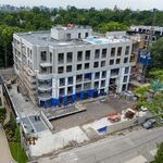
North York Centre was planned in the mid-80s. Still being built.
Cornell and Markham Centre were planned in the mid-90s. Barely built.
Langstaff Gateway was planned about 5 years ago. Not built at all.

Secondarily, there's the ideas themselves. Smart Growth/New Urbanism really came to the fore in the mid-90s. Some places (e.g. Markham) were early adopters. But on a large scale you need those ideas to emerge as ideas, and then to take hold at schools and with academics and then to work their way into the minds of a generation of planners and then into the actual practice, in the public and private sectors and, finally, to win the hearts and minds of the actual politicians and developers who decide what will get built and how. That takes a generation or more. So, Jennifer Keesmaat in Toronto is someone very much of this mindset but that doesn't mean the City of Vaughan is staffed by a team of Keesmaats, nor that the developers in Vaughan buy into all that. Yet. There's obviously a lot of momentum we're trying to stop and it won't happen at once.

So, to address some of the specific examples cited here:
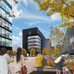
Because TIME is important, you have to look at things in context. You should look at Cornell and Markham Centre as first-stage efforts to build "better" greenfield suburban developments (both have proceeded in stages and both have been revised over the years, but still). The next generation is things like Avondale (Yonge/401) development and, for anyone familiar, the area just north of Richmond Hill Centre. It's not "new urbanist" BUT it has relatively narrow pedestrian streets, well-above-average density and houses that face onto Yonge Street. Yes, it's a suburban stretch of Yonge Street but it's a start.

Langstaff Gateway/RH Centre, cited above, is a next-generation iteration and though there are some superficial similarities, it should not be compared to Avondale, which it was. No one wants me to go on at length about the differences but I will give you the stunningly obvious ones:
a) There is NO employment in Avondale; it's entirely residential, unless you want to count the condo on Yonge that has a Starbucks downstairs. By contrast, RHC has a 1:1 jobs/resident ratio (planned, yes, not reality right now) and Langstaff has more like 2:1, so overall it's a relatively even balance.
b) Avondale's key flaw, IMHO, is that it's closer to the 401 than Sheppard. Even though it's (rightfully) marketed as "walk to the subway" it's not RIGHT ON the subway. RHC/Langstaff is directly atop TWO subway stops AND a GO station AND a YRT/Viva station AND the 407 Transitway station.
44North knows all this, but he has a penchant for saying crazy things and then saying he was mis-represented.

I can't say, because I'm not psychic, how it will look when it's all done but the underlying planning is very much different. (You can read a bit here http://www.calthorpe.com/langstaff)

It's really part of the same "sprawl repair" stuff. The Markham portion of those lands is (no offence) basically an industrial wasteland and the RH portion is typical big box crap. You introduce a tighter street grid, green space etc. etc. The key similarity to Avondale is that it's not DIRECTLY oriented to Yonge but rather internally. But then again, that's negated by the transit (i.e. that the subway will leave Yonge itself and the other transit is already converging east of there).

Finally, I agree with ehlow about those New Urbanist developments. Cornell and Cathedraltown (and there's one in Niagara-on-the-Lake that's quite lovely, and a passable one in Oakville) are NOT the answer to "sprawl" but they are much, much better than what was built in the 90s. IMHO, they are a far better form of relatively-auto-oriented greenfield development. However, the real challenge is to find the proper places where we can do "sprawl repair" and those are going to be places along prime transit corridors and particularly the nodes where they converge. (And, of course, not just introducing condos and residential but a mix of employment too; that's the trick, as others have already noted.)

EDIT: Just to add I really like the diversity of insertnamehere's images. It's rather amusing that pretty much all those "good" examples have a Starbucks. It's like a weird bellwether of success :) One I'd point to, actually, is Disera Drive (the Thornhill image). For people who don't know, that's here:

disera.JPG


So, it's just north of the Promenade Mall, west of Bathurst. You will note that Walmart is right on the right there, at the Bathurst/Centre Street corner. BUT you will also note that, unlike most Walmarts, it is up against the intersection instead of having a parking lot that fronts onto the street. (The Centre Street frontage is also now being filled in by pad retail, so the parking lot is nearly invisible from either street. I haven't seen that with another Walmart and its also worth making sure North44 and others know that big box retailers are increasingly opening small, urban locations in recognition of the trends he dismisses. I saw a mini Home Depot on (I think?) 3rd Avenue in New York last year.

Anyway, this is because the city (Vaughan!)specifically asked them not to build the big box centre they wanted. So, they built a bit of a unique Walmart (it's also coloured different than most and has some other superficial design features along the street facing) and then the pedestrian "main street" in the picture.
It's not perfect but it's another example of the transitional development I was talking about, and it mostly works. Disera Drive is not Main Street Unionville but it's definitely got some people walking and eating ice cream in the summer. It's a step in the right direction.
 

Attachments

  • disera.JPG
    disera.JPG
    83 KB · Views: 699
Last edited:
I'm really not impressed with the pictures insertnamehere posted, aside from the shot of NYCC and Thornhill.

They are like the least impressive examples of walkable stretches in the inner suburbs, except they also happen to be devoid of street life, unlike the inner suburbs. If that is what we are striving for, we are striving very low IMO.

Why can't the suburbs build something akin to the Shops at Don Mills?

0QD8Lpz.png


Lg1ikbh.png


sAzaiCg.png


3P6IpPU.png


HrqjQ35.png


i4vyu73.png


zncWeGc.png


Replicating the Shops at Don Mills is aiming high, it is almost European!
 
Replicating the Shops at Don Mills is aiming high, it is almost European!

Riiiiight. But now you're comparing mixed-use neighbourhoods to an outdoor mall. I know they're doing residential there but it's not the same as the places pictured and discussed above. You're also comparing an infill to examples that are primarily greenfield.

Oh, it's also (despite that lovely replica TO street sign in the picture) a private development. All those walkable "streets," are really no different than the pedestrian-friendly hallways in a mall. So, by all means, enjoy sitting in the "public square" beneath the Doug Coupland sculptures. But don't think it's the same as sitting in a public park in a real neighbourhood, including (as a couple of examples) the public square in Cornell or the park at the top of Disera. Both are pretty boring and neither is within walking distance of an Anthropologie, but then that's kind of my point.

I happen to like the Shops (though they are a bit upscale, aren't they?) and it's a fine example of "sprawl repair." But it's a bit of apples and oranges, whether you're comparing it to Cornell or Avondale or Richmond Hill Centre or Oakville. Never forget, for all its charms, it's really just a mall. You don't think there are people living in apartments above the Aroma, do you?

So, yeah, I don't think that's what our neighbourhoods should aspire to replicate and I'm pretty sure it's not what Europeans do either. (I do think it's what our MALLS can aspire to but that just goes to show what I said above about how trends are changing, bit by bit...)
 
Last edited:
I think one of the biggest reasons newer suburbs are less urban is perhaps surprisingly, environmental regulations. Having to put in SWM ponds and leave every tiny creek and drainage channel open (and requiring developers to leave wide naturalized buffer zones around them to boot), creates dead zones, chops developments into islands, and separates them from the roads. Look at the cropped second pic from Jasonzed especially; the Crystal Uptown at Hurontario and Eg. Notice the wide buffer around the Cooksville Creek, extending right to the new street. Under the old rules, builders would have been able to put another one of the townhouse buildings at the intersection. And look at how far to the west the buffer extends.

Untitled1.jpg


Untitled2.jpg
 

Attachments

  • Untitled1.jpg
    Untitled1.jpg
    534.9 KB · Views: 692
  • Untitled2.jpg
    Untitled2.jpg
    471.3 KB · Views: 691
Riiiiight. But now you're comparing mixed-use neighbourhoods to an outdoor mall. I know they're doing residential there but it's not the same as the places pictured and discussed above. You're also comparing an infill to examples that are primarily greenfield.

Oh, it's also (despite that lovely replica TO street sign in the picture) a private development. All those walkable "streets," are really no different than the pedestrian-friendly hallways in a mall. So, by all means, enjoy sitting in the "public square" beneath the Doug Coupland sculptures. But don't think it's the same as sitting in a public park in a real neighbourhood, including (as a couple of examples) the public square in Cornell or the park at the top of Disera. Both are pretty boring and neither is within walking distance of an Anthropologie, but then that's kind of my point.

I happen to like the Shops (though they are a bit upscale, aren't they?) and it's a fine example of "sprawl repair." But it's a bit of apples and oranges, whether you're comparing it to Cornell or Avondale or Richmond Hill Centre or Oakville. Never forget, for all its charms, it's really just a mall. You don't think there are people living in apartments above the Aroma, do you?

So, yeah, I don't think that's what our neighbourhoods should aspire to replicate and I'm pretty sure it's not what Europeans do either. (I do think it's what our MALLS can aspire to but that just goes to show what I said above about how trends are changing, bit by bit...)

They are in fact building several residential towers in the nearby vicinity, but I'll take your points. It is build as a mall. But that is not a bad thing. Malls are designed to be human-scale and optimized for a pedestrian environment, is that not exactly the kind of characteristics that we want to replicate for our urban environments? "What would it look like if we had mall architects plan our cities like malls?"


As for people living above Aroma Espresso... Why not? You can replicate this exact environment in a place like Cornell and plot 4-10s midrise residential on top of all these buildings. And it can be a public initiative too rather than a private one like Shops at Don Mills. The end result would look something like one of those "sprawl repair" images posted above.
 

Back
Top