You are using an out of date browser. It may not display this or other websites correctly.
You should upgrade or use an alternative browser.
You should upgrade or use an alternative browser.
Planned Sprawl in the GTA
- Thread starter innsertnamehere
- Start date
Lenser
Senior Member
Yeah, that's a pretty tame decline. Not terribly encouraging.
sixrings
Senior Member
Maybe if we saw the stats for decline for urban areas vs rural areas it would be more encouraging. A Lot of the states is rural or bedroom communities. Much more so than Canada.
W. K. Lis
Superstar
Yeah, that's a pretty tame decline. Not terribly encouraging.
The current price drop for gasoline and other fuels maybe one reason for the slow decline. The price will go down followed by another rise. The people who will assume the current low prices are "normal" will be shocked by the eventual increase. Better to prepare now for the eventual increases. Build for higher density and public transit now.
sixrings
Senior Member
The current price drop for gasoline and other fuels maybe one reason for the slow decline. The price will go down followed by another rise. The people who will assume the current low prices are "normal" will be shocked by the eventual increase. Better to prepare now for the eventual increases. Build for higher density and public transit now.
you can now by a prius for 20k... by the time gas goes up people will be upgrading to hybrids... gas prices wont change driving habits. traffic and tolls might.
W. K. Lis
Superstar
you can now by a prius for 20k... by the time gas goes up people will be upgrading to hybrids... gas prices wont change driving habits. traffic and tolls might.
Except that people would more likely buy one car for the family. They'll use public transit, bicycling, walking, or automobile-sharing at other times. However, to make the "other times" worth while, there has to be less sprawl, more mixed zoning, and more walkable neighbourhoods.
waterloowarrior
Senior Member
The beginnings of Markham's plan to use up a huge chunk of its white belt before 2031ish (12,000 units of housing for a projected 38,000 new residents and 19,000 new jobs). I'm not sure I'm a big fan of extending the bypass road -- it will only lead to more sprawl post-2031 as it cuts through what's left of the white belt.
http://www2.markham.ca/markham/ccbs...1209/Conceptual Master Plan Update Report.pdf
Also, a bit unrelated, but York Downs (golf course) looks like it will become new housing as well: http://www.yorkregion.com/news-stor...r-york-downs-golf-club/#.VH4o7zOeDYg.facebook
As much as I think Markham has been progressive with Markham Centre, etc., there is an awful lot of sprawl still on the way. The only saving grace is that new lowrise developments will be denser than in the past.
I was looking up the golf course location and noticed Markham has a pretty big gated community
http://goo.gl/maps/wO00j
W. K. Lis
Superstar
A "gated community" is low-density housing with a "security guard" at the entrance. Similar to a high-density condo tower with a "security guard" at the entrance.
Do "problems" occur in condos? Yes.
Do "problems" occur in condos? Yes.
TJ O'Pootertoot
Senior Member
Yeah, that gated community is Swan Lake. But I think it's the only one (certainly the only one of that size) in the city.
Anyway, there's still going to be new, peripheral development but Markham is doing less of it than any other municipality and it will be noticeably denser than what there has been before. So, it is where it is geographically and we'll see how it takes shape but it really shouldn't be "sprawl" as it's been thought of.
Anyway, there's still going to be new, peripheral development but Markham is doing less of it than any other municipality and it will be noticeably denser than what there has been before. So, it is where it is geographically and we'll see how it takes shape but it really shouldn't be "sprawl" as it's been thought of.
salsa
Senior Member
It's nice that Markham wants to build denser peripheral developments, but they really need to stop building huge roads and unwalkable neighbourhoods.


innsertnamehere
Superstar
Mark hams newer arterials aren't as bad, but you need to remember that markhams transportation is still heavily auto based and in those low density areas it doesn't make sense to do it otherwise.
43% is a very encouraging number given the pure dependency on the automobile we see today. That's nearly a 15% drop, or the equivalent of 45 million Americans shifting the way they get around.
43% is a very encouraging number given the pure dependency on the automobile we see today. That's nearly a 15% drop, or the equivalent of 45 million Americans shifting the way they get around.
Jonny5
Senior Member
I doubt there is a farm there. Even small farms are quite large and would be clearly visible. And any farmer from the time the area was rural (50 years ago) would be too old to farm today, and it's hard to believe any farmer's sons would keep farming there for this long.
It's probably just a leased vacant lot used for haying, as you see that in some places.
Yes. I'm sure I recall the Star running a story a few years ago about the last working farm in Toronto being sold to developers. This is probably just for haying as you said, or growing sod. I compare this to the parcel of land directly west of the Burlington GO station, which until only a year ago was used for growing sod. Burlington's sprawl had extended a dozen miles north of this spot more than thirty years ago. At one point maybe twenty years ago I remember it was leased to a car dealership around the corner that used it to store surplus cars, using barely 1% of the space. Sprawl that is barely controlled by zoning often creates these weird plots of land that are left vacant because the rental income is trivial to the capital appreciation, so the owner doesn't care what it's used for in the interim period until they sell it.
Last edited:
Dandy Horse
Active Member
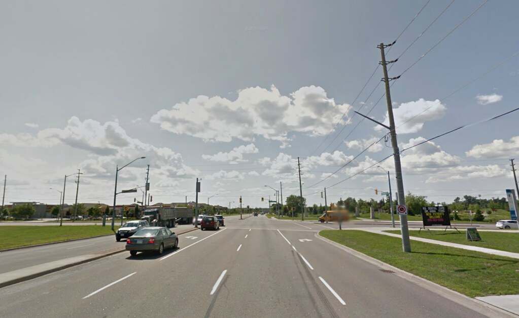
I'm up in Newmarket this week in the area south of green lane where the 404 hwy used to end. The highway now goes until ravenshow rd. Not so surprisingly, traffic congestion on Leslie street adjacent to the highway is complete mayhem. When a light goes red two lanes of cars each direction quickly back up for the equivalent of three or four city blocks. This is way worse traffic than you would find anywhere downtown. Has the highway spurred growth to the north, is that where these cars are coming from? I havnt been north of Newmarket lately but the amount of traffic is way more than a few years ago, and this is with the new highway supposedly offering an alternate route. I know east gwill was meant to sprawl a lot (EG sprawl was written into the greenbelt for some reason). Has this already been built?
wopchop
Building Toronto
My folks live in Newmarket, so I'm there a bit, but I think the Rapidway construction on Davis Drive has driven a lot of traffic onto alternate routes - Yonge, Green Lane and Leslie all seem busier to me lately. In the last couple years, there has also been some new plaza development on Leslie and a new subdivision across from Stonehaven at Mulock & Leslie.I'm up in Newmarket this week in the area south of green lane where the 404 hwy used to end. The highway now goes until ravenshow rd. Not so surprisingly, traffic congestion on Leslie street adjacent to the highway is complete mayhem. When a light goes red two lanes of cars each direction quickly back up for the equivalent of three or four city blocks. This is way worse traffic than you would find anywhere downtown. Has the highway spurred growth to the north, is that where these cars are coming from? I havnt been north of Newmarket lately but the amount of traffic is way more than a few years ago, and this is with the new highway supposedly offering an alternate route. I know east gwill was meant to sprawl a lot (EG sprawl was written into the greenbelt for some reason). Has this already been built?
As far as East Gwillimbury goes, north of green lane on Leslie is Sharon, where there has been some development, but not as much as the parcels of EG at Green Lane & Yonge. These are the major greenfield lands (they were all farms into the early 2000s) that EG had planned development for when the Greenbelt was being planned for.
Newmarket has always had bad traffic issues for a town of it's size, as there are only four major arteries that everyone drives on (Yonge, Davis, Leslie, Mulock) to get around anywhere.
Last edited:
Transportfan
Senior Member
KPMG is predicting that the share of multi-car households in the U.S. will drop from today’s 57% to 43% by 2040. See link.
To access the complete whitepaper, “Me, My Car, My Life,†please click here
.
Another article about Toronto I thought had died has been resurrected by the USS Yankee as usual. Written by a company I thought was Canadian until today to boot.


