


TJ O'Pootertoot
Senior Member
I typed a longer response and then lost it; isn't that the most frustrating thing?
-no one disputes there is a gap between an initial plan and what you end up with at the end of the day. It's still a very ambitious and laudable plan. It's ironic that over in the Yonge north thread, you basically talked about why the subway doesn't need to even go here.
-if we're talking about Langastaff/RHC it IS right on the subway x 2. The Langstaff half, yes, only has a direct subway connection at its far end. So what?
-a new growth centre does not need a city hall
-moreover, there is ALREADY a Regional office WITH a courthouse existing in RHC. So there. (On high tech road)
Partially correct. A challenge is to get people from the furthest parts of the Markham side into the main mobility hub on the RH side. His solution was a circulator bus route in the short term with a possible upgrade to PRT at buildout. That's 20+ years away, so there seems little point arguing it's some kind of Jetson's idea. We may have autonomous cars by then, after all. And PRT didn't exist in 1968; it does now, so not sure what your point is there.
no, the park does not ensure a 60% modal split but then you objected to even bringing the subway here is and that most certainly IS relevant...
I won't comment on all the parts you pasted. No one disputes it's a unique and ambitious plan (the Markham plan) so it's not surprising RH, for example, expressed concerns. What those comments show to me is that they're not idiots; they know it will require ongoing monitoring and vigilance to realize.
In planning, NOTHING is guaranteed; that's why it's called PLANNING. but you can still try and set goals for your municipality and communities the same way you do for your life.
I'll apologize if I'm crossing lines but the personal attacks from some real frustration with your inability to grasp and concede certain things. I'm not under the illusion the future has already occurred but I understand what the PLAN is much better than you do.
It’s not “right on” the subway
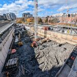
Secondary plan said the subway was supposed to finish sometime soon. A shovel has yet to hit the ground. This throttles development phasing, population maximums, and numerous other issues.
-no one disputes there is a gap between an initial plan and what you end up with at the end of the day. It's still a very ambitious and laudable plan. It's ironic that over in the Yonge north thread, you basically talked about why the subway doesn't need to even go here.
-if we're talking about Langastaff/RHC it IS right on the subway x 2. The Langstaff half, yes, only has a direct subway connection at its far end. So what?
I meant major civic centre building (e.g courthouse, city hall, regional offices).
-a new growth centre does not need a city hall
-moreover, there is ALREADY a Regional office WITH a courthouse existing in RHC. So there. (On high tech road)
Didn’t Calthorpe also say the site should have personal rapid transit? Why would ‘the greatest design firm in the world’ suggest such an idea as pods to get around? If anyone wants to know about how ludicrous such an idea is, go to page 24 of TJ’s link. Seems more like a idea from 1968 than 2008.
Partially correct. A challenge is to get people from the furthest parts of the Markham side into the main mobility hub on the RH side. His solution was a circulator bus route in the short term with a possible upgrade to PRT at buildout. That's 20+ years away, so there seems little point arguing it's some kind of Jetson's idea. We may have autonomous cars by then, after all. And PRT didn't exist in 1968; it does now, so not sure what your point is there.
Continuing to bandy about 6yo renderings is not proof that the linear park will exist as shown, nor is it proof that +60% of people will take transit. Master and secondary plans change all the time. Certain EA’s haven’t been completed, and over time there will be issues requiring resolution – the lack of a subway (although major) being just one of them.
no, the park does not ensure a 60% modal split but then you objected to even bringing the subway here is and that most certainly IS relevant...
I won't comment on all the parts you pasted. No one disputes it's a unique and ambitious plan (the Markham plan) so it's not surprising RH, for example, expressed concerns. What those comments show to me is that they're not idiots; they know it will require ongoing monitoring and vigilance to realize.
In planning, NOTHING is guaranteed; that's why it's called PLANNING. but you can still try and set goals for your municipality and communities the same way you do for your life.
Edit: And after rereading your post, I'm noting a lot of personal attacks. That's not fair. If you read the reports, you'll see that things are not as guaranteed as you claim, and that what I've stated here and on the Yonge North thread seems to be reinforced to some extent. Clearly I'm not the only one that has concerns and doubts about this development.
I'll apologize if I'm crossing lines but the personal attacks from some real frustration with your inability to grasp and concede certain things. I'm not under the illusion the future has already occurred but I understand what the PLAN is much better than you do.


