News   Jul 12, 2024
 1.1K     0 
News   Jul 12, 2024
 952     1 
News   Jul 12, 2024
 359     0 

Miscellany Toronto Photographs: Then and Now

Then and Now for Sep 28.


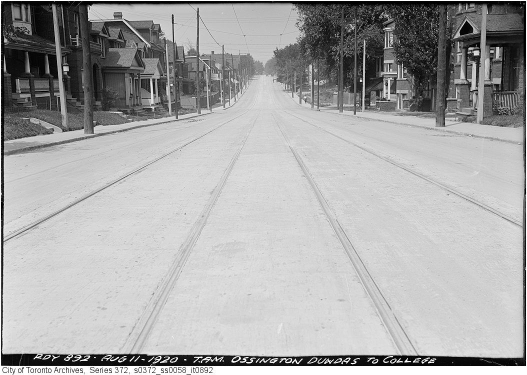
Then. 'Aug 11, 1920'. Ossington from just N of Dundas looking N.

193.jpg


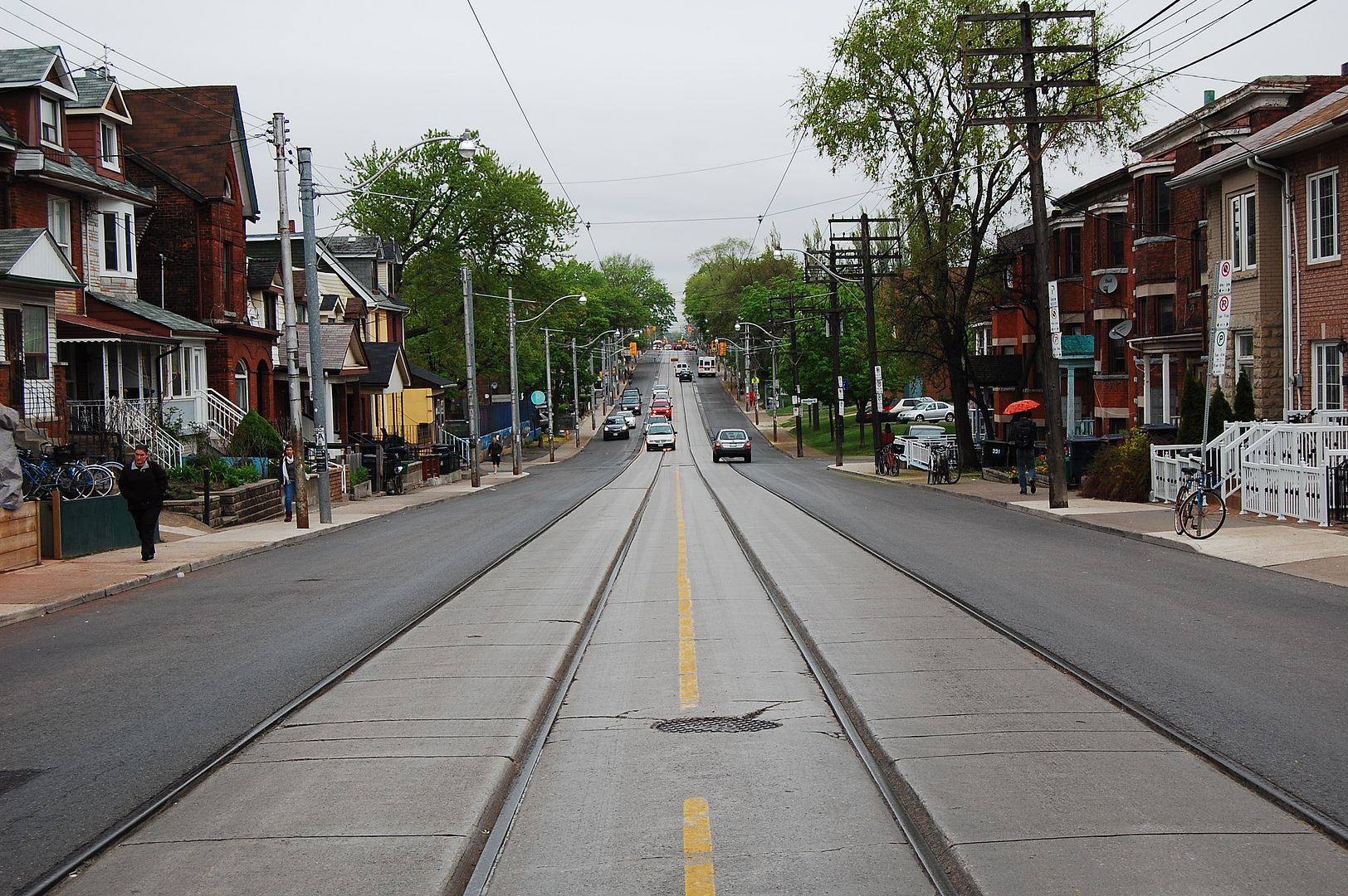
Now. July 2011. Amazing. 91 years between the two pictures and outwardly nothing has changed. However, there have been the inevitable porch revisions, new facings on the houses on the rightmost of the picture and homes in the left distance demolished for a schoolyard.

194.jpg
 
91 years between the two pictures and outwardly nothing has changed. However, there have been the inevitable porch revisions, new facings on the houses on the rightmost of the picture and homes in the left distance demolished for a schoolyard.
Quite the contrast between this and Eglinton east of Leaside.
 
NOPE! IBM no longer makes them, have not for a few years now. Thinkpad is now made by Lenovo, a Chinese company that bought all IBM personal computing.
Even longer. Lenovo made them for IBM for years before they "officially" started making them. I have a T40 at home that still runs great (with Linux).
 
Whether the photo's deceptive or not, that looks like a pretty precarious and foolhardy place to put a house.

s0065_fl0127_it0004.jpg

Aren't there some abandoned properties - because of erosion - on the edge of the Scarborough Bluffs? This was in the news a few years ago.
 
Nice going Mustapha , kinda dangerous standing in the middle of the road , been there, almost got clipped on Pharmacy once.

Yessir, run to the middle, 'snap'... run back to safety. :) So many drivers drive in what I calll 'squirt' fashion - my term - they accelerate so fast..
 
Whether the photo's deceptive or not, that looks like a pretty precarious and foolhardy place to put a house.

That's likely why the photo was taken in the first place. The construction probably triggered a landslide and the city engineer was called in to document grounds for a demolition order.
 
I had assumed that Ossington was widened during the craze to create arterial roads in the 1950s. Apparently not. Was it originally laid out this way?

Ossington between Queen & Dundas was part of 'the Dundas road' - the main route out of town - so it may have started out a bit wider. That photo's a bit north of that and the dip in the road is where Garrison Creek is/was.
 
Ossington to the north of Dundas doesn't really line up with Ossington south of Dundas, so I don't know if the width was a continuation of it being a part of the old Dundas Rd. I suspect it was laid out wider later on; methinks the Dovercourt Land Co. had aspirations for a grand Dovercourt.

All speculation on my part, mind.
 
This is the southwest corner of Eglinton & Brentcliffe
s0065_fl0131_it0018.jpg

brewster and Anna have given us a fine tour of the Eglinton, Laird, Brentcliffe area.

Do they and others know about the early airfield that was in that vicinity?
It was somewhere east of Laird, north of Wicksteed and may have extended above Eglinton at Brentcliffe.
I've been searching for some sign of the old buildings but have found only this one which resembles a airplane hanger - no one has identified it for certain!

Leasideairfield192930.jpg


Now (2009) an auto shop at Laird & Parkhurst
AutoEurotic-Leaside.jpg
 

Back
Top