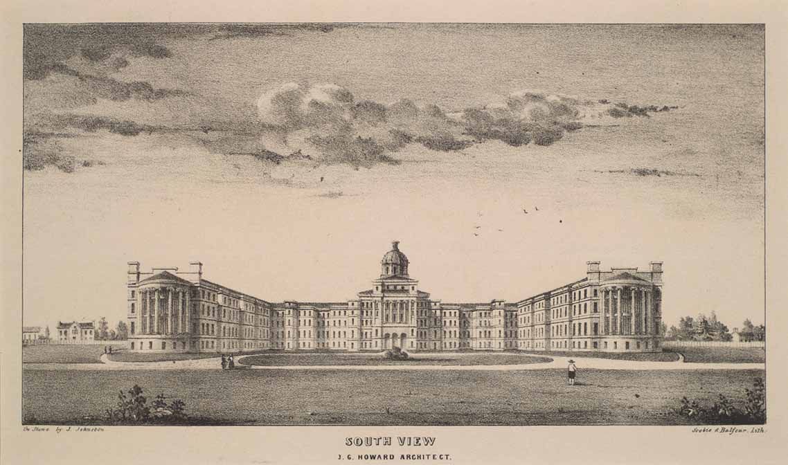
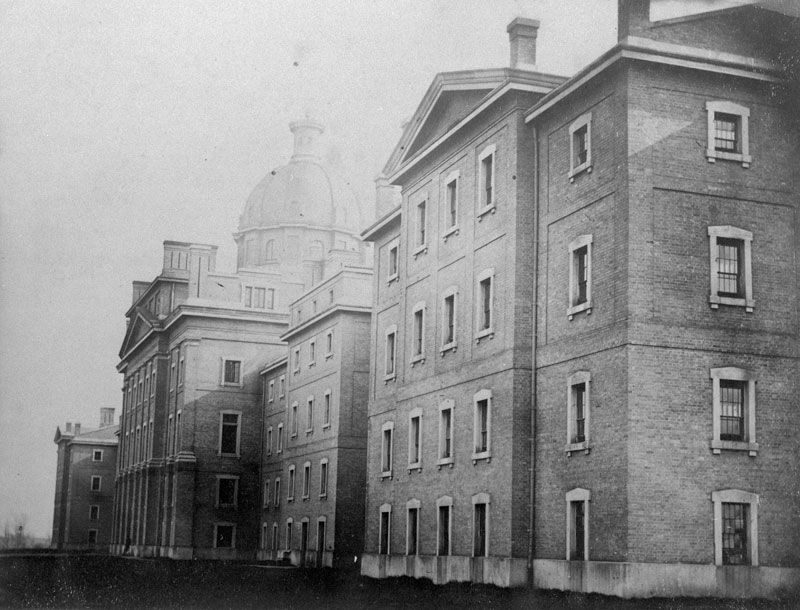
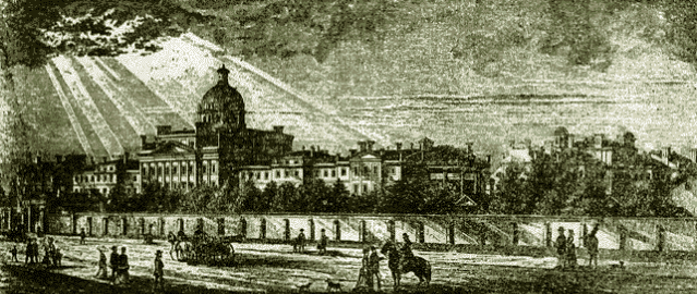
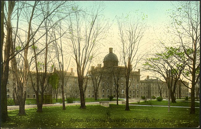
Mustapha:
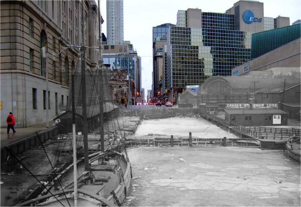
This is the most amazing thread with so much useful - and surprising - information but I worry that one day, like many sites, UT will vanish and it will be lost (or at least difficult to retrieve). I hope you are keeping an archived copy and that maybe the Toronto Archives are too (since many of the 'now' pictures match older photos from their collection.)
I also wish there was a better way to navigate the thread as (unlike the progress of a new building) there is no rationale in the order of the postings.
Thanks to you for starting it and to you and others for continuing it.
Thank you DSC. I was inspired in June 2008 to start this thread when our city's 175 birthday was looming. I started it as a lark - an occasional then daily visual 'snippet' of a random Toronto location. I imagined it as an online cocktail party with like minded friends standing around an old style carousel slide projector, delighting as the next image twigged old memories or a discussion of what was lost, or perhaps, even gained.
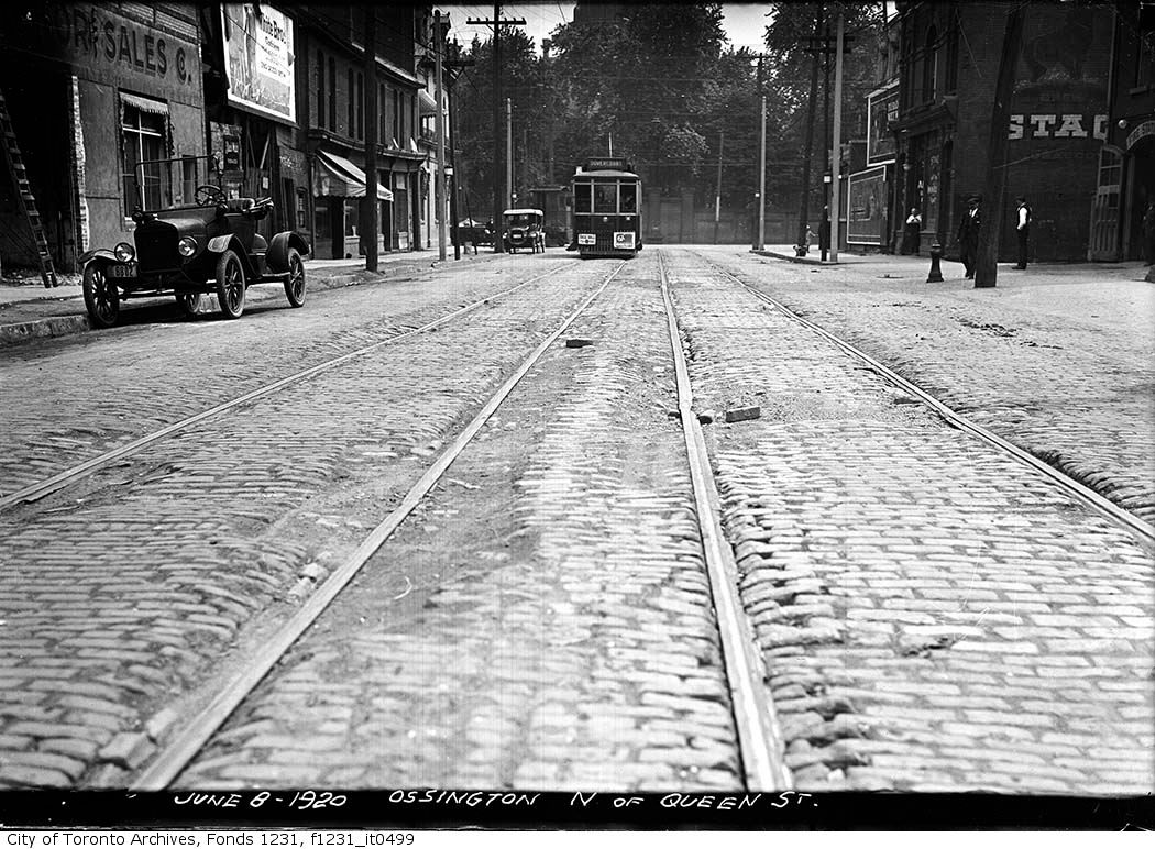
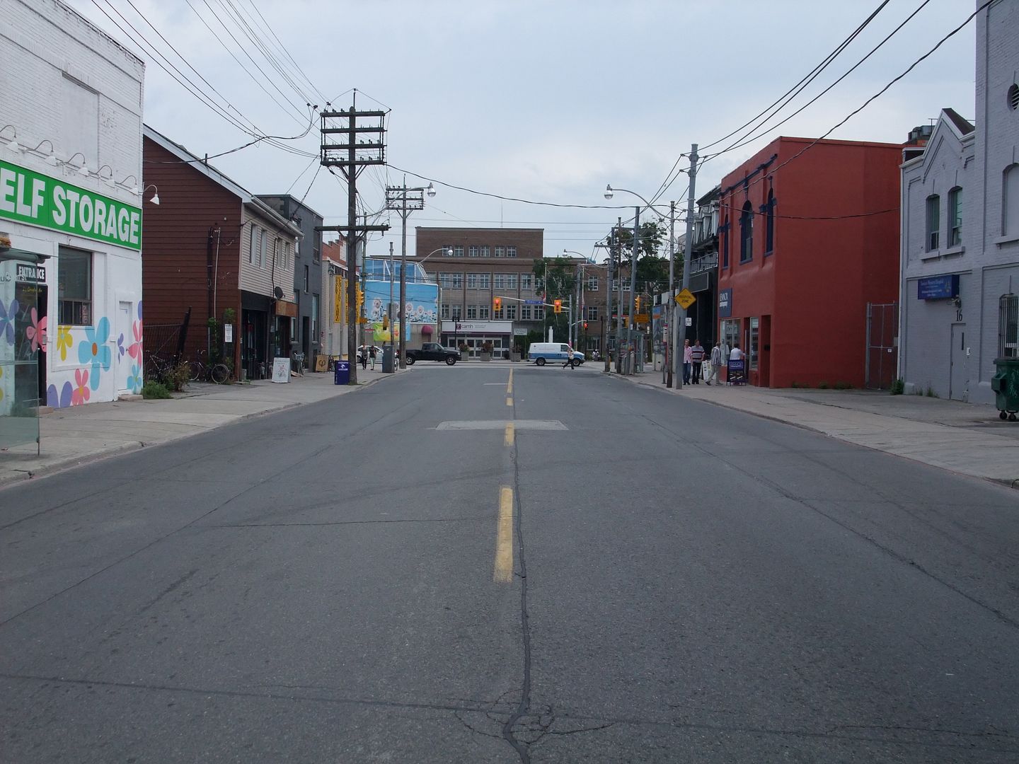
I realize that the sheer volume of pictures - I try to add one a day - and the posts from others have added up to something approaching an informal resource. I save it as a showthread.php_file from time to time, but I am not sure this is the right way to archive it. I host all the pictures (the 'Thens' as well as the 'Nows') from my Photobucket account. I have the pictures on two thumb drives as well.
I could recreate - after a fashion - this thread by making a web page of my own, but the contributors [Anna, goldie, Aladone, androiduk, thecharioteer, adma, doyenne - what's-her-name, et al, if I didn't mention you, I love you all
")
] are what gives this thread its life. It sure isn't the quality of my photos - taken with a 'point and shoot' and inconsistent at best. Or my (lack of) research - the Historicist pages at Torontoist is the place for substance.
I've never been in contact with the Toronto Archives nor they with me.
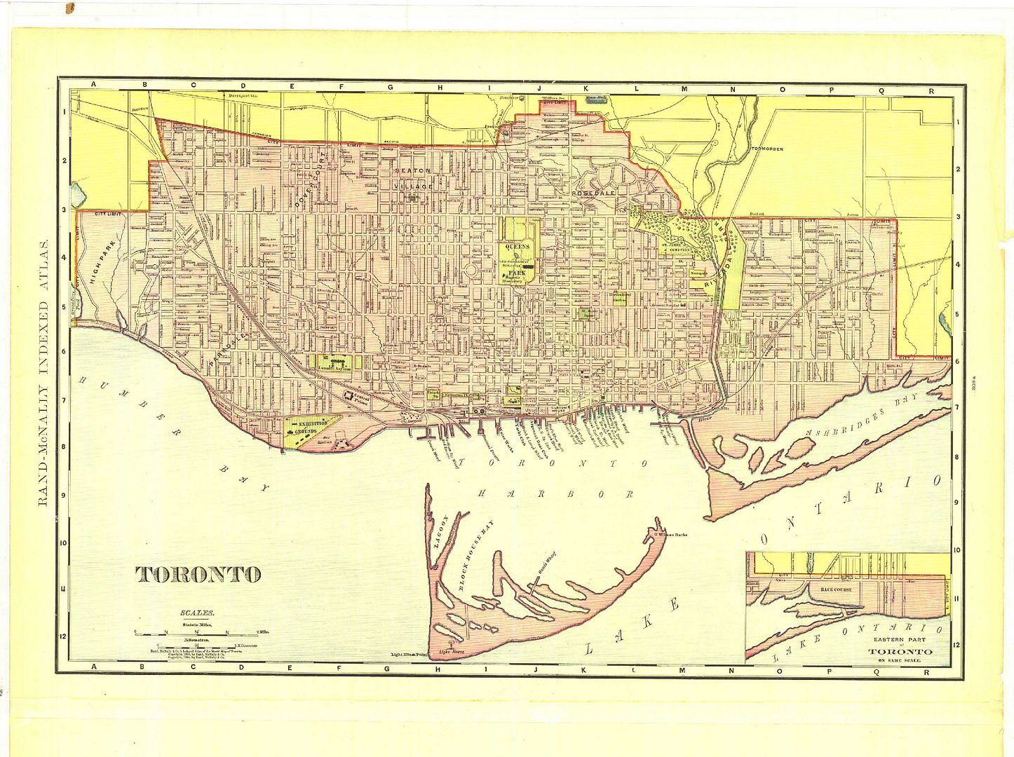
You wrote: "I also wish there was a better way to navigate the thread as (unlike the progress of a new building)there is no rationale in the order of the postings". ---- Quite right, and I have my regrets about this. My shot gun approach to finding pictures at the Toronto archives has from the beginning consisted of nothing more that a random inspiration for a new keyword for the search field. Street names were the first to be exhausted.
As I said, a lark. Work pressures prevent anything resembling planning.
At some point, the interesting pictures from Toronto Archives will be exhausted and this thread might settle down a bit. But with the posts of maps and postcards, personal reminisces, etc., that may be a awhile. Let's hope.
The owners of UT make all this possible. I contributed $ awhile back, just beer money, really. Ok, two cases of beer money. If any of you can, please contribute.