News   Apr 29, 2024
 1.6K     0 
News   Apr 29, 2024
 1K     1 
News   Apr 29, 2024
 625     0 

McCleary District (CreateTO, Perkins&Will, ?s)

Northern Light

Superstar
Member Bio
Joined
May 20, 2007
Messages
31,936
Reaction score
89,708
Location
Toronto/EY
I'm creating a new thread for the McCleary District for discussion of the district as a whole and preliminary concepts before we get to individual buildings some years in the future.

Before the map, let me put the full credits as these would not fit up top:

1712147755700.png


Now a map to orient everyone:

1712147819477.png


The above comes from our kick-off discussion point, this presentation to the Waterfront Design Review Panel:


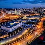
Select slides from the above:

1712147934762.png


1712147991537.png


1712148037252.png


1712148077137.png


1712148104777.png


1712148171527.png


1712148199383.png


At this point, its important to say, that the team has not settled on which high level options to pursue in terms of the Parks and Open Space plan, how much and where; and in terms of where maximum density will go, the north or the west.

There are lots of slides on these points with different inspiration pictures, but they won't fit in one UT post, so do follow the link for greater detail.

1712148412033.png


1712148505114.png


1712148479617.png


1712148550155.png
 
Concise and informative as usual! Thanks, NL.

And this provided an answer to a question that has been bothering me. Why delay development for 4 or 5 years? Because of flood proofing requirements.
 
What do they mean by "film-friendly streets?" Why does film production require 40m wide roads?
I know that film crews often require very large turning radii for trucks carrying sets, booms,etc. As well you might have dozens of trailers needing nearby access for shoots that have vastly different requirements. Also Jason Paris would be able to provide insider insight.
 
Last edited:
I was also interested to see potential development at the Pinewood site as well as a new Turning Basin District.
 
At this point, its important to say, that the team has not settled on which high level options to pursue in terms of the Parks and Open Space plan, how much and where; and in terms of where maximum density will go, the north or the west.

Both options are wrong. It should be in the centre, lining Broadview. This would (1) place the highest density close to future transit, (2) cement Broadview as the centre of this new community, and (3) be consistent with Broadview's central role in East Harbour helping to create an appropriate relationship between those two future districts.
 
Both options are wrong. It should be in the centre, lining Broadview. This would (1) place the highest density close to future transit, (2) cement Broadview as the centre of this new community, and (3) be consistent with Broadview's central role in East Harbour helping to create an appropriate relationship between those two future districts.

They do leave open other options, and yours is sensible in many respects.

But I can understand why they got where they did; by default, they will want less shadows on key parkland, notably McCleary in this case; and so density at the north end vs the south makes sense.

After that, the farthest west is least likely to Shadow McCleary.

***

Worth noting, the planners do lean to a vision of Broadview being a primary retail street along with Commissioners:

1712178042414.png


Also I didn't post all the alternative visions for the green space (all include McCleary) but there are two other principle ideas being bandied about:

1712178151323.png


1712178187810.png


1712178217888.png


1712178247379.png


1712178279987.png


1712178306108.png


So, in all the options, you can see that there would be no shadowing issue to speak of in the first block of Broadview (angled street) south of Lakeshore.

After that, height on Broadview will cast shadows at sunset.

In the most southern block the issue would be most acute, because at least some of the buildings at Commissioners Transfer are likely to remain.

Meanwhile, you have the secondary 'central' park.

Height on Broadview has virtually no effect in the first block south of Lakeshore regardless of park placement, height further south may cause some morning shadows, while height on Commissioners would leave the park in perpetual shadow.

Shadows from the west are least impactful in summer/shoulder seasons as sunset is usually a much warmer time of day than early morning.

Ok, have fun playing Sim City everyone. .
 
They do leave open other options, and yours is sensible in many respects.

But I can understand why they got where they did; by default, they will want less shadows on key parkland, notably McCleary in this case; and so density at the north end vs the south makes sense.

After that, the farthest west is least likely to Shadow McCleary.

***

Worth noting, the planners do lean to a vision of Broadview being a primary retail street along with Commissioners:


Also I didn't post all the alternative visions for the green space (all include McCleary) but there are two other principle ideas being bandied about:

So, in all the options, you can see that there would be no shadowing issue to speak of in the first block of Broadview (angled street) south of Lakeshore.

After that, height on Broadview will cast shadows at sunset.

In the most southern block the issue would be most acute, because at least some of the buildings at Commissioners Transfer are likely to remain.

Meanwhile, you have the secondary 'central' park.

Height on Broadview has virtually no effect in the first block south of Lakeshore regardless of park placement, height further south may cause some morning shadows, while height on Commissioners would leave the park in perpetual shadow.

Shadows from the west are least impactful in summer/shoulder seasons as sunset is usually a much warmer time of day than early morning.

Ok, have fun playing Sim City everyone. .

While I'm playing Sim City, especially since this district is being essentially created from scratch, my response would be to redevelop McCleary Park into part of the new neighbourhood (with the smaller community park somewhere in this east portion of the district) and to have the much larger McCleary+ sized park at the west side of the district adjacent to the new Don River. Locating the high density at Broadview would be far enough away that shadow impacts shouldn't be so bad, and this improves the parkland too, by better connecting the most significant parkland to the river and the Villiers greenspace.
 
While I'm playing Sim City, especially since this district is being essentially created from scratch, my response would be to redevelop McCleary Park into part of the new neighbourhood (with the smaller community park somewhere in this east portion of the district) and to have the much larger McCleary+ sized park at the west side of the district adjacent to the new Don River. Locating the high density at Broadview would be far enough away that shadow impacts shouldn't be so bad, and this improves the parkland too, by better connecting the most significant parkland to the river and the Villiers greenspace.

While I would expect resistance to the idea; I think its worth exploring, you should share it with the team!
 

Back
Top