


Lone Primate
Active Member
This journey didn't really end up the way I had intended it starting out. What started as just a chance to see an old relic (which was largely frustrated) eventually became a much more interesting experience.
On Labour Day I decided to go to the Dundas Street bridge where it crosses Sixteen Mile Creek in Oakville. This was because I'd noticed six pillars from an abandoned and removed bridge standing alongside the new bridge. I thought it might be poignant to go and photograph them.
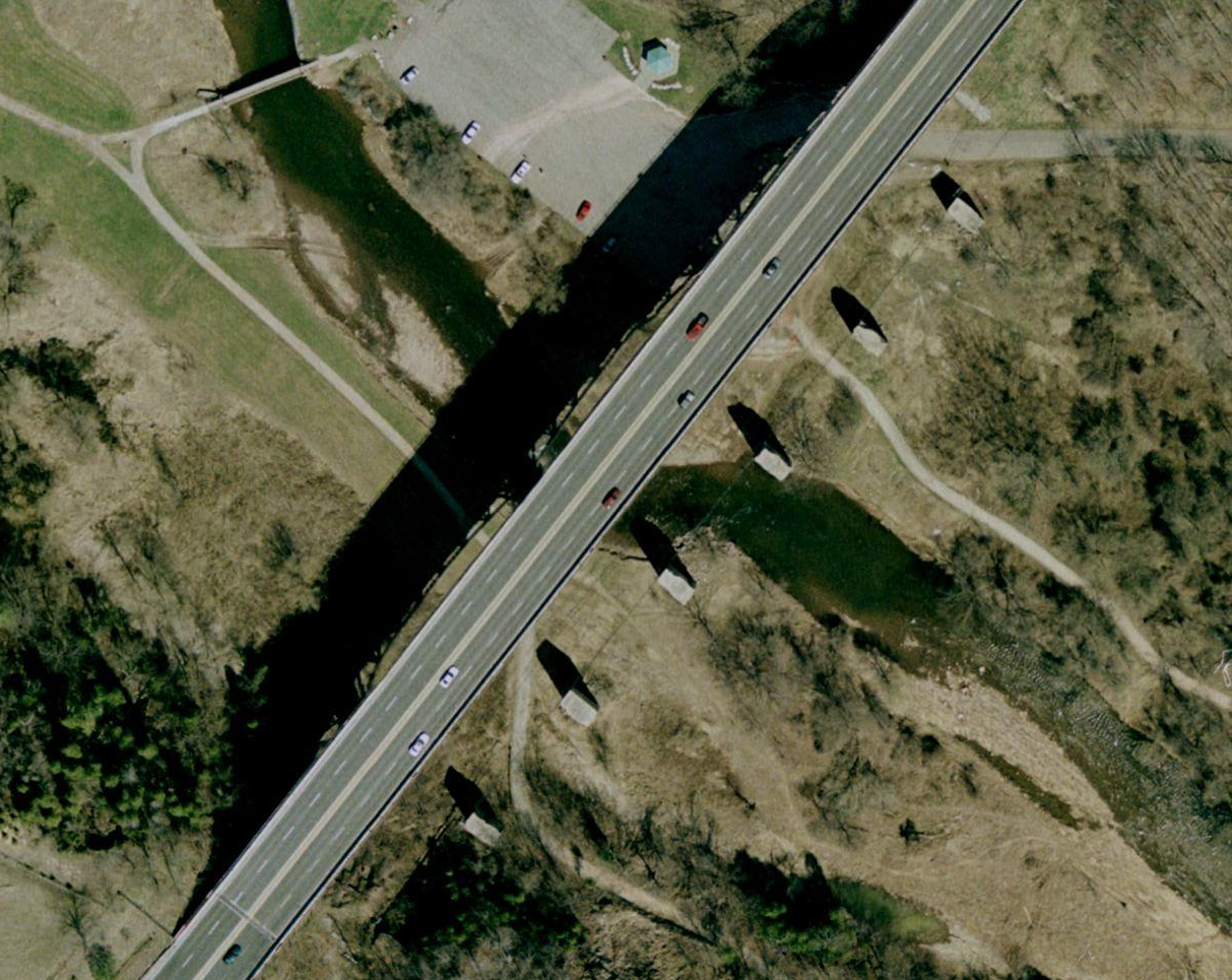
Above is a view of those pillars and the current bridge. Research done by a friend of mine informs us that that old, now gone, bridge was built in 1921, and cost $75,898.13 (yes, apparently provincial accounting was once that precise)... which to me is an incredibly low figure, even for the day. The current bridge that replaced it was built in 1948, and expanded to four lanes in 1979. What those operations cost, I have no idea. Anyway, I wanted to see those $75K pillars.
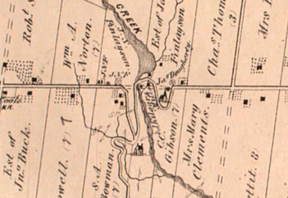
Now, I didn't realize it at the time I went there, but the river valley under those bridges was once the village of Proudfoot's Hollow, named for a local settler who owned much the area's industry, including, I believe, the mill that was once there. Above is the same place around 1880. I discovered this a couple of days after taking the photos you're about to see.
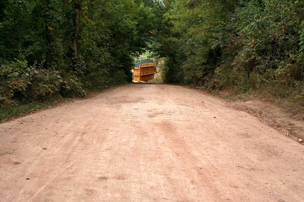
The area under the bridges is now Lions Valley Park, and the road down to it is also so-named. It leads south down from Dundas on the east side and follows the track of the crossing you see in the 1880 map. It's currently closed... construction's going on. This is a view down the road as seen in September, 2007 (for future historians!). Down there at the bottom, you can see the yellowy-orange framing of something being built.
Down at the bottom of Lions Valley Park Road. You can see something big is in the works. Again, I didn't know what at the time, but I know now. The Dundas bridge system here is being replaced. There will be two spans. One, taking three lanes eastward, will actually recover the course of the lost 1921 bridge. A new bridge carrying three lanes westbound will be built replacing the current 1948 span. Yes, the bridge you see today is due to itself be torn down.
Notice, too, that my reason for being there — the 1921 pillars — are largely absent. Only two of the six remained when I was there to take the shots. I was rather disappointed. I wish I could have photographed them as a long, lonesome set of remnants. I missed my chance. Hey, I only had about sixty years! No fair.
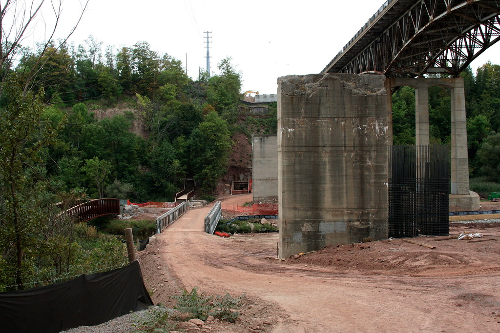
Off to the left in this shot are two new bridges. One is a foot bridge replacing one removed north of Dundas Street. The other is a temporary (I assume) bridge for construction vehicles.
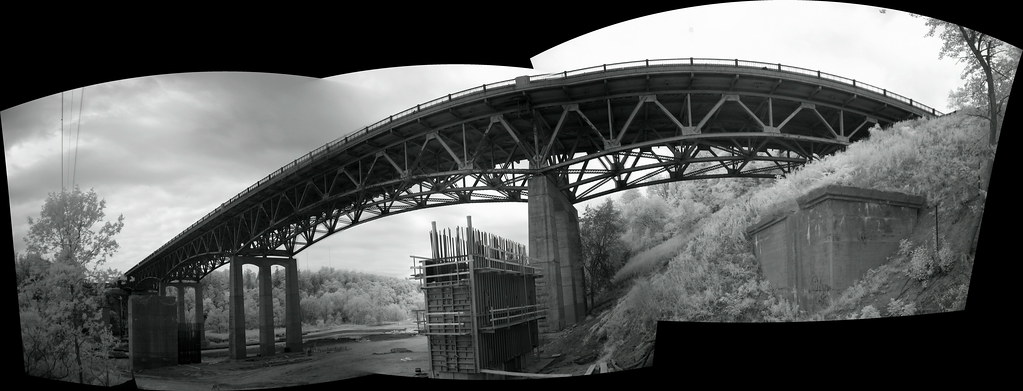
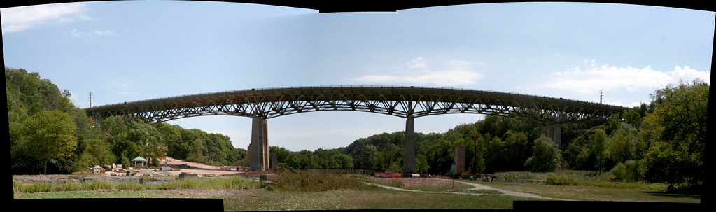
A panoramic infrared view of the 1948 Dundas Street bridge, seen from the southeast side, at the base of Lions Valley Park Road.
Dundas Street bridge seen from about half way across the new foot bridge. Somewhere in this view, 150 years ago, the village of Proudfoot's Hollow once stood, with a population of about 500 at its height. Hard to imagine.what that looked like, but it must have been a handsome place at the time. I guess the only downside would have been the flooding.
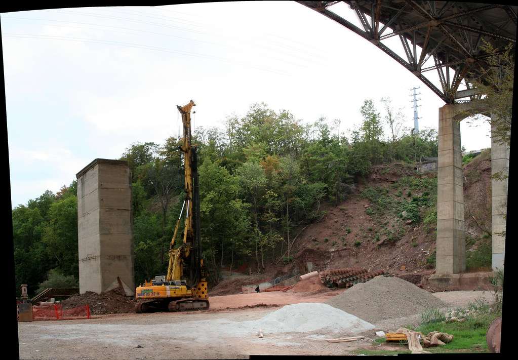
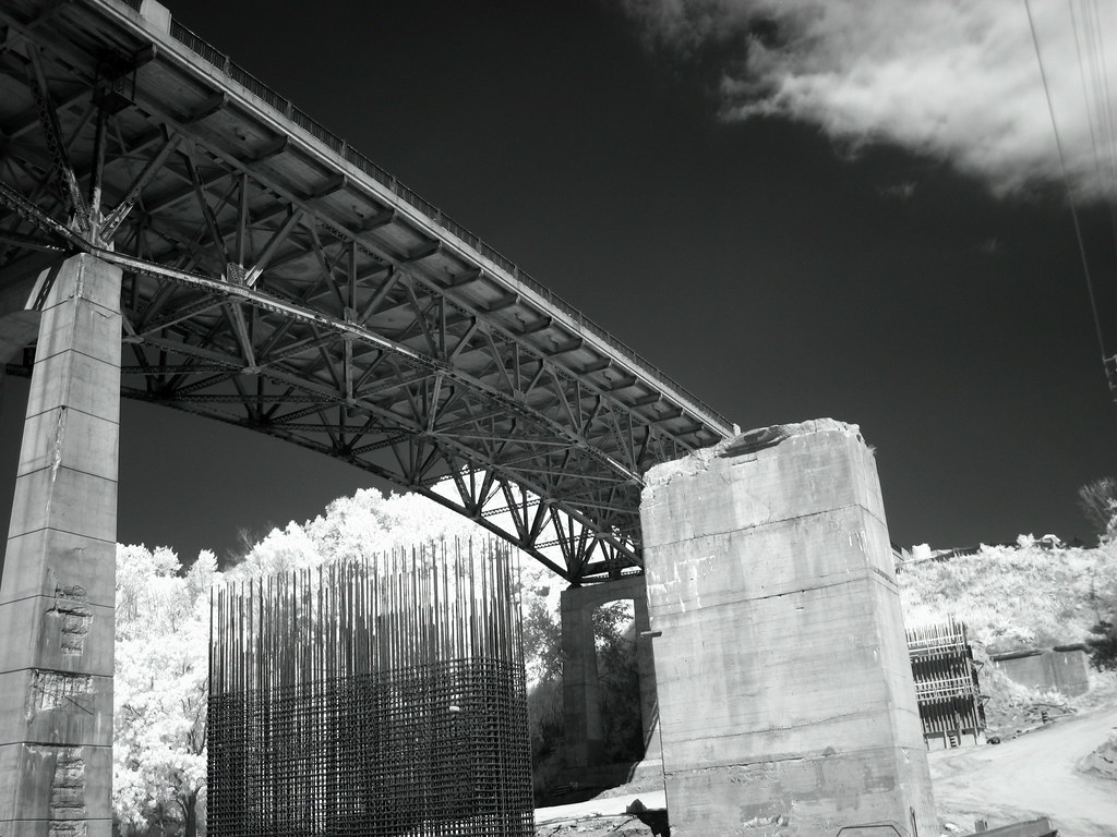
This maching must be used for pulling down the old pillars. I'm sad to see them go, but curious to see what the new bridges will be like. At the upper right, just to the left of the current pillar, you can see the abutment that once brought Dundas Street down to whatever bridge it was carried the 1921 course across. I imagine it, too, will soon be gone.
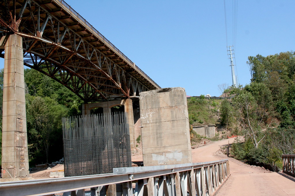
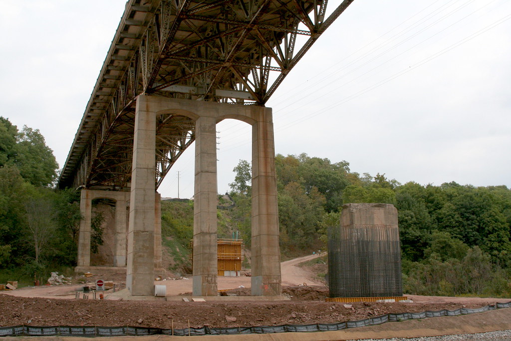
South of Dundas Street, standing on the new foot bridge and looking east. There's the current bridge, the pillar of the long-lost 1921 bridge, and the steelwork for one of the pillars of the upcoming 2007/2008 bridge. In the distance, you can see the east abutment of the 1921 bridge. You can just imagine the drop and climb in the winter.
A similar view, in infrared.
A view of the 1948 bridge from the north, from what must have been within the village of Proudfoot's Hollow at one time. Obviously the contemporary view wouldn't have looked much like this.
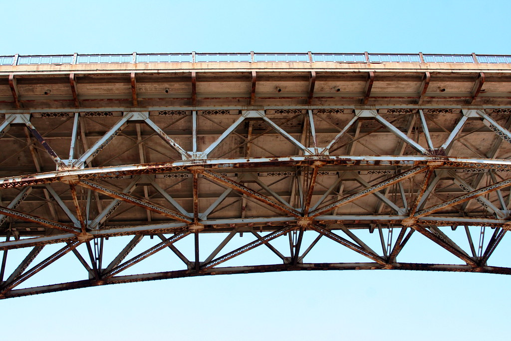
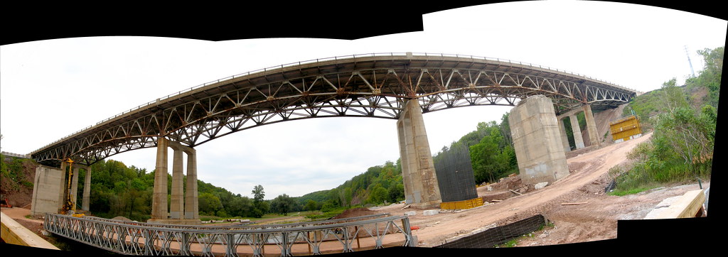
A detailed look at the 1948 bridge from the south. A few years from now, no one will be able to take in this view ever again.
From the north, a look at the east side of the current, doomed bridge. Someone living and working in Proudfoot's Hollow would have seem a view something like this, except, of course, without the huge 1948 span in the shot.
A similar view in infrared.
Until recently, this was the footbridge across the river. In 1888, somewhere around the same spot, this bridge was built:

This floodplain is where Proudfoot's Hollow once was. Nothing remains. In 1962, the following pictures were taken of the mill that once existed here:


Current inhabitant. This is six separate shots of a hawk flying over me as I stood in the middle of Sixteen Mile Creek.
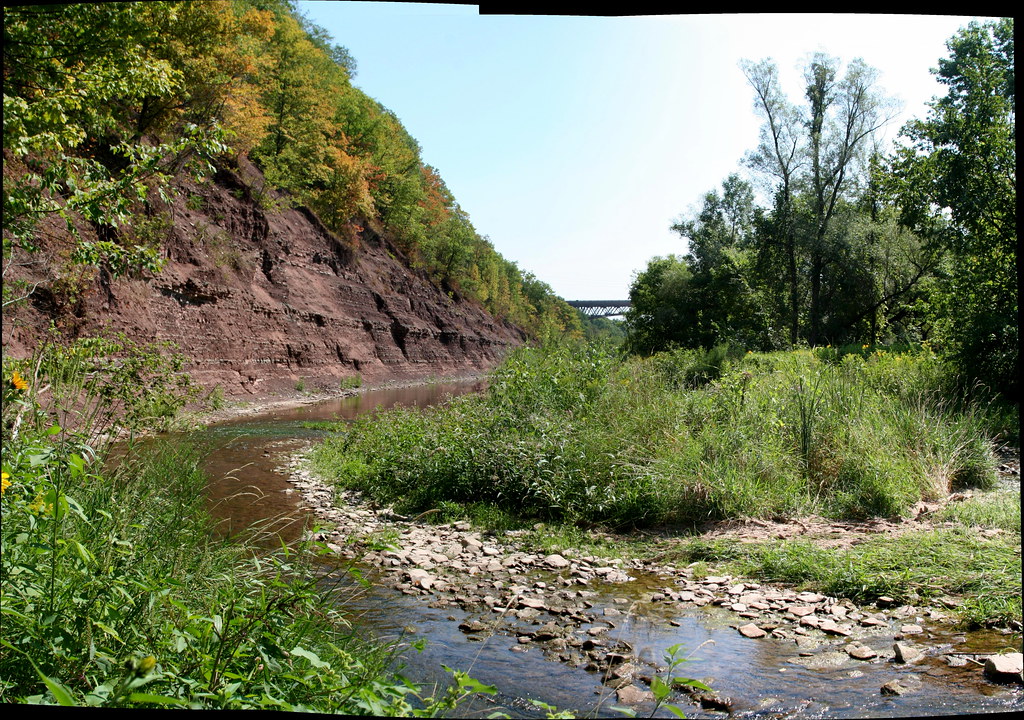
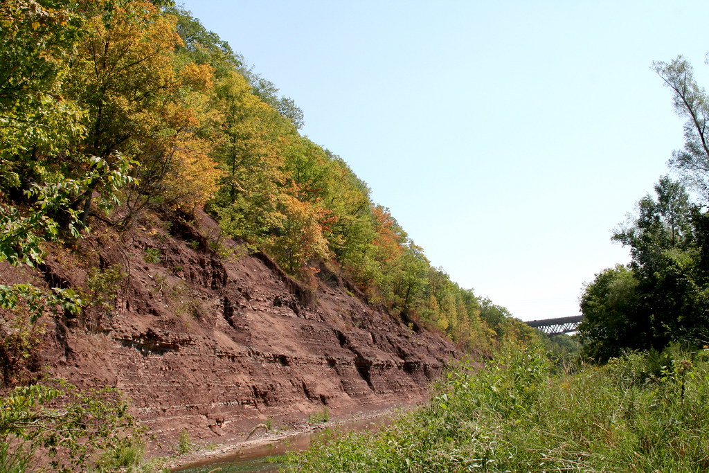
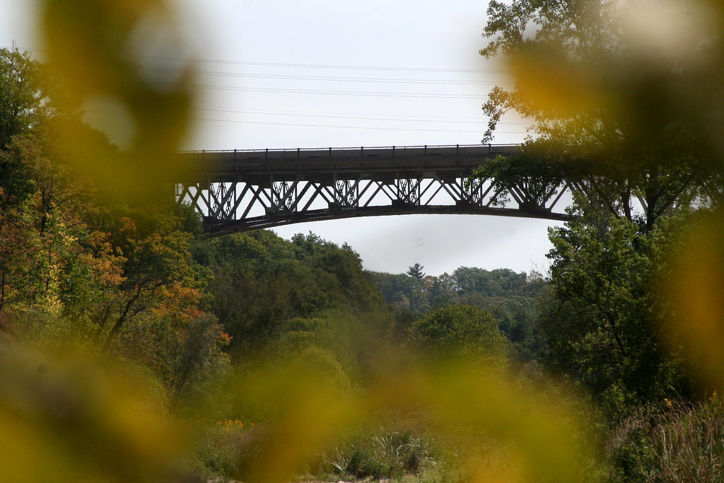
The following are three views of the current Dundas Street bridge as I waded south down Sixteen Mile Creek towards it.
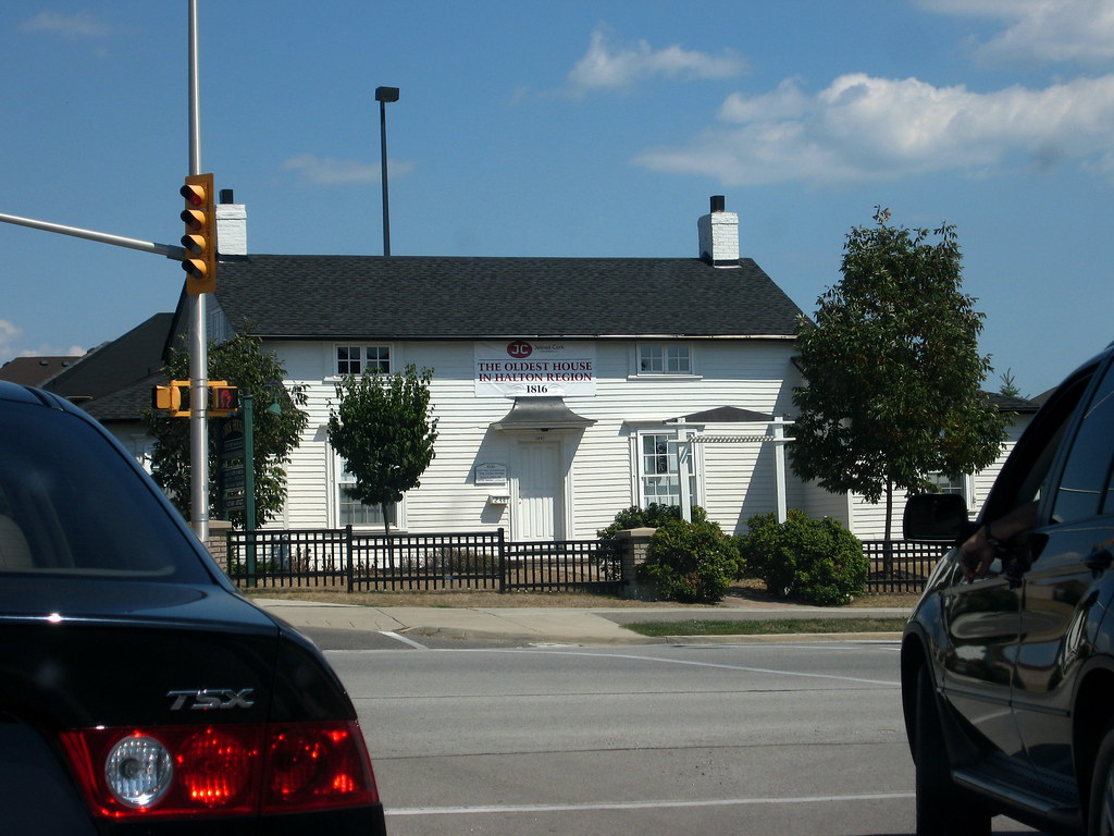
Up on Negayawa Blvd., successor to 4th Line, and just south of Dundas Street, this is (according to the sign) "the oldest house in Halton Region", dating to 1816. Not long till its bicentennial, it would seem!
Of Proudfoot's Hollow itself, there are some fascinating details. Originally called Sixteen Hollow, some of its history is recorded in Oakville's website...
In 1827 George Chalmers built a settlement with water-powered mills beside the Sixteen at the Dundas crossing.
A small sawmill and gristmill were constructed on the valley bottom at the edge of a pond formed by a dam.
In future years a church, school, ashery, blacksmith shop, distillery and tavern provided services to the local farmers.
In 1844 Chalmers suffered financial difficulties and sold his buildings to John Proudfoot, after which the community was locally referred to as "Proudfoot's Hollow."
The village continued to prosper with the addition of a tannery, carding mill and steam stave mill until the coming of the railroad to Oakville in 1855. The railroad and the collapse of world grain prices adversely impacted the prosperity of the village.
From 500 persons the village declined to only two families by the 1880's.
From the Halton Regional Museum, we get the following:
In 1827, located in the Sixteen Mile Creek valley at Dundas Street, the village of Proudfoot’s Hollow (originally called Sixteen Hollow) began to grow around a saw mill, a grist mill and a tavern. John Proudfoot after whom the village was named, purchased these properties about 1840. Within a few years the village boasted a tannery, carding mill, sash factory, stave and barrel factory, brewery and distillery, tailors shop, general store, shoemaker and a three story hotel where the stagecoach stopped to take on passengers and exchange horses.
In the 1840’s, Proudfoot’s Hollow was one of many milling centres which grew to process wheat and logs brought in by local farmers. After processing, timber, potash, and barrel staves were floated down river to Oakville harbour for export.
In the 1860’s, this milling centre, along with many others, declined rapidly due to plunging wheat prices and exhausted timber resources. By 1880, it was virtually a ghost village with only three houses remaining of the busy commercial centre that once boasted a population of over 500. One hundred years later all visible traces of the village had disappeared, covered with layers of mud and silt deposited by frequent flooding of the Sixteen Mile Creek.
...as well as this, which I personally find particularly poignant. The passenger pigeon is a personal bugbear of mine.
The Passenger Pigeon: Victim of a Changing Landscape
Before settlement, Halton was rich in many plant and animal species which are no longer found here. These included marten, fisher, wolverine, timber wolf, lynx, wapiti, cougar, Atlantic salmon, and vast flocks of passenger pigeons. The Sixteen Mile Creek watershed lay in the centre of the Ontario passenger pigeon nesting area.
Squab (young passenger pigeon) was considered a delicacy. In the early and mid-19th century, hunters reported bags of up to 130 birds obtained with a single gunshot. Huge passenger pigeon flocks "darkened the skies" and it was reported their excrement killed large trees when the flock had roosted in them. The last large flights occurred about 1869. Extinction was caused as much by reduction of the hardwood forest habitat in which the birds lived, as by intensive shooting and trapping. The last record of breeding pairs in Halton was made near Campbellville in 1886.
The last passenger pigeon (once the singular most numerous species of bird on Earth), "Martha", died on September 1st, 1914, in the Cincinnati Zoo. Of interest to Torontonians is this: Mimico, in Etobicoke — the name Mimico is derived from a Mississaugas word omiimiikaa meaning "abundant with Wild Pigeons" (c.f. 19th century Mississaugas omiimii, "pigeon") referring to passenger pigeons.
On Labour Day I decided to go to the Dundas Street bridge where it crosses Sixteen Mile Creek in Oakville. This was because I'd noticed six pillars from an abandoned and removed bridge standing alongside the new bridge. I thought it might be poignant to go and photograph them.
Above is a view of those pillars and the current bridge. Research done by a friend of mine informs us that that old, now gone, bridge was built in 1921, and cost $75,898.13 (yes, apparently provincial accounting was once that precise)... which to me is an incredibly low figure, even for the day. The current bridge that replaced it was built in 1948, and expanded to four lanes in 1979. What those operations cost, I have no idea. Anyway, I wanted to see those $75K pillars.
Now, I didn't realize it at the time I went there, but the river valley under those bridges was once the village of Proudfoot's Hollow, named for a local settler who owned much the area's industry, including, I believe, the mill that was once there. Above is the same place around 1880. I discovered this a couple of days after taking the photos you're about to see.
The area under the bridges is now Lions Valley Park, and the road down to it is also so-named. It leads south down from Dundas on the east side and follows the track of the crossing you see in the 1880 map. It's currently closed... construction's going on. This is a view down the road as seen in September, 2007 (for future historians!). Down there at the bottom, you can see the yellowy-orange framing of something being built.
Down at the bottom of Lions Valley Park Road. You can see something big is in the works. Again, I didn't know what at the time, but I know now. The Dundas bridge system here is being replaced. There will be two spans. One, taking three lanes eastward, will actually recover the course of the lost 1921 bridge. A new bridge carrying three lanes westbound will be built replacing the current 1948 span. Yes, the bridge you see today is due to itself be torn down.
Notice, too, that my reason for being there — the 1921 pillars — are largely absent. Only two of the six remained when I was there to take the shots. I was rather disappointed. I wish I could have photographed them as a long, lonesome set of remnants. I missed my chance. Hey, I only had about sixty years! No fair.
Off to the left in this shot are two new bridges. One is a foot bridge replacing one removed north of Dundas Street. The other is a temporary (I assume) bridge for construction vehicles.
A panoramic infrared view of the 1948 Dundas Street bridge, seen from the southeast side, at the base of Lions Valley Park Road.
Dundas Street bridge seen from about half way across the new foot bridge. Somewhere in this view, 150 years ago, the village of Proudfoot's Hollow once stood, with a population of about 500 at its height. Hard to imagine.what that looked like, but it must have been a handsome place at the time. I guess the only downside would have been the flooding.
This maching must be used for pulling down the old pillars. I'm sad to see them go, but curious to see what the new bridges will be like. At the upper right, just to the left of the current pillar, you can see the abutment that once brought Dundas Street down to whatever bridge it was carried the 1921 course across. I imagine it, too, will soon be gone.
South of Dundas Street, standing on the new foot bridge and looking east. There's the current bridge, the pillar of the long-lost 1921 bridge, and the steelwork for one of the pillars of the upcoming 2007/2008 bridge. In the distance, you can see the east abutment of the 1921 bridge. You can just imagine the drop and climb in the winter.
A similar view, in infrared.
A view of the 1948 bridge from the north, from what must have been within the village of Proudfoot's Hollow at one time. Obviously the contemporary view wouldn't have looked much like this.
A detailed look at the 1948 bridge from the south. A few years from now, no one will be able to take in this view ever again.
From the north, a look at the east side of the current, doomed bridge. Someone living and working in Proudfoot's Hollow would have seem a view something like this, except, of course, without the huge 1948 span in the shot.
A similar view in infrared.
Until recently, this was the footbridge across the river. In 1888, somewhere around the same spot, this bridge was built:
This floodplain is where Proudfoot's Hollow once was. Nothing remains. In 1962, the following pictures were taken of the mill that once existed here:
Current inhabitant. This is six separate shots of a hawk flying over me as I stood in the middle of Sixteen Mile Creek.
The following are three views of the current Dundas Street bridge as I waded south down Sixteen Mile Creek towards it.
Up on Negayawa Blvd., successor to 4th Line, and just south of Dundas Street, this is (according to the sign) "the oldest house in Halton Region", dating to 1816. Not long till its bicentennial, it would seem!
Of Proudfoot's Hollow itself, there are some fascinating details. Originally called Sixteen Hollow, some of its history is recorded in Oakville's website...
In 1827 George Chalmers built a settlement with water-powered mills beside the Sixteen at the Dundas crossing.
A small sawmill and gristmill were constructed on the valley bottom at the edge of a pond formed by a dam.
In future years a church, school, ashery, blacksmith shop, distillery and tavern provided services to the local farmers.
In 1844 Chalmers suffered financial difficulties and sold his buildings to John Proudfoot, after which the community was locally referred to as "Proudfoot's Hollow."
The village continued to prosper with the addition of a tannery, carding mill and steam stave mill until the coming of the railroad to Oakville in 1855. The railroad and the collapse of world grain prices adversely impacted the prosperity of the village.
From 500 persons the village declined to only two families by the 1880's.
From the Halton Regional Museum, we get the following:
In 1827, located in the Sixteen Mile Creek valley at Dundas Street, the village of Proudfoot’s Hollow (originally called Sixteen Hollow) began to grow around a saw mill, a grist mill and a tavern. John Proudfoot after whom the village was named, purchased these properties about 1840. Within a few years the village boasted a tannery, carding mill, sash factory, stave and barrel factory, brewery and distillery, tailors shop, general store, shoemaker and a three story hotel where the stagecoach stopped to take on passengers and exchange horses.
In the 1840’s, Proudfoot’s Hollow was one of many milling centres which grew to process wheat and logs brought in by local farmers. After processing, timber, potash, and barrel staves were floated down river to Oakville harbour for export.
In the 1860’s, this milling centre, along with many others, declined rapidly due to plunging wheat prices and exhausted timber resources. By 1880, it was virtually a ghost village with only three houses remaining of the busy commercial centre that once boasted a population of over 500. One hundred years later all visible traces of the village had disappeared, covered with layers of mud and silt deposited by frequent flooding of the Sixteen Mile Creek.
...as well as this, which I personally find particularly poignant. The passenger pigeon is a personal bugbear of mine.
The Passenger Pigeon: Victim of a Changing Landscape
Before settlement, Halton was rich in many plant and animal species which are no longer found here. These included marten, fisher, wolverine, timber wolf, lynx, wapiti, cougar, Atlantic salmon, and vast flocks of passenger pigeons. The Sixteen Mile Creek watershed lay in the centre of the Ontario passenger pigeon nesting area.
Squab (young passenger pigeon) was considered a delicacy. In the early and mid-19th century, hunters reported bags of up to 130 birds obtained with a single gunshot. Huge passenger pigeon flocks "darkened the skies" and it was reported their excrement killed large trees when the flock had roosted in them. The last large flights occurred about 1869. Extinction was caused as much by reduction of the hardwood forest habitat in which the birds lived, as by intensive shooting and trapping. The last record of breeding pairs in Halton was made near Campbellville in 1886.
The last passenger pigeon (once the singular most numerous species of bird on Earth), "Martha", died on September 1st, 1914, in the Cincinnati Zoo. Of interest to Torontonians is this: Mimico, in Etobicoke — the name Mimico is derived from a Mississaugas word omiimiikaa meaning "abundant with Wild Pigeons" (c.f. 19th century Mississaugas omiimii, "pigeon") referring to passenger pigeons.