


Strange Advance
Active Member
Member Bio
- Joined
- Nov 16, 2008
- Messages
- 795
- Reaction score
- 1,004
- Location
- Home of the Brave, Worlds Away
I don't know if this is the appropriate subforum, for I don't have any photos. I was hoping someone else might.
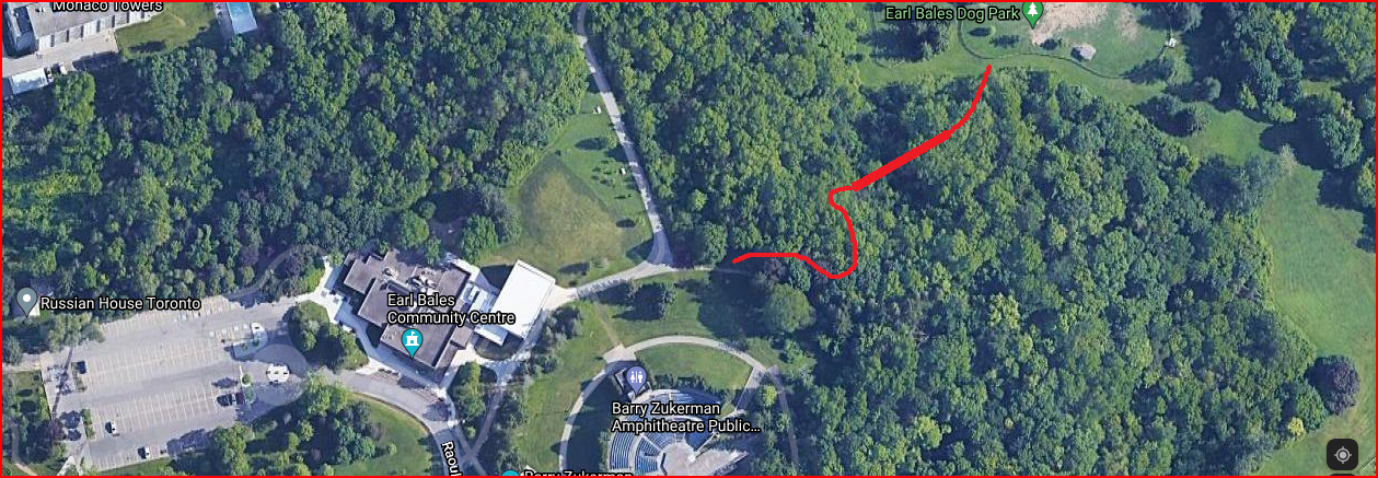
Anyone who lives or lived in North York and is of a certain age might remember the wooden footbridge in Earl Bales Park, which permitted easy foot travel from the lower level of the park to the upper, and vice versa. At both ends of the bridge, there were delightful little asphalt paths through the woods. The one at the lower level was enveloped by overgrowth long ago, and is no longer detectable, as far as I know (I haven't actually walked through the woods and checked for remnants). But on the upper level there's still a path leading into the woods and the edge of the gulley the bridge once spanned.
The bridge was torn down about 35-40 years ago. I have no idea why. I have fond memories of it from my childhood. To my mind, it would still be useful today, because the only way to go from upper to lower or lower to upper on foot is via unofficial dirt paths through the woods, via the ski hill, or on the steep asphalt road/path at the far north end of the park.
This area of the park - and other areas as well - has changed quite a lot over the years. Looking at the GoogleMaps link below, the dog park has only existed for about 20 years, and the area to the west of the dog park, which is now completely forested, was a large toboggan hill until about 25-30 years ago. That entire area was virtually clear of trees. I think city officials closed the hill to tobogganing because it was too dangerous.
I have made a Paint sketch (bottom) showing very approximately the configuration and location of the bridge (thicker line) and paths (thinner lines). The bridge was much shorter than I have depicted it.
Anyone here recollect what I'm talking about, and, even better, have some information on the bridge's dismantling and/or photographs of it? I couldn't find anything about it online.
https://www.google.ca/maps/@43.7547559,-79.4326622,261m/data=!3m1!1e3