News   Nov 04, 2024
 353     4 
News   Nov 04, 2024
 505     0 
News   Nov 04, 2024
 476     0 

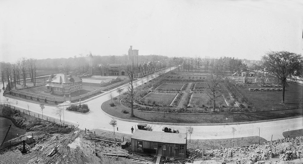
Evocative Images of Lost Toronto

I believe that "dark sky" is the result of damage to the photo.
And I wonder if the Bank of Nova Scotia building may still exist behind a new storefront.

Winchester Dr. at Danforth 1919
View attachment 131315

View attachment 131322

The "before" photo looks like an idyllic meeting of city and countryside. On the one hand, you have the urbane neoclassical facade of the Bank of Nova Scotia, streetcar tracks, pedestrians, and a car. On the other hand, you have a winding dirt lane through a wooded area next to a wide open field. It's like a scene from Caledon amidst an urban streetscape.
 
And another photo, in the Toronto Archives.View attachment 131279
Sorry to be stuck on the Bales family in Lansing (Willowdale) but here’s a 1955 Salmon photo of the Oliver D. Bales barn. I think it's the barn visible in the background of the barn-raising photo with the woman and children in the pony trap. I remember this barn at the northeast corner of Yonge and 401. It’s hard to believe that a barn was in that location within living memory. The Mclean-Hunter printing plant is visible in the background. The photo is in the TPL collection.
Oliver D. Bales barn 1955.jpg
 

Attachments

  • Oliver D. Bales barn 1955.jpg
    Oliver D. Bales barn 1955.jpg
    351.4 KB · Views: 1,345
Sorry to be stuck on the Bales family in Lansing (Willowdale) but here’s a 1955 Salmon photo of the Oliver D. Bales barn. I think it's the barn visible in the background of the barn-raising photo with the woman and children in the pony trap. I remember this barn at the northeast corner of Yonge and 401. It’s hard to believe that a barn was in that location within living memory. The Mclean-Hunter printing plant is visible in the background. The photo is in the TPL collection.View attachment 131360
Aerial view by Northway Surveys Corporation in 1949, showing part of St. Andrews golf course, the beginning of Yorkminster subdivision, and pre-401 at Yonge St. The Oliver Bales barn and Mclean-Hunter plant are near the upper left with Park Lawn Mausoleum just visible across Yonge St.
St. Andrew's June 1949.jpg
 

Attachments

  • St. Andrew's June 1949.jpg
    St. Andrew's June 1949.jpg
    413.3 KB · Views: 1,032
Photo taken by my grandfather from the 7th floor of the Temple Building, 1913.
1913-from-7th-floor-temple-building-jpg.131383

Excellent and rare photo! Thanks, nostalgic.
That white building would be Shea’s Hippodrome Theatre on what is now Bay St.
Shea's.jpg
 

Attachments

  • Shea's.jpg
    Shea's.jpg
    100.3 KB · Views: 1,034
Photo taken by my grandfather from the 7th floor of the Temple Building, 1913.View attachment 131383
The corner building is the Manning Chambers by E.J.Lennox, seen here in 1905 and 1955 (prior to being demolished for Nathan Phillips Square):

chambers 2.jpg


chambers.jpg
 

Attachments

  • chambers 2.jpg
    chambers 2.jpg
    300.8 KB · Views: 1,057
  • chambers.jpg
    chambers.jpg
    164.5 KB · Views: 1,029
"Evocative Images" is right! I had to go searching as I'm intrigued about the history of the Don there and further north, and if in 1910 there was a third railway RoW showing in the image posted above (A third set of telegraph and signal wires are clearly visible in this and other pics I'm looking at after searching. albeit not so clearly in the latter pic below)

Rather than belabour that point of conjecture, here's a pic from that era with stunning detail within the focal depth of field:

upload_2018-1-2_21-32-39.png

https://torontoist.com/2016/05/historicist-seton-and-sauriol/

Here's another:

upload_2018-1-2_21-36-4.png

https://torontoist.com/wp-content/uploads/2016/05/don-valley-1909.jpg

Beyond the obvious wonderment of staring endlessly to find myself in those pictures (and that's generations before I was born) I also have a technical puzzle to determine if those telegraph/signal posts are still hosting wires! I know that three railway companies ran tracks down that section of the Don Valley, but later one of them hosted another for overhead rights, and perhaps this is an abandoned trackbed in the near field of the latter pic above? I see neither wires or rails.

Anyone?
 

Attachments

  • upload_2018-1-2_21-32-39.png
    upload_2018-1-2_21-32-39.png
    803.9 KB · Views: 1,064
  • upload_2018-1-2_21-36-4.png
    upload_2018-1-2_21-36-4.png
    783.4 KB · Views: 977
I always suspected that photo was taken as part of the Prince Edward Viaduct planning and the kids just happened to be standing there. Either that or junior engineers just doing some field work.

Here is the full size image:

1909 - Don Valley - Looking West from near Danforth Rd. by A Stitch in Time, on Flickr
EZzwmh
Wow! Amazingly panoramic. I get a much better idea now of the lay of the valley, the O&Q spans are crystal clear in the distance just right of upper centre. Depth of field is amazing.

Needless to say the rails and telegraph wire are intact, a glint of light showing the latter. It appears that the Belt Line and Cdn Northern share the same RoW to the west of the river, but separate tracks, albeit I'm still looking for definitive map or photographic proof of that.

This leads me to believe it to have been the case:

THE TORONTO BELT LINE RAILWAY COMPANY
(property acquired by Canadian National Railway Company December 31, 1943).
Inactive since December 31, 1943.

[...]
upload_2018-1-2_23-13-43.png

https://s3.amazonaws.com/content.si...3d3ef499934d53ca95da7b74980b29f9f2a872fee7806
 

Attachments

  • upload_2018-1-2_23-13-43.png
    upload_2018-1-2_23-13-43.png
    36.5 KB · Views: 1,188

Back
Top