News   May 09, 2024
 129     0 
News   May 08, 2024
 1.3K     2 
News   May 08, 2024
 1.3K     2 

Miscellany Toronto Photographs: Then and Now

This one has been bugging me since Goldie posted it as I know the terrain very well.

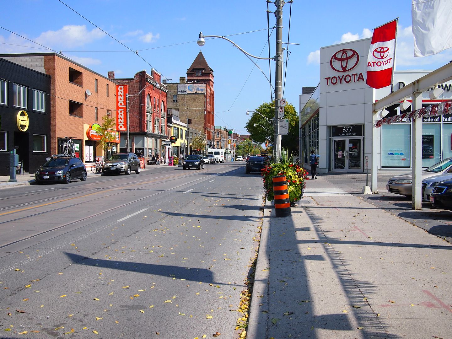
Yesterday I was driving down Donlands and passed this Victorian, now painted a hideous yellow, denuded of its verandah, and partly surrounded by a low-rise warehouse building. But it's the right age and, I believe, in the right location to be the farmhouse in the distance on the right. On Donlands, west side, just south of Somers. I couldn't get a decent shot myself as the light was against me but these from street view are pretty good, considering the access to the house is all but blocked.

View attachment 12581

You Go Girl!
I believe you may be absolutely correct.
That house is obviously one of the oldest on Donlands and I should have remembered it because I lived only 1/2 block away for 21 years.
The adjacent building was once a garage and gas station.
You'll notice in the foreground (the street paving and the duplicate manhole-covers) the old border between Toronto & East York.
 
A wonderful smile. The forsythia are blooming and the daffodils are tall enough to cut. April 27. Campbell House garden. University Avenue and Queen Street.

P4273104_zps75417181.jpg
 
Then and Now for April 29, 2013.


Then. Queen Street looking E from Baseball Place. December 26, 1954.

The place of baseball alluded to in this long gone laneway was Sunlight Park.

Before Rogers Centre, before Exhibition Stadium, before Maple Leaf Stadium, before Hanlan's Point Ballpark, there was Sunlight Park.

1084.jpg


http://en.wikipedia.org/wiki/Sunlight_Park


Now. September 2012.

1085.jpg


The Baseball Place sign lasted up until - I think - about 1990 or so, I used to be intrigued by it.
 
Then and Now for April 30, 2013.


Then. 'King Street and Leader Lane. Leader Lane on the right. c1920?'

1920kingatleaderlane.jpg


Now. September 2012. Well, there's a survivor back there; the white and brown building, which can 'just' be glimpsed in the Then picture on the far right. Also survivors are the red brick buildings seen in the distance - that's Colborne street. Colborne Street is a bit of a contemplative spot for me; very 19th century and next to no car traffic. I'll polish off an espresso while leaning against a lamp post there. It could use a sidewalk cafe. Someone should open one.

DSC_0536.jpg
 
Then and Now for May 1, 2013.


Then. St. Lawrence Drill Shed. 'Jarvis, W side, between Esplanade and Front, running thru to Market.' 1894 drawing.

1090stlawrencearedrillshed.jpg


1890 Goads below. It was gone by the time the 1903 Goads (not shown) came out.

10911890GoadsDrillshedonfutureStLawrenceMktsiteby1903goadsitwasgone.jpg


1092ArmouriesoriginalbuildingEsplanadeisthisnwviewandisthatoldfishmarketbuildingonleft.jpg


Now. September 2012. St. Lawrence South Market.

1093.jpg
 
Last edited:
Then and Now for April 30, 2013.


Then. 'King Street and Leader Lane. Leader Lane on the right. c1920?'

1920kingatleaderlane.jpg

Let's not forget this 1856 view:

f1498_it0002.jpg


And in 1890, on far left (building on right was the Leader Newspaper offices for which Leader Lane was named):


1892:


Attachments

  • f1498_it0002.jpg
    f1498_it0002.jpg
    97.5 KB · Views: 1,036
Last edited:
Let's not forget this 1856 view:

View attachment 12607


And in 1890, on far left (building on right was the Leader Newspaper offices for which Leader Lane was named):


1892:


As usual thecharioteer's images fill me with some regret for the loss of those buildings for a parking lot. Leader Lane would have been charming had it remained intact.
 
Then and Now for May 2, 2013.


Then. Mar. 10, 1916. 'Ice hanging from buildings in lane. Rear of 10 Toronto Street, N side.'

1099.jpg


Now. October 2012.

1100.jpg
 

Back
Top