News   Feb 18, 2026
 145     0 
News   Feb 18, 2026
 404     1 
News   Feb 17, 2026
 598     0 

Toronto Eglinton Line 5 | ?m | ?s | Metrolinx | Arcadis

The average "Torontonian" may know what each line is and where they go - actually evidence this isn't true either - but the average tourist will read the map and will not know what the mode of transport is. Nothing indicates that line 6 is a LRT running at grade in traffic while line 5 is an LRT that is partially underground and partially at grade. The TTC map doesn't state that these are LRT lines. Likewise, someone visiting Toronto would see this map and have no idea about all the streetcar lines that exist unless they also see the full system map that includes streetcars. I feel like that would be something that is useful to know when riding the subway. Regardless of the streetcar map, it would be great to indicate which subway stations connect to which streetcar on the subway and LRT map. That currently does not exists either, so not sure why line 6 is special in that regards besides marketing.
You’re way overthinking this.
 
There are times when the bus will be faster than a subway, too. Should we remove subways from the map as well, then? It would make it awfully empty....

Of course, this point also ignores the fact that to the majority of users - those who travel at the busiest times of the day - the rapid transit line is faster than a bus could ever be.

Dan
No, quite the opposite actually. I think we should add infill stations to line 1 and 2 so I can hit each strip mall on the route.

Jokes aside, some stops don't need to exist on the eastern portion of line 5. Otherwise we get a rapid transit line in the eastern portion that is only rapid during rush hour, but a streetcar during every other time. That's not great.
 
The same as in many cities. This shouldn't be primary concern. Changing it will confuse more people that it would fix. Perhaps we should have a fantasy thread for route numbers and 400-series highway numbering.
I agree. So perhaps the best would be for line 6 to be a streetcar line instead. But I digress and will leave it at that.
 
The average "Torontonian" may know what each line is and where they go - actually evidence this isn't true either - but the average tourist will read the map and will not know what the mode of transport is. Nothing indicates that line 6 is a LRT running at grade in traffic while line 5 is an LRT that is partially underground and partially at grade. The TTC map doesn't state that these are LRT lines. Likewise, someone visiting Toronto would see this map and have no idea about all the streetcar lines that exist unless they also see the full system map that includes streetcars. I feel like that would be something that is useful to know when riding the subway. Regardless of the streetcar map, it would be great to indicate which subway stations connect to which streetcar on the subway and LRT map. That currently does not exists either, so not sure why line 6 is special in that regards besides marketing.


Well that's because its not operated by the TTC and is technically not within the same system so why would it. It is marketed as a separate service. Although, it would be nice to have the line show up in the subway map.

On the other hand, the streetcars and LRT lines are operated by the TTC but are marketed differently, even if Line 6 is more akin to current streetcars and Line 5 is more like a subway. It doesn't make sense besides marketing.

I am not sure any pickup line about transit will make anyone new friends...
Changing Line 6 to a streetcar line on the maps would actually be to the detriment of riders, as all the individual stop names would be removed in line with the other 5xx routes. Also the average Torontonian or tourist cares much less than you think they do about the specifics of the train they are riding in. The vast majority of people who see the 6 roundel on a map and show up and see it runs at grade will not care. In addition, using subway-style branding should make the off-board payment at surface stops slightly less confusing as it is in line with subway standards.
 
but the average tourist will read the map and will not know what the mode of transport is.
Under what circumstances would a tourist who is not a railbuff need to use line 6?

Otherwise we get a rapid transit line in the eastern portion that is only rapid during rush hour, but a streetcar during every other time. That's not great.
On opening day, I observed that vehicles on the eastern section were doing upwards of 40 km/h in some segments (presumably they'd be able to go even faster, if there was TSP) and upwards of 50 in between Sloane and O'Connor, and in between Golden Mile and Birchmount. Possibly others, too

Where, on the legacy streetcar network, can a vehicle reach a speed like this???? Line 5 has a lot of power that will be tapped when we can get TSP going.
 
Where, on the legacy streetcar network, can a vehicle reach a speed like this???? Line 5 has a lot of power that will be tapped when we can get TSP going.
I certainly see such speeds late at night - though surely not allowed.

There is the Queensway section of the 501/508 route - but that's the exception, And now the car speed limit has been dropped from 60 to 40 (why??? there isn't even a sidewalk!)
 
Changing Line 6 to a streetcar line on the maps would actually be to the detriment of riders, as all the individual stop names would be removed in line with the other 5xx routes. Also the average Torontonian or tourist cares much less than you think they do about the specifics of the train they are riding in. The vast majority of people who see the 6 roundel on a map and show up and see it runs at grade will not care. In addition, using subway-style branding should make the off-board payment at surface stops slightly less confusing as it is in line with subway standards.
That's a fair point, but then maybe it's worth going the other way about it and making the necessary upgrades to Spadina, St. Clair, etc to have off-board payments, better shelters at stops, and actually appear on the map so people know where they are going. Once TSP is implemented, if this actually happens, on Spadina AND Line AND line 5 east section then what really makes them all that different besides the vehicles used?
 
With traffic light priority Line 5 will perform excellently.

With traffic light priority and vehicles that run smoothly across the rails and don't require speed limits of 10 km/h all over the place Line 6 could perform excellently.

512 with signal priority could operate very well.

509 and 510 with signal priority would operate well.

Line 5 is rapid transit already. Line 6 could become rapid transit. 512, 509, and 510 will never be rapid transit.

Why? Because of intersection spacing, track build, and neighborhood pedestrian volumes. It would be simply too dangerous to run trams down the middle of downtown streets at high speed with pedestrians running across the street from behind parked cars, and tourists not looking where they are walking, especially with a track and wheel design that leads to less protection against derailment.
 
Streetcars/trams an LRTs can be equally fast and reliable and also equally the opposite.............they are what you make them.

Generally speaking, what separates streetcars/trams from LRT are the features of the vehicles themselves. The basic technology is the same but LRT vehicles have 3 main advantages over standard streetcar/trams that set them apart:
1} The vehicles can be joined together and not just articulated
2} LRT vehicles can be driven from both ends of the trains
3} LRT vehicles always have doors on each side of the train.

There are some exceptions of course but generally speaking if a train has ALL these features they are considered as LRT and if not, they are considered streetcar/trams.
 
Perhaps this will solve the issue of what we call line 6: the cost to modify signage, plus the cost to pay Mosaic to do it, plus the premium Mosaic would charge to do it, plus the fee they'd charge to assess how much they'd charge for the change, would put this probably over a million, and there was already a few times more than that spent on changing the station ID signs at each of the stations due to reasons also not supported by a strong business case. There's no compelling reason to spend that kind of money unless it's part of a larger re-designating of various other lines which would be ill advised anyway.
 
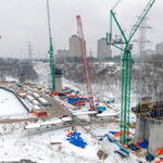
Tried L5 today from VP to DV, and later DV to Yonge. The above-ground section wasn't too bad, but it was annoying that it decided to stop at Swift dr. for no reason (no station there) despite there being a few seconds of green light remaining. On the second trip, I noticed transsee predictions initially appeared more accurate than for the real subway lines (refreshing the page does not reset back to 1:00 all over again, before refreshing straight to 0:00, but rather the countdown stays consistent, i.e. refreshing 0:33 continues the countdown where it left off), but turns out the arrival times were outright lying. A train was "due" to arrive at DV at 20:36:44, but in reality it finally showed up at 20:42, and transsee was still showing 1 min when the train started departing. It did seem to reach 50 or 60, but not 80 (is 80 ever supposed to happen in service, or only during testing?), and while it didn't feel overly fast, I had a hard time imagining it going that fast in mixed traffic with cars going at the same speed.

In metro and tram cities in Europe like Prague or Vienna or Budapest, for short to mid distance journeys, even in the city centre, it's usually more efficient to take the surface tram rather than to take the metro. Does that mean that they got screwed on their subway design? Or is it that different forms of transit provide different kinds of functions in different circumstances for different kinds of people that don't fit neatly into your extremely narrow parameters of what rapid transit shouldn't and shouldn't be?
Apparently some of them even have parallel tram & subway lines shadowing eachother. So maybe we can, in the indefinite future none of us will ever live to see, build a real subway line underneath the existing line 5.
It's usually faster to take the lowly, disgraced 501, 504, 505, 506, 508 across from one end of the "U" to the other, so according to the parameters of your argument, we can definitely remove line 1 from the rapid transit map.
It's faster to take the 504 from Yonge to University than line 1 from King to St. Andrew? I doubt it, but what do I know.
Otherwise we get a rapid transit line in the eastern portion that is only rapid during rush hour, but a streetcar during every other time.
Why would it be more rapid during rush hour than off-peak? Shouldn't it be rather the opposite?
Under what circumstances would a tourist who is not a railbuff need to use line 6?
Under the circumstances that they are bright enough to know Toronto exists north of Bloor (I, on the other hand, could never believe Toronto exists south of York Mills or Sheppard, let alone its southern border sitting on the shore of a lake 10x its size!), and if they're coming from abroad, they surely must know that the world is way bigger than that.
 
Last edited:
Under what circumstances would a tourist who is not a railbuff need to use line 6?
The only time I've ever been in Guelph, was to do an application interview at U of G. So someone outside of Toronto applying at Humber Poly might take Line 6 to the campus. (And they'd probably show up late!)
 
February 11, 2026:

Part 1:

Avenue Station Secondary Entrance Fare-Paid Zone:

IMG_7501.jpeg
IMG_7502.jpeg
IMG_7503.jpeg
IMG_7504.jpeg
IMG_7505.jpeg
IMG_7506.jpeg


Part 2: Avenue Station Secondary Entrance Stairwell will be up tomorrow.

ETA: It will be interesting.
 
Last edited:

Back
Top