Mississauga Hurontario-Main Line 10 LRT | ?m | ?s | Metrolinx

Mississauga is considering having the Downtown Loop run along Confederation Parkway rather than Duke of York Boulevard to capture more riders from future development.

New rendering showcasing the multi-use path at Mineola Station:
View attachment 484227

There will a virtual open house on Thursday, June 15th at 7pm.
Admittedly I at once thought up confederation made the most sense. But I do think this is just a bit too far west. I get that buildings have been built here but the square one lot will be built soon and we should be encouraging as much as possible to be built there. Also confederation does not go by city hall or the performance arts centre. Missing those two places would be a big miss in a city which already lacks places to go for things to do.
 
Why can’t some of the lrts go around the loop while the others go straight up and down hurontario.
Not in the plan at this time

There is even the thought of having the line split in 2, but would require platforms for the intersection just like it is today for route 2 and 17 with extra travel time up to 15 minutes..

Since they are only planning on running one car LRV with service 8-12 minutes as plan as well not set in stone yet, that the loop spiting would see a LRV every 16-24 minutes. Doesn't encourage people to leave the car at home or use transit. You can walk faster from M City or Parkside faster than wait of a LRV.

So to service 30% of riders using the loop will mean 70% of the riders must spend an extra 10-15 minutes travel time in each direction if not more.

It boil down that the loop is needed to feed the white elephant in the city core than moving riders quicker to/from where they want to go to and doesn't encouraging people to use transit than the car if they own one in the first place.

The big issue that the transit hub has been in the wrong locations since the 80's and only 25% of the actual size needed today let along 2040
I agree the location of the transit hub is a disaster and id move it. I can see how the loop could be beneficial though to some. But there really should be two services. It’s not that complicated.
 
I agree the location of the transit hub is a disaster and id move it. I can see how the loop could be beneficial though to some. But there really should be two services. It’s not that complicated.
Been pushing for an transit hub since 2010 to handle 150000 by 2040 with the current one seeing close to 60000 in 2019 that was bult for a city of 250000 seeing 25000 a day, not counting GO or Brampton in 1995. You are haft way there now with everyone.

I call for it to be in the north-east corner of Sq One with a true connection to the transitway, a possibility connection to the Milton Line and the LRT staying on Hurontario. So its a 5/10 minute walk to Sq One which is no different for Yonge-Queen or Dundas Station as well to City Hall

They talk about 75,000 for the core and if done right, more like 200000 including employment. Various developers are calling for support to build office towers and that not going to happen for another 30 year plus with tons of vacant land with free surface parking. Looking at $30-60,000 per parking spot underground that is only use 12 hours a day at the best of times. There hasn't been a new tower in the core for the last 25 years. The Exchange District is replacing one that was torn down and will become the tallest of all existing towers once built.
 
While they're at it why dont they consider extending the loop all the way west to Erindale GO and south to Queensway? It would be the most optimal way to capture more riders while making sure no one gets anywhere in a reasonable amount of time.
Somewhat less cheekily, maybe eventually the Dundas BRT could be upgraded to LRT, interline with Hurontario up to Burnhamthorpe to connect to MCC. Less crazy than extending Line 2 to MCC.

With this loop, they could operate it as a separate service from MCC perhaps down to Port Credit.
 
Somewhat less cheekily, maybe eventually the Dundas BRT could be upgraded to LRT, interline with Hurontario up to Burnhamthorpe to connect to MCC. Less crazy than extending Line 2 to MCC.

With this loop, they could operate it as a separate service from MCC perhaps down to Port Credit.
If one looks at today service on Hurontario, ridership falls off at the Queensway and why the 103 doesn't run to PC any more. If and when Development happens on Hurontario from the Queensway to PC as well around it, demand for service will be less than going to Brampton. One reason the thought been there from day one for splitting the line in 2.

Only has to look at the plan development for Eglinton area to see ridership will out strip the south end even with the development from Cooksville GO Station to King St.

In time, Dundas BRT can be upgraded to LRT only East of Hurontario, but it doesn't fit in Metrolinx plan to have continues service From Kipling to Waterdown. The demand will nor be there for an LRT west of Mavis Rd until all those plaza are converted to mixed-use. You can't put in an light BRT west of Erin Mills today, especially in Oakville even though it been on Halton Master Transportation plan as well Oakville for over 30 years.

Until the blight on Dundas east of Hurontario disappear, only need an BRT until it can support an LRT. Having the LRT on Dundas going to MCC is an operation issue and only take an issues that service become an issues on Dundas. Best to leave Dundas as its own line as well not having the single seat ride.

The last time I did a full review of ridership on Hurontario, it was a 40/60 split at CCTT and this was well over 8 years ago with the south seeing the higher number. Also before Brampton started to run service to MCC as well Mississauga bus routes were change at CCTT
 
While they're at it why dont they consider extending the loop all the way west to Erindale GO and south to Queensway? It would be the most optimal way to capture more riders while making sure no one gets anywhere in a reasonable amount of time.
I honestly think they need a separate line extending from UTM thru erindale go towards MCC but it feels like there needs to be more than those locations for it to make sense to build.
 
Staring Monday June 19 to Sunday June 25 at 10pm, Elm St W is close for utility relocation with route 3 on detour. Work was supposed to happen on Sunday with closure, but nothing was taking place. It supposed to be close next Sunday as well.

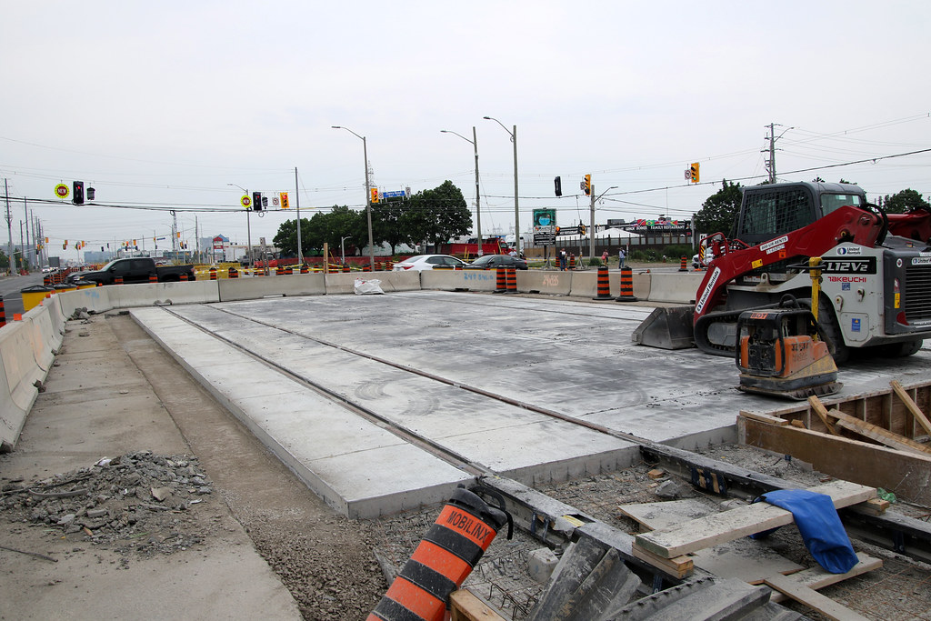
The car folks will enjoy the reopening of the full intersection on June 18, subject to weather. They have to pour the top coat for the track on the southside as well pave the gap between the guideway and the road.

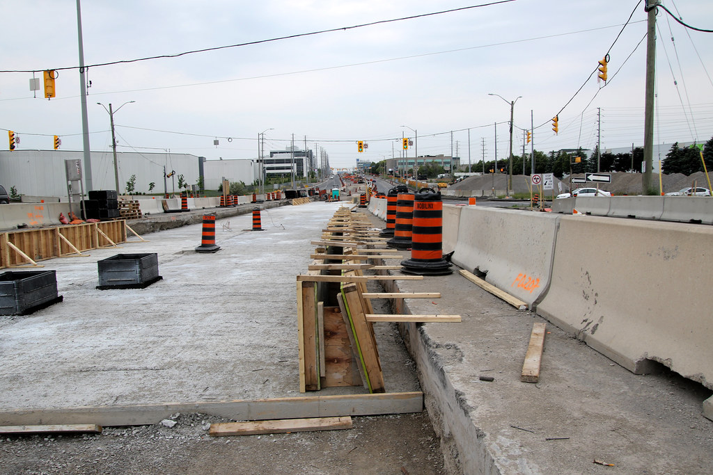
no one working on the line other than a 5 man crew getting tracks ready on Top Flight for leveling and alignment so concrete can be pour to anchor them in place. Once done, the crew will move to the westside of the only entrance and exit for Comfort Inn.

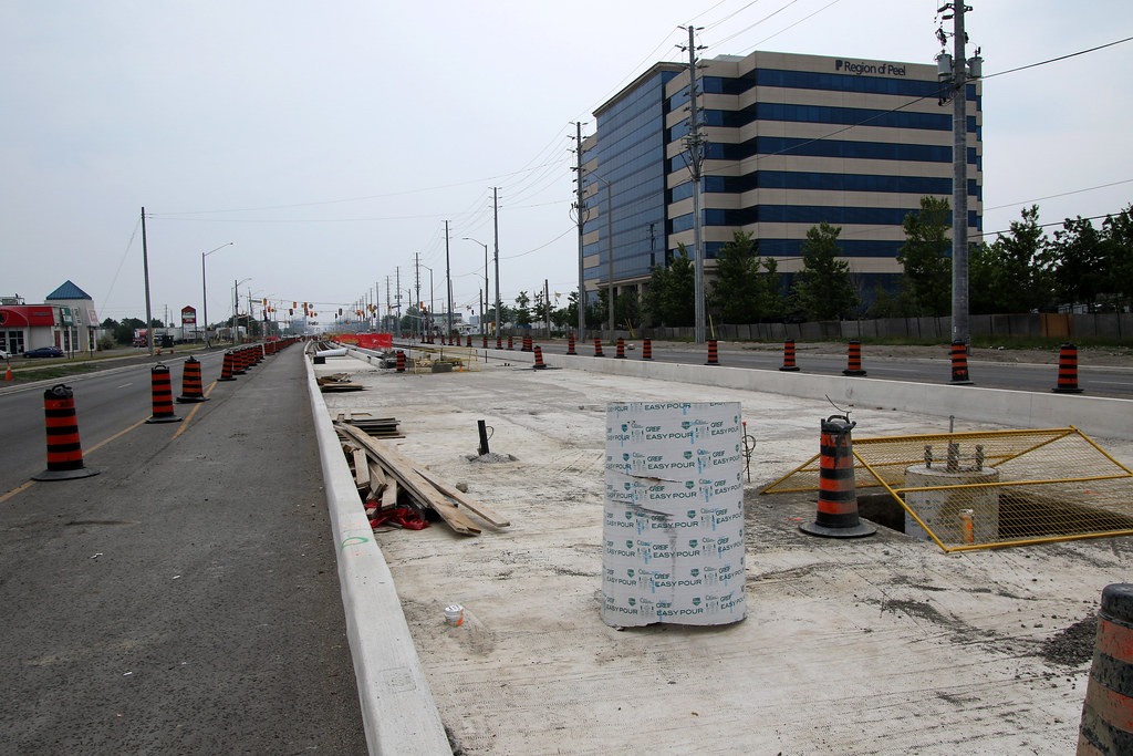
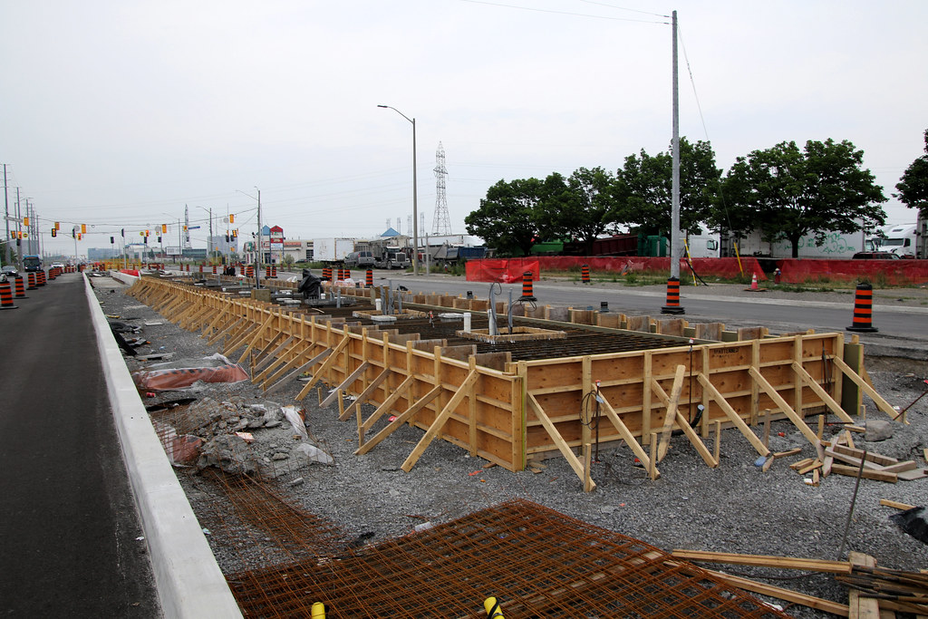
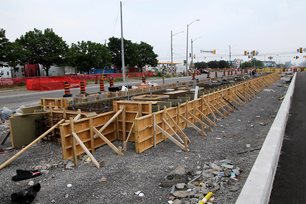
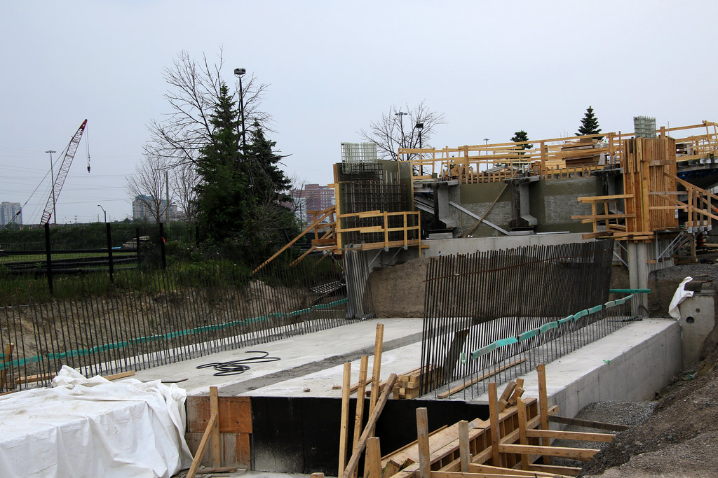
No one working on the hwy 401 westbound off ramp that has the base poured and working on forming the road curb for the guideway. The same thing is suppose to happen for the eastbound off ramp.

The 401 overpass is ready for the guideway built on it.

Did a walking tour from Britannia to the 407 parking lot and wasn't sure how much I would see as I could see the rain coming as I left home. It started to spite as I near Top Flight that only las a few minute. Once home it poured.

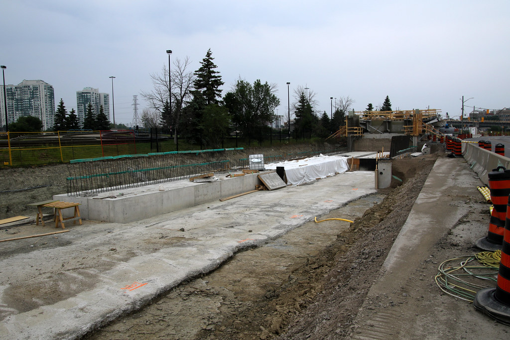
Nothing much has happen for the Britannia platform nor the guideway going south that is missing. Tracks still not in its final place for Matheson. Form in Place for Bristol platform. Work underway for Courtneypark and Derry Platforms.

By the looks of things, switches will be place north of Traders as well north of Kingsway. Trader could be a double crossover while the area north of Kingsway will see 2 single switches.

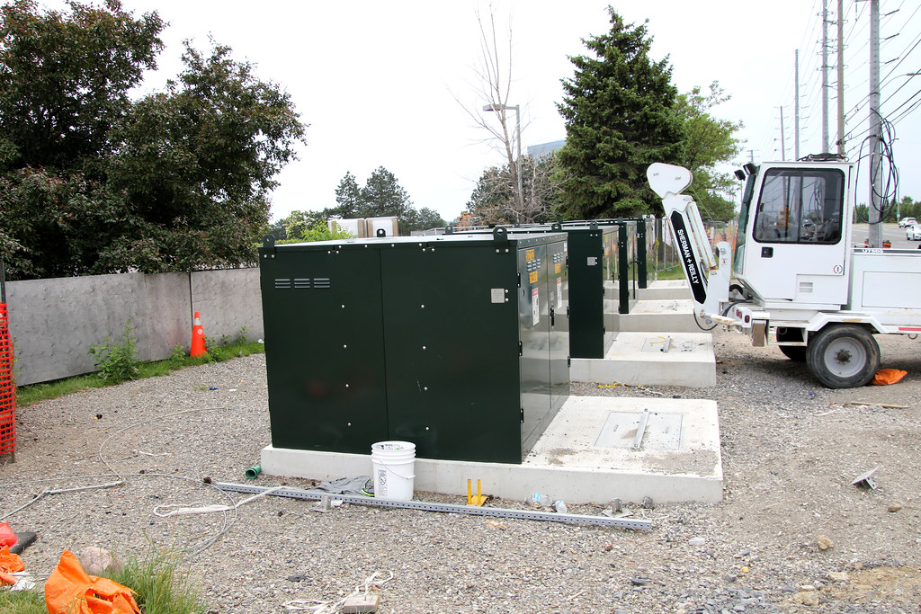
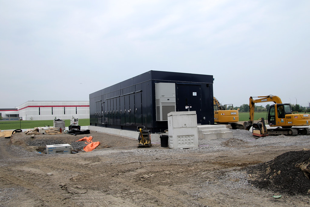
Just south of Skway the first substation in place with grading taking place on both side of it. Never noticed it until taking the bus to Sq One, there is a substation at Top Flight on the west side and it partly shows up in one of the photo shots of the intersection.

The outbound track is being form just out of site along with poles foundations. May see that track in another month or so.

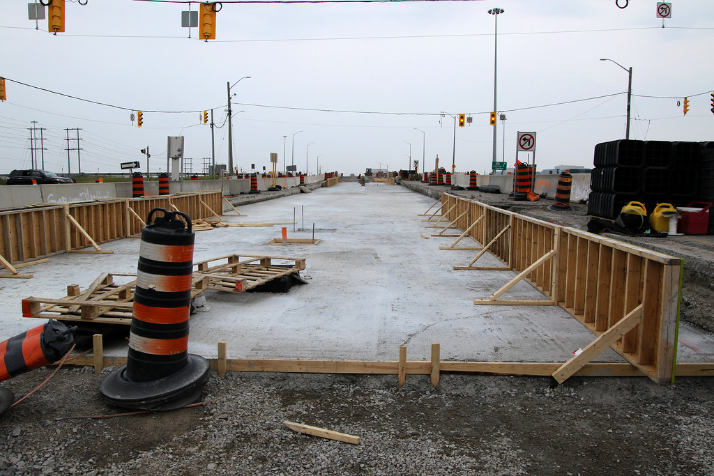
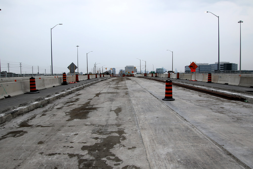
The bulk of the guideway built from Matheson to just north of the Kingsway have tracks in place with a few areas waiting for concrete pour as well having tracks install. There are 16 sections of rail on the 401 overpass waiting to be splice into 4 tracks for the close intersection for the 401 off ramp.

They have added more base to support the retaining wall for the ramp to Rathburn with the south side missing a lot of it.

One more intersection north of Courtneypark Dr to be close for the guideway along with the 401 eastbound off ramp, Britannia Intersection, Top Flight Intersection to complete the test area. Top Flight is setup to have the guideway cross the northbound lanes that is ready to shift the traffic to the new lanes once the guideway is in place. Once traffic is shifted, the centre guideway can be built to connect to the section north of Kingsway.

Since we are about 18 months way from the completion date, I am expecting it will be about Q2 2025 with service starting O3/Q4 of 2025 at this time Time will tell later on this year when we may see service.

At this time, there is no room north of Top Flight to add any more industrial unless Hydro One allows it under their system which I don't see happening.

Photos will start to be posted on Monday with over 200 of them.

The one thing I see that is odd is the centre pole foundation in the guideway.. Most are single ones with a number of locations having 2 side by side to 3 in the same location. Only a few so far that I have see, The other is the hydro running beside the tracks to/from the OMSF where the poles are next to the transmission lines and shorter than the ones being upgraded on Hurontario. Are they to be upgraded like the rest or left as is since the tracks will be used to move the LRV's in/out of the yard??

I see the guideway in place for the test area by late fall and maybe the OS will be in place by year end or Q1 2024. This also applies to the guideway to Eglinton
 
June 11
All the photos are now on line and brake this down into 2 posting of a few of them.

Not sure why hydro has set these boxes up at Britannia other than space
52968775762_996944e424_b.jpg


First substation at Skyway area
52969542381_49db2ae126_b.jpg


To the very Right At Top Flight you can partly see the 2nd Substation as well space to built the guideway across the northbound traffic lanes and the shift traffic to the new lanes. Will then allow the building of the centre guideway to the section north of Kingsway
52970076908_43f2ba17d4_b.jpg


This is the largest area I have seen so far to say 2 single switches will be use there than the double crossover by Traders
52969762109_608c287779_b.jpg

52969762384_3f1f8ecdd0_b.jpg


Hard to say if paving took place today with the rain, but don't expect to seen the concrete top coat pour at Derry. No big deal if its a day late opening
52968995807_6a0f76ec69_b.jpg

52970047543_6be50ea54f_b.jpg
 
Post 2
Derry platform almost ready to have concrete pour for it. They have done this as well at Courtneypark different than Matheson with Bristol being form the same way
52970047083_6c1ca98453_b.jpg

52969732089_559de3a28a_b.jpg


At the close 401 exit and
52968825227_2a35dbc19c_b.jpg

52968825712_7c00307257_b.jpg


401 overpass
52968825887_66802540b3_b.jpg


Rathbun Ramp
52970018540_bfc4ba5f35_b.jpg

52970018775_b16423cdfc_b.jpg


Crew working on Top Flight
52969761064_f66f98863c_b.jpg

52969994895_176a6ae425_b.jpg
 
Hazel McCallion Line - Virtual Open House


On June 15, 2023, from 7:00 PM - 8:30 PM Metrolinx is hosting a live virtual open house to share updates about the Hazel McCallion Light Rail Transit Line.
Metrolinx project experts will make a brief presentation providing an update on the project, major milestones, bike infrastructure and community engagement.
The presentation will be followed by a question-and-answer session with our project leaders.
To get involved, register to receive a link to the live stream of the open house and submit your questions online ahead of or during the live presentation, for the project leaders in the form below. You may also choose to upvote other participant questions that have been submitted. Top voted questions will be answered during the Q&A session. Any questions that are not answered during the live session will be responded to within 14 business days.
If you have questions about the event or how to participate, please reach out to us at peel@metrolinx.com
We look forward to welcoming you!


e36db44e-8d95-fbcf-405c-7dcd6291576b.jpg


Contact Us

If you have any questions or concerns, please feel free to reach out to Metrolinx Community Relations team at 416-202-7500 or email Peel@metrolinx.com
For more updates and information on this project, and to get the latest news on what’s happening in Peel, subscribe to our newsletter: www.metrolinx.com/hazelmccallionline
 
I agree the location of the transit hub is a disaster and id move it. I can see how the loop could be beneficial though to some. But there really should be two services. It’s not that complicated.

Just dedicate one car to running the loop and nothing but the loop, slotting in between the rest that run on by. Those that need to go to destinations on the loop can transfer, and if the straight-through's run every 10 or 15 minutes, then it's only a 5 or 7.5 minute wait for the transfer onto the circulator.
 
Just dedicate one car to running the loop and nothing but the loop, slotting in between the rest that run on by. Those that need to go to destinations on the loop can transfer, and if the straight-through's run every 10 or 15 minutes, then it's only a 5 or 7.5 minute wait for the transfer onto the circulator.
This is what I was thinking. You could even make it a free loop if you wanted, like they have in the CBD on their trams in Melbourne.
 
This is what I was thinking. You could even make it a free loop if you wanted, like they have in the CBD on their trams in Melbourne.

<spit-balling>

Heck, use a curb-guided bus (Wikipedia | Guided bus) for the thing, and then all you have to do is make a tiny bit of the right-of-way at the transfer platform compatible with both the guided bus and the LRT, and the rest of the loop can be added on the cheap with just painted bus lanes and transit priority signals. No extra track, overhead electrification, or switches required. The savings would pay for multiple circulator vehicles that could slot in more often than just that one every 5 to 7.5 minutes...
 
Last edited:
Just dedicate one car to running the loop and nothing but the loop, slotting in between the rest that run on by. Those that need to go to destinations on the loop can transfer, and if the straight-through's run every 10 or 15 minutes, then it's only a 5 or 7.5 minute wait for the transfer onto the circulator.
Or maybe the loop + down to Cooksville, especially in the event Milton Line is upgraded. I could see a one seat ride to a GO station being useful for overall travel time to MCC.
 

Back
Top