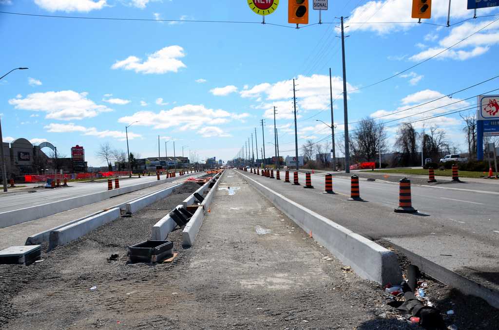
Mississauga Hurontario-Main Line 10 LRT | ?m | ?s | Metrolinx

The latest word that I've gotten on it is that they have in fact been working on it over the past month-plus.

But they are also suffering from some very serious soil issues there, and so progress is going much more slowly than had been intended

Dan.

What's an example of a soil issue? Too much sand?
 
This thread has been quiet lately so time to spice it up! But first, I don't know why these two other projects are showing up:
1680696525457.png


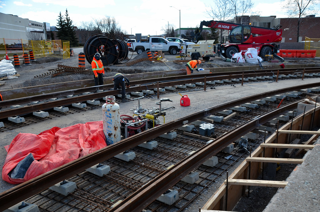
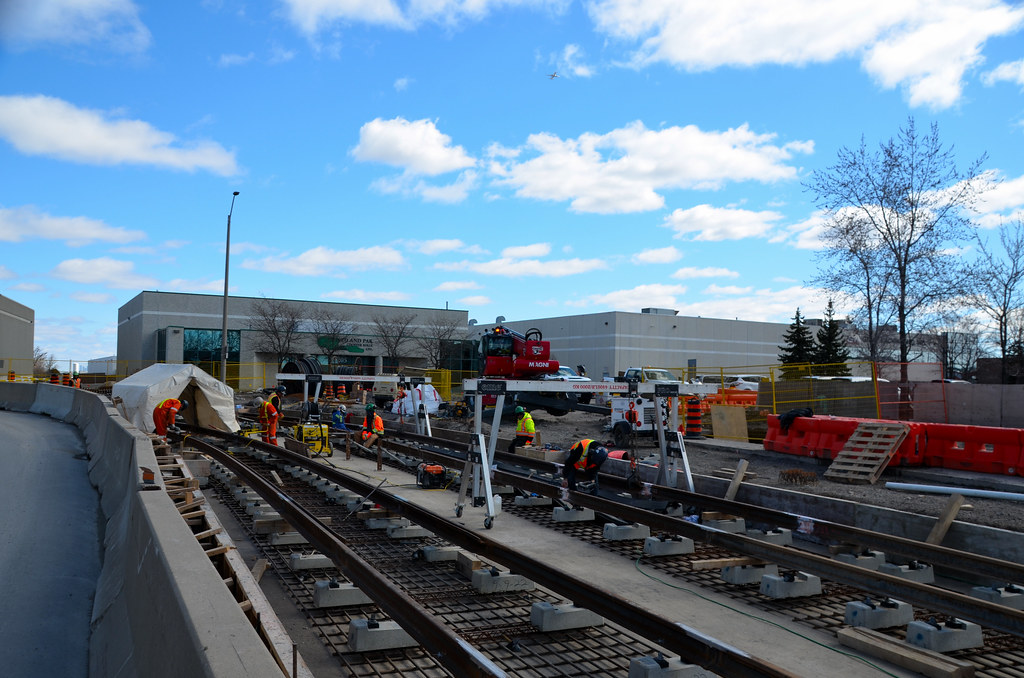
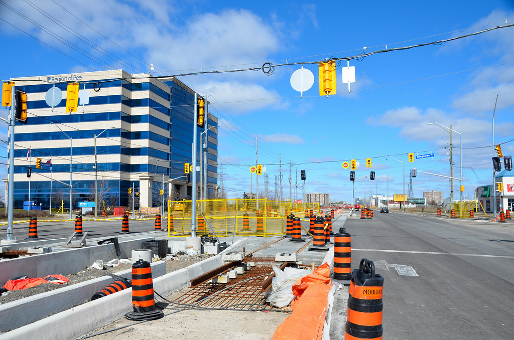
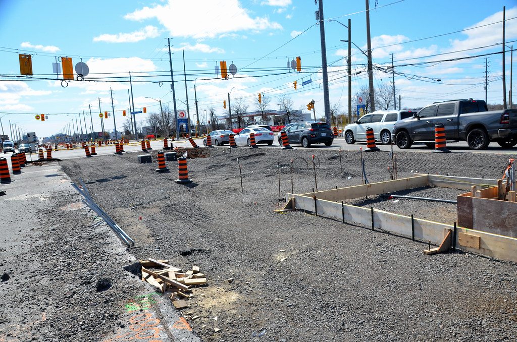
Anyway, to the photos taken April 2nd. I'll have more of Port Credit station in a separate post.
1680696725063.jpeg

1680696600522.jpeg

1680696624193.jpeg

1680696671775.jpeg

1680696693168.jpeg
 
Looks like someone is hacking UT site this past week as this not the fitst time things have shown up in threads that shouldn't be there in the first place.

Shot the elevated section last week and only 2 more piers to be form to support the the elevated line before the beams can be place. at City View. The ramp piers are very close to each others that will have short spans beams. Nothing has taken place for the remaining piers for the 403 overpass. The photos are next in line to be uploaded as I am uploading the last of the backlog in batches that will bring me to be up to date finally. Just up loaded March 7 first batch

They were removing the asphalt from the ramp to Station Gate on Rathburn and expect work to start there either for utilities or the guideway shortly. If its for the guideway, we will see the station been built as well.

Noticed form work for one of the elevated section to pour the deck and can be seen in Tim shots.

Still a lot of utilities work still taking place from Burnhamthrope to the Queensway with grading taking place between the CP bridge and Fairview. New curbs will be next before they can pave the new road before shifting to the east side.

Haven't had the chance to look at other areas, but expect to see a great amount of tracks in place between Courtneypark and Derry road now.as it was being place the last time I was up there.
 
Dropped by the office late this afternoon and the section between Pinetree Way and Minneola is back to single lane. Traffic has been shifted to the east while utility and sewer main work occurs on the west side. I also received a Metrolinx construction advisory confirming the above as well as stating hydro pole replacement will be happening as well. It seems like only a few years ago that they replaced all the older poles with taller ones after the ice storm back in 2013.

Anyway, here are some more photos, also from April 2nd:
Eaglewood bridge really taking shape:
1680739212293.jpeg

1680739278271.jpeg


The usual Port Credit push box shots:
1680739310727.jpeg

1680739362770.jpeg


QEW Activity:
1680739434729.jpeg

1680739460272.jpeg

1680739489981.jpeg
 
Dropped by the office late this afternoon and the section between Pinetree Way and Minneola is back to single lane. Traffic has been shifted to the east while utility and sewer main work occurs on the west side. I also received a Metrolinx construction advisory confirming the above as well as stating hydro pole replacement will be happening as well. It seems like only a few years ago that they replaced all the older poles with taller ones after the ice storm back in 2013.

Anyway, here are some more photos, also from April 2nd:
Eaglewood bridge really taking shape:
View attachment 466766
View attachment 466767

The usual Port Credit push box shots:
View attachment 466768
View attachment 466769

QEW Activity:
View attachment 466770
View attachment 466771
View attachment 466772
Thanks for the updates.

I find it strange that those new hydro poles are to be replace as they were only installed in the last 2 years. Looking at them and the ones in the north end, they are not as tall as the north end and most likely don't meet ML standards for hydro lines next to an LRT line. A good case where they should had been bury in the first place.

There is a substation going in on the east side of Hurontario next to the rail corridor.

Not surprised seeing forming on the Englewood bridge as it was ready for beams in early March. I have asked the question and haven't heard back yet as if the guideway will be in place before they open the new bridge with a traffic light intersection. I expect it will be as the existing bridge will be remove to allow for building the retaining wall for the creek up to where it goes under Hurontario.

Now spring is here, time to get work underway for the utilities that will reduce to 2 lanes in place of 4 over the winter months.

Your shots shows the box under the rail corridor has moved a number of feet to date.

They are building the new road base of the northbound lanes under the QEW and assuming new retaining wall will be built after the concrete is pour for it. I assuming the missing lane for the QEW will be place once the retaining walls are in place.
 
Was planning on spending the day shooting the corridor today, but the winds were to raw

As it stands today, Britannia, 401, Vision Dr, Ambassador, Derry Rd and Top Flight still need rail across those intersection to complete the test area for the new cars.

Crews were working on the rails for the Top Flight and Edward Blvd intersection that is close until April 18. Traffic lights in place at the intersection for one way traffic to/from the 407 loop, local business and to the stock plie area.. The westbound road is in place with the tracks in the centre on Top flight with the tracks going on the east side of Edward Blvd.

Construction has started on the Derry Rd station platform and it well north of Derry compare to the Mathison platform.

Unless my eyes were playing tricks on me, the area that had a top coat of concrete to fully encase the track has been removed. It was one of the areas I wanted to check out today.

Most of the northbound track is in place from Courtney Park to Ambassador with some missing area. Work underway for the southbound track.

Work is still taking place in the areas for the guideway north of Eglinton and not ready yet for concrete form work.

It looks like a pier support has been removed on Rathburn which I thought was odd when I saw it a few weeks ago as it was very close to another one in the first place.

Photos should be up this week as I have finally got rid of the huge backlog with 2 days of photo still to be uploaded
 
Starting April 13th to May 8, Nahani Way intersection will be close for track work. Pedestrian Walkway over the Guideway area is 200' south of the intersection with no north crossway in place. This leaves Bristol and Watergarden to be done between Britannia and Eglinton.

Bristol platform is in the process of having forming built and place on the ground for it before being built as one box for the station platform.

4 transformer boxes have been installed on Britannia just west of Hurontario with tubing being place underground today. All new hydro poles on the westside of Hurontario are taller than the current ones that the top wires are starting point of 3 wires and over 10' higher to get to the top of the new poles. I guess fear of arcing between the LRT and hydro poles is the reason for taller poles.

As far as I could see today, platforms have been installed on the bottom beams flanges for the section of the elevated section. This will allow the pouring of the concrete deck for the track work that will take place later this year.

The last 2 rebar columns are in place on Rathbun to be form and concrete pour before the cap beam can be form. One form column that was close to another pier which I though was odd has been removed.

Rathburn east of City Center/View is been clean up and looks like it will return to normal use late this month.

Just got back the rebuilt camera today and since I still had daylight and a glorious day for shooting, decided to do a test run with the cameras like I wanted to do last week. Walked from Britannia to Sq One looking and taking photos of the corridor.

Nothing has happen yet for the area south of Britannia to where the guideway starts. No change to the area where I think a crossover will be going in. The area where there was a top coat of concrete has been removed.

Ties being installed from Matheson to Watlne for both tracks with rail sitting on top for the northbound track waiting to be splice together.

From Matheson to Bristol, guide system in place to allow the pouring of the first of 2 centre curb with forming machine setup at Matheson. The next block south of Bristol will be stake with guidelines.

From there on to Kingsbridge things are in various stages of work.

Lots of stacks around the creek area at the south end of the plaza at Kingsbridge that it looks like the westbound 403 ramp will happen well north of the current location as well shifted to the west to allow the LRT get to the 403 bridge. The other option I see is the LRT guideway moving to the west side south of Kingsbridge to start climbing the elevate line over both the 403 westbound ramp and 403 itself.

I thought I shot about 125 photos and boy was I wrong. End up shooting 425 that included 5 urban projects as well the LRT stuff. Will take a few days to get at them with this weather for shooting things at hand that I am out dated on.
 
Last edited:
April 7
Lot more up on site not only for this day, as well this year now I am caught up.
52816006690_2543f3b41b_b.jpg
52816051768_c206ec65c1_b.jpg

52815035997_d139ff807d_b.jpg

52815792724_0a732f2aae_b.jpg

52816006960_d30fffa426_b.jpg

52816052293_105d827bc9_b.jpg


The Derry Platform is being built differently than Matheson was, as well Bristol that just started being built. It is also futher north than the other 2
52815792149_8f2c2b2e1a_b.jpg

52816007455_0123becc85_b.jpg

52816007485_8aeb3fb57c_b.jpg

52815036887_808b9cd9a3_b.jpg
 
Looks like the west side of Mineola is to be close this weekend as I only saw one sign say the intersection was close for this weekend. Other than being close, assuming things based on what I see taking place.

Looking at the Hydro poles that where installed last year today from the QEW south, they need to be taller like the ones being place north of Eglinton to the 407.

The new Englewood bridge should be pour next week as the equipment is on site for the pour.

Slow going south of Dundas as its mainly a single lane road.

Work on the sidewalk and road taking place under the QEW.

The southbound lanes between John St and Fairview have been pave to allow traffic to switch to it so other work can take place. This only is a temporary setup as new curb and retraining wall still have to be built.

Don't know who is reasonable for the sound barrier walls going up on both sides of the street, but not the normal barriers. Small steel post with wooden fencing between them and about 8-10' high. The west side have wooden fence in the past while the east side had mesh framing about 4' high.
 
Nearside traffic signals would have been safer for pedestrians.

Vehicles see the light sooner before reaching the intersection, which makes it less likely that cars run red lights. Importantly, though, vehicles need to stop farther back to see the signal, meaning that the crosswalk is kept clear for pedestrian use. In Austria and Switzerland, a stop bar serves as an extra indicator of where cars should stay, but the signal placement itself is doing most of the work. This intentional design choice makes it safer for multiple road users to interact in the same space. Pedestrians have less fear of cars inching forward and encroaching on the crosswalk, and cars are less likely to run red lights because they can see the signal sooner. Keeping cars farther back also allows for a tighter turning radius for a vehicle coming from a perpendicular road, allowing intersections to be smaller, use fewer materials and have shorter crossing distances for pedestrians.
See link.

Picture1.png
15685188-2619-4f3b-a370-bbc74f6069ec-767x1024.jpg


"STOP" signs are nearside in both North America and Europe. Why not traffic signals?
 
Last edited:
Nearside traffic signals would have been safer for pedestrians.


See link.

Picture1.png
15685188-2619-4f3b-a370-bbc74f6069ec-767x1024.jpg
That would resolved the issue on Eglinton today for the Caledonia Station.

Saw a lot of those traffic lights last year, but getting it here is a tough fight.

In 2012, I saw them where they were behind where Trams stop.
 
The yard access trackage is actual streetcar-line style! Looks weird but cool in an industrial suburban side street!
Industrial stops a haft a block north of that intersection, as the Hydro corridor is there as well protection for the 407 BRT route.

What is odd that only the inbound track is built to the yard at this time will rail laying on the ground next to it. What is even weir that inbound track is high off the ground and assume it lad to due with water in the area, but was told that was to be the level of the area for industrial use. What industrial when you have hydro wires over that land?? If and when they built the BRT route, the current 407 bus terminal and parking lot can be use for industrial needs.
 

Back
Top