Lone Primate
Active Member
Lost Bridges: 3D photos of Bronte (Twelve) and Sixteen Mile Creeks
Just about a week ago now, a lens I sent away for for my Rebel XT arrived. It's the Loreo 3D Lens-in-a-Cap, and basically, it's a beam-splitter that takes two slightly different angles of the same view and conveys them to the sensor of the camera. What you get is an image with two essentially identical views, left and right, side-by-side I the same image. Taken at the same instant, they capture a moment in time that, when they're superimposed together (like, say, by crossing your eyes slightly), recreate the view in three dimensions. It's a simple, but effective and inexpensive means of stereography.
This summer just past, I became interested in a couple of old bridges on Dundas Street (a.k.a. Highway 5) in Halton Region; one over Sixteen Mile Creek and one over Twelve Mile Creek, which is also known at Bronte Creek. They've both been removed in favour of newer bridges, but the pillars that once carried those spans across their respective valleys are still there (in one case, at least in part). I visited the Bronte Creek bridge with a friend of mine in July, though the shots I took then were from the existing bridge and from the old western, poison ivy-strangled abutment of the former bridge... I didn't take any shots of the pillars from down in the valley itself that day. As for the former six pillars once to be seen at Sixteen Mile Creek, they're now down to two... the other four have been torn out in recent months to make room for the newer-still bridge about to recover their course (and be twinned with one that will mean the destruction of the currently-existing span there, if I've understood the plan correctly). I suppose at any time in the past sixty years or so I might have wandered down there and seen those six tall, slab-like pillars standing like a row of dominoes, but by the time I realized they were there, most of them weren't. Well, at least I made the journey there — three times now, because it's under construction and the view changes week to week. It was that very fact that prompted me to want to record that change for people like me in the future who won't have had the chance to see it for themselves... and then to start recording how things look around here more generally. All this led to a desire to shoot it in three dimensions, and so I ordered the lens, and there... now you're up to speed.
So like I said, the lens arrived last week, and I knew the first thing I wanted to do was go back out to those bridges and record them in three dimensions. I asked my buddy to come along. I was hoping for bright skies, because even with the limited work I'd already done with stereography, I've noticed that a strong contrast really enhances the effect.
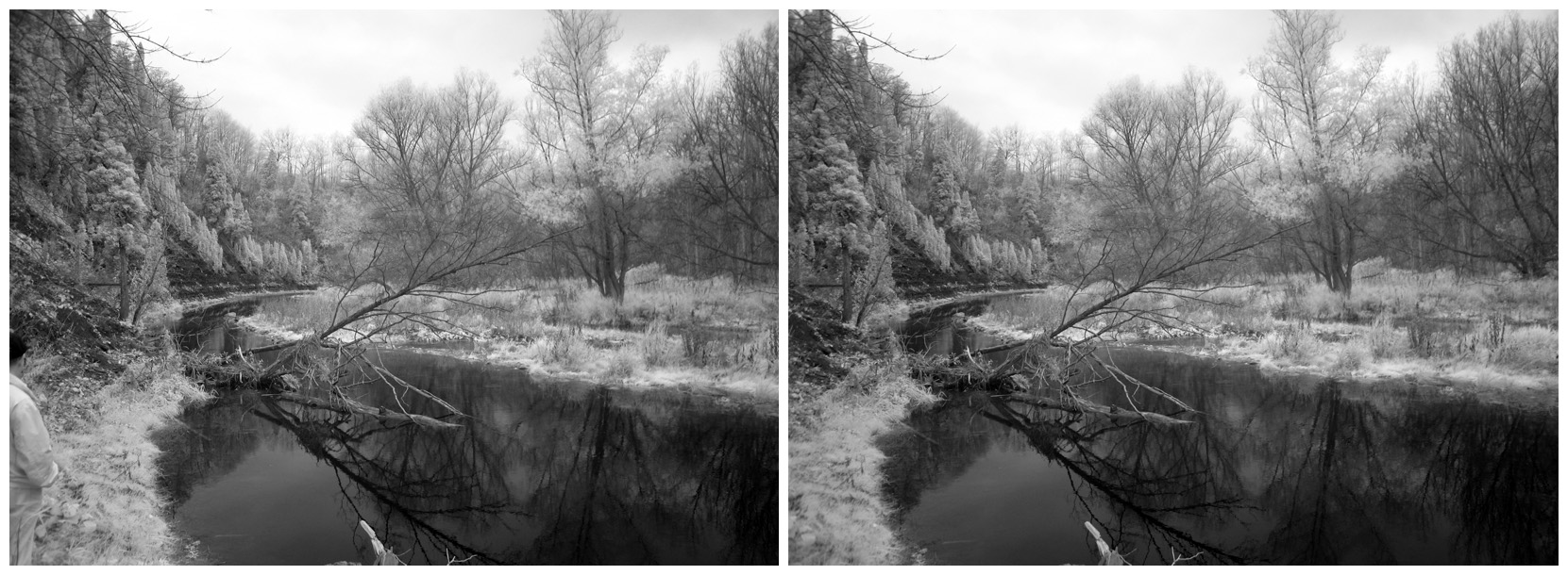
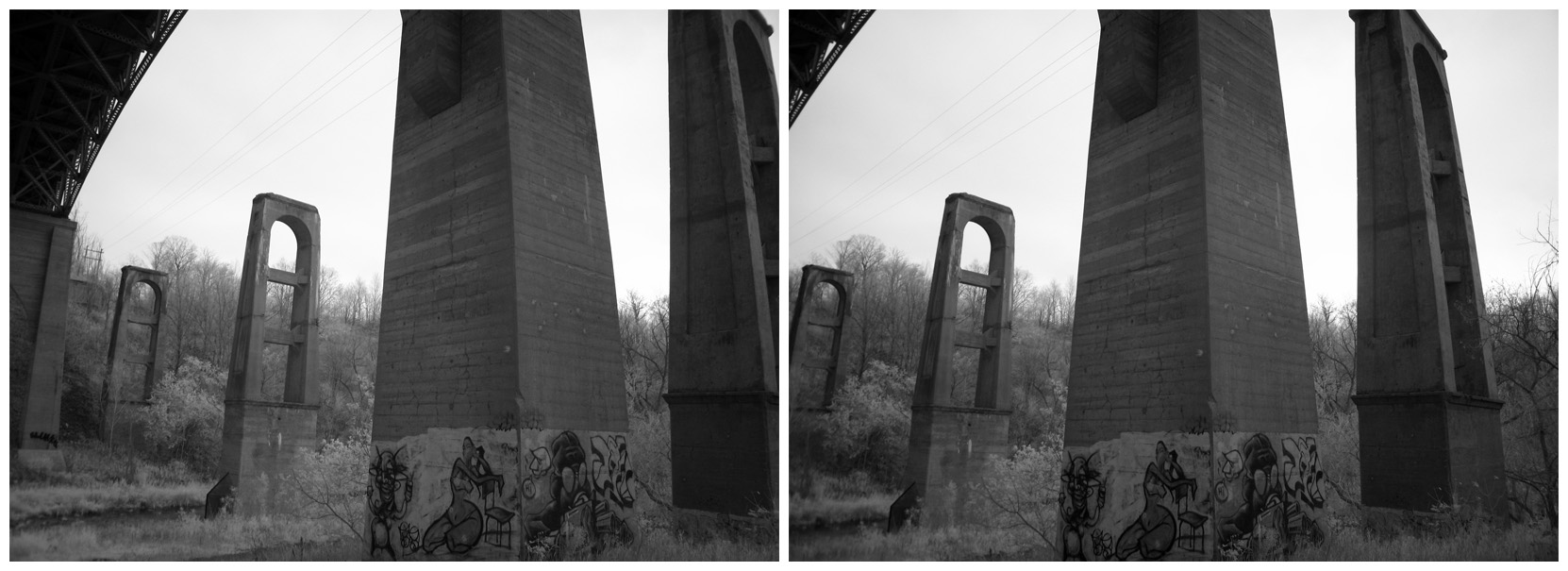
No such luck, at least starting out. We got to Bronte Creek, and at my friend's suggestion, parked on the north side and began to wander down into the valley under the bridge. It was gloomy, but I started shooting anyway. In addition to the Rebel XT with the Loreo lens, I also had the S80 and the S70 there, and I was alternating between taking genuine one-shot 3D pictures and "cha-cha" two-image versions with the other two cameras. Something I can only manage this way, it occurred to me, was 3D infrared photography, which I've done now. I wonder if that was a first?")
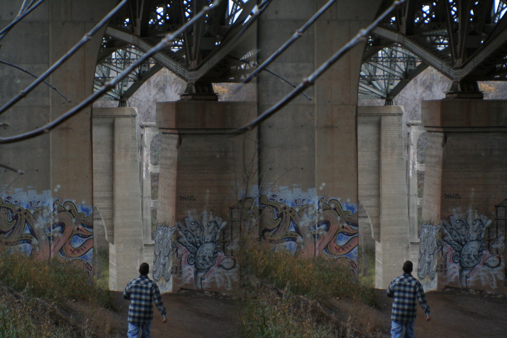
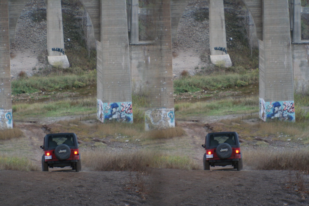
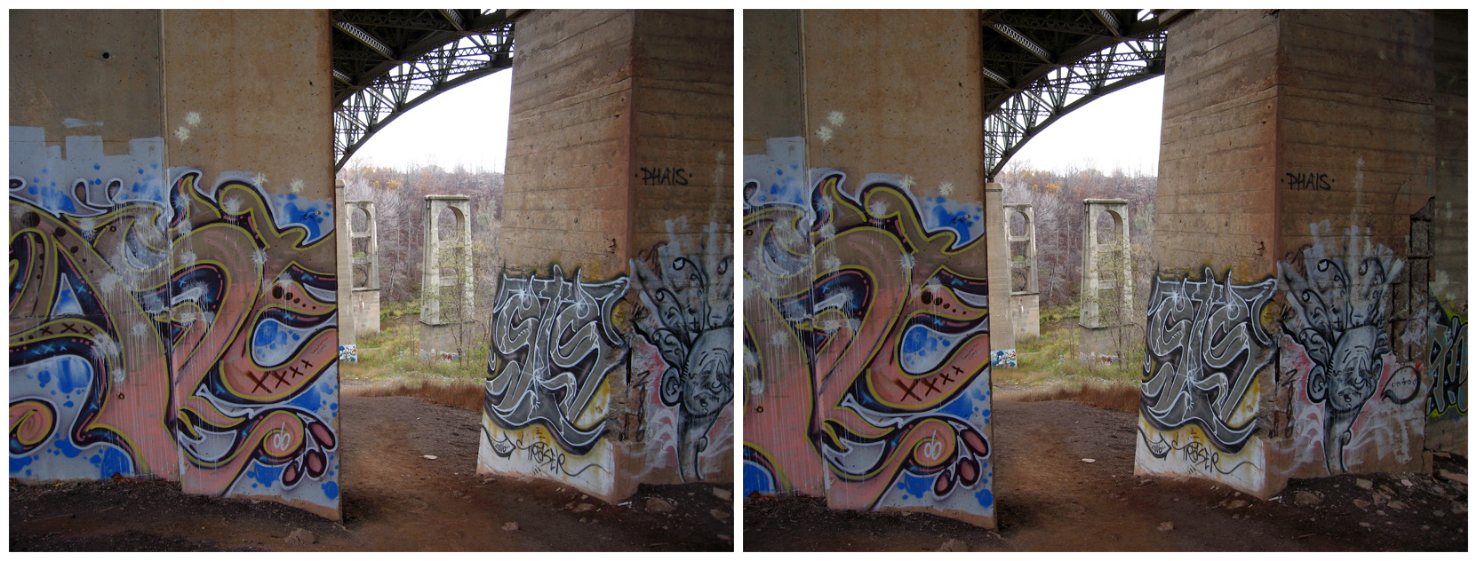
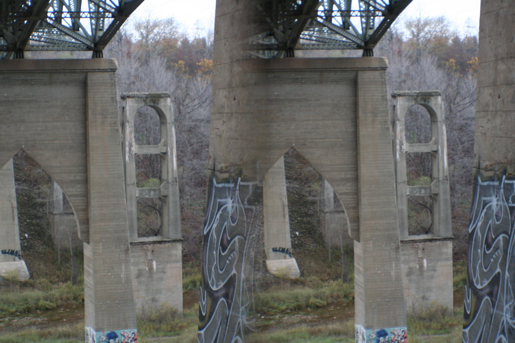
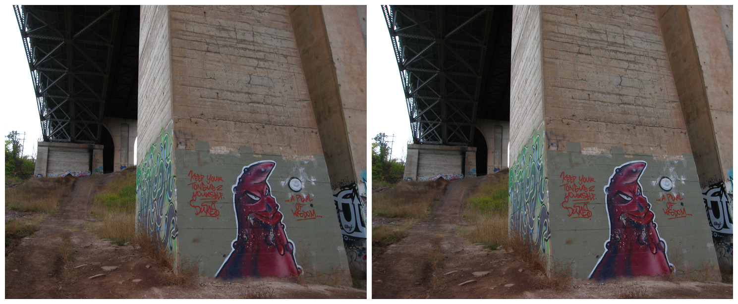
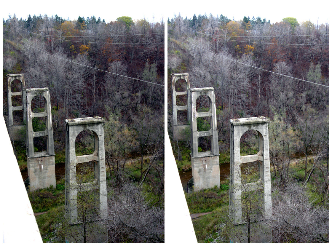
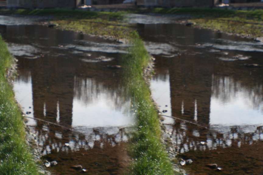
A couple of guys showed up and, while they weren't rude about it, they kept getting into the shots. They were trying to get down into the valley. Then they left. A few moments later, we were in their way when they started driving a red jeep down to the river! What for, we never did figure out; they were there less than ten minutes and then they took off again. But I got a number of nice shots down there of the valley, the pillars of the old bridge and the supports of the modern one, and then some shots similar to those from last summer, taken from the new bridge and the abutment of the old lost bridge itself.
I guess we were there a little over half an hour. On our way out, we bumped into a guy who was all suited up to go fishing in the river. Six weeks ago I was wading around in the rivers, but here we are in mid-November and this guy was all decked out in rubber to the top of his head so he wouldn't die of hypothermia standing in Bronte Creek. That's progress...
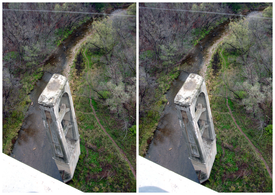
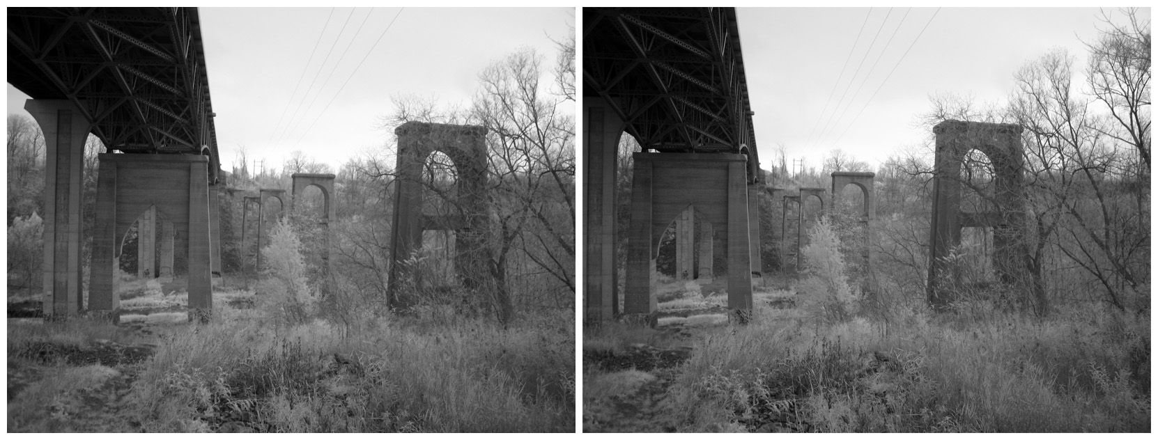
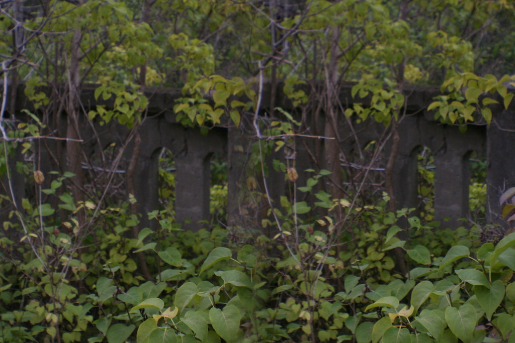
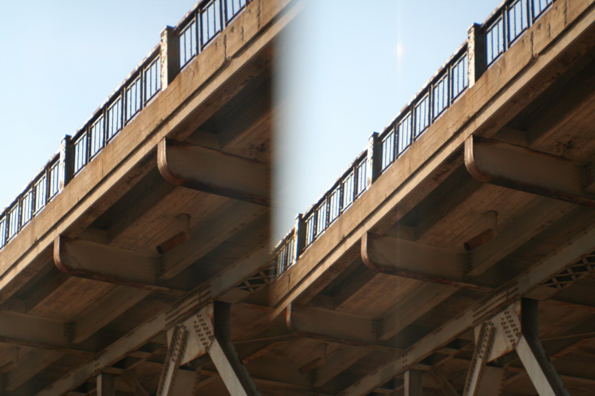
The three shots below were taken from the western abutment of the former Dundas Street bridge, now just a platform overlooking the valley below...
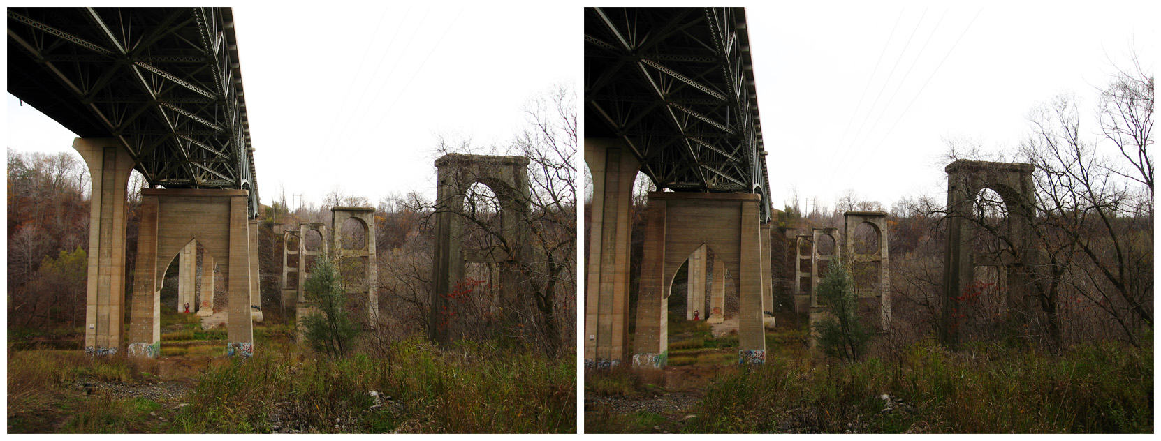
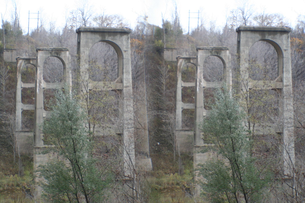
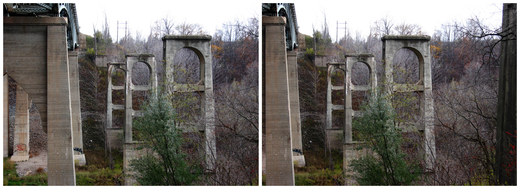
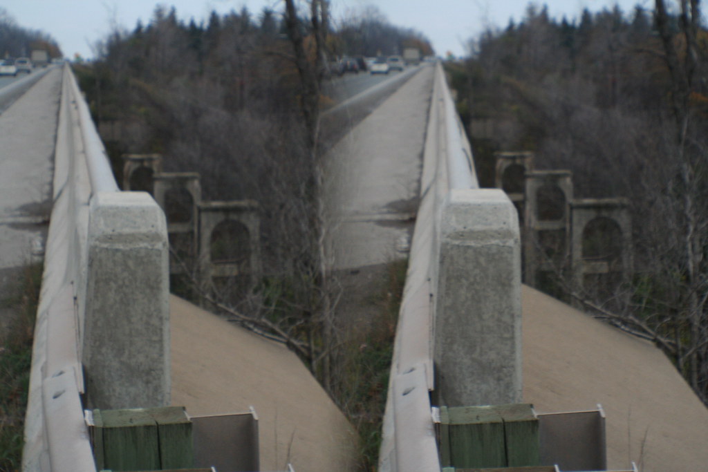
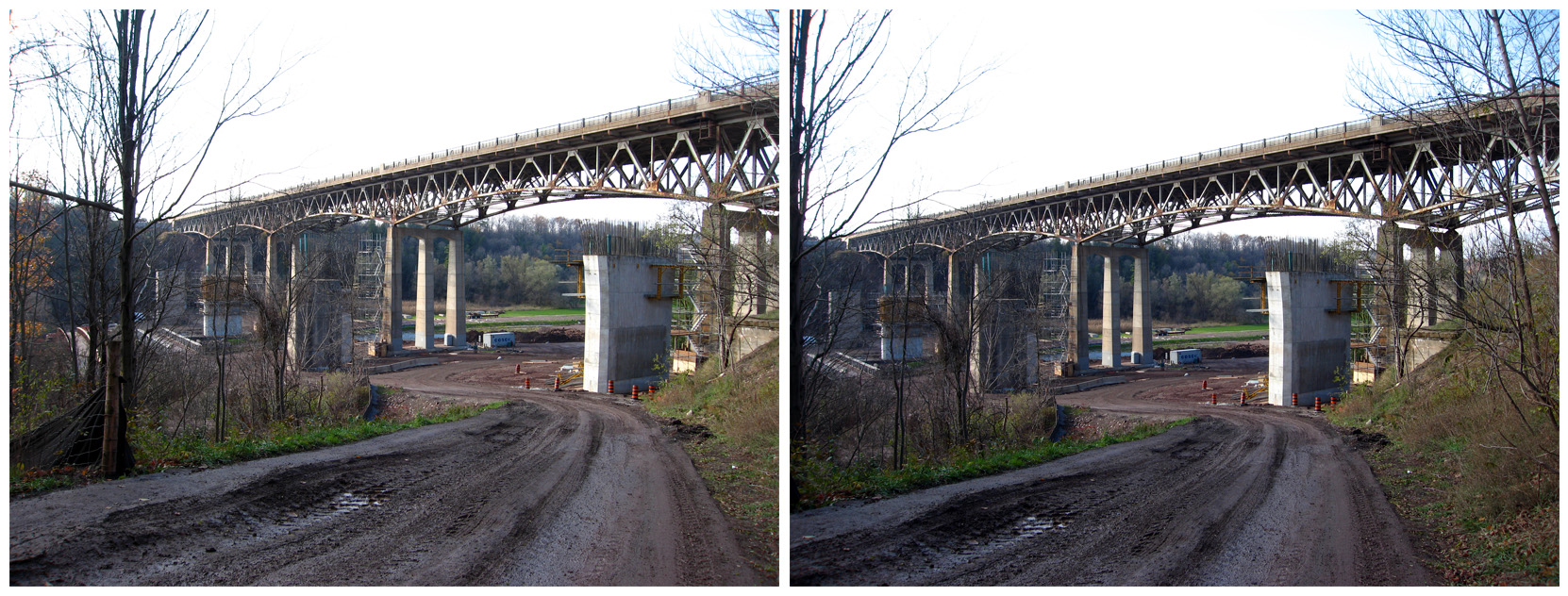
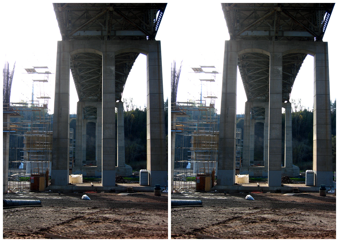
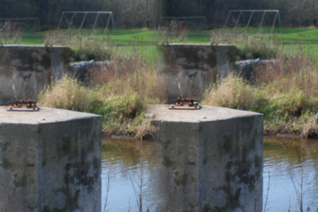
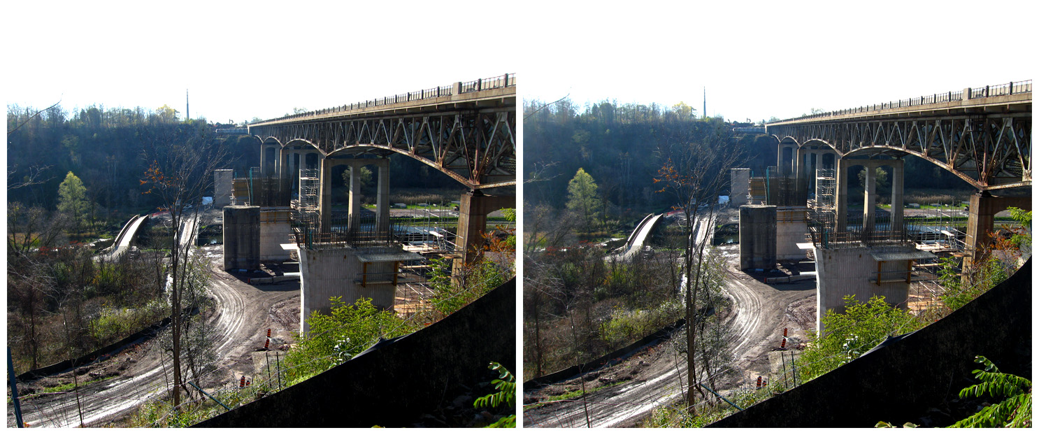
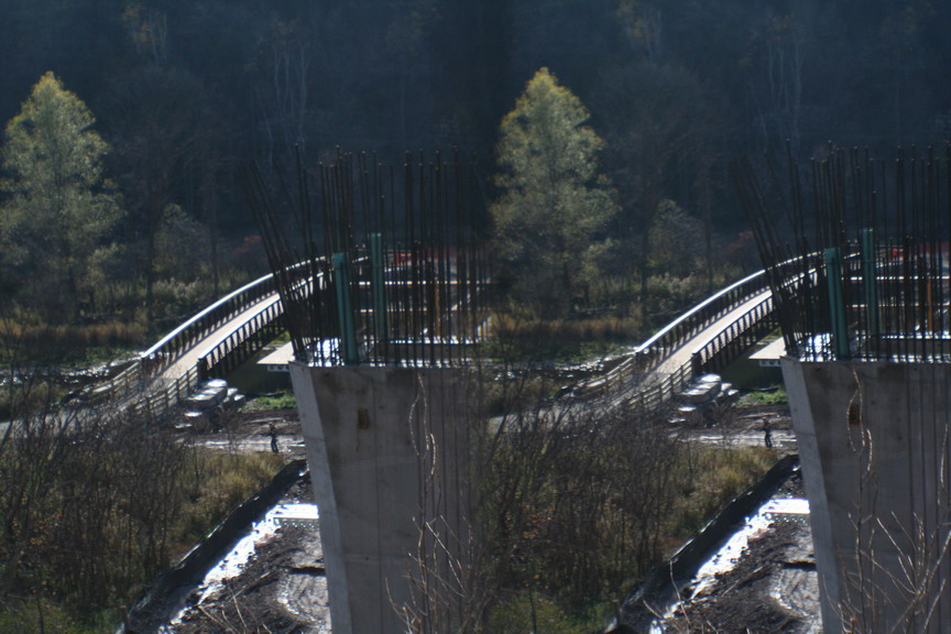
We headed along Dundas Street eastward to Sixteen Mile Creek, where construction of a new pair of bridges is underway. I guess there was a time when you could just turn and drive down into the park, but right now that's not an option. We did walk down that road into it, once we parked in the adjacent suburb. Those two pillars I'd seen before were still standing, but the new ones that will carry the next span across the valley in a year or so are already taking very visible shape. I keep wondering if those last two remaining pillars will survive, and as what, and for what. It's my self-appointed task to see. And record.
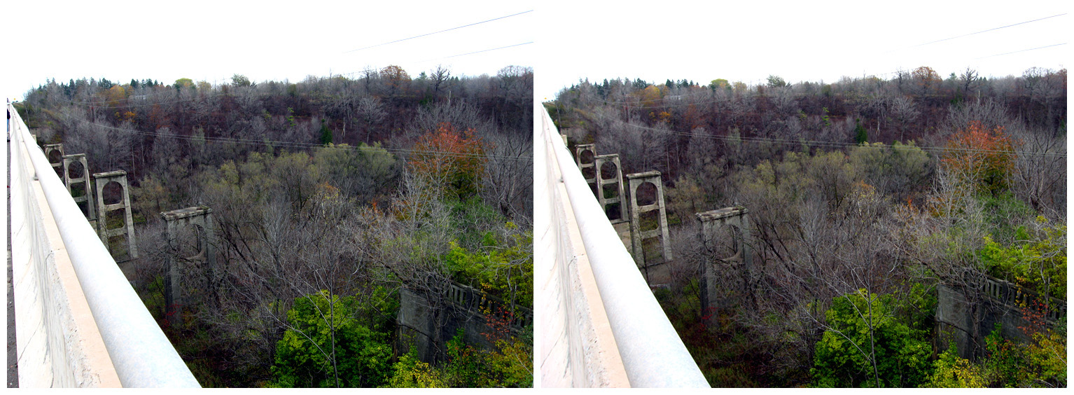
By this time, the sun had come out at last, and I played around with the new lens a little more. I took pictures of simple things; the grass, the edge of the creek, the flood plain, the sides of the valley, the bridge itself in the distance. That's important, because in a couple of years, that bridge itself will be gone, just like the one it replaced. Someday people will wonder what it looked like, just as I wonder about the old one long gone. Hopefully, I'll be able to show them.

The flood plain was, 150 years ago, a village; it's now a park. There's a little pagoda down there that talks about the town, wildlife, and stuff like that. I stood back and tried to photograph it. It was at that point that my pal pointed at the new lens, which has three focal settings, and gently wondered if I had it on the right one. I didn't, actually; it was set for 1.5 m "close-ups", if they can be called that. There's a setting for 5 m, and another for infinity. I told him that I hadn't seen much difference between the three settings, but I decided what the hell and adjusted it appropriately. Well, once I got home and viewed them, I realized that most of what I'd shot till then wasn't bad, but was kind of soft-focus. Not really impressive. The shots after his comment are sharp and definitely more striking. It's immediately obvious because the first "good" shot follows one that's essentially identical, except fuzzier. So... live and learn, live and learn.
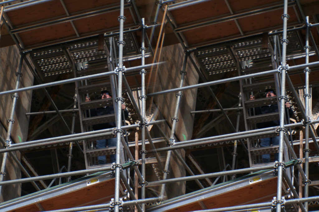
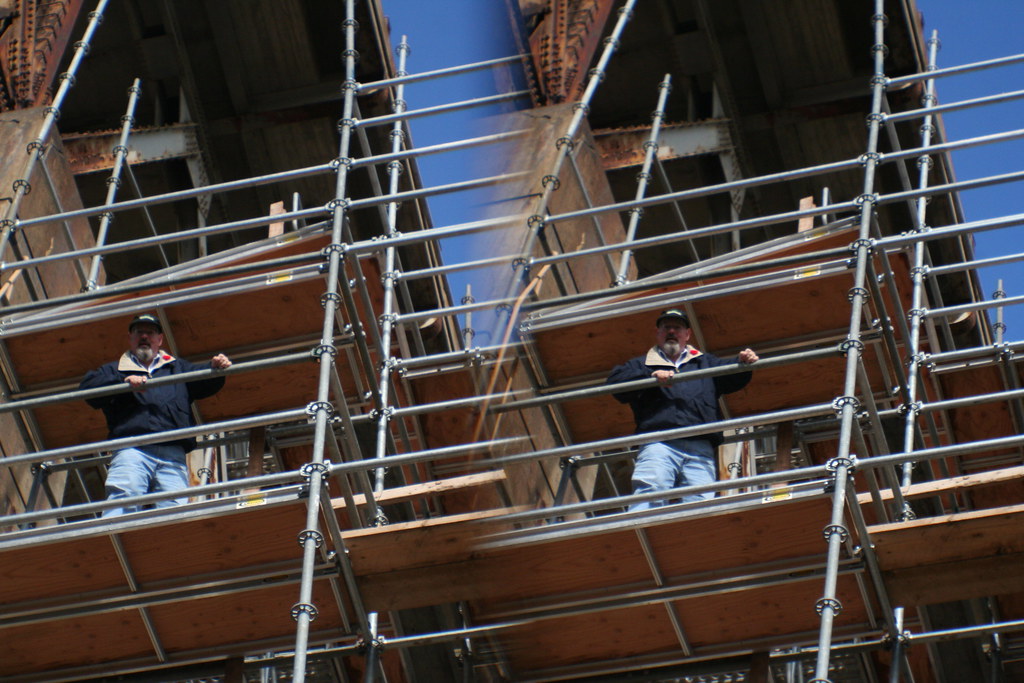
We decided to go, but as it turned out, we ended up spending another half hour there at the eastern foot of the bridge. My friend found a way up into the scaffolding for one of the new pillars. I was game to follow, but the means of getting up to the first set of stairs was too daunting for me... I'm not a fan of heights, and I was carrying too much equipment to want to risk crushing it or dropping it. So, I took pictures of him climbing instead, and they were actually pretty interesting once I got home and looked at them.
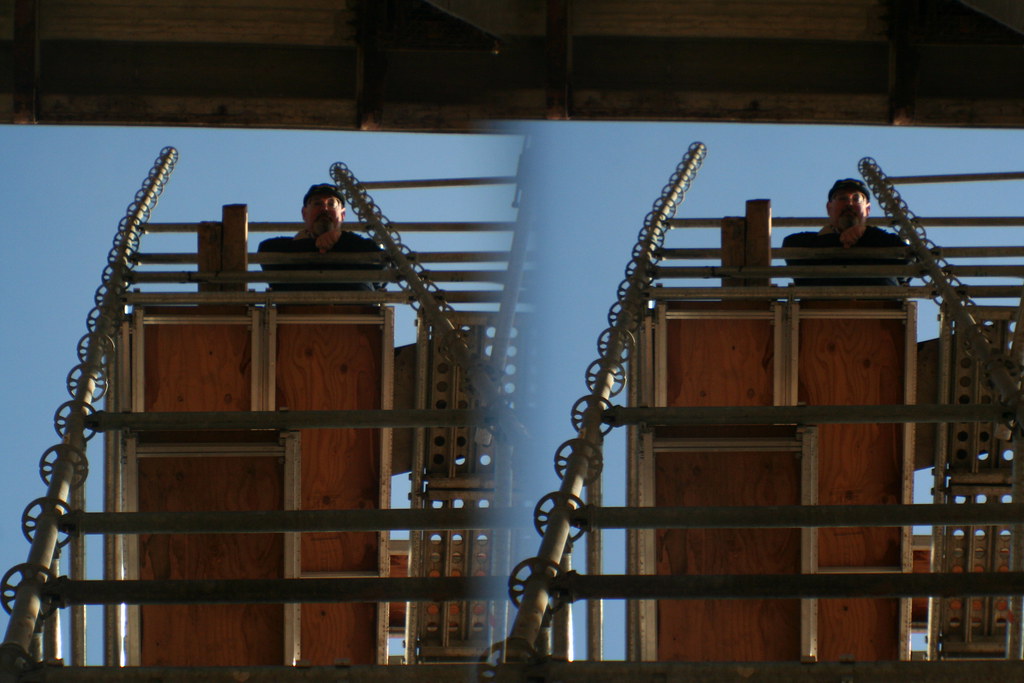
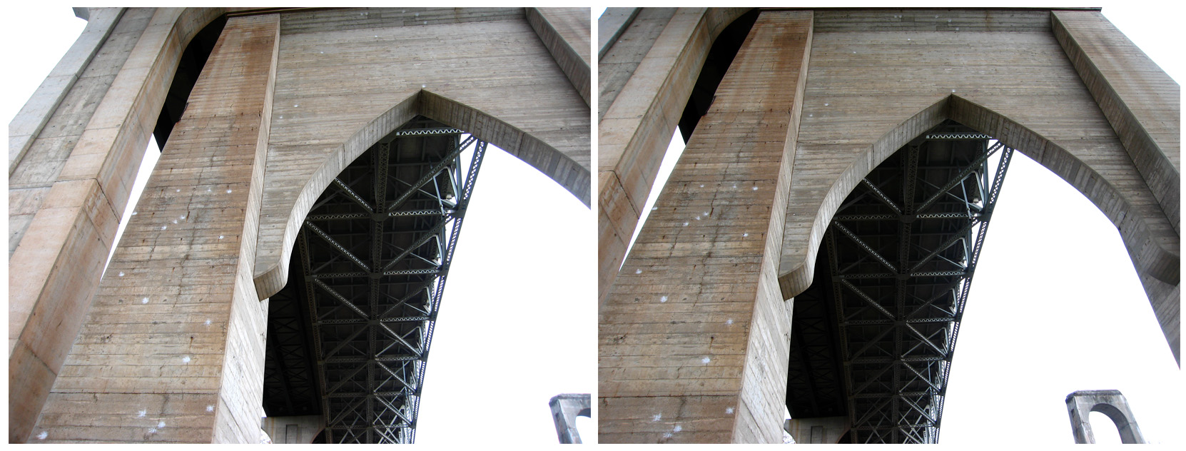
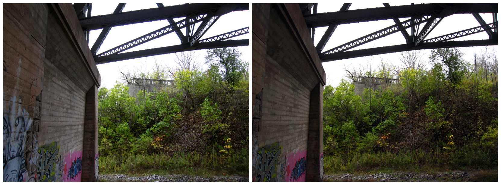
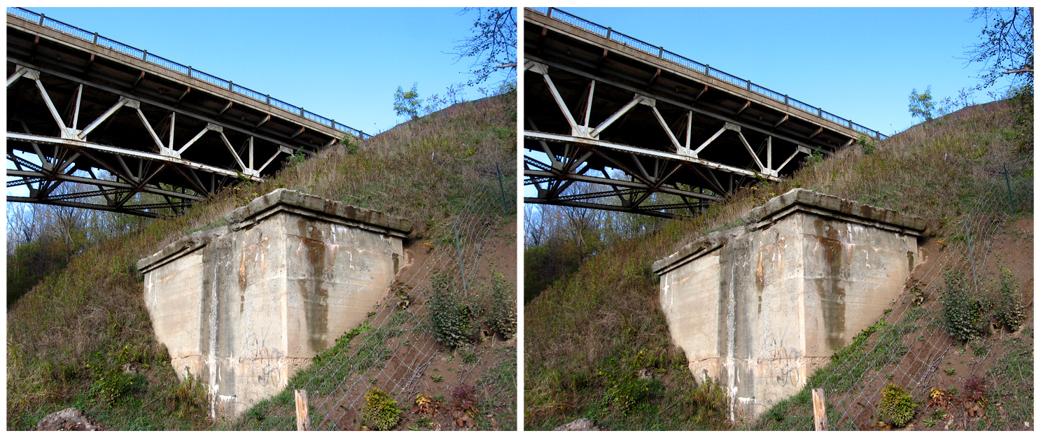
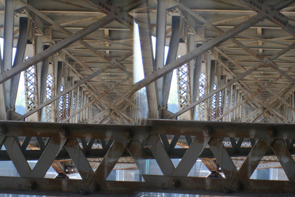
I wanted to shoot from the level of the lip of the valley, but the shortest route was actually up the edge, rather than back up the road and around the church, and back down the "new" old course of Dundas Street. The way was steep, really steep; something like 60 degrees, I think, and it was just loose gravel and dry clay. Every yard gained meant two feet slipping back, sometimes more. I had this really weird sensation as I struggled with this. I suddenly remembered doing exactly this kind of thing dozens of times as a kid, but it was the kind of knowledge you sort of file away as irrelevant as you enter your teenage years and effectively forget. But I got this "oh yeah" moment of recognition as I tried climbing this stuff, and it was like being 10 again, all that once-practical information bursting forth after being dammed up for decades. More recent hiking experience suggested to me that climbing where there was vegetation — something to hold the soil — was a better idea, so I did that. I sat in the grass near the top for about five minutes, shooting down into the valley. In the meantime, My friend climbed the clay and was haunting the riveted undercarriage of the bridge at its eastern anchor. I joined him, and got some very nice shots of the ribbing of the bridge, built so long ago by men now almost certainly gone, with their handiwork itself due to follow in a year or two. But I have recorded it, in three dimensions.
Just about a week ago now, a lens I sent away for for my Rebel XT arrived. It's the Loreo 3D Lens-in-a-Cap, and basically, it's a beam-splitter that takes two slightly different angles of the same view and conveys them to the sensor of the camera. What you get is an image with two essentially identical views, left and right, side-by-side I the same image. Taken at the same instant, they capture a moment in time that, when they're superimposed together (like, say, by crossing your eyes slightly), recreate the view in three dimensions. It's a simple, but effective and inexpensive means of stereography.
This summer just past, I became interested in a couple of old bridges on Dundas Street (a.k.a. Highway 5) in Halton Region; one over Sixteen Mile Creek and one over Twelve Mile Creek, which is also known at Bronte Creek. They've both been removed in favour of newer bridges, but the pillars that once carried those spans across their respective valleys are still there (in one case, at least in part). I visited the Bronte Creek bridge with a friend of mine in July, though the shots I took then were from the existing bridge and from the old western, poison ivy-strangled abutment of the former bridge... I didn't take any shots of the pillars from down in the valley itself that day. As for the former six pillars once to be seen at Sixteen Mile Creek, they're now down to two... the other four have been torn out in recent months to make room for the newer-still bridge about to recover their course (and be twinned with one that will mean the destruction of the currently-existing span there, if I've understood the plan correctly). I suppose at any time in the past sixty years or so I might have wandered down there and seen those six tall, slab-like pillars standing like a row of dominoes, but by the time I realized they were there, most of them weren't. Well, at least I made the journey there — three times now, because it's under construction and the view changes week to week. It was that very fact that prompted me to want to record that change for people like me in the future who won't have had the chance to see it for themselves... and then to start recording how things look around here more generally. All this led to a desire to shoot it in three dimensions, and so I ordered the lens, and there... now you're up to speed.
So like I said, the lens arrived last week, and I knew the first thing I wanted to do was go back out to those bridges and record them in three dimensions. I asked my buddy to come along. I was hoping for bright skies, because even with the limited work I'd already done with stereography, I've noticed that a strong contrast really enhances the effect.
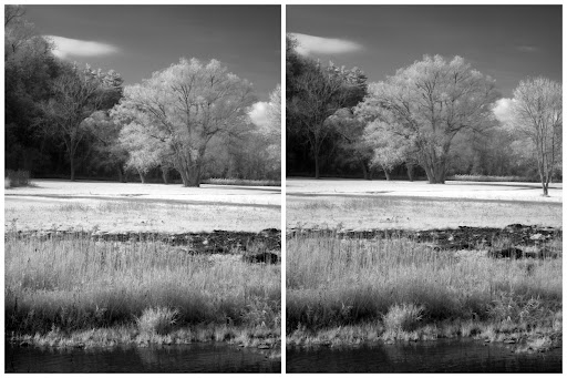
No such luck, at least starting out. We got to Bronte Creek, and at my friend's suggestion, parked on the north side and began to wander down into the valley under the bridge. It was gloomy, but I started shooting anyway. In addition to the Rebel XT with the Loreo lens, I also had the S80 and the S70 there, and I was alternating between taking genuine one-shot 3D pictures and "cha-cha" two-image versions with the other two cameras. Something I can only manage this way, it occurred to me, was 3D infrared photography, which I've done now. I wonder if that was a first?
A couple of guys showed up and, while they weren't rude about it, they kept getting into the shots. They were trying to get down into the valley. Then they left. A few moments later, we were in their way when they started driving a red jeep down to the river! What for, we never did figure out; they were there less than ten minutes and then they took off again. But I got a number of nice shots down there of the valley, the pillars of the old bridge and the supports of the modern one, and then some shots similar to those from last summer, taken from the new bridge and the abutment of the old lost bridge itself.
I guess we were there a little over half an hour. On our way out, we bumped into a guy who was all suited up to go fishing in the river. Six weeks ago I was wading around in the rivers, but here we are in mid-November and this guy was all decked out in rubber to the top of his head so he wouldn't die of hypothermia standing in Bronte Creek. That's progress...
The three shots below were taken from the western abutment of the former Dundas Street bridge, now just a platform overlooking the valley below...
We headed along Dundas Street eastward to Sixteen Mile Creek, where construction of a new pair of bridges is underway. I guess there was a time when you could just turn and drive down into the park, but right now that's not an option. We did walk down that road into it, once we parked in the adjacent suburb. Those two pillars I'd seen before were still standing, but the new ones that will carry the next span across the valley in a year or so are already taking very visible shape. I keep wondering if those last two remaining pillars will survive, and as what, and for what. It's my self-appointed task to see. And record.
By this time, the sun had come out at last, and I played around with the new lens a little more. I took pictures of simple things; the grass, the edge of the creek, the flood plain, the sides of the valley, the bridge itself in the distance. That's important, because in a couple of years, that bridge itself will be gone, just like the one it replaced. Someday people will wonder what it looked like, just as I wonder about the old one long gone. Hopefully, I'll be able to show them.
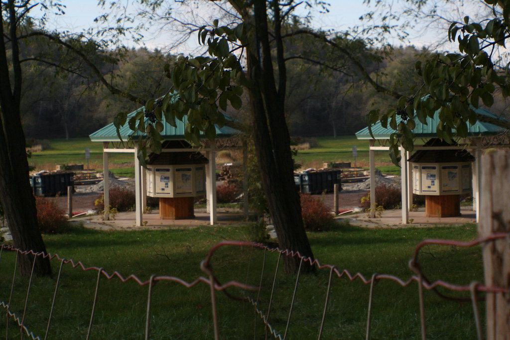
The flood plain was, 150 years ago, a village; it's now a park. There's a little pagoda down there that talks about the town, wildlife, and stuff like that. I stood back and tried to photograph it. It was at that point that my pal pointed at the new lens, which has three focal settings, and gently wondered if I had it on the right one. I didn't, actually; it was set for 1.5 m "close-ups", if they can be called that. There's a setting for 5 m, and another for infinity. I told him that I hadn't seen much difference between the three settings, but I decided what the hell and adjusted it appropriately. Well, once I got home and viewed them, I realized that most of what I'd shot till then wasn't bad, but was kind of soft-focus. Not really impressive. The shots after his comment are sharp and definitely more striking. It's immediately obvious because the first "good" shot follows one that's essentially identical, except fuzzier. So... live and learn, live and learn.
We decided to go, but as it turned out, we ended up spending another half hour there at the eastern foot of the bridge. My friend found a way up into the scaffolding for one of the new pillars. I was game to follow, but the means of getting up to the first set of stairs was too daunting for me... I'm not a fan of heights, and I was carrying too much equipment to want to risk crushing it or dropping it. So, I took pictures of him climbing instead, and they were actually pretty interesting once I got home and looked at them.
I wanted to shoot from the level of the lip of the valley, but the shortest route was actually up the edge, rather than back up the road and around the church, and back down the "new" old course of Dundas Street. The way was steep, really steep; something like 60 degrees, I think, and it was just loose gravel and dry clay. Every yard gained meant two feet slipping back, sometimes more. I had this really weird sensation as I struggled with this. I suddenly remembered doing exactly this kind of thing dozens of times as a kid, but it was the kind of knowledge you sort of file away as irrelevant as you enter your teenage years and effectively forget. But I got this "oh yeah" moment of recognition as I tried climbing this stuff, and it was like being 10 again, all that once-practical information bursting forth after being dammed up for decades. More recent hiking experience suggested to me that climbing where there was vegetation — something to hold the soil — was a better idea, so I did that. I sat in the grass near the top for about five minutes, shooting down into the valley. In the meantime, My friend climbed the clay and was haunting the riveted undercarriage of the bridge at its eastern anchor. I joined him, and got some very nice shots of the ribbing of the bridge, built so long ago by men now almost certainly gone, with their handiwork itself due to follow in a year or two. But I have recorded it, in three dimensions.