14K
14K
 1
1
 25
25  Corktown Common
 |
 |
 |

 4 renderings


|
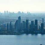
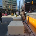
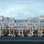
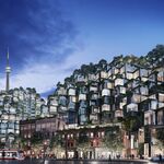
The centrepiece of the West Don Lands, Corktown Common will be a 7.3 hectare (18 acre) active, vibrant and inviting park that will not only serve the local community, but residents from throughout Toronto and visitors from far and wide. Construction of the park, which will occupy the south eastern portion of the neighbourhood and will run along the Don River from King Street to the rail corridor in the south, started in September 2010. When completed, the beautiful green space will invite people to the Don River and offer inspiring experiences along the river’s edge as well as spectacular views of downtown and Lake Ontario.
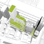
Corktown Common will transform an abandoned post-industrial site into a dynamic, year-round, re-naturalized public park, animated by a wide variety of programming and a beautiful multi-functional Pavilion. Innovatively positioned atop the area’s Flood Protection Landform (FPL), the park will renew the site while addressing vital infrastructure, taking full advantage of the robust topography.
The park design by Michael Van Valkenburgh Associates was integrated into the contours and the elevation provided by the FPL. The design capitalizes on the unique landscape to open sightlines to the Toronto skyline and the lake, creating a sense of scale and grandeur.
two distinct halves
At the broadest scale, the FPL organizes the park both physically and programmatically into two distinct halves. In response to site conditions and FPL regulations that restrict active recreation and the planting of woody vegetation on the eastern slope of the landform, an extensive 3.2 hectare (7.9 acre) urban prairie will be created on the river side of the park. The urban prairie grassland will include an upland meadow on the upper slope, while a lowland wet meadow at the base of the landform will add ecological and experiential diversity. The wet meadow will be a crucial part of a park-wide ecological stormwater recycling system. Meandering trails, multi-use bike paths, and a boardwalk will allow visitors to explore this unique urban landscape. Along the Don River, renewal of the multi-use trail system and new access under the Bala railway corridor will provide direct access to the Don River Trail and the river’s edge.
The 3.6 hectare (8.9 acre) western city side of the FPL is defined by a dynamic, unfolding topography that creates varied, flexible spaces for a diverse range of passive and active pursuits. Woodland plantings will work in concert with the topography to define each space and screen views of the surrounding urban infrastructure. The spaces in this part of the park will be more introspective, allowing immersive experiences of nature providing opportunities for focused specific activities, ranging from soccer and lacrosse to bird watching, picnicking, concerts, and tobogganing.

|
Buildings Discussion |
| Views: 141K | Replies: 421 | Last Post: Feb 09, 2023 |

| 25 photos |

|
| • Oct 18, 2023 | 20 YEARS: The Canary District - Then and Now |
| • Apr 29, 2021 | Cranes from Corktown Common |
| • Apr 02, 2021 | Front Street East in the West Don Lands |
| • Jun 11, 2020 | Throwback Thursday: West Don Lands Approaching the 2015 Pan Am Games |
| • May 07, 2020 | Skyline From Above Corktown Common |
| • Apr 30, 2019 | Photo of the Day: Skyline from Corktown Common |
| • Nov 30, 2018 | Ground Breaking Officially Kicks Off Port Lands Transformation |
| • Sep 13, 2018 | Photo of the Day: Planet Toronto |
| • May 18, 2018 | Photo of the Day: Corktown Common |
| • Mar 07, 2018 | Photo of the Day: Corktown Common |